Mattituck is a hamlet and census-designated place (CDP) in Suffolk County, New York, United States. The population was 4,219 at the 2010 census.
Located in the Town of Southold, Mattituck CDP roughly corresponds to the hamlet by the same name.
| Name: | Mattituck CDP |
|---|---|
| LSAD Code: | 57 |
| LSAD Description: | CDP (suffix) |
| State: | New York |
| County: | Suffolk County |
| Elevation: | 13 ft (4 m) |
| Total Area: | 12.10 sq mi (31.35 km²) |
| Land Area: | 8.98 sq mi (23.26 km²) |
| Water Area: | 3.12 sq mi (8.09 km²) |
| Total Population: | 4,322 |
| Population Density: | 481.24/sq mi (185.80/km²) |
| ZIP code: | 11952 |
| Area code: | 631 |
| FIPS code: | 3646140 |
| GNISfeature ID: | 0956678 |
Online Interactive Map
Click on ![]() to view map in "full screen" mode.
to view map in "full screen" mode.
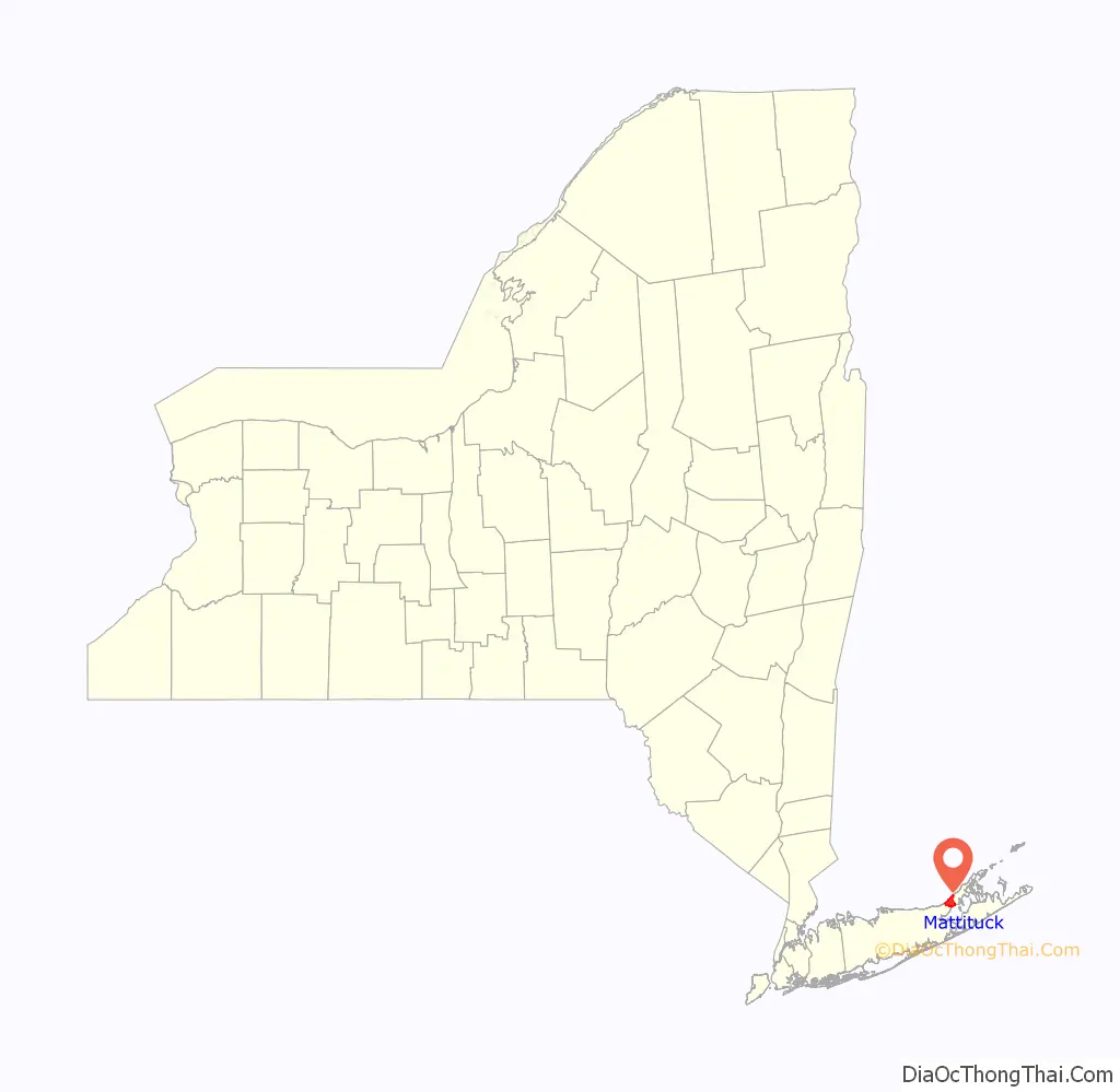
Mattituck location map. Where is Mattituck CDP?

History
Mattituck is believed to have derived its name from the Algonquian name for “Great Creek”. Mattituck Creek has been dredged and is used extensively by pleasure craft on Long Island Sound (the Mattituck Inlet is the entrance into Mattituck Creek, and the whole waterway is now popularly referred to as Mattituck Inlet).
It is only one of two harbors (the other being Mt. Sinai harbor) on the north side of Long Island on the Sound east of Port Jefferson.
The Mattituck Inlet and James Creek (which has also been dredged for boats) on the Peconic Bay come within 500 yards (460 m) of each other and would provide a shortcut between the Peconic and Sound through the North Fork if connected via a canal. However, authorities have resisted the connection, fearing an ecological disaster. Still, the inlet is blamed for coastal erosion because it interrupts the longshore drift on the sound.
Corchaug Indians, who were the first residents of the area, sold land to Theophilus Eaton, governor of New Haven, Connecticut. The area was eventually settled by English colonists. The meadowlands were held in common by the residents of Southold from its founding in 1640. The town of Southold was established by Charter to the New Haven Colony of Connecticut in 1658. The woodlands were also held in common until 1661, when that land was divided among individual proprietors.
Mattituck was occupied by British troops during the Revolutionary War and Governor Tryon visited.
Mattituck hosts an annual Strawberry Festival and is located in the heart of over 30 vineyards in the Long Island Wine Region. The festival is usually held on Father’s Day weekend every year.
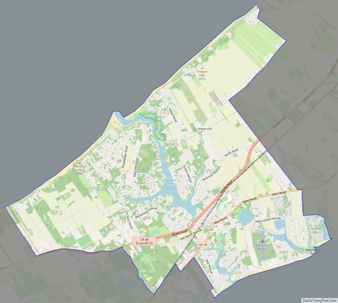
Mattituck Road Map
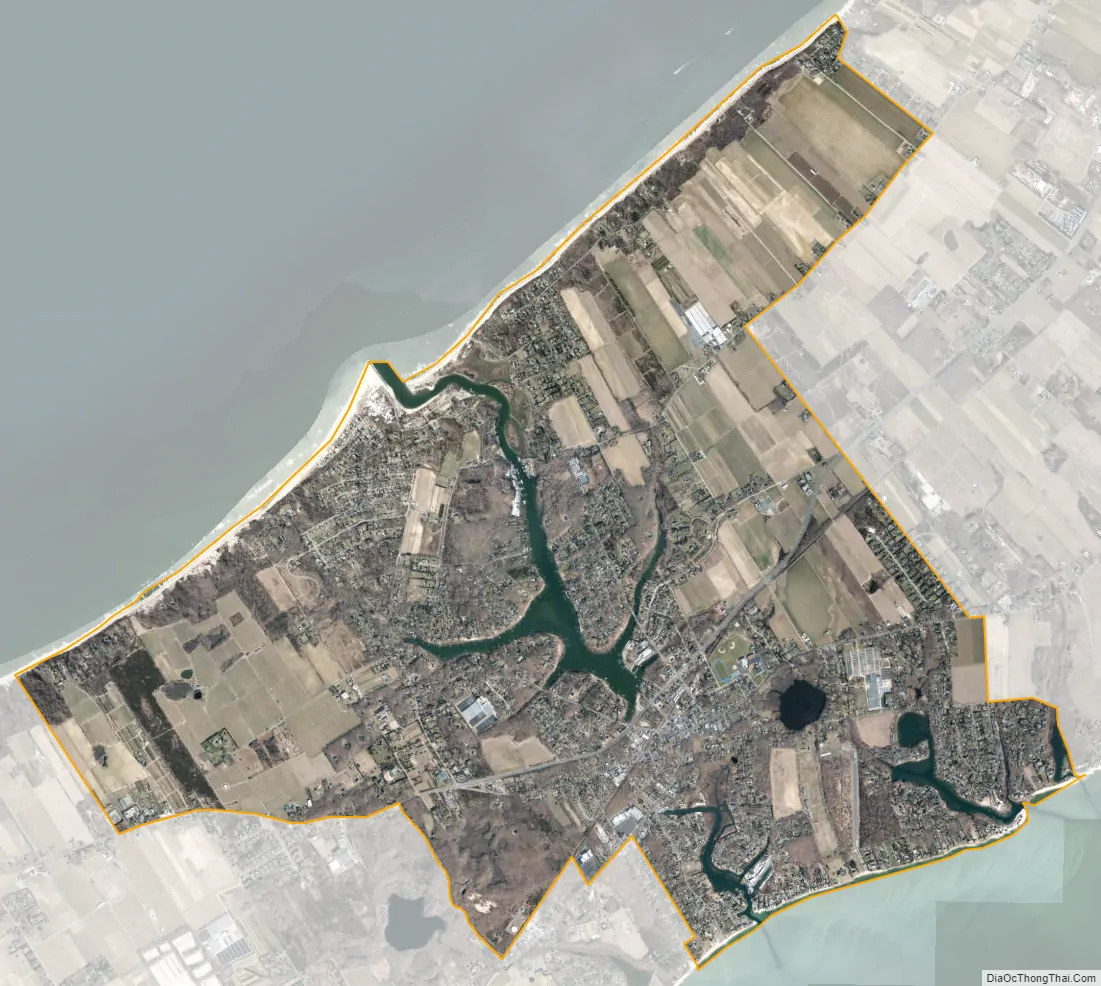
Mattituck city Satellite Map
Geography
According to the United States Census Bureau, the community has a total area of 9.3 square miles (24.2 km), of which 9.0 square miles (23.3 km) is land and 0.35 square miles (0.9 km), or 3.88%, is water.
See also
Map of New York State and its subdivision:- Albany
- Allegany
- Bronx
- Broome
- Cattaraugus
- Cayuga
- Chautauqua
- Chemung
- Chenango
- Clinton
- Columbia
- Cortland
- Delaware
- Dutchess
- Erie
- Essex
- Franklin
- Fulton
- Genesee
- Greene
- Hamilton
- Herkimer
- Jefferson
- Kings
- Lake Ontario
- Lewis
- Livingston
- Madison
- Monroe
- Montgomery
- Nassau
- New York
- Niagara
- Oneida
- Onondaga
- Ontario
- Orange
- Orleans
- Oswego
- Otsego
- Putnam
- Queens
- Rensselaer
- Richmond
- Rockland
- Saint Lawrence
- Saratoga
- Schenectady
- Schoharie
- Schuyler
- Seneca
- Steuben
- Suffolk
- Sullivan
- Tioga
- Tompkins
- Ulster
- Warren
- Washington
- Wayne
- Westchester
- Wyoming
- Yates
- Alabama
- Alaska
- Arizona
- Arkansas
- California
- Colorado
- Connecticut
- Delaware
- District of Columbia
- Florida
- Georgia
- Hawaii
- Idaho
- Illinois
- Indiana
- Iowa
- Kansas
- Kentucky
- Louisiana
- Maine
- Maryland
- Massachusetts
- Michigan
- Minnesota
- Mississippi
- Missouri
- Montana
- Nebraska
- Nevada
- New Hampshire
- New Jersey
- New Mexico
- New York
- North Carolina
- North Dakota
- Ohio
- Oklahoma
- Oregon
- Pennsylvania
- Rhode Island
- South Carolina
- South Dakota
- Tennessee
- Texas
- Utah
- Vermont
- Virginia
- Washington
- West Virginia
- Wisconsin
- Wyoming


