Merritt Park is a census-designated place (CDP) in the town of Fishkill in Dutchess County, New York, United States. As of the 2010 census it had a population of 1,256.
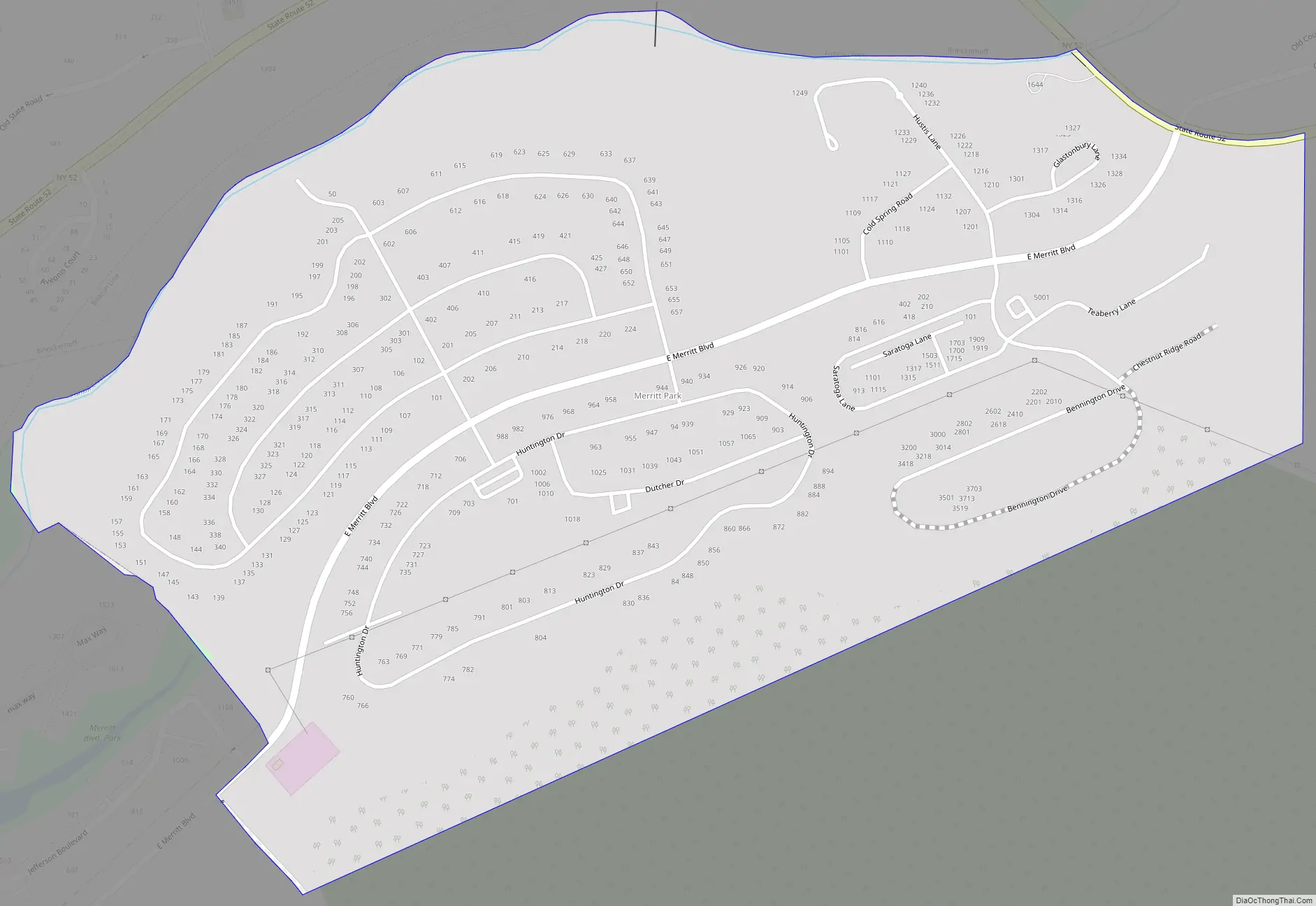
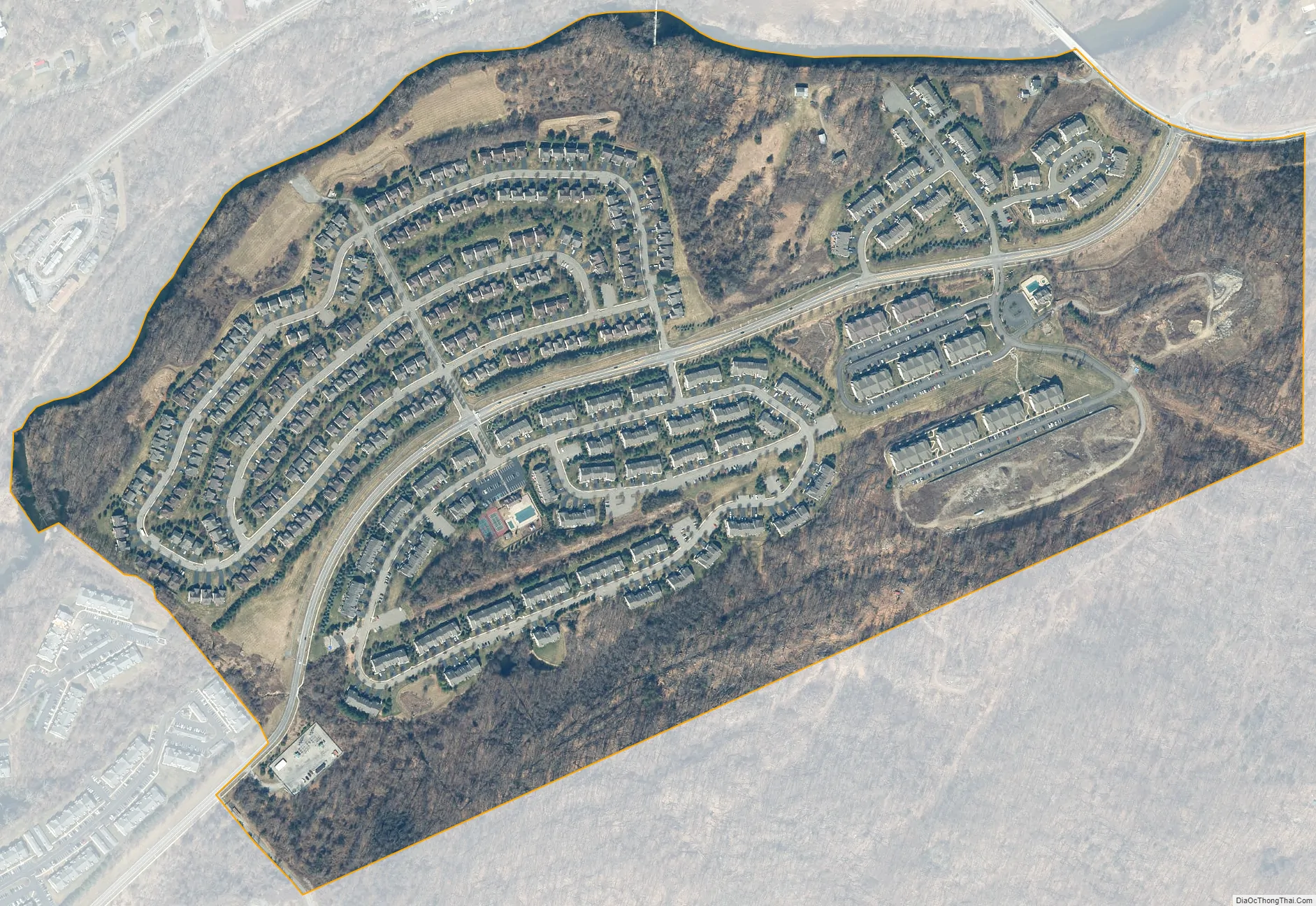
The CDP is located in the eastern part of the town of Fishkill in southwestern Dutchess County. It is bordered to the west by the village of Fishkill, to the north by Fishkill Creek, to the southeast by 904-foot (276 m) Honness Mountain, and to the northeast by New York State Route 52. Merritt Boulevard is the main thoroughfare through the community, connecting NY 52 to the northeast with U.S. Route 9 in the southern part of Fishkill village.
| Name: | Merritt Park CDP |
|---|---|
| LSAD Code: | 57 |
| LSAD Description: | CDP (suffix) |
| State: | New York |
| County: | Dutchess County |
| Elevation: | 285 ft (87 m) |
| Total Area: | 0.44 sq mi (1.15 km²) |
| Land Area: | 0.44 sq mi (1.15 km²) |
| Water Area: | 0.00 sq mi (0.00 km²) |
| Total Population: | 1,647 |
| Population Density: | 3,726.24/sq mi (1,437.34/km²) |
| Area code: | 845 |
| FIPS code: | 3646750 |
| GNISfeature ID: | 2584278 |
Online Interactive Map
Click on ![]() to view map in "full screen" mode.
to view map in "full screen" mode.
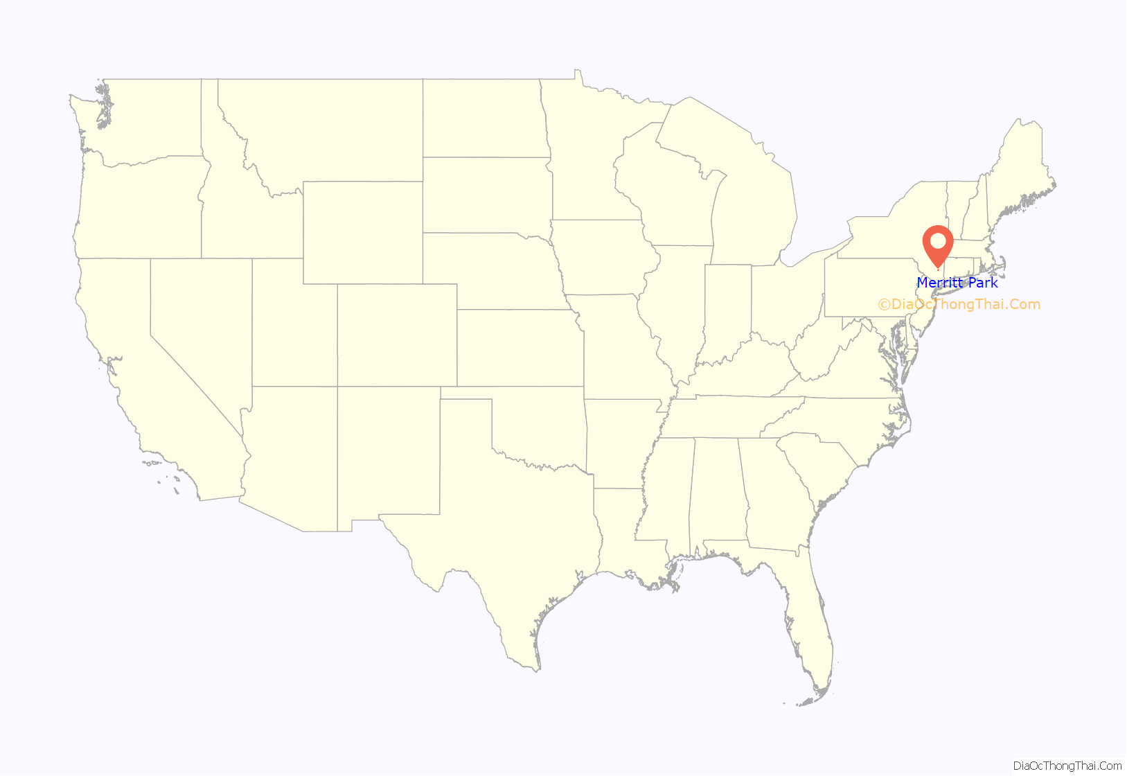
Merritt Park location map. Where is Merritt Park CDP?
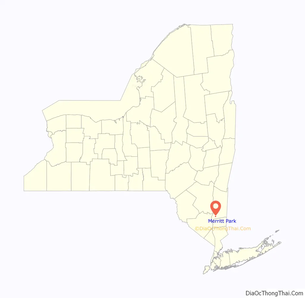
Merritt Park Road Map
Merritt Park city Satellite Map
Geography
According to the U.S. Census Bureau, the Merritt Park CDP has a total area of 0.44 square miles (1.15 km), all land.
See also
Map of New York State and its subdivision:- Albany
- Allegany
- Bronx
- Broome
- Cattaraugus
- Cayuga
- Chautauqua
- Chemung
- Chenango
- Clinton
- Columbia
- Cortland
- Delaware
- Dutchess
- Erie
- Essex
- Franklin
- Fulton
- Genesee
- Greene
- Hamilton
- Herkimer
- Jefferson
- Kings
- Lake Ontario
- Lewis
- Livingston
- Madison
- Monroe
- Montgomery
- Nassau
- New York
- Niagara
- Oneida
- Onondaga
- Ontario
- Orange
- Orleans
- Oswego
- Otsego
- Putnam
- Queens
- Rensselaer
- Richmond
- Rockland
- Saint Lawrence
- Saratoga
- Schenectady
- Schoharie
- Schuyler
- Seneca
- Steuben
- Suffolk
- Sullivan
- Tioga
- Tompkins
- Ulster
- Warren
- Washington
- Wayne
- Westchester
- Wyoming
- Yates
- Alabama
- Alaska
- Arizona
- Arkansas
- California
- Colorado
- Connecticut
- Delaware
- District of Columbia
- Florida
- Georgia
- Hawaii
- Idaho
- Illinois
- Indiana
- Iowa
- Kansas
- Kentucky
- Louisiana
- Maine
- Maryland
- Massachusetts
- Michigan
- Minnesota
- Mississippi
- Missouri
- Montana
- Nebraska
- Nevada
- New Hampshire
- New Jersey
- New Mexico
- New York
- North Carolina
- North Dakota
- Ohio
- Oklahoma
- Oregon
- Pennsylvania
- Rhode Island
- South Carolina
- South Dakota
- Tennessee
- Texas
- Utah
- Vermont
- Virginia
- Washington
- West Virginia
- Wisconsin
- Wyoming


