Beacon is a city located on the Hudson River in Dutchess County, New York, United States, in New York’s 104th State Assembly district. The 2020 census placed the city total population at 13,769. Beacon is part of the Poughkeepsie–Newburgh–Middletown, New York Metropolitan Statistical Area as well as the larger New York–Newark–Bridgeport, New York–New Jersey–Connecticut–Pennsylvania Combined Statistical Area.
Beacon was so named to commemorate the historic beacon fires that blazed forth from the summit of the Fishkill Mountains to alert the Continental Army of British troop movements. Originally an industrial city along the Hudson, Beacon experienced a revival beginning in 2003 with the arrival of Dia Beacon, one of the largest modern art museums in the United States. Recent growth has generated debates on development and zoning issues.
The area known as Beacon was settled by Europeans as the villages of Matteawan and Fishkill Landing in 1709. They were among the first colonial communities in the county. Beacon is located in the southwestern corner of Dutchess County in the Mid-Hudson Region, approximately 90 miles (140 km) south of Albany, and approximately 60 miles (97 km) north of New York City.
| Name: | Beacon city |
|---|---|
| LSAD Code: | 25 |
| LSAD Description: | city (suffix) |
| State: | New York |
| County: | Dutchess County |
| Elevation: | 138 ft (42 m) |
| Total Area: | 4.88 sq mi (12.63 km²) |
| Land Area: | 4.74 sq mi (12.27 km²) |
| Water Area: | 0.14 sq mi (0.35 km²) |
| Total Population: | 13,769 |
| Population Density: | 2,905.47/sq mi (1,121.81/km²) |
| ZIP code: | 12508 |
| Area code: | 845 |
| FIPS code: | 3605100 |
| GNISfeature ID: | 0977521 |
Online Interactive Map
Click on ![]() to view map in "full screen" mode.
to view map in "full screen" mode.
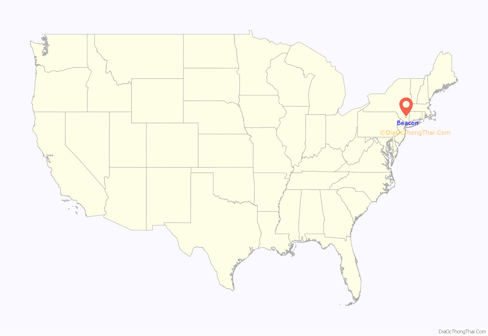
Beacon location map. Where is Beacon city?
History
In 1683 Francis Rombout and Gulian Verplanck, merchant-fur traders from New York City, purchased the land that would come to include the City of Beacon from the Wappinger tribe. The sale was sanctioned by James II of England in 1685 in the Rombout Patent. Rombout died in 1691, leaving his share to his daughter, Catheryna Brett. The Rombout Patent was partitioned in 1706, and Brett received and maintained approximately 28,000 acres (110 km) along the Vis Kill.
Brett sold some of her land to other settlers, often retaining the right to build a flour mill on the property. During the first third of the nineteenth century, Dutchess County ranked first among New York State counties in wheat production. Mills on Brett’s property attracted farmers from both sides of the river. In 1748 Brett and a group of other settlers agreed to build the Frankfort Store House near the water at the “Lower Landing” north of Dennings Point. This store marked the beginning of river freighting in the area, and Fishkill Landing developed into a river port. As early as 1780 two dozen vessels operated out of Fishkill Landing. John Peter DeWint, owner of 2,000 acres at Fishkill Landing, helped further raise its status as a port by building the Long Dock in 1815. The village of Fishkill Landing was incorporated in 1864.
Matteawan was situated on the Fishkill Creek about a mile and a half east of Fishkill Landing, and a like distance above the mouth of the creek, whose hydraulic properties contributed to its development as a manufacturing center. It lay at the foot of the Fishkill Mountains, and was a station on both the Newburgh, Dutchess & Connecticut, and the New York & New England Railroads, and was connected with the Fishkill Landing by stage, and rail.
The city served a variety of roles during the Revolutionary War. It manufactured war supplies, and served as a fort and signaling point. The city’s name came from signal fires lit atop nearby Mount Beacon.
During the 1800s, the city became a factory town and was known as “The Hat Making Capital of the US” with nearly 50 hat factories operating at one time. The Matteawan Manufacturing Company was the first in the area devoted to hat production, employing 500 workers. Many others followed, including Dutchess Hat Works, which produced 450 dozen hats daily by 1900 owned its own showroom in Manhattan.
Beacon incorporated as a city in 1913, combining the villages of Fishkill Landing and Matteawan as well as a small portion of the hamlet of Glenham from the town of Fishkill.
During the 1960s, urban renewal led to the destruction of some significant historic buildings. In 1975, the Dutchess Ski area, which had been a large tourist attraction, was closed. Also in the 1970s, a decline in the economy shuttered most of Beacon’s factories. This resulted in a severe and ongoing economic downturn that lasted from about 1970 to the late 1990s, during which almost 80 percent of the city’s commercial business spaces and factories were vacant. Starting in the late 1990s, and with the opening of Dia Beacon, one of the world’s largest contemporary art museums, in 2003, Beacon began an artistic and commercial rebirth. New development continues to enlarge the city.
Beacon Road Map
Beacon city Satellite Map
Geography
According to the United States Census Bureau, the city has a total area of 4.9 square miles (13 km), of which 4.8 square miles (12 km) is land and 0.1 square miles (0.26 km) is water. The total area is 2.25% water, which includes the Beacon Reservoir.
Located on the eastern shore of the Hudson River, Beacon is noted for its proximity to numerous historic sites and large cities. It is located minutes away from Bannerman’s Castle and West Point. Beacon also sits with the famous Mount Beacon as its backdrop and the Hudson River as its front door. The city also is located across the river from its larger sister city, Newburgh. Beacon is just 20 minutes south of the Hudson Valley Region capital city, Poughkeepsie. Danbury, Connecticut, lies approximately 30 miles to the east, while New York City is 55 miles to the south.
Neighborhoods
The city includes the following neighborhoods:
Main Neighborhoods
- River Side Section
- Mountain Side Section
Secondary Neighborhoods
- North Tree Streets
- South Tree Streets
- Business District (Main Street Area)—revitalized over the last decade with artists’ studios, shops and restaurants
- “Davies” or “The Apartments” (Section of City with a Concentrated Area of Public Housing on South Ave)
- “Forrestal Heights”—This also is partially populated by elderly fixed income persons in the one high rise building in the complex and welfare recipients in the two-story apartments in the surrounding neighborhood.
- “The Derk” (Neighborhood east of Fishkill Creek along East Main; generally, the environs of Beacon Fire Station 1.)
Historic neighborhoods
See also: Lower Main Street Historic District
Byrnsville, or Tioronda, was a hamlet near the mouth of the Fishkill creek, about a mile south of Fishkill Landing, and contained the Tioronda Hat Works. In 1880 it had a population of two hundred and seventeen. The Hat Works occupied the site of an old cotton-mill at this place which failed before 1850. A grist and saw-mill were subsequently built on the site but torn down by Lewis Tompkins in 1878 when the Hat Works were erected. A little below these works is the former site of the Madam Brett grist-mill, for which this has been mistaken.
Groveville derives its name from the extensive oak grove which formerly occupied the site. There was a grist mill at Groveville from a very early day, owned about 1820 by Samuel Upton, a Quaker. who acquired it from Abraham Dubois. Upton also erected on the opposite side of the race a stone building which he used as a fulling mill. Sometime after 1840, the property, was sold it to the Glenham Co., who converted it to a woolen mill, and did carding, spinning and weaving.
The first several blocks of Main Street east of its junction with South Avenue constitutes the Lower Main Street Historic District and features many small businesses located in vintage Italianate-style buildings.
Historic places
- Bogardus-DeWindt House is located on Tompkins Avenue, a short distance west of NY 9D, in Beacon, New York, United States. It typifies the houses built in the region between 1750 and 1830. It was included on the National Register of Historic Places on April 19, 1993.
- Madam Brett Homestead, 50 Van Nydeck Avenue: the oldest building in Dutchess County, and is on the National Register of Historic Places.
- Denning’s Point is a peninsula that extends into the Hudson River. It was known as “DePeyster’s Point” until Adjutant-General William Denning purchased the land in 1785. The land has been the site of a brickyard and other industries. It is now the location of The Beacon Institute for Rivers and Estuaries. There is evidence that Alexander Hamilton lived on Denning’s Point during the Revolutionary War and started crafting The Federalist Papers while living at this location.
- Eustatia is a brick cottage in the Victorian Gothic style overlooking the Hudson River on Monell Place. It was built in 1867 to designs by Frederick Clarke Withers for his friend John Monell. Monell had recently married Caroline DeWindt Downing, widow of the influential Newburgh architect Andrew Jackson Downing, with whom Withers had worked. They built the house on property deeded to them by her father, John DeWindt. Its original form and appearance have remained largely intact since its construction. In 1979 it was added to the National Register of Historic Places.
- The Howland Cultural Center, located on Main Street, is the former historic Howland Circulating Library. It was designed in 1872 by Richard Morris Hunt, brother of Eliza Howland brother-in-law of Joseph Howland. He was one of a committee of ten local benefactors who had joined to establish a library for their city, and commissioned Hunt for the job. When the library opened, its 2,200-volume collection was available only to subscribers. Later the library opened to the general public, but by 1976 the collection needed more space and so the library moved down Main Street. The old library building is now in the hands of a private non-profit organization, the Howland Cultural Center, which presents art exhibitions and other cultural activities. It was added to the National Register of Historic Places on May 5, 1973.
- Lewis Tompkins Hose Company No. 1 Firehouse
- Mount Gulian
- Dia Beacon
- Peter C. DuBois House
- Reformed Church of Beacon, originally the Reformed Dutch Church of Fishkill Landing, is a congregation of the Reformed Church in America. The oldest church in Beacon, the congregation was established in 1813. It overlooks the Hudson River from the top of a bluff. The church and its cemetery were added to the National Register of Historic Places in 1988.
- St. Joachim and St. John the Evangelist’s Church (Beacon, New York)
- St. Luke’s Episcopal Church (Beacon, New York)
- Tioronda Bridge
- Trinity Methodist Church (Beacon, New York)
- United States Post Office is located at 369 Main Street, Beacon NY. It is a stone structure in the Dutch Colonial Revival architectural style built in the mid-1930s. It includes an interior mural by Charles Rosen. In 1988 it was listed on the National Register of Historic Places along with many other older post offices in the state. The building’s fieldstone exterior is a distinctive feature of New Deal era design.
- Beacon is home to one of a handful of operating “dummy lights” in the United States. The Beacon Dummy Light is located at the intersection of Main and East Main Streets. It is a traffic signal on a pedestal which sits in the middle of an intersection, dating back to the 1920s. Two others are located in New York, in Canajoharie and Croton-on-Hudson.
See also
Map of New York State and its subdivision:- Albany
- Allegany
- Bronx
- Broome
- Cattaraugus
- Cayuga
- Chautauqua
- Chemung
- Chenango
- Clinton
- Columbia
- Cortland
- Delaware
- Dutchess
- Erie
- Essex
- Franklin
- Fulton
- Genesee
- Greene
- Hamilton
- Herkimer
- Jefferson
- Kings
- Lake Ontario
- Lewis
- Livingston
- Madison
- Monroe
- Montgomery
- Nassau
- New York
- Niagara
- Oneida
- Onondaga
- Ontario
- Orange
- Orleans
- Oswego
- Otsego
- Putnam
- Queens
- Rensselaer
- Richmond
- Rockland
- Saint Lawrence
- Saratoga
- Schenectady
- Schoharie
- Schuyler
- Seneca
- Steuben
- Suffolk
- Sullivan
- Tioga
- Tompkins
- Ulster
- Warren
- Washington
- Wayne
- Westchester
- Wyoming
- Yates
- Alabama
- Alaska
- Arizona
- Arkansas
- California
- Colorado
- Connecticut
- Delaware
- District of Columbia
- Florida
- Georgia
- Hawaii
- Idaho
- Illinois
- Indiana
- Iowa
- Kansas
- Kentucky
- Louisiana
- Maine
- Maryland
- Massachusetts
- Michigan
- Minnesota
- Mississippi
- Missouri
- Montana
- Nebraska
- Nevada
- New Hampshire
- New Jersey
- New Mexico
- New York
- North Carolina
- North Dakota
- Ohio
- Oklahoma
- Oregon
- Pennsylvania
- Rhode Island
- South Carolina
- South Dakota
- Tennessee
- Texas
- Utah
- Vermont
- Virginia
- Washington
- West Virginia
- Wisconsin
- Wyoming
