Mount Morris is a village in the town of Mount Morris in Livingston County, New York, United States. The village population was 2,986 at the 2010 census, out of 4,465 in the entire town. The village and town are named after Robert Morris.
The village is at the northeastern entrance to Letchworth State Park, which contains a scenic gorge and triple waterfall on the Genesee River.
| Name: | Mount Morris village |
|---|---|
| LSAD Code: | 47 |
| LSAD Description: | village (suffix) |
| State: | New York |
| County: | Livingston County |
| Elevation: | 630 ft (192 m) |
| Total Area: | 2.05 sq mi (5.30 km²) |
| Land Area: | 2.05 sq mi (5.30 km²) |
| Water Area: | 0.00 sq mi (0.00 km²) |
| Total Population: | 2,898 |
| Population Density: | 1,415.04/sq mi (546.45/km²) |
| ZIP code: | 14510 |
| Area code: | 585 |
| FIPS code: | 3648945 |
| GNISfeature ID: | 0957862 |
| Website: | townofmtmorris.com |
Online Interactive Map
Click on ![]() to view map in "full screen" mode.
to view map in "full screen" mode.
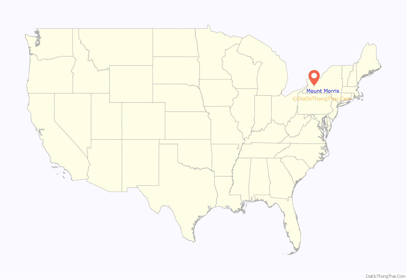
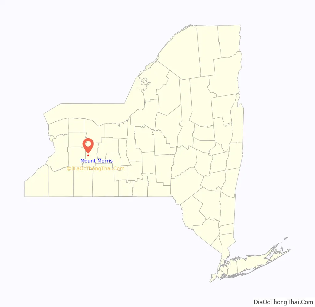
Mount Morris location map. Where is Mount Morris village?
History
The community was first called “Allen Hill” and “Richmond Hill” by early settler Ebenezer “Indian” Allen. The village of Mount Morris was incorporated in 1835. It was named after Robert Morris, a financier of the American Revolution, and later owner of the Morris Reserve, from which the lands around Mount Morris were sold to settlers.
The main trade route in the town’s early days was the Genesee Valley Canal which ran south from the Erie Canal at Rochester to Olean. The canal was abandoned in the 1870s and later used as a railroad right of way for a succession of railroads, which eventually consolidated into the Pennsylvania Railroad. The Friends of the Genesee Valley Greenway have built hiking trails along some of the canal route.
Mount Morris Academy was an important early school, but it closed in 1867.
Just upstream (west) from the village on the Genesee River is the Mount Morris Dam (550 feet (170 m) long, 216 feet (66 m) high), which was built between 1948 and 1952 for flood control of the lower Genesee Valley. An earlier and much smaller dam, still extant in the village, was used for mills; now it is a small hydroelectric generating station.
In the early 21st century, Greg O’Connell, a retired New York City detective and developer of properties in Red Hook, Brooklyn, bought 19 buildings along the town’s Main Street in an effort to revive the downtown area.
National Register of Historic Places
The following sites and historic districts are listed on the National Register of Historic Places.
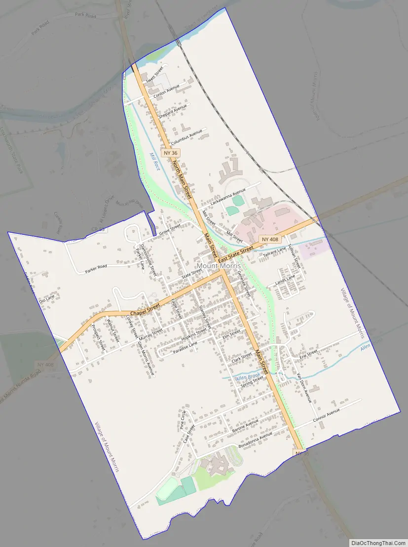
Mount Morris Road Map
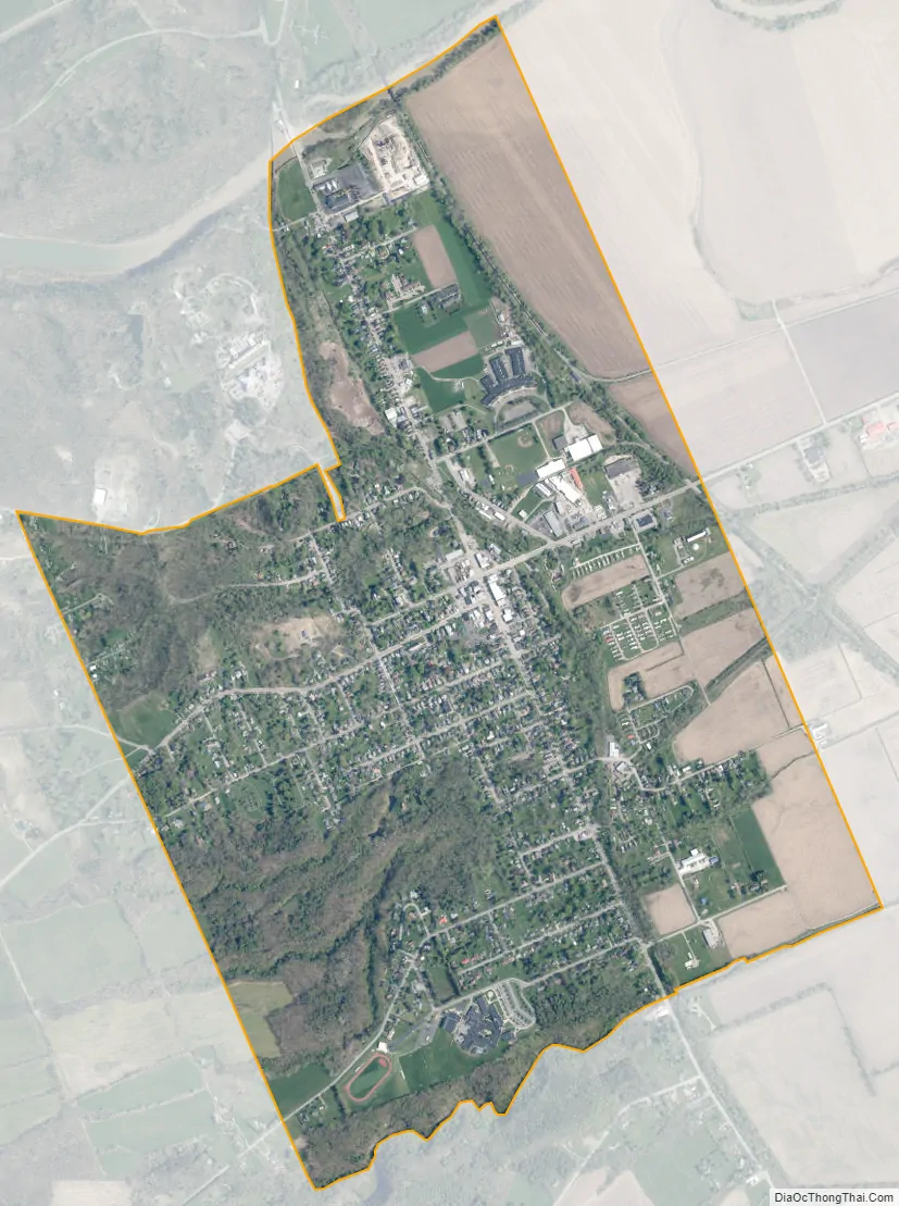
Mount Morris city Satellite Map
Geography
Mount Morris is located in western Livingston County at 42°43′23″N 77°52′37″W / 42.722996°N 77.877001°W / 42.722996; -77.877001Coordinates: 42°43′23″N 77°52′37″W / 42.722996°N 77.877001°W / 42.722996; -77.877001 (42.722996, -77.877001), in the northern part of the town of Mount Morris. According to the United States Census Bureau, the village has a total area of 2.0 square miles (5.3 km), all land. The Genesee River forms the northern border of the village (and the town), while Allens Creek and Damonsville Creek flow through the village.
New York State Route 36 and New York State Route 408 intersect in the village. Geneseo, the county seat, is 6 miles (10 km) to the northeast. Interstate 390 passes 2 miles (3 km) east of the village, leading north 36 miles (58 km) to Rochester and southeast 65 miles (105 km) to Corning.
Climate
Compared to the rest of Upstate New York (and all of the northeastern United States), Mount Morris receives relatively little precipitation. A 1910 study reported an average annual total of 25.3 inches (640 mm) of precipitation, making Mount Morris the driest place in New York. More recent data puts the annual precipitation at 27.7 inches (700 mm).
See also
Map of New York State and its subdivision:- Albany
- Allegany
- Bronx
- Broome
- Cattaraugus
- Cayuga
- Chautauqua
- Chemung
- Chenango
- Clinton
- Columbia
- Cortland
- Delaware
- Dutchess
- Erie
- Essex
- Franklin
- Fulton
- Genesee
- Greene
- Hamilton
- Herkimer
- Jefferson
- Kings
- Lake Ontario
- Lewis
- Livingston
- Madison
- Monroe
- Montgomery
- Nassau
- New York
- Niagara
- Oneida
- Onondaga
- Ontario
- Orange
- Orleans
- Oswego
- Otsego
- Putnam
- Queens
- Rensselaer
- Richmond
- Rockland
- Saint Lawrence
- Saratoga
- Schenectady
- Schoharie
- Schuyler
- Seneca
- Steuben
- Suffolk
- Sullivan
- Tioga
- Tompkins
- Ulster
- Warren
- Washington
- Wayne
- Westchester
- Wyoming
- Yates
- Alabama
- Alaska
- Arizona
- Arkansas
- California
- Colorado
- Connecticut
- Delaware
- District of Columbia
- Florida
- Georgia
- Hawaii
- Idaho
- Illinois
- Indiana
- Iowa
- Kansas
- Kentucky
- Louisiana
- Maine
- Maryland
- Massachusetts
- Michigan
- Minnesota
- Mississippi
- Missouri
- Montana
- Nebraska
- Nevada
- New Hampshire
- New Jersey
- New Mexico
- New York
- North Carolina
- North Dakota
- Ohio
- Oklahoma
- Oregon
- Pennsylvania
- Rhode Island
- South Carolina
- South Dakota
- Tennessee
- Texas
- Utah
- Vermont
- Virginia
- Washington
- West Virginia
- Wisconsin
- Wyoming


