Mount Sinai is a hamlet and census-designated place (CDP) located within the Town of Brookhaven, in Suffolk County, New York, United States. The population was 12,118 at the 2010 census. The hamlet is located on the North Shore of Long Island.
Mount Sinai was first settled in the 1660s and was known by the name of Old Mans until a name change in the 1840s. Initially an agricultural hamlet, it transitioned into a popular resort town in the late-19th century and developed into a suburb of New York City in the mid-20th century. While primarily a residential community, the hamlet contains Mount Sinai Harbor and its popular public beach, Cedar Beach.
| Name: | Mount Sinai CDP |
|---|---|
| LSAD Code: | 57 |
| LSAD Description: | CDP (suffix) |
| State: | New York |
| County: | Suffolk County |
| Elevation: | 33 ft (10 m) |
| Total Area: | 7.44 sq mi (19.27 km²) |
| Land Area: | 6.00 sq mi (15.54 km²) |
| Water Area: | 1.44 sq mi (3.73 km²) |
| Total Population: | 11,623 |
| Population Density: | 1,937.49/sq mi (748.02/km²) |
| ZIP code: | 11766 |
| Area code: | 631, 934 |
| FIPS code: | 3649066 |
| GNISfeature ID: | 0957909 |
Online Interactive Map
Click on ![]() to view map in "full screen" mode.
to view map in "full screen" mode.
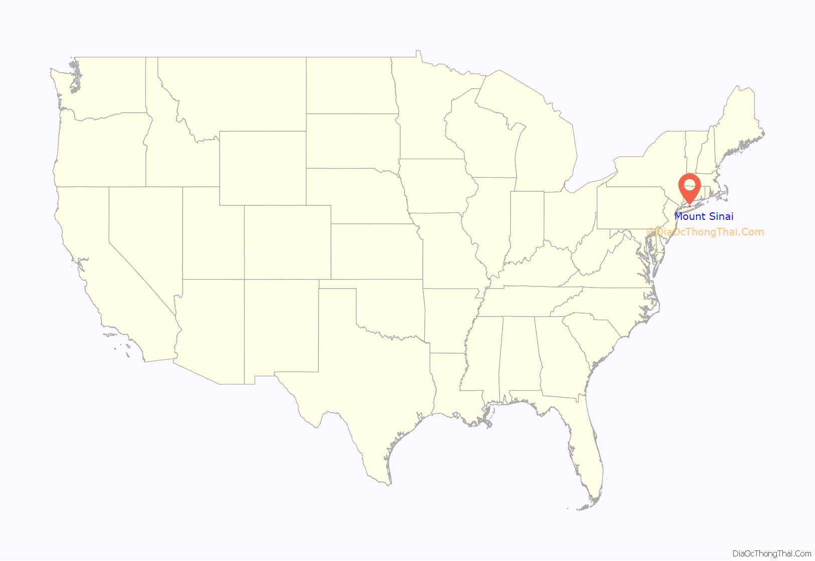
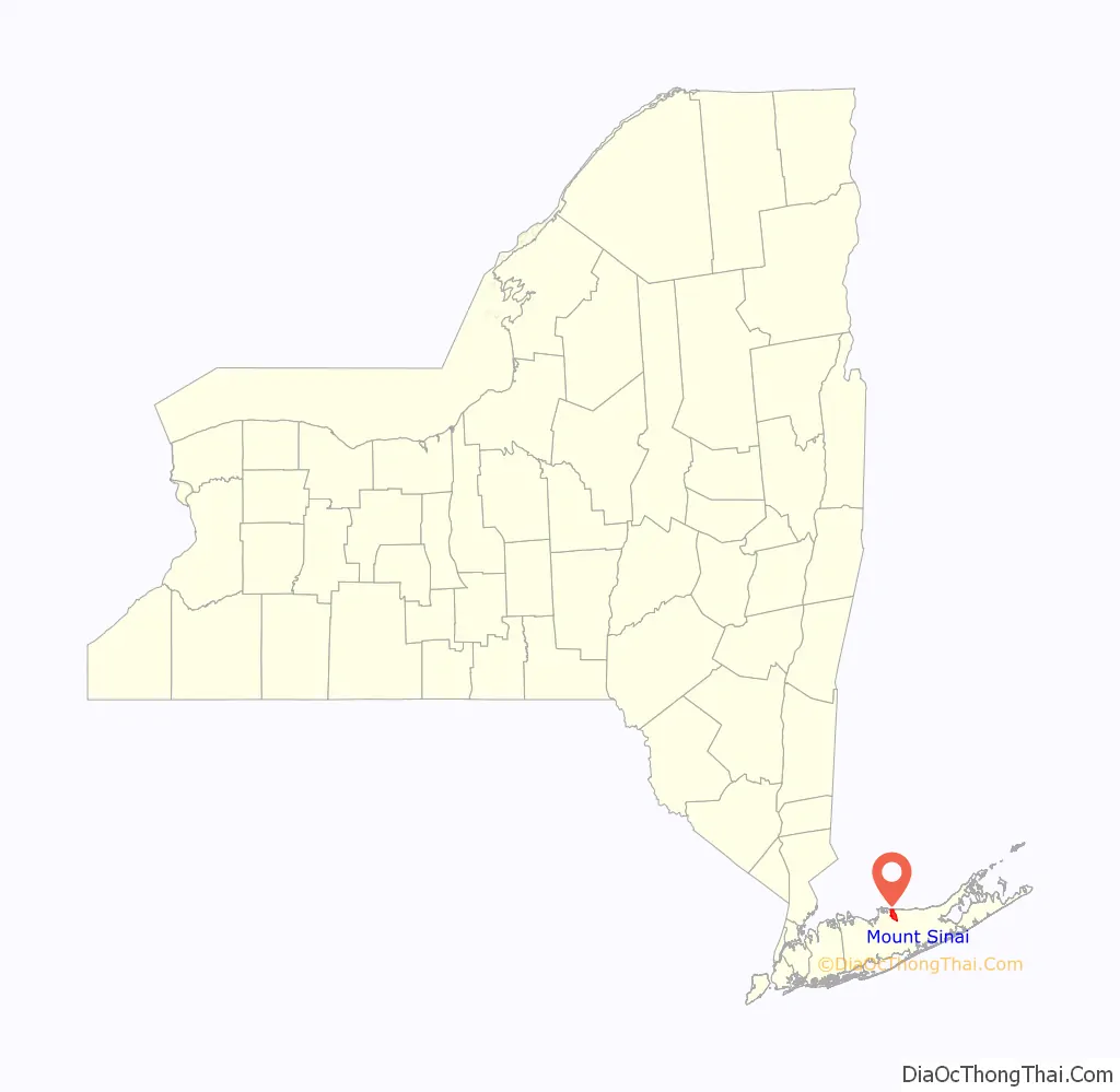
Mount Sinai location map. Where is Mount Sinai CDP?
History
Mount Sinai was founded in the 1660s.
Origins
The area now known as Mount Sinai was originally called Nonowatuck, or “stream that dries up”, by the Seatocot family of Native Americans who lived here. The first European settlers were Colonial settlers living in what is now Setauket, who obtained a deed from these local Native Americans in 1664.
The origin of the town’s initial European name, “Old Mans”, is not known. The most prominent telling concerns Major John Gotherson, an elderly Englishman who was supposedly swindled into incorrectly believing he’d bought land in the New World by Captain John Scott, an important leader in Long Island’s early history. After Gotherson sent representatives who were quickly turned away, local residents started to jokingly refer to the land as “the Old Mans”.
During the American Revolution, the area and Old Mans Harbor were under British control. However, because of its remote location the British did not have troops stationed here. Many citizens moved their families to Connecticut during British occupation. During the course of the war, American agents visited local patriots and received information, clothing, supplies and money to support the cause. In 1780, American Major Benjamin Tallmadge and a detachment of Continental Army dragoons landed at Cedar Beach and traveled south to successfully attack the British at Manor St. George. The route he and his men took is now marked as an historic trail.
Development as agricultural hamlet
Building of houses occurred in spurts. Initially most building occurred within a mile (2 km) of the harbor. Few houses were built south of North Country Road until the late 19th century. Much of the land south of North Country Road was owned and cultivated by farmers.
There is no known 17th-century structure still standing. The 18th century is represented by six buildings dating from 1705 to 1790. Certain of these homes have structural elements which date from the early period. The 19th century has the largest number of surviving historical structures. These can be divided into two periods, 1800-1840s and 1880-1890s. Again, some of these buildings incorporated structural elements of earlier periods.
In 1840 the people of Old Mans applied for a post office. Evidently Old Mans was not considered a proper name for the area. The name was changed to Mount Vernon. This name was used for only a year as there already was a Mount Vernon in New York. Old Mans was used once again, but for unknown reason another name change occurred. The name Mount Sinai, after the biblical mountain, was chosen by the first postmaster, Charles Phillips. Local legend says that he chose the name arbitrarily by pointing a needle at random into his Bible. Mount Sinai is the name residents have used since 1841/1842.
In addition to the farmland that populated Old Mans, the town’s trees provided much of the wood for the shipbuilding trade centered in neighboring Port Jefferson. A shipyard existed in Old Mans for a time, but this was moved to the naturally deeper harbor of Port Jefferson. Riggers, sail-makers, ship carpenters and others lived in Mount Sinai and commuted to Port Jefferson. Grist mills were located somewhere along Pipe Stave Hollow and Crystal Brook Hollow roads. Records indicate that a number of windmills were located on the hills overlooking the harbor.
As the population expanded, a number of businesses were established along Route 25A. A commercial center did not develop in Mount Sinai and residents depended on businesses in the neighboring village of Port Jefferson.
Houses of worship
Prior to 1740, Mount Sinai residents had to travel to Setauket for services. In the 1740s a no-longer-standing Protestant church was built. The local Congregational group was established in 1789 and in 1807 this group erected the still-active Mount Sinai Congregational Church. In the early 19th century, a Methodist church was built on Shore Road, but this was later sold when the congregation joined with that of Port Jefferson.
Resort town
Once the Long Island Rail Road reached adjacent Port Jefferson in 1879, and temporarily continued into Mount Sinai from 1895 to 1939, new visitors and residents began appearing from New York City and from elsewhere on Long Island in order to enjoy the hamlet’s beaches and bucolic setting.
The development of Mount Sinai for its natural and recreational qualities had begun with the 1841 establishment of a special care facility for sick and disabled children on the southwestern side of Mount Sinai Harbor.
This consisted of housing and volunteer workers on a 130-acre (53 ha) plot, with the location being chosen due to its close proximity to St. Charles Hospital in adjacent Port Jefferson.
On April 2, 1892, this parcel was sold to Dr. Jerome Walker, who established the Crystal Brook Park Association which is still owned and occupied today by Mount Sinai’s oldest private community known as Crystal Brook Park.
Seasonal vacation houses were erected along Mount Sinai Harbor. Cedar Beach, which is located on a peninsula that divides the harbor from the Long Island Sound, became a popular recreational destination. The Chandler Estate, on Mount Sinai Harbor’s southern side, was repurposed as vacation cottages and housed Marilyn Monroe and Arthur Miller during their holidays in the 1950s.
Suburban growth
In the first half of the 20th century the pace of building slowed. Although large tracts of farmland persisted, there were small pockets of development around the hamlet. Examples of these are the “colony” of homes built off Pipe Stave Hollow Road, both north and south of Route 25A, and the scattered development on Mount Sinai and Chestnut avenues. During this time a community was mapped but never developed just south of Route 25A and east of Crystal Brook Hollow Road.
It was not until the 1960s that housing developments began to occur as suburbanization spread eastward. Lands once farmed were now sold and developed into homes for new residents of Mount Sinai. This included the sale and development of the 404-acre Davis Peach Farm in the first years of the 2000s.
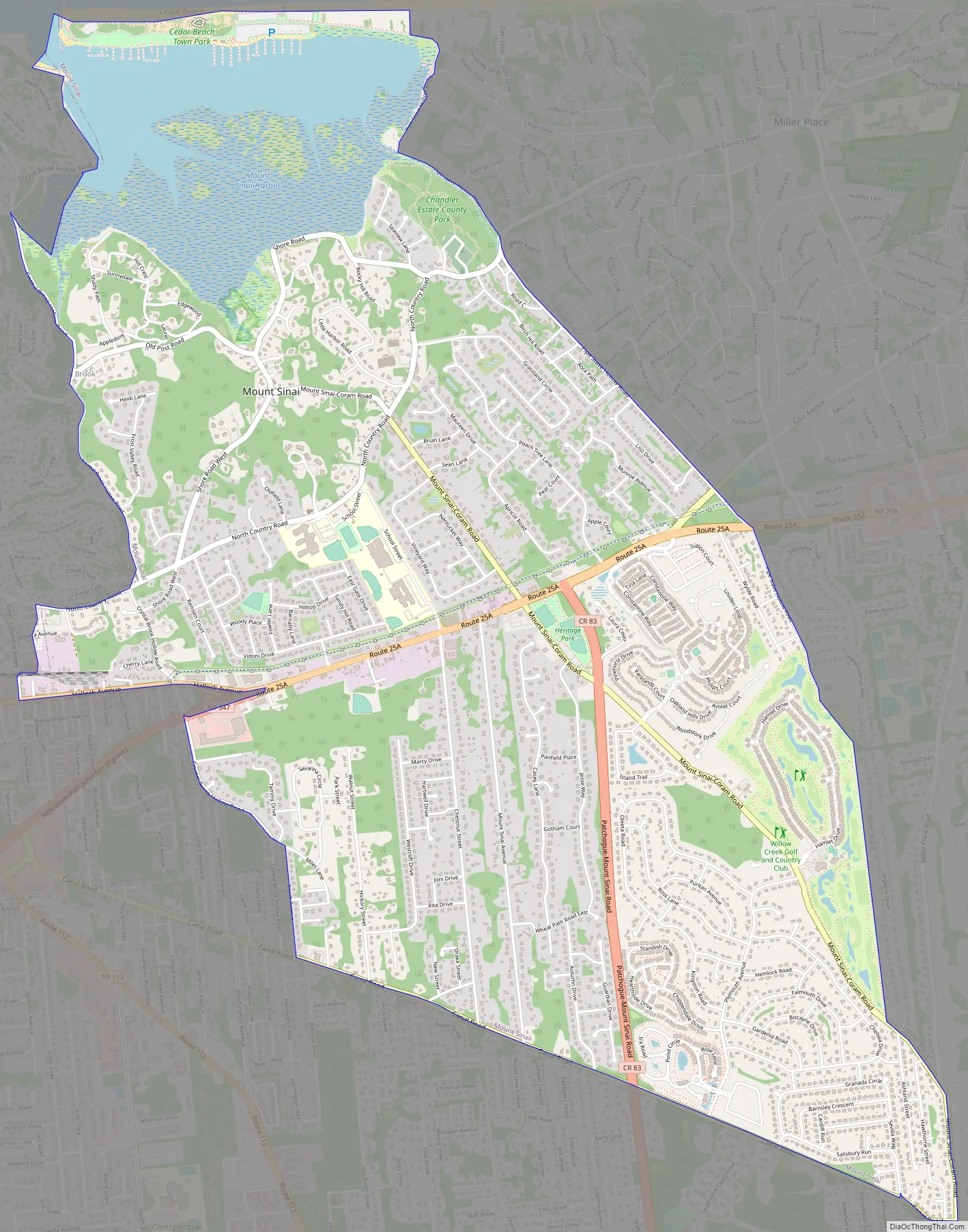
Mount Sinai Road Map
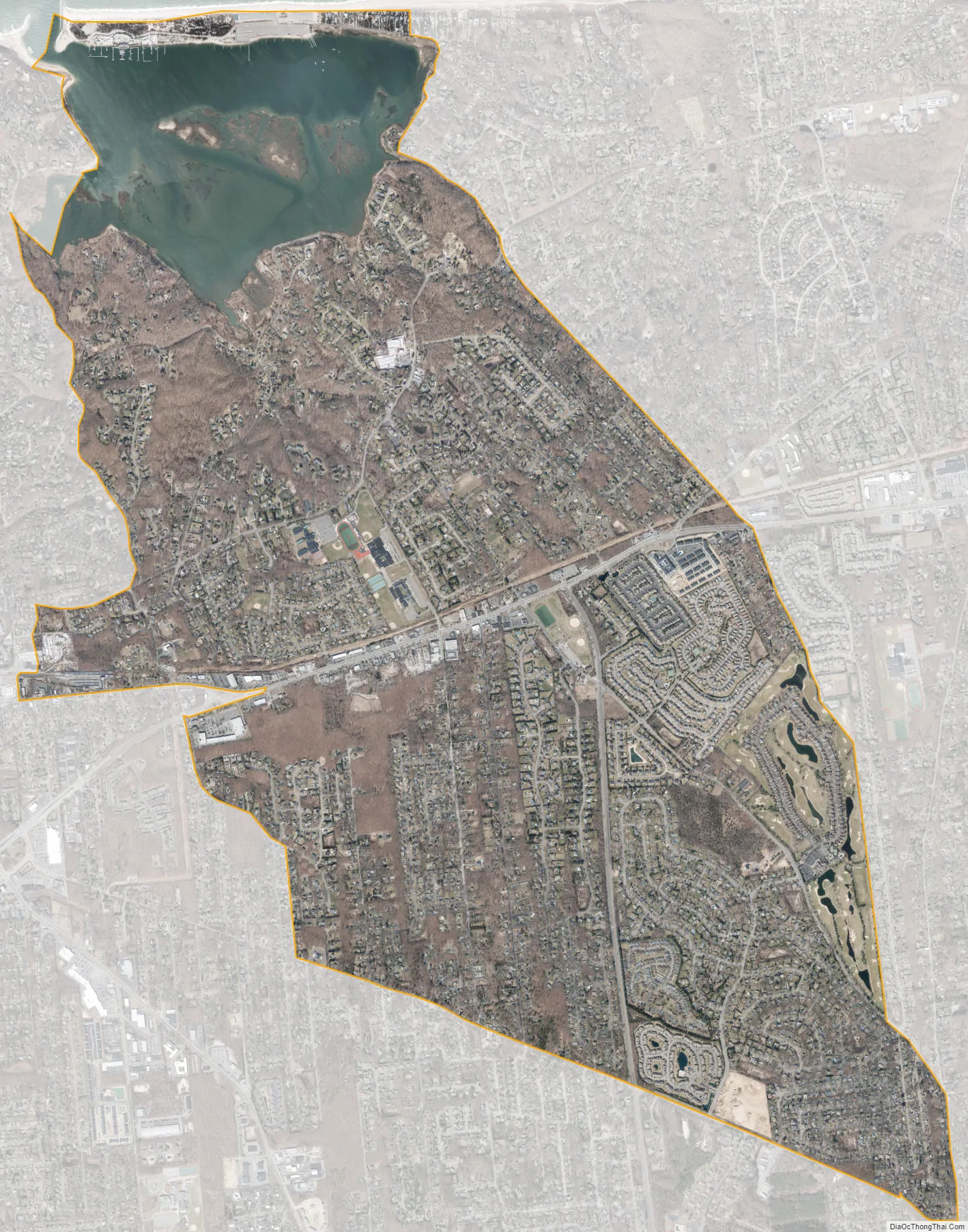
Mount Sinai city Satellite Map
Geography
Mount Sinai is located at 40°56′19″N 73°01′07″W / 40.938532°N 73.018668°W / 40.938532; -73.018668 (40.938532, -73.018668), bordering Long Island Sound on the North Shore of Long Island. According to the United States Census Bureau, the community has a total area of 6.4 square miles (16.6 km), of which 6.0 square miles (15.5 km) is land and 0.42 square miles (1.1 km), or 6.53%, is water. Mount Sinai is bordered by Port Jefferson to the west, Port Jefferson Station to the southwest, Coram to the south, and Miller Place to the east.
Mount Sinai Harbor
The northern part of Mount Sinai Harbor borders an active recreation area that is located on a 2-mile long peninsula. This includes Cedar Beach, one of the most popular North Shore beaches during the summer months. A marine sanctuary and nature preserve connects the various sections of Cedar Beach with scenic walking trails and serves to protect the remaining sand dunes. Commonly owned lands set aside in 1664 are being used for public recreation or have been rented for private use by a fishing station, yacht club and boatyard. A number of commercial fishermen work out of the harbor and fish in Long Island Sound. The peninsula, which is most directly accessible from the neighboring community of Miller Place, contains a number of historical vacation houses on both sides of the boundary line. The majority of these houses have since been converted to full-year use.
The southern part of it is a more serene location. Clamming is a popular activity during low tide, as is fishing at high tide. Throughout its history, Mount Sinai Harbor has been utilized for the catching of shellfish, the fishing of snapper and flounder, the hunting of waterfowl, sand milling, and the harvesting of salt hay. Satterly Landing, a small park that once housed a boathouse, provides views across the harbor.
The original mouth of the harbor was on the east side. Winds and tides continually narrowed its opening. Local residents toiled at widening the mouth. In the mid 19th century a new mouth was dredged on the west side of the harbor. Tides continue to dump sand, narrowing the mouth of the harbor. It still must be dredged to keep it open to allow for the boats moored in the harbor to reach the Sound. Three major civic battles were waged in the 20th century when various plans to dredge the harbor were proposed and pursued by the Town of Brookhaven. Two dredging projects were approved, and the present channels and deep basin south of Cedar Beach are the result of that action. A united civic action finally got the dredges out of the harbor in the late 1960s.
See also
Map of New York State and its subdivision:- Albany
- Allegany
- Bronx
- Broome
- Cattaraugus
- Cayuga
- Chautauqua
- Chemung
- Chenango
- Clinton
- Columbia
- Cortland
- Delaware
- Dutchess
- Erie
- Essex
- Franklin
- Fulton
- Genesee
- Greene
- Hamilton
- Herkimer
- Jefferson
- Kings
- Lake Ontario
- Lewis
- Livingston
- Madison
- Monroe
- Montgomery
- Nassau
- New York
- Niagara
- Oneida
- Onondaga
- Ontario
- Orange
- Orleans
- Oswego
- Otsego
- Putnam
- Queens
- Rensselaer
- Richmond
- Rockland
- Saint Lawrence
- Saratoga
- Schenectady
- Schoharie
- Schuyler
- Seneca
- Steuben
- Suffolk
- Sullivan
- Tioga
- Tompkins
- Ulster
- Warren
- Washington
- Wayne
- Westchester
- Wyoming
- Yates
- Alabama
- Alaska
- Arizona
- Arkansas
- California
- Colorado
- Connecticut
- Delaware
- District of Columbia
- Florida
- Georgia
- Hawaii
- Idaho
- Illinois
- Indiana
- Iowa
- Kansas
- Kentucky
- Louisiana
- Maine
- Maryland
- Massachusetts
- Michigan
- Minnesota
- Mississippi
- Missouri
- Montana
- Nebraska
- Nevada
- New Hampshire
- New Jersey
- New Mexico
- New York
- North Carolina
- North Dakota
- Ohio
- Oklahoma
- Oregon
- Pennsylvania
- Rhode Island
- South Carolina
- South Dakota
- Tennessee
- Texas
- Utah
- Vermont
- Virginia
- Washington
- West Virginia
- Wisconsin
- Wyoming


