Northport is a historic maritime village on the northern shore of Long Island in Suffolk County, New York, United States. Initially designated Great Cow Harbour by 17th-century English colonists, the area was officially renamed Northport in 1837. In 1894, in an effort to localize governance, the community was incorporated as a village.
Northport is known for its Victorian era village center, still bearing trolley rails from a long since discontinued streetcar line which would transport village residents to the Long Island Rail Road station in East Northport. The village Main Street runs from the Village Green along the harbor-front to the former hamlet of Vernon Valley, which has since been subsumed by the neighboring community of East Northport. As of 2010, the village has a population of approximately 7,401 and is served by the Northport-East Northport School District.
| Name: | Northport village |
|---|---|
| LSAD Code: | 47 |
| LSAD Description: | village (suffix) |
| State: | New York |
| County: | Suffolk County |
| Incorporated: | 1894 |
| Elevation: | 0−59 ft (0−18 m) |
| Total Area: | 2.53 sq mi (6.55 km²) |
| Land Area: | 2.30 sq mi (5.96 km²) |
| Water Area: | 0.23 sq mi (0.59 km²) |
| Total Population: | 7,347 |
| Population Density: | 3,190.19/sq mi (1,231.71/km²) |
| ZIP code: | 11768 |
| Area code: | 631 |
| FIPS code: | 3653396 |
| GNISfeature ID: | 0958968 |
| Website: | northportny.gov |
Online Interactive Map
Click on ![]() to view map in "full screen" mode.
to view map in "full screen" mode.
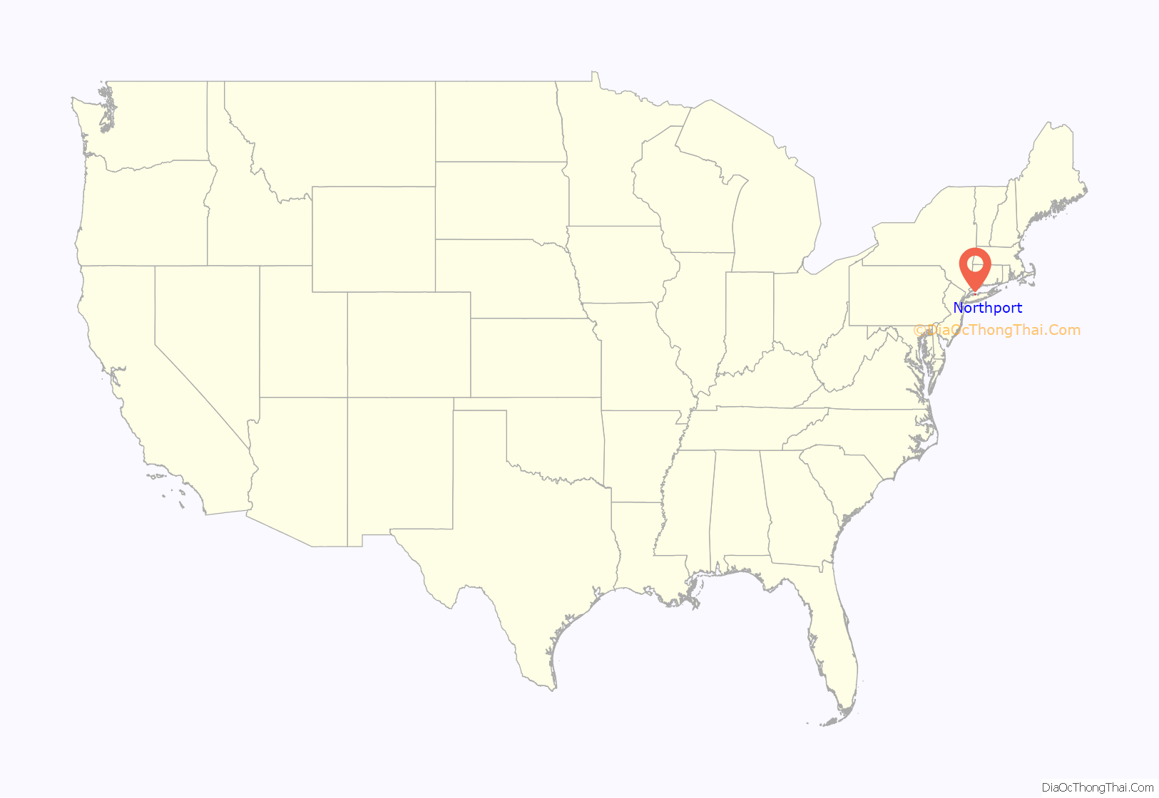
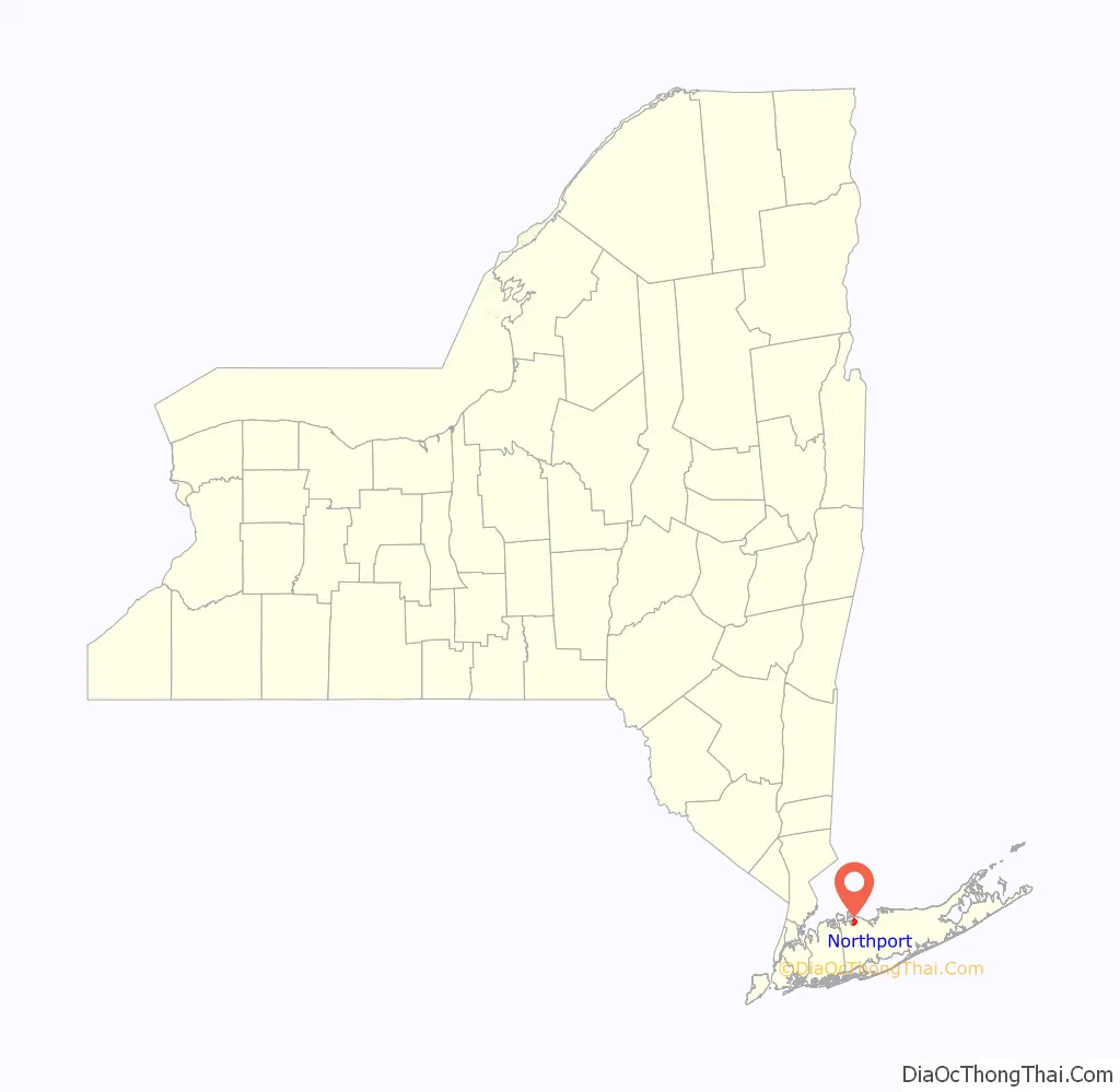
Northport location map. Where is Northport village?
History
European settlement
The original inhabitants of the area now known as Northport were the Matinecocks, one of 13 Native American tribes of Long Island. The Matinecocks called this land Opcathontyche, which meant “wading place creek”. After Dutch interest a few years earlier, the land was sold by Chief Asharoken, head of the Matinecocks, to three Englishmen in 1656.
With land that was well suited for farming, the early settlers grazed cattle on pastures around the harbor. The area soon became known as Great Cow Harbour. (The nearby hamlet of Centerport was known as Little Cow Harbour.) The oldest house still standing in Northport, the Skidmore House on Main Street, was built in 1761. In 2009 the house was put up for sale, sparking the village to pass a historical preservation law.
Growth, change, and shipbuilding
In the early 19th century, Great Cow Harbor was still a rural farming community. By the 1830s, the village contained only eight dwellings. But a new industry of shipbuilding brought rapid change and growth. The village shifted away from its farming roots as shipbuilding became the community’s primary industry. By 1837, the village was being referred to as Northport.
The 1860 census listed Northport’s population at 1,016. By 1874, it had become the most flourishing village on Suffolk County’s north shore, with three ship yards, five sets of marine railways, two hotels, and at least six general stores.
Northport’s shipbuilding boom lasted fifty years, but waned at the end of the century as steel-hulled ships began replacing the wooden vessels produced in the village.
Railroads and trolleys
On April 25, 1868, the Long Island Rail Road opened a station within the village of Northport. This was an essential transportation link for the village, especially for the growing commuter population. However, just a few years later the LIRR decided to move the Northport station to a new location in Larkfield to facilitate further railway extension to Port Jefferson. The new railway station located on Larkfield Road was opened on January 13, 1873, and retained the station name of Northport.
To avoid confusion with the former station located in the village of Northport, train conductors would refer to the station in Larkfield as “East of Northport” because the station was located east of the Northport railway junction which directed trains north to the station located in the village. Despite the fact that Larkfield was primarily south of Northport, the area became known thereafter as East Northport. The original rail spur to Northport was afterwards known as the Northport Branch. After the old village station closed in 1899, Northport decided to build a 2.5-mile (4.0 km) trolley line to take commuters between Main Street and the new Northport station located in Larkfield. The new commuter trolley opened in mid-April 1902. The trolley would eventually become obsolete with the increasing popularity of the automobile, and the trolley made its last scheduled commuter run on August 19, 1924.
Incorporation and annexation
Although it was known by the name of Northport since at least 1837, the village of Northport was not formally incorporated until 1894, becoming the first village in the Town of Huntington to do so. Over the years Northport has expanded from its original borders, annexing other established communities.
Around the Revolutionary War, a concentration of 31 families began settling 1.5 miles (2.4 km) east of Northport, around where Main Street and Route 25A now intersect 40°53′58″N 73°19′47″W / 40.8995°N 73.3296°W / 40.8995; -73.3296. This settlement was originally known as Red Hook and changed names to Vernon Valley in 1820. By 1874 Vernon Valley had a population of around 150 inhabitants. Vernon Valley became part of Northport in the mid-20th century.
Northport also annexed the formerly independent settlement of Crab Meadow 40°55′15″N 73°19′13″W / 40.9207°N 73.3202°W / 40.9207; -73.3202 (also known as Great Neck), as well as western parts of the Freshpond community 40°55′21″N 73°17′47″W / 40.9224°N 73.2965°W / 40.9224; -73.2965.
Modern Northport
By the 1920s, after nearly a century of heavy commercial use, the waterfront which had supported the community for generations had fallen into decay. The village decided to purchase the land along the harbor and created Northport Memorial Park in 1932, which is a defining feature of Northport today.
In 1967, the Long Island Lighting Company (LILCO) opened the Northport Power Station, currently the largest oil-fired electric generating station on the East Coast. The four enormous stacks are a well-known landmark that can be seen from as far away as Connecticut across Long Island Sound. Each stack is 600 feet (180 m) tall.
The Northport Trolley which had ceased operations in 1924 enjoyed a popular revival in the 1970s and 1980s, transporting weekend tourists along Main Street. Unlike the original electric trolleys, this nostalgic replica was horse driven. It also ran on rubber automobile tires rather than utilizing the original rails which still remain a visible element of Main Street to this day.
In July 1984, Northport garnered nationwide media attention for being the site of the gruesome murder of 17-year-old Gary Lauwers by his friend, high school dropout and alleged devil-worshiper Ricky Kasso. The events made national headlines and have since been recounted in books and movies, which caused the village to suffer a negative reputation for reputed satanism.
Every September the village of Northport commemorates its rich history with the celebration of Cow Harbor Day, which follows the annual Great Cow Harbor 10K race.
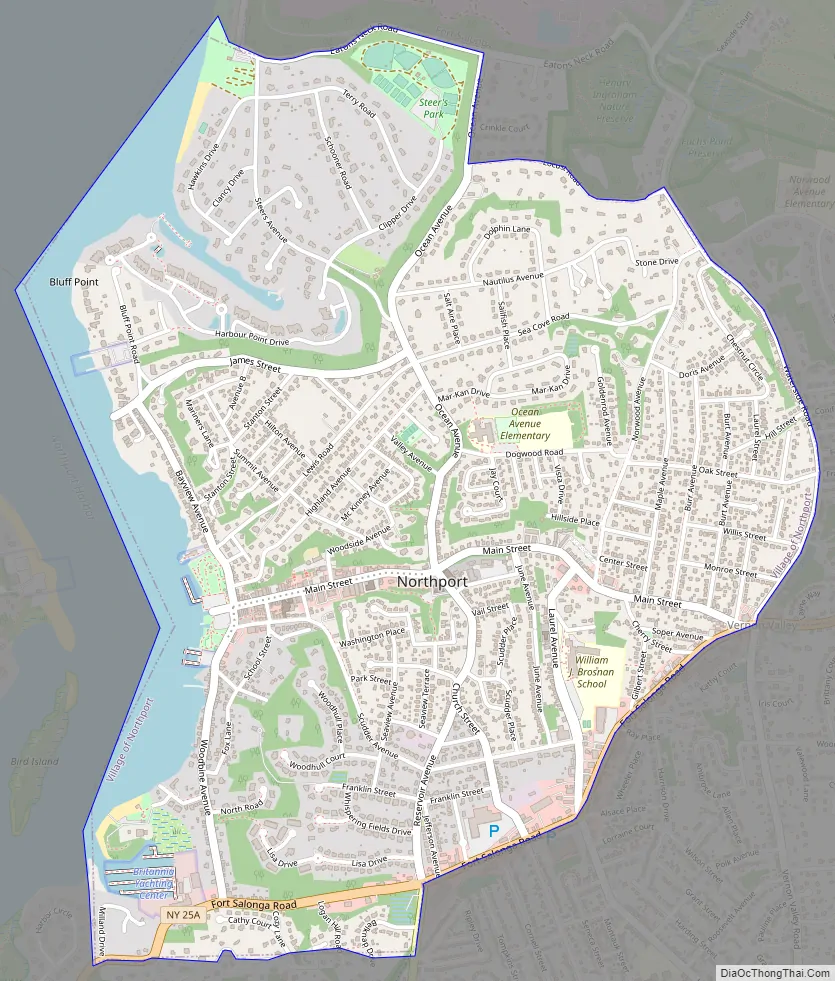
Northport Road Map
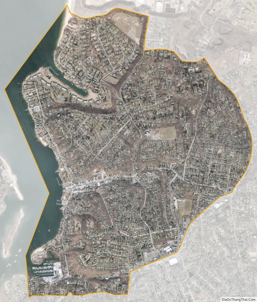
Northport city Satellite Map
Geography
Northport is located at 40°54′10″N 73°20′39″W / 40.90278°N 73.34417°W / 40.90278; -73.34417 (40.902803, -73.344069). According to the United States Census Bureau, the village has a total area of 2.5 square miles (6.5 km), of which 2.3 square miles (6.0 km) is land and 0.2 square miles (0.52 km), or 9.02%, is water.
Most of the village is made up of the low, steep hills of Long Island’s northern terminal moraine. To the west is the highly sheltered Northport Harbor, to the north is Long Island Sound, and to the east are woods and marshland.
A prominent feature of Northport is Steer’s Pit (known simply as “The Pit” to locals), a large land depression carved into the cliffs adjacent to Northport Harbor and just south of the enormous LIPA smokestacks. This unusual geographic feature is the result of sand mining operations by the Steers and Steers Company. Mining began in 1923 and ceased in the 1950s. The mined sand was shipped by barge to New York City where, mixed with Portland cement and rock aggregate, it became the sidewalks of New York. The area has since been utilized for home and condo use, and a portion of the Pit is a park used by local youth soccer and baseball leagues. The Northport Fire Department maintains a training facility in the Pit that is the site of the annual fireman’s fair in the summer.
See also
Map of New York State and its subdivision:- Albany
- Allegany
- Bronx
- Broome
- Cattaraugus
- Cayuga
- Chautauqua
- Chemung
- Chenango
- Clinton
- Columbia
- Cortland
- Delaware
- Dutchess
- Erie
- Essex
- Franklin
- Fulton
- Genesee
- Greene
- Hamilton
- Herkimer
- Jefferson
- Kings
- Lake Ontario
- Lewis
- Livingston
- Madison
- Monroe
- Montgomery
- Nassau
- New York
- Niagara
- Oneida
- Onondaga
- Ontario
- Orange
- Orleans
- Oswego
- Otsego
- Putnam
- Queens
- Rensselaer
- Richmond
- Rockland
- Saint Lawrence
- Saratoga
- Schenectady
- Schoharie
- Schuyler
- Seneca
- Steuben
- Suffolk
- Sullivan
- Tioga
- Tompkins
- Ulster
- Warren
- Washington
- Wayne
- Westchester
- Wyoming
- Yates
- Alabama
- Alaska
- Arizona
- Arkansas
- California
- Colorado
- Connecticut
- Delaware
- District of Columbia
- Florida
- Georgia
- Hawaii
- Idaho
- Illinois
- Indiana
- Iowa
- Kansas
- Kentucky
- Louisiana
- Maine
- Maryland
- Massachusetts
- Michigan
- Minnesota
- Mississippi
- Missouri
- Montana
- Nebraska
- Nevada
- New Hampshire
- New Jersey
- New Mexico
- New York
- North Carolina
- North Dakota
- Ohio
- Oklahoma
- Oregon
- Pennsylvania
- Rhode Island
- South Carolina
- South Dakota
- Tennessee
- Texas
- Utah
- Vermont
- Virginia
- Washington
- West Virginia
- Wisconsin
- Wyoming


