Philadelphia is a village in Jefferson County, New York, United States. The population was 1,252 at the 2010 census, down from 1,519 in 2000.
The village is in the town of Philadelphia and is northeast of Watertown. It is also just northwest of Fort Drum.
The village contains a “Quaker Cemetery”, and its summer festival is called “Quaker Days”.
| Name: | Philadelphia village |
|---|---|
| LSAD Code: | 47 |
| LSAD Description: | village (suffix) |
| State: | New York |
| County: | Jefferson County |
| Elevation: | 486 ft (148 m) |
| Total Area: | 0.96 sq mi (2.48 km²) |
| Land Area: | 0.96 sq mi (2.48 km²) |
| Water Area: | 0.00 sq mi (0.00 km²) |
| Total Population: | 1,098 |
| Population Density: | 1,146.14/sq mi (442.63/km²) |
| ZIP code: | 13673 |
| Area code: | 315 |
| FIPS code: | 3657551 |
| GNISfeature ID: | 0960294 |
| Website: | townofphiladelphiany.com |
Online Interactive Map
Click on ![]() to view map in "full screen" mode.
to view map in "full screen" mode.
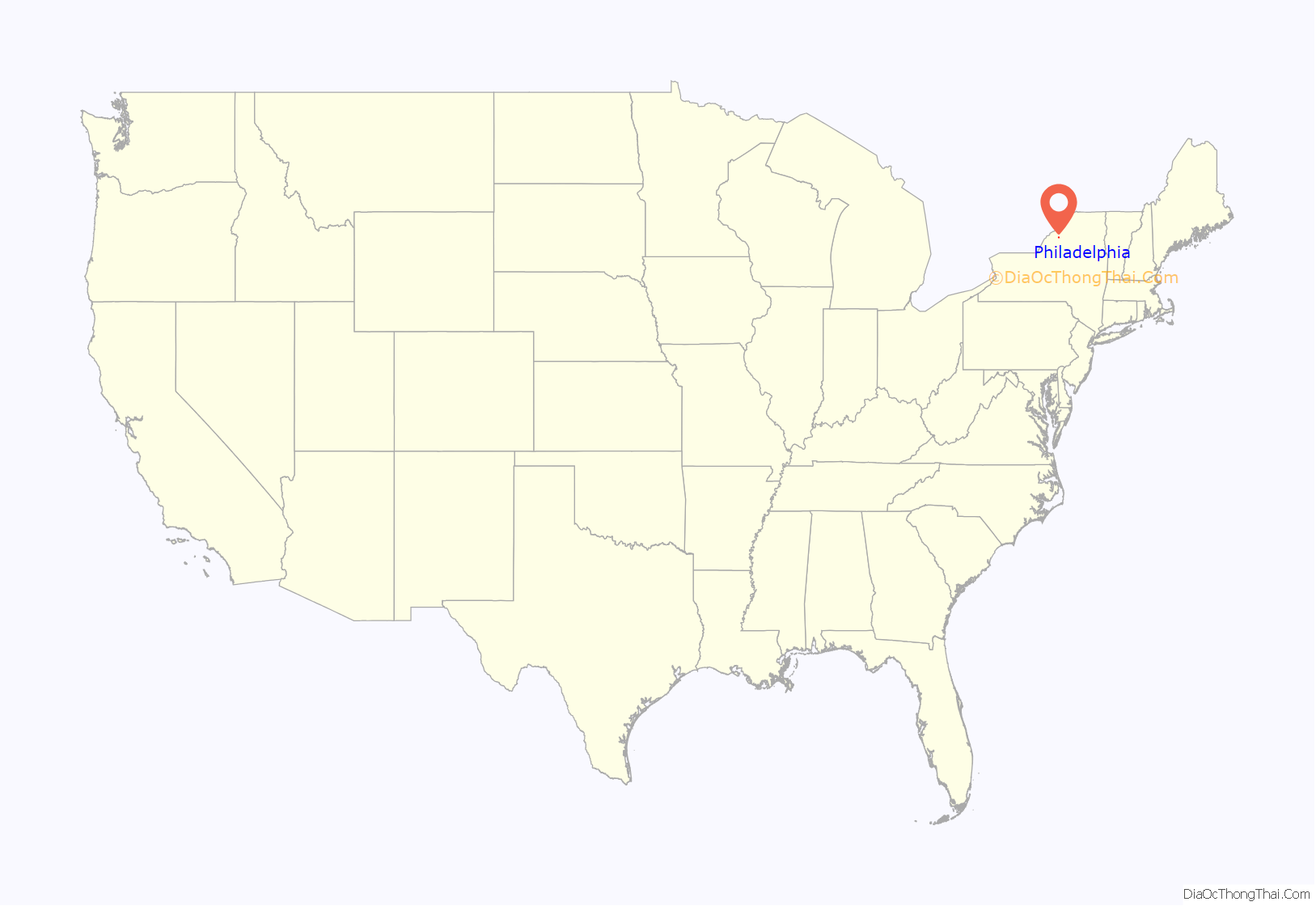
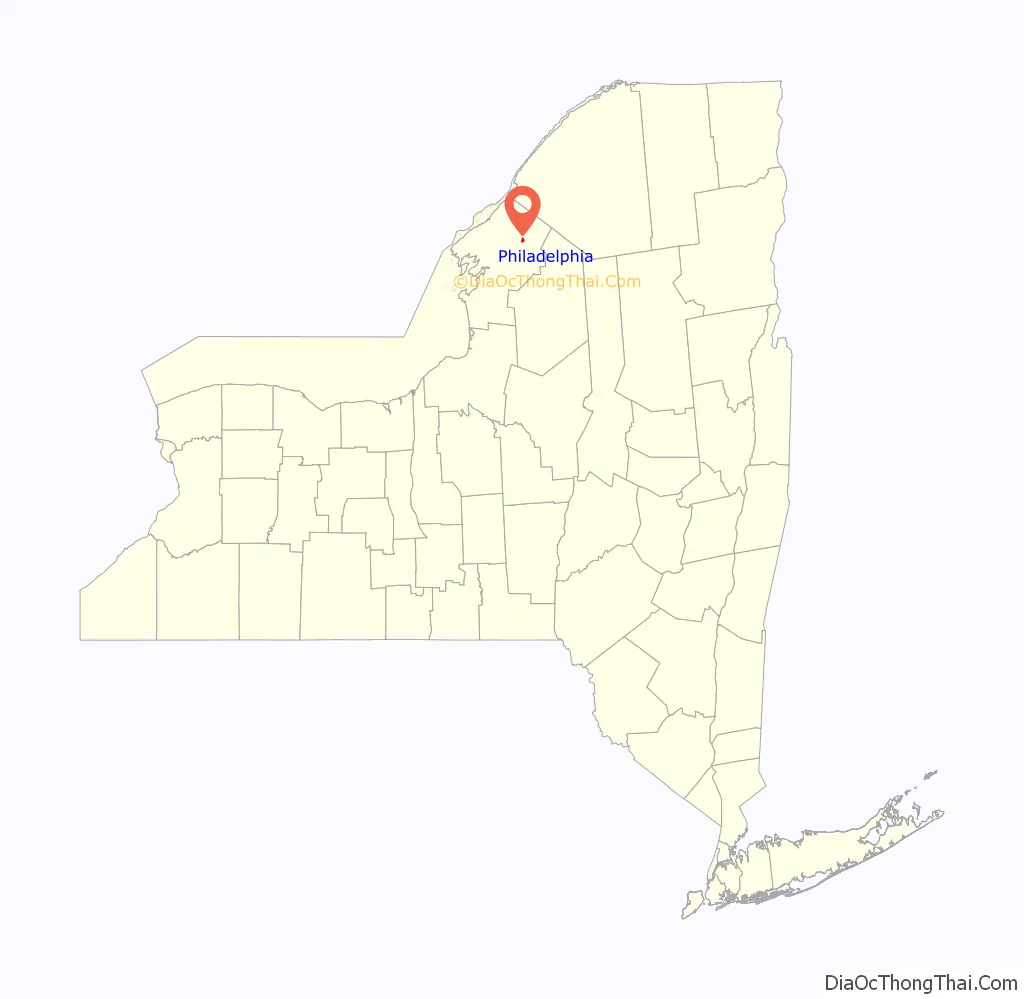
Philadelphia location map. Where is Philadelphia village?
History
The current village was formerly “Friends Settlement” and “Benezet”. It was settled by Quakers.
Philadelphia was incorporated as a village in 1872.
Philadelphia holds the December record low temperature for New York state of −47 °F (−44 °C).
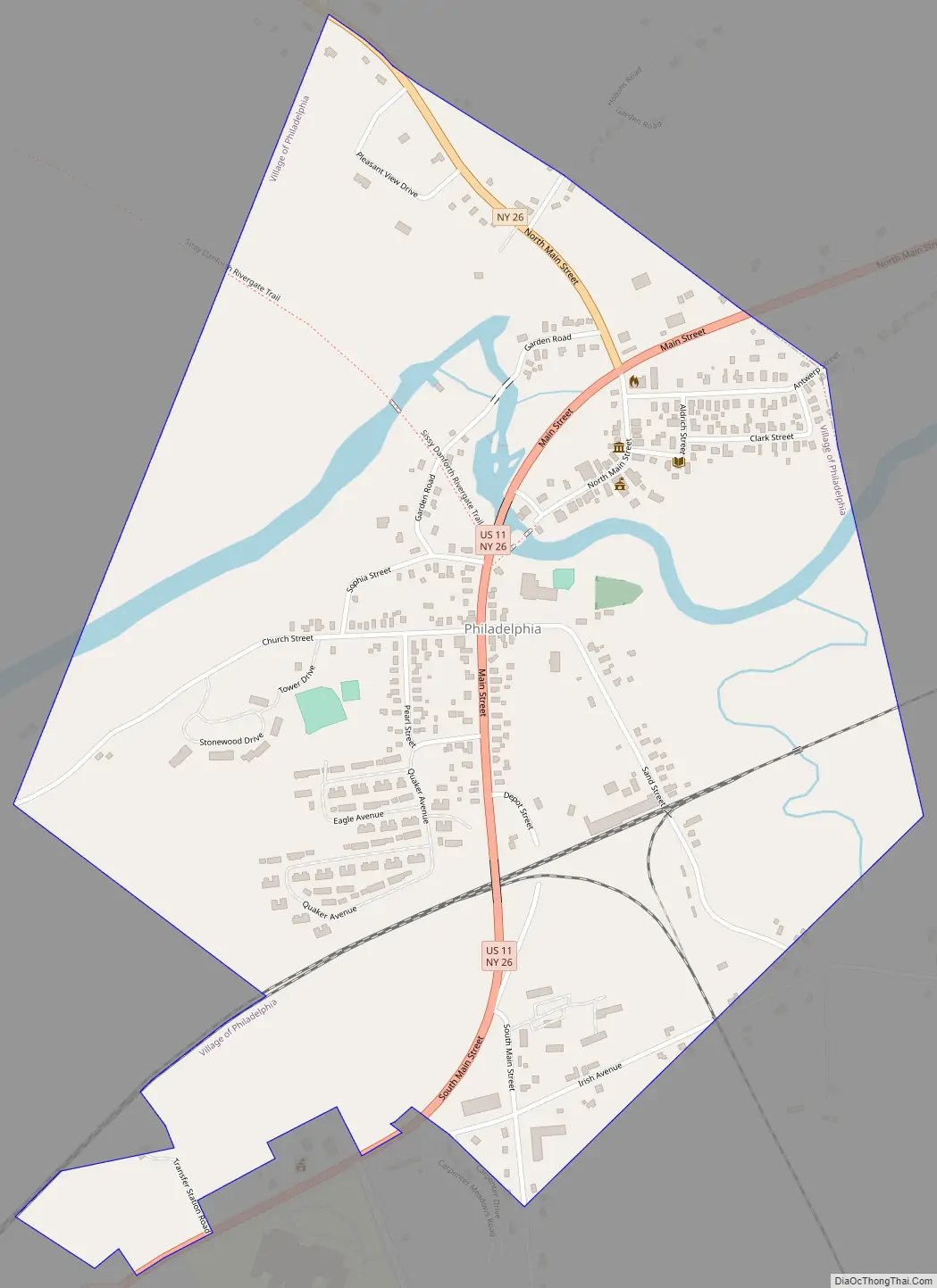
Philadelphia Road Map
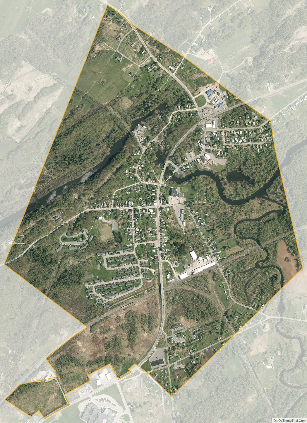
Philadelphia city Satellite Map
Geography
According to the United States Census Bureau, the village has a total area of 0.89 square miles (2.3 km), all land.
The village is located on U.S. Route 11 at the junction with New York State Route 26. US-11 leads southwest 17 miles (27 km) to Watertown, the Jefferson county seat, and northeast 18 miles (29 km) to Gouverneur. NY-26 leads northwest 18 miles (29 km) to Alexandria Bay on the St. Lawrence River.
The Indian River runs through the center of the village.
See also
Map of New York State and its subdivision:- Albany
- Allegany
- Bronx
- Broome
- Cattaraugus
- Cayuga
- Chautauqua
- Chemung
- Chenango
- Clinton
- Columbia
- Cortland
- Delaware
- Dutchess
- Erie
- Essex
- Franklin
- Fulton
- Genesee
- Greene
- Hamilton
- Herkimer
- Jefferson
- Kings
- Lake Ontario
- Lewis
- Livingston
- Madison
- Monroe
- Montgomery
- Nassau
- New York
- Niagara
- Oneida
- Onondaga
- Ontario
- Orange
- Orleans
- Oswego
- Otsego
- Putnam
- Queens
- Rensselaer
- Richmond
- Rockland
- Saint Lawrence
- Saratoga
- Schenectady
- Schoharie
- Schuyler
- Seneca
- Steuben
- Suffolk
- Sullivan
- Tioga
- Tompkins
- Ulster
- Warren
- Washington
- Wayne
- Westchester
- Wyoming
- Yates
- Alabama
- Alaska
- Arizona
- Arkansas
- California
- Colorado
- Connecticut
- Delaware
- District of Columbia
- Florida
- Georgia
- Hawaii
- Idaho
- Illinois
- Indiana
- Iowa
- Kansas
- Kentucky
- Louisiana
- Maine
- Maryland
- Massachusetts
- Michigan
- Minnesota
- Mississippi
- Missouri
- Montana
- Nebraska
- Nevada
- New Hampshire
- New Jersey
- New Mexico
- New York
- North Carolina
- North Dakota
- Ohio
- Oklahoma
- Oregon
- Pennsylvania
- Rhode Island
- South Carolina
- South Dakota
- Tennessee
- Texas
- Utah
- Vermont
- Virginia
- Washington
- West Virginia
- Wisconsin
- Wyoming


