Rockville Centre, commonly abbreviated as RVC, is an incorporated village located in the Town of Hempstead in Nassau County, on the South Shore of Long Island, in New York, United States. The population was 26,016 at the 2020 census.
| Name: | Rockville Centre village |
|---|---|
| LSAD Code: | 47 |
| LSAD Description: | village (suffix) |
| State: | New York |
| County: | Nassau County |
| Incorporated: | 1893 |
| Elevation: | 30 ft (9 m) |
| Total Area: | 3.34 sq mi (8.64 km²) |
| Land Area: | 3.25 sq mi (8.42 km²) |
| Water Area: | 0.09 sq mi (0.22 km²) |
| Total Population: | 26,016 |
| Population Density: | 8,002.46/sq mi (3,089.88/km²) |
| ZIP code: | 11570 |
| Area code: | 516 |
| FIPS code: | 3663264 |
| GNISfeature ID: | 2391098 |
| Website: | www.rvcny.gov |
Online Interactive Map
Click on ![]() to view map in "full screen" mode.
to view map in "full screen" mode.
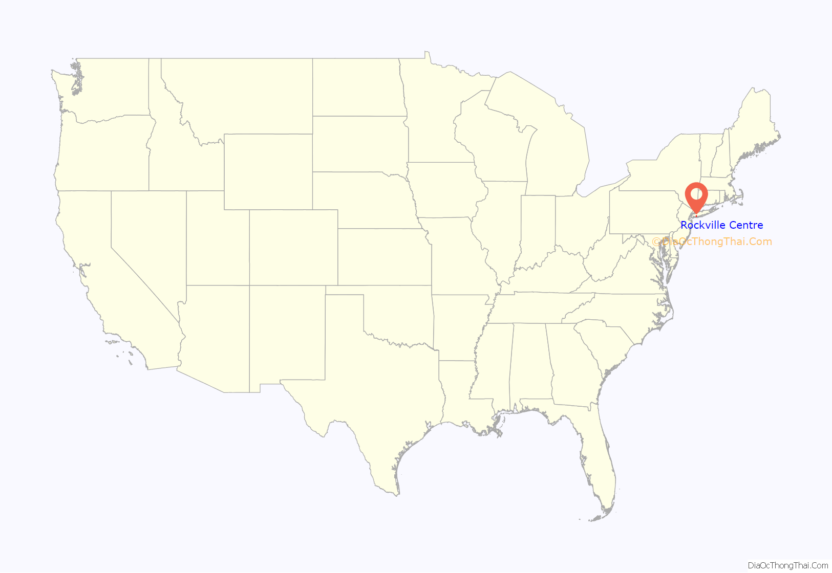
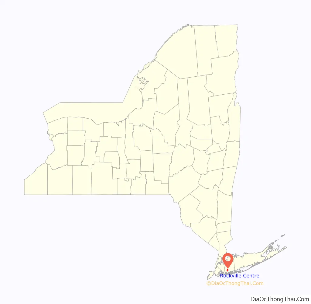
Rockville Centre location map. Where is Rockville Centre village?
History
Rockville Centre has been occupied by humans for thousands of years. Generally speaking, the people of the prehistoric Woodlands period East River culture are believed to have been the Algonkian-speaking ancestors of the historical Indian tribes of western Long Island. The historical territory of their Lenape descendants, the Canarsie, Recouwacky (Rockaway), Matinecock and Massapequa, included present-day western Long Island’s Queens and Nassau Counties.
By the year 1643, there were roughly thirteen Algonquin bands (then referred to as tribes) living east of the Dutch-English settlements: the four or so Lenape chieftaincies in western Long Island, and Metoac descendants of the prehistoric Woodlands period Windsor culture living on eastern Long Island, considered by some to be branches of the Pequot: Merrick, Nissequoge, Secatoag, Seatauket, Patchoag, Poosepatuck (also called Uncachogee), Corchaug, Shinnecock, Manhasset and Montaukett.
Imported diseases had decimated the natives in 16th century. While disease was still a major factor during the decades of the 17th century, native mortality in western Long Island due to disease was similar to that of the settlers. Most Lenape were pushed out of their homeland by expanding European colonies; the colonies received many emigrants while the Munsee-speaking Indian communities did not. Their dire situation was exacerbated by losses from intertribal conflicts.
The Reckouakie tribe (the Reckonhacky chieftaincy) had left their original land in present-day Rockaway and its surroundings in Queens County to Dutch Governor Kieft in 1640 because he wanted it for better defense of New Netherlands. Most settled to the east in what was to become Rockville Centre on the traditional land of the Matinecock (or of the Massapequa), with whom they had ties of kinship. Dutch and English settlers declared the 1639 treaty meant no Indians would remain in western Long Island (so they could sell it to emigrants), in contrast to the exact terms of the treaty which meant the Native Americans were willing to share the usufruct of unoccupied land, with the Dutch leadership having eminent domain superior to their sachem’s eminent domain. This led to many conflicts, then four years of open warfare. The Reckonhacky / Rockaway were party to a peace treaty dated May 24, 1645 following the devastation of Indian communities by Dutch soldiers. Violent expropriation dislocated them with the arrival of additional Dutch and English settlers.
The hamlet was named “Rockville Centre” in 1849, after local Methodist preacher and community leader Mordecai “Rock” Smith. It was incorporated as a village in 1893. Rockville Centre emerged in the late nineteenth and early twentieth century as a commuter town connected to New York by the Long Island Rail Road (LIRR). In 1915, the New York Tribune went so far as to declare that Rockville Centre was a place in which “the average mortal could live happily.”
Like many Long Island communities at the time, Rockville Centre’s population included a considerable number of supporters of the Ku Klux Klan during the 1920s. When the white supremacist organization placed a wreath at the town’s memorial to its war dead in 1923, the American Legion removed it in protest, but the village police received so many calls of complaint in response that they were forced to replace the wreath. In the late 1960s, the village of Rockville Centre received a stinging rebuke for its failure to maintain public housing units primarily inhabited by African-Americans. A report from Nassau County’s Human Rights Commission stated Rockville Centre was “at best indifferent to, if not actually in favor of, Negro removal.” Martin Luther King Jr. visited Rockville Centre in 1968, where he addressed a large audience at South Side Junior High School on March 26, 1968.
On February 17, 1950, two LIRR trains collided near Rockville Centre station, killing 32 and injuring more than 80.
The Rockville Centre Post Office was listed on the National Register of Historic Places in 1989.
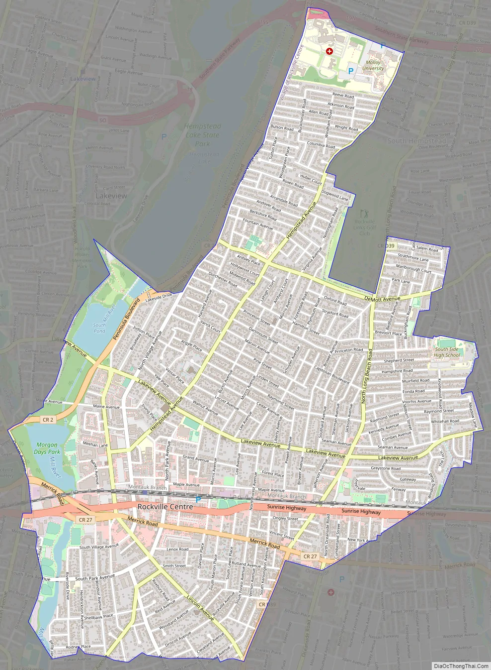
Rockville Centre Road Map
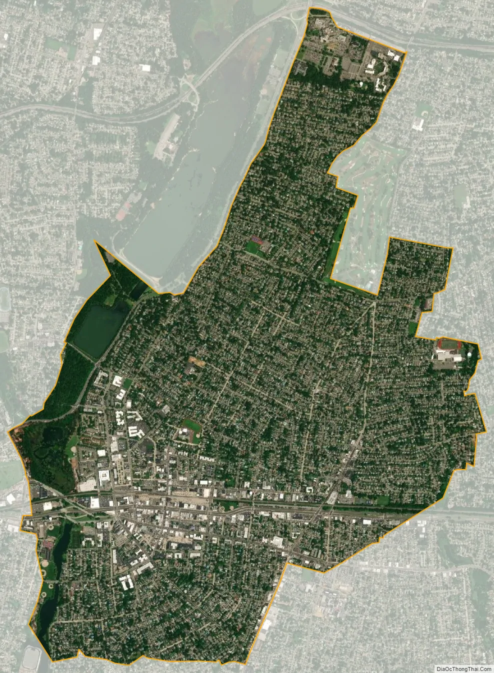
Rockville Centre city Satellite Map
Geography
Rockville Centre is located at 40°39’48” North, 73°38’13” West (40.663390, −73.636831). The village has a total area of 3.4 square miles (8.8 km), of which 3.3 square miles (8.5 km) is land and 0.1 square miles (0.26 km) is water, the latter total comprising 2.38% of the total area.
See also
Map of New York State and its subdivision:- Albany
- Allegany
- Bronx
- Broome
- Cattaraugus
- Cayuga
- Chautauqua
- Chemung
- Chenango
- Clinton
- Columbia
- Cortland
- Delaware
- Dutchess
- Erie
- Essex
- Franklin
- Fulton
- Genesee
- Greene
- Hamilton
- Herkimer
- Jefferson
- Kings
- Lake Ontario
- Lewis
- Livingston
- Madison
- Monroe
- Montgomery
- Nassau
- New York
- Niagara
- Oneida
- Onondaga
- Ontario
- Orange
- Orleans
- Oswego
- Otsego
- Putnam
- Queens
- Rensselaer
- Richmond
- Rockland
- Saint Lawrence
- Saratoga
- Schenectady
- Schoharie
- Schuyler
- Seneca
- Steuben
- Suffolk
- Sullivan
- Tioga
- Tompkins
- Ulster
- Warren
- Washington
- Wayne
- Westchester
- Wyoming
- Yates
- Alabama
- Alaska
- Arizona
- Arkansas
- California
- Colorado
- Connecticut
- Delaware
- District of Columbia
- Florida
- Georgia
- Hawaii
- Idaho
- Illinois
- Indiana
- Iowa
- Kansas
- Kentucky
- Louisiana
- Maine
- Maryland
- Massachusetts
- Michigan
- Minnesota
- Mississippi
- Missouri
- Montana
- Nebraska
- Nevada
- New Hampshire
- New Jersey
- New Mexico
- New York
- North Carolina
- North Dakota
- Ohio
- Oklahoma
- Oregon
- Pennsylvania
- Rhode Island
- South Carolina
- South Dakota
- Tennessee
- Texas
- Utah
- Vermont
- Virginia
- Washington
- West Virginia
- Wisconsin
- Wyoming


