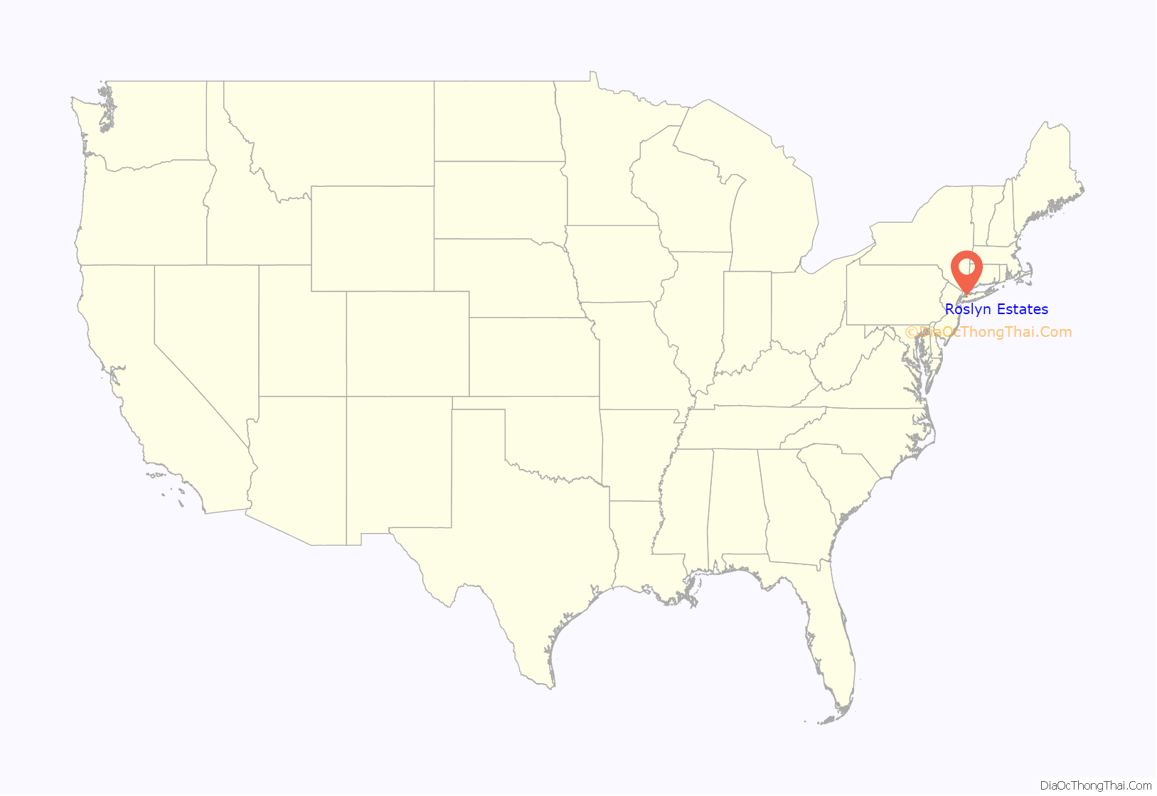
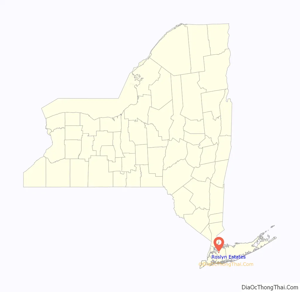
Roslyn Estates is a village in the Town of North Hempstead in Nassau County, on the North Shore of Long Island, in New York, United States. It is considered part of the Greater Roslyn area, which is anchored by the Incorporated Village of Roslyn. The population was 1,318 at the 2020 census.
| Name: | Roslyn Estates village |
|---|---|
| LSAD Code: | 47 |
| LSAD Description: | village (suffix) |
| State: | New York |
| County: | Nassau County |
| Incorporated: | June 8, 1931 |
| Elevation: | 230 ft (70 m) |
| Total Area: | 0.44 sq mi (1.13 km²) |
| Land Area: | 0.44 sq mi (1.13 km²) |
| Water Area: | 0.00 sq mi (0.00 km²) |
| Total Population: | 1,318 |
| Population Density: | 3,016.02/sq mi (1,165.28/km²) |
| FIPS code: | 3663792 |
| GNISfeature ID: | 0962931 |
| Website: | www.villageofroslynestates.com |
Online Interactive Map
Click on ![]() to view map in "full screen" mode.
to view map in "full screen" mode.
Roslyn Estates location map. Where is Roslyn Estates village?
History
Roslyn Estates was first developed in the early 20th Century (circa 1908) by Dean Alvord, who also developed Prospect Park South in Brooklyn and Belle Terre in Port Jefferson. It was nicknamed “The Eden of Long Island” when originally developed, due to the community’s design and setting.
In 1931, residents decided to try incorporating Roslyn Estates as a village, due to the fact that the original deed restrictions were set to expire around that time. Their efforts to incorporate were successful, and the Village of Roslyn Estates was incorporated on June 8, 1931.
In 1972, Roslyn Estates Village Hall was built. It was designed by John A. Grammas on land given to the village by the firm of Saul Sokolov, Inc., which had developed that section of Roslyn Estates.
In 1974, Mayor Robert D. Zucker attempted to have the boundaries of the Manhasset Park District redrawn to include the village after the district added an additional 260 parking spaces to the commuter parking fields at the Manhasset Long Island Rail Road station. Zucker stated that many Roslyn Estates residents preferred the Manhasset station over the closer Roslyn station due to the fact that service to/from Pennsylvania Station on the Port Washington Branch is direct, whereas a change at Jamaica is required on the Oyster Bay Branch. By having the district boundaries redrawn to include the village, Roslyn Estates residents would have the ability to be guaranteed a parking space at the Manhasset station for commuting to/from Manhattan. Officials from both North Hempstead and the Manhasset Park District, as well as Manhasset residents lamented the idea, given that Roslyn Estates is not part of the Greater Manhasset area, and felt that the needs of Greater Manhasset should be paramount for the Manhasset Park District. The proposal was ultimately denied.
Roslyn Estates celebrated its 50th Anniversary in 1981.
The name of Roslyn Estates was taken directly from the name which was used by the community’s original development group, Roslyn Estates, Incorporated. The “Roslyn” part of its name is shared with Roslyn, Roslyn Harbor, and Roslyn Heights, and ultimately can be traced back to when the name “Roslyn” was chosen for that village, which was chosen because the geography in Roslyn reminded officials of the geography of Roslin, Scotland.
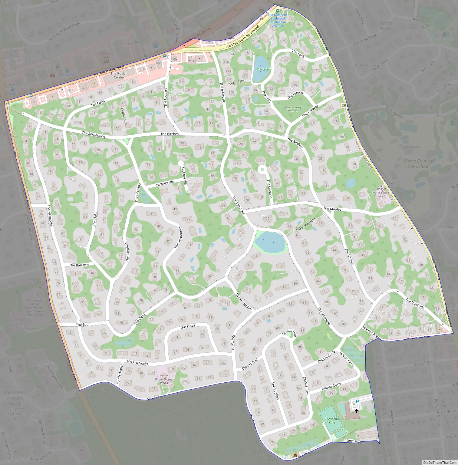
Roslyn Estates Road Map
Roslyn Estates city Satellite Map
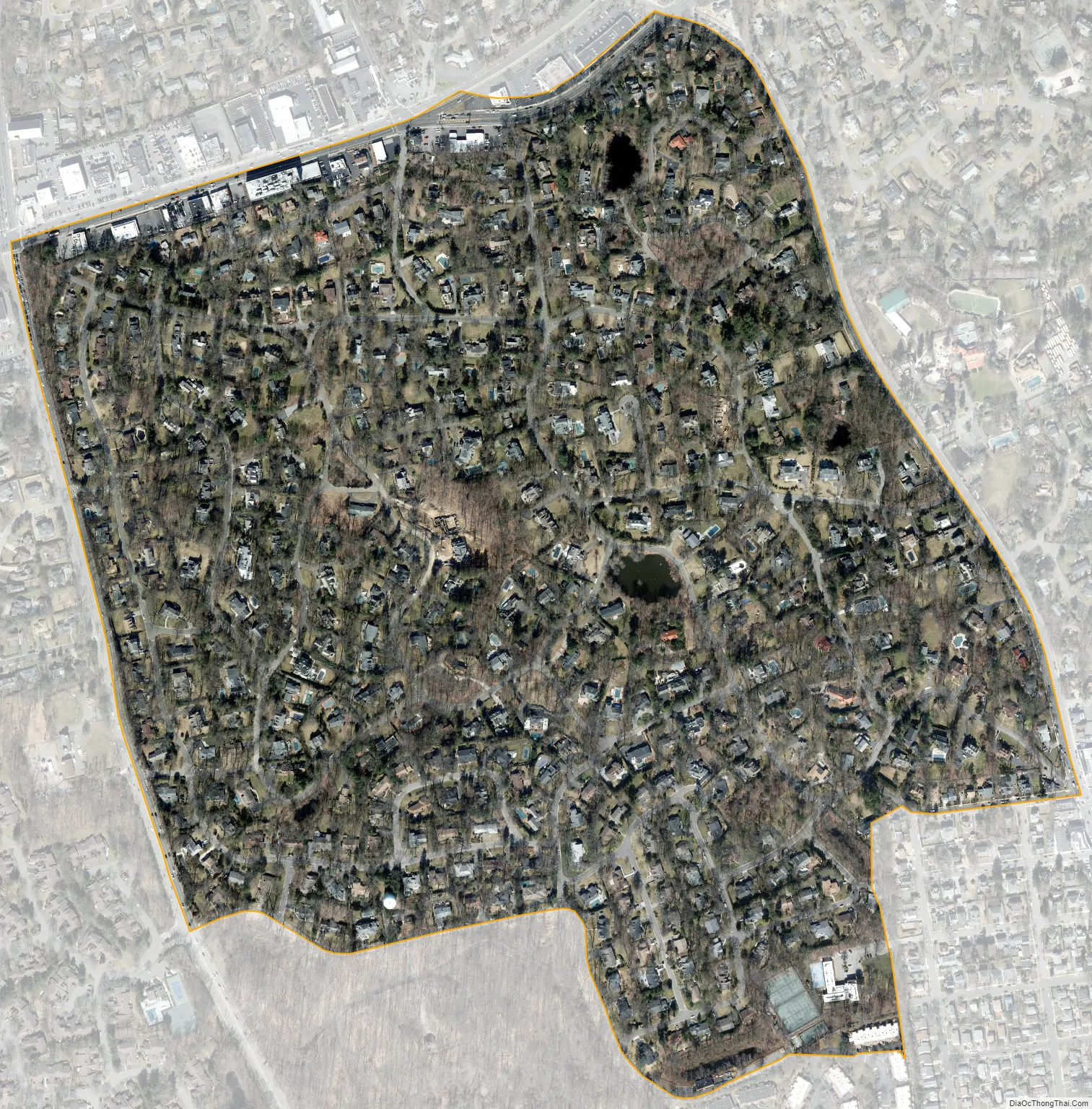
Geography
According to the United States Census Bureau, the village has a total area of 0.4 square miles (1.0 km), all land.
Topography
Like the rest of Long Island’s North Shore, Roslyn Estates is situated on a terminal moraine known as the Harbor Hill Moraine. This moraine was formed by glaciers during the Wisconsin Glacial Episode, The moraine is named for Harbor Hill – the highest geographic point in Nassau County, which is located in nearby East Hills.
According to the United States Environmental Protection Agency and the United States Geological Survey, the highest point in Roslyn Estates is located between The Pines and The Hemlocks, at 287 feet (87 m), and the lowest point is located near The Locusts, at approximately 170 feet (52 m).
Drainage
Roslyn Estates is split among four minor drainage areas: Inner Hempstead Harbor (part of the Hempstead Harbor Watershed), Hempstead Lake, Mill River (both part of the Mill River Watershed), and Leeds Pond (part of the Manhasset Bay Watershed), and is located within the larger Long Island Sound/Atlantic Ocean Watershed.
Climate
The Village of Roslyn Estates features a humid subtropical climate (Cfa) under the Köppen climate classification,. As such, the village experiences hot, humid summers and cold winters, and experiences precipitation throughout the entirety of the year.
See also
Map of New York State and its subdivision:- Albany
- Allegany
- Bronx
- Broome
- Cattaraugus
- Cayuga
- Chautauqua
- Chemung
- Chenango
- Clinton
- Columbia
- Cortland
- Delaware
- Dutchess
- Erie
- Essex
- Franklin
- Fulton
- Genesee
- Greene
- Hamilton
- Herkimer
- Jefferson
- Kings
- Lake Ontario
- Lewis
- Livingston
- Madison
- Monroe
- Montgomery
- Nassau
- New York
- Niagara
- Oneida
- Onondaga
- Ontario
- Orange
- Orleans
- Oswego
- Otsego
- Putnam
- Queens
- Rensselaer
- Richmond
- Rockland
- Saint Lawrence
- Saratoga
- Schenectady
- Schoharie
- Schuyler
- Seneca
- Steuben
- Suffolk
- Sullivan
- Tioga
- Tompkins
- Ulster
- Warren
- Washington
- Wayne
- Westchester
- Wyoming
- Yates
- Alabama
- Alaska
- Arizona
- Arkansas
- California
- Colorado
- Connecticut
- Delaware
- District of Columbia
- Florida
- Georgia
- Hawaii
- Idaho
- Illinois
- Indiana
- Iowa
- Kansas
- Kentucky
- Louisiana
- Maine
- Maryland
- Massachusetts
- Michigan
- Minnesota
- Mississippi
- Missouri
- Montana
- Nebraska
- Nevada
- New Hampshire
- New Jersey
- New Mexico
- New York
- North Carolina
- North Dakota
- Ohio
- Oklahoma
- Oregon
- Pennsylvania
- Rhode Island
- South Carolina
- South Dakota
- Tennessee
- Texas
- Utah
- Vermont
- Virginia
- Washington
- West Virginia
- Wisconsin
- Wyoming


