Roslyn Harbor is a village in Nassau County, on the North Shore of Long Island, in New York, United States. It is considered part of the Greater Roslyn area, which is anchored by the Incorporated Village of Roslyn. The population was 1,051 at the 2010 census.
The Incorporated Village of Roslyn Harbor lies in both the Town of North Hempstead and the Town of Oyster Bay.
| Name: | Roslyn Harbor village |
|---|---|
| LSAD Code: | 47 |
| LSAD Description: | village (suffix) |
| State: | New York |
| County: | Nassau County |
| Incorporated: | October 17, 1931 |
| Elevation: | 108 ft (33 m) |
| Total Area: | 1.19 sq mi (3.09 km²) |
| Land Area: | 1.19 sq mi (3.08 km²) |
| Water Area: | 0.00 sq mi (0.00 km²) |
| Total Population: | 1,067 |
| Population Density: | 895.89/sq mi (345.97/km²) |
| ZIP code: | 11545, 11548, 11576 |
| FIPS code: | 3663803 |
| GNISfeature ID: | 0962933 |
| Website: | www.roslynharbor.org |
Online Interactive Map
Click on ![]() to view map in "full screen" mode.
to view map in "full screen" mode.
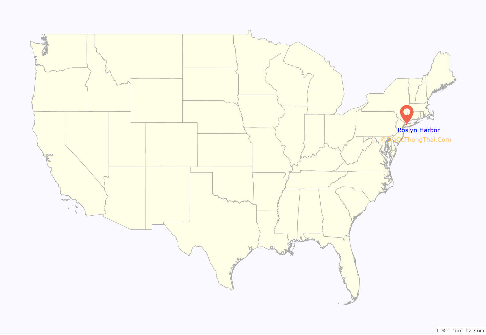
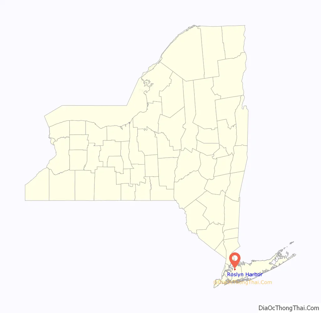
Roslyn Harbor location map. Where is Roslyn Harbor village?
History
Roslyn Harbor incorporated as a village on October 17, 1931 as a result of the residents wishing to make their own zoning codes and other laws under the Municipal Home Rule Law. At the time, the majority of Roslyn Harbor consisted of a few large estates.
The “Roslyn” part of Roslyn Harbor’s name is shared with Roslyn, Roslyn Estates, and Roslyn Heights, and ultimately can be traced back to when the name “Roslyn” was chosen for that village, which was chosen because the geography in Roslyn reminded officials of the geography of Roslin, Scotland. The “Harbor” part of the name reflects its proximity to Hempstead Harbor. The name was chosen during the incorporation movement.
An earlier proposed name was Roslyn Hills, due to its hilly location, proximity to Roslyn, and because the Long Island Rail Road advertised the area as the “Switzerland of Long Island.” The “Hills” was substituted with “Harbor” after concerns were expressed that it could be mixed up with Roslyn Heights.
Prior to incorporating, the area was generally considered part of Roslyn (which wouldn’t incorporate until 1932), and before that name was chosen for the area in 1844, it was known as Hempstead Harbor.
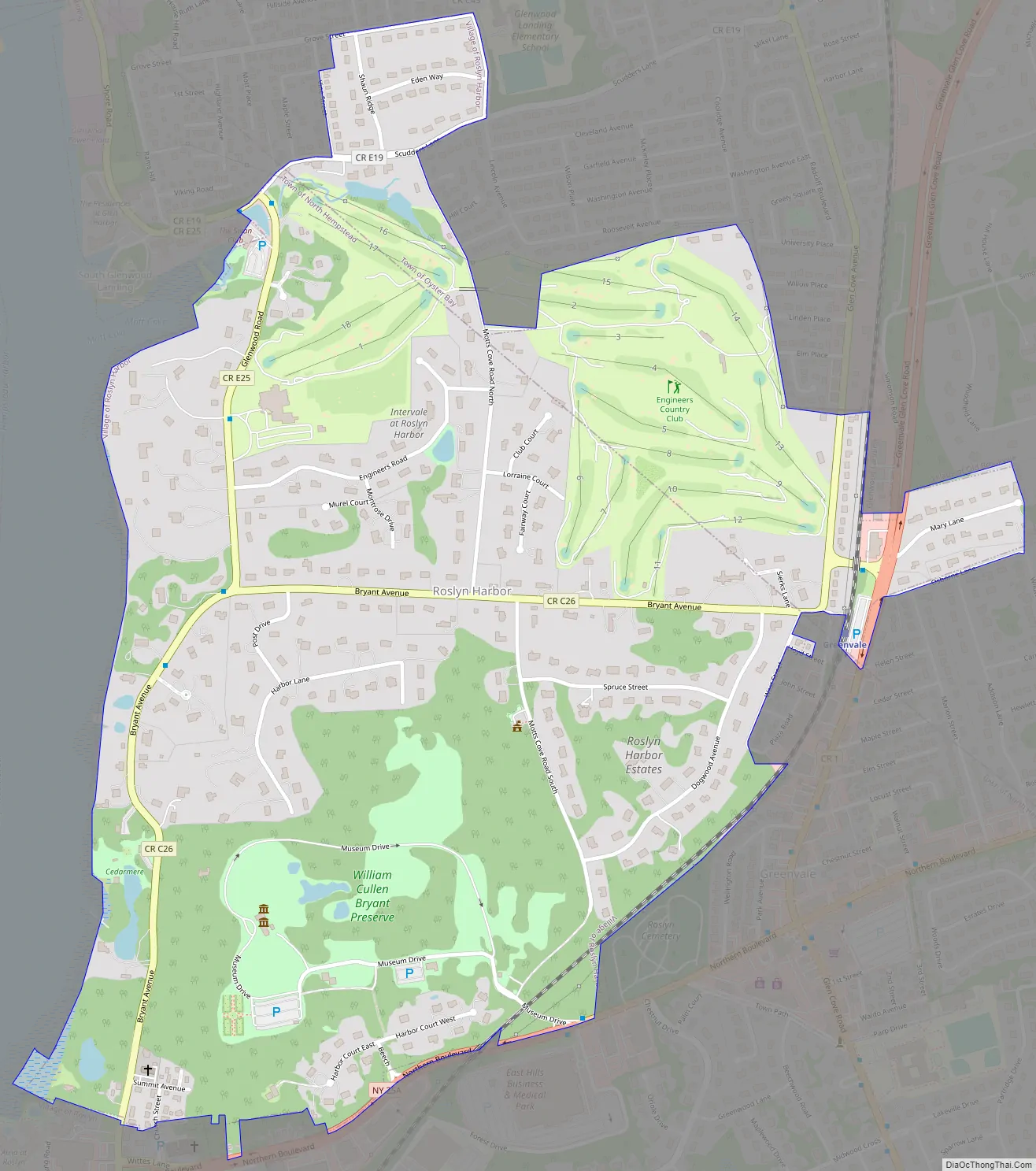
Roslyn Harbor Road Map
Roslyn Harbor city Satellite Map
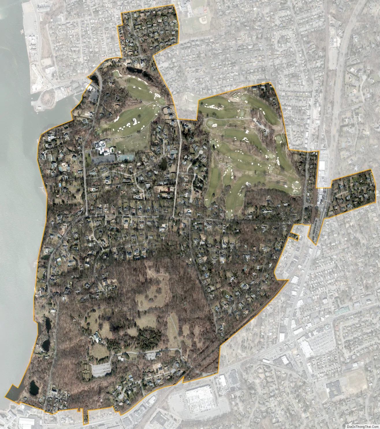
Geography
According to the United States Census Bureau, the village has a total area of 1.2 square miles (3.1 km), all land.
Roslyn Harbor is located within the Hempstead Harbor Watershed, and is also located within the larger Long Island Sound/Atlantic Ocean Watershed.
According to the United States Environmental Protection Agency and the United States Geological Survey, the highest point in Roslyn Harbor is located just southwest of the intersection of Dogwood Avenue and Spruce Street, at 234 feet (71 m), and the lowest point is Hempstead Harbor, which is at sea level.
See also
Map of New York State and its subdivision:- Albany
- Allegany
- Bronx
- Broome
- Cattaraugus
- Cayuga
- Chautauqua
- Chemung
- Chenango
- Clinton
- Columbia
- Cortland
- Delaware
- Dutchess
- Erie
- Essex
- Franklin
- Fulton
- Genesee
- Greene
- Hamilton
- Herkimer
- Jefferson
- Kings
- Lake Ontario
- Lewis
- Livingston
- Madison
- Monroe
- Montgomery
- Nassau
- New York
- Niagara
- Oneida
- Onondaga
- Ontario
- Orange
- Orleans
- Oswego
- Otsego
- Putnam
- Queens
- Rensselaer
- Richmond
- Rockland
- Saint Lawrence
- Saratoga
- Schenectady
- Schoharie
- Schuyler
- Seneca
- Steuben
- Suffolk
- Sullivan
- Tioga
- Tompkins
- Ulster
- Warren
- Washington
- Wayne
- Westchester
- Wyoming
- Yates
- Alabama
- Alaska
- Arizona
- Arkansas
- California
- Colorado
- Connecticut
- Delaware
- District of Columbia
- Florida
- Georgia
- Hawaii
- Idaho
- Illinois
- Indiana
- Iowa
- Kansas
- Kentucky
- Louisiana
- Maine
- Maryland
- Massachusetts
- Michigan
- Minnesota
- Mississippi
- Missouri
- Montana
- Nebraska
- Nevada
- New Hampshire
- New Jersey
- New Mexico
- New York
- North Carolina
- North Dakota
- Ohio
- Oklahoma
- Oregon
- Pennsylvania
- Rhode Island
- South Carolina
- South Dakota
- Tennessee
- Texas
- Utah
- Vermont
- Virginia
- Washington
- West Virginia
- Wisconsin
- Wyoming


