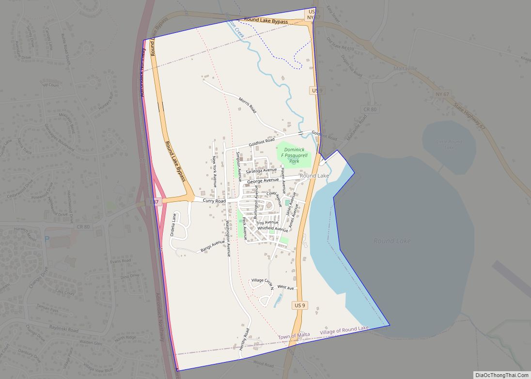
Round Lake is a village in Saratoga County, New York, United States. The population was 1,245 at the 2020 census. The name is derived from a circular lake adjacent to the village. In 1975, the Round Lake Historic District, which encompasses the village, was added to the National Register of Historic Places.
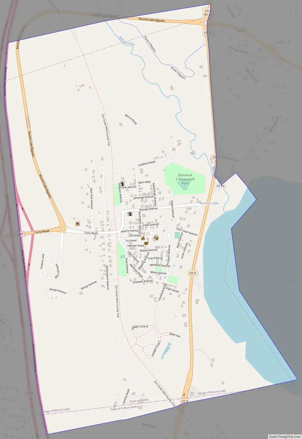
The Village of Round Lake is in the Town of Malta.
| Name: | Round Lake village |
|---|---|
| LSAD Code: | 47 |
| LSAD Description: | village (suffix) |
| State: | New York |
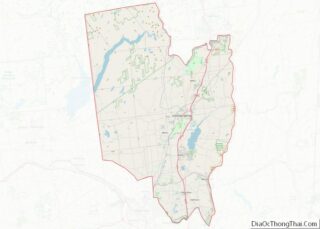
| County: | Saratoga County |
| Elevation: | 164 ft (50 m) |
| Total Area: | 1.23 sq mi (3.18 km²) |
| Land Area: | 1.12 sq mi (2.91 km²) |
| Water Area: | 0.11 sq mi (0.28 km²) |
| Total Population: | 828 |
| Population Density: | 737.97/sq mi (284.82/km²) |
| ZIP code: | 12151 |
| Area code: | 518 |
| FIPS code: | 3663957 |
| GNISfeature ID: | 0962980 |
| Website: | http://www.roundlakevillage.org/ |
Online Interactive Map
Click on ![]() to view map in "full screen" mode.
to view map in "full screen" mode.
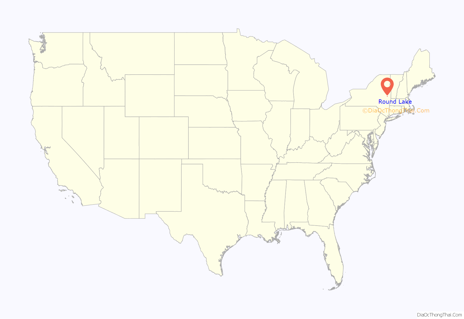
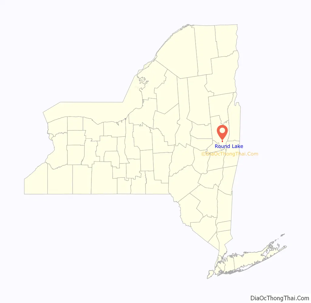
Round Lake location map. Where is Round Lake village?
History
The village began in 1867 as a summer camp meeting locale for groups of Methodists. At first, visitors lived in tents, while visiting ministers could rent space in the second story of the meeting’s passenger station. By 1868 more permanent structures including cottages, a two-story trustees office and bookstore, and a market appeared. The village was owned and governed by the Round Lake Association. By 1881 lectures patterned after Chautauqua Institution were being conducted. In 1887 George West constructed the George West Museum of Art and Archaeology to enhance the cultural offerings.
Among the noted Methodist residents was Rev. Strong, creator of the tome Strong’s Bible concordance until his death.
The 1980-pipe Ferris Tracker organ, originally built in 1847 for Calvary Episcopal Church in New York City, was moved to the Round Lake Auditorium in 1888 and is considered to be the oldest and largest three-manual organ in existence. The organ is still used for musical programs today.
By mid 20th century, declining interest in the cultural activities of the Round Lake Association led to its demise in the 1960s. The museum was dismantled in 1965. After the association was dissolved, the village was incorporated in 1969 to take its place.
Round Lake Road Map
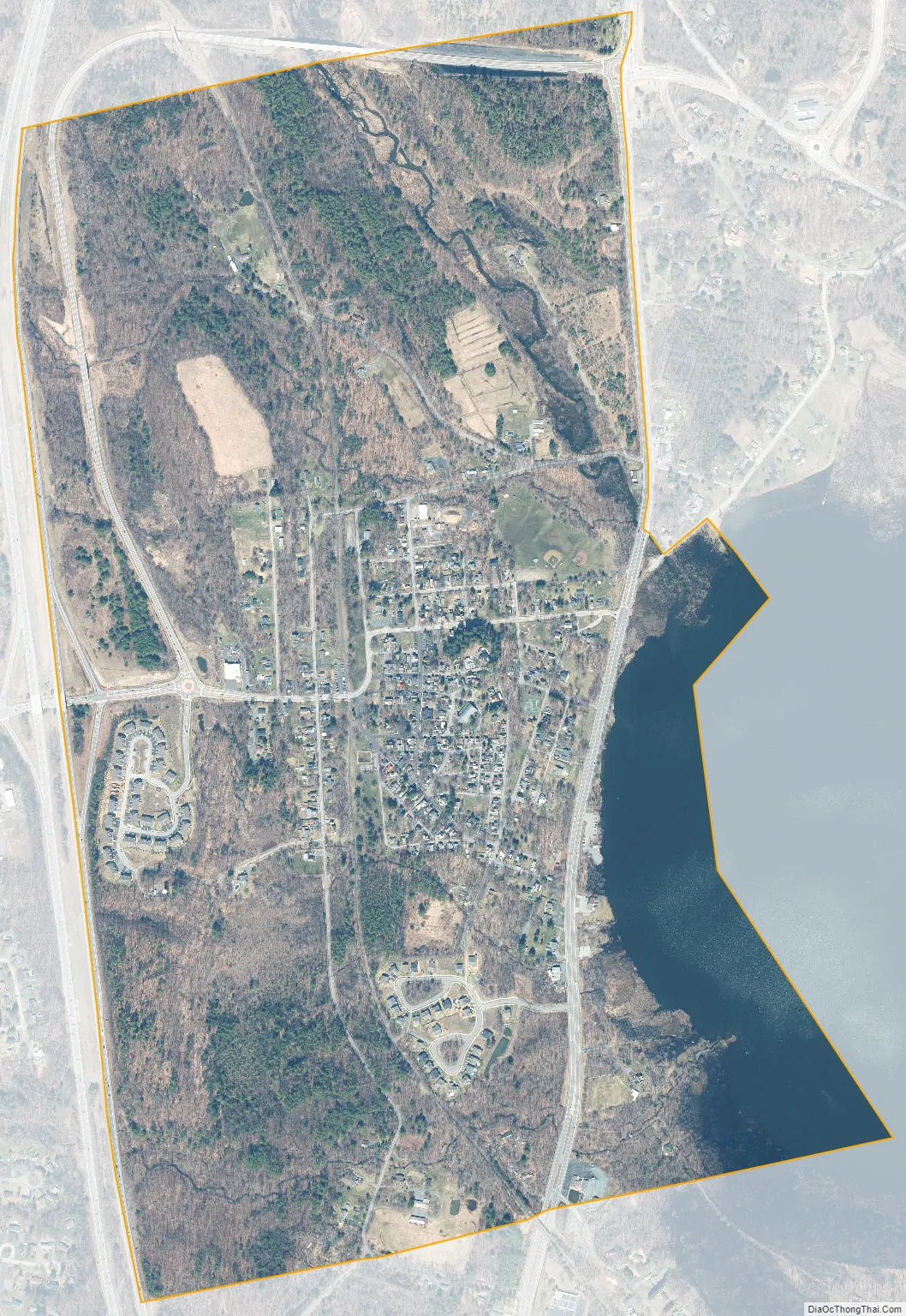
Round Lake city Satellite Map
Geography
Round Lake is located at 42°56′12″N 73°47′37″W / 42.93667°N 73.79361°W / 42.93667; -73.79361 (42.936784, -73.793661).
According to the United States Census Bureau, the village has a total area of 1.2 square miles (3.1 km), of which 1.1 square miles (2.8 km) is land and 0.1 square miles (0.26 km) (7.69%) is water.
The village is located on the western side of a lake called Round Lake. Little Round Lake is a smaller lake, northeast of Round Lake and connected by a short passage. New York State Route 67 passes the northeastern side of the lake.
U.S. Route 9 passes through the eastern side of the village and Interstate 87, the Adirondack Northway, is one-half mile to the west. County Roads 80 and 823, passing through the village, link US-9 to the Northway.
See also
Map of New York State and its subdivision:- Albany
- Allegany
- Bronx
- Broome
- Cattaraugus
- Cayuga
- Chautauqua
- Chemung
- Chenango
- Clinton
- Columbia
- Cortland
- Delaware
- Dutchess
- Erie
- Essex
- Franklin
- Fulton
- Genesee
- Greene
- Hamilton
- Herkimer
- Jefferson
- Kings
- Lake Ontario
- Lewis
- Livingston
- Madison
- Monroe
- Montgomery
- Nassau
- New York
- Niagara
- Oneida
- Onondaga
- Ontario
- Orange
- Orleans
- Oswego
- Otsego
- Putnam
- Queens
- Rensselaer
- Richmond
- Rockland
- Saint Lawrence
- Saratoga
- Schenectady
- Schoharie
- Schuyler
- Seneca
- Steuben
- Suffolk
- Sullivan
- Tioga
- Tompkins
- Ulster
- Warren
- Washington
- Wayne
- Westchester
- Wyoming
- Yates
- Alabama
- Alaska
- Arizona
- Arkansas
- California
- Colorado
- Connecticut
- Delaware
- District of Columbia
- Florida
- Georgia
- Hawaii
- Idaho
- Illinois
- Indiana
- Iowa
- Kansas
- Kentucky
- Louisiana
- Maine
- Maryland
- Massachusetts
- Michigan
- Minnesota
- Mississippi
- Missouri
- Montana
- Nebraska
- Nevada
- New Hampshire
- New Jersey
- New Mexico
- New York
- North Carolina
- North Dakota
- Ohio
- Oklahoma
- Oregon
- Pennsylvania
- Rhode Island
- South Carolina
- South Dakota
- Tennessee
- Texas
- Utah
- Vermont
- Virginia
- Washington
- West Virginia
- Wisconsin
- Wyoming