Savannah is a hamlet (and census-designated place) located in the Town of Savannah, Wayne County, New York, United States. The population was 558 at the 2010 census. Savannah was incorporated as a village in 1867, but dissolved in 1979. Government offices for the Town of Savannah are located in the hamlet.
| Name: | Savannah CDP |
|---|---|
| LSAD Code: | 57 |
| LSAD Description: | CDP (suffix) |
| State: | New York |
| County: | Wayne County |
| Incorporated: | April 15, 1867 |
| Elevation: | 420 ft (128 m) |
| Total Area: | 1.18 sq mi (3.05 km²) |
| Land Area: | 1.18 sq mi (3.05 km²) |
| Water Area: | 0.00 sq mi (0.00 km²) |
| Total Population: | 487 |
| Population Density: | 413.06/sq mi (159.43/km²) |
| ZIP code: | 13146 |
| Area code: | 315 and 680 |
| FIPS code: | 3665332 |
| GNISfeature ID: | 2631236 |
Online Interactive Map
Click on ![]() to view map in "full screen" mode.
to view map in "full screen" mode.
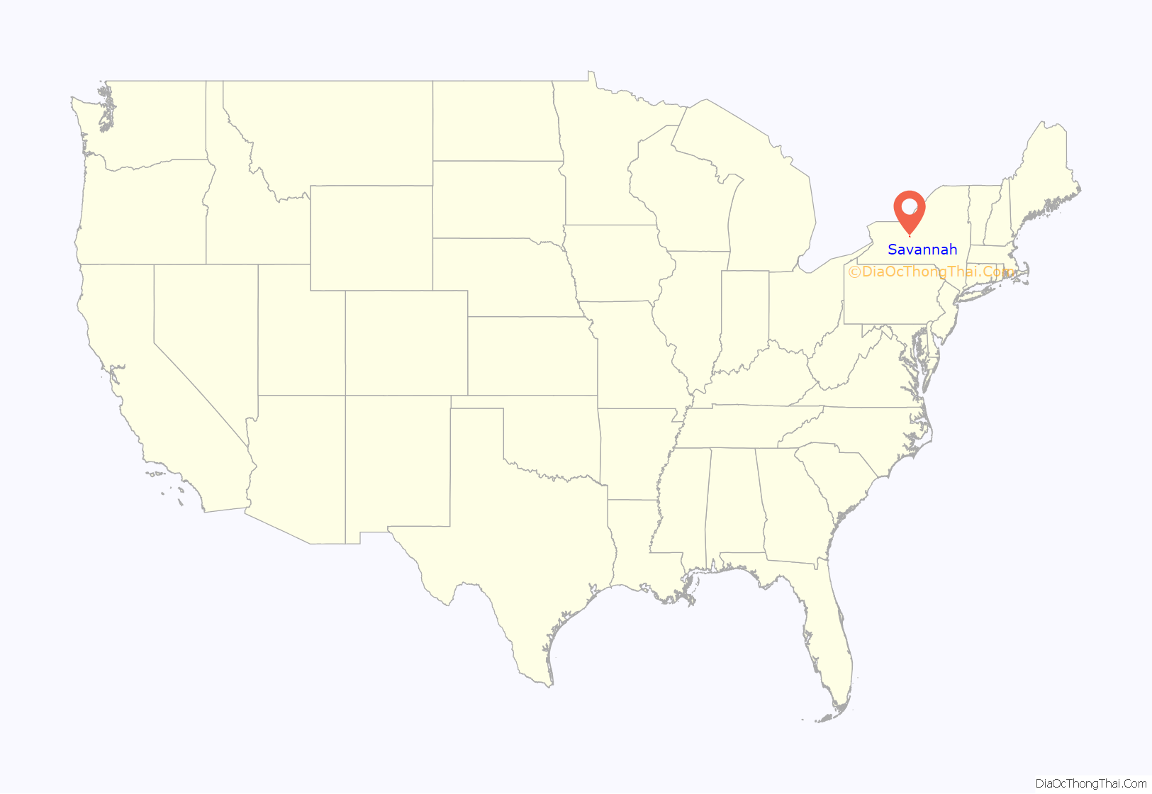
Savannah location map. Where is Savannah CDP?
History
The community of Savannah was established along the old New York Central Railroad in 1854 and incorporated as a village thirteen years later…initially covering roughly 1,200 acres (4.9 km) of Military Lots #64 and #65 within the Town of Savannah (known at that time as Township #27). By 1877, the village had three church societies, a union schoolhouse, a hotel, a steam-stave mill and a number of shops and stores. Unfortunately, in the early morning hours of November 3, 1908, a fire swept throughout Savannah and destroyed most of the village. Twenty-two buildings were consumed by fire and twelve families were left homeless. Many of the buildings on Main Street were left in ruins. The village was eventually rebuilt.
On March 21, 1978, voters decided 134–75 in favor of dissolution. The Village of Savannah was officially dissolved on December 31, 1979. All government activities previously managed by the village are now handled by the Town of Savannah.
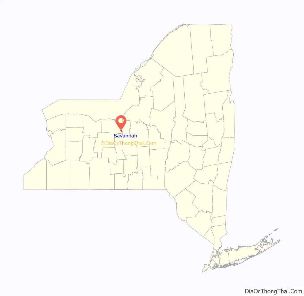
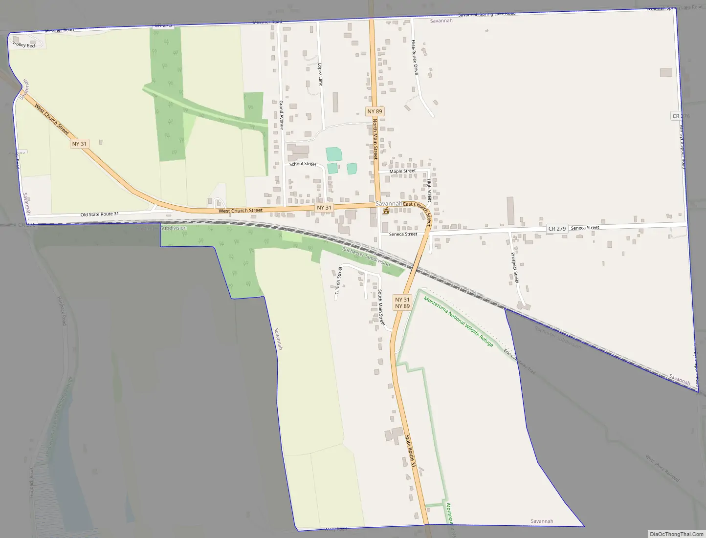
Savannah Road Map
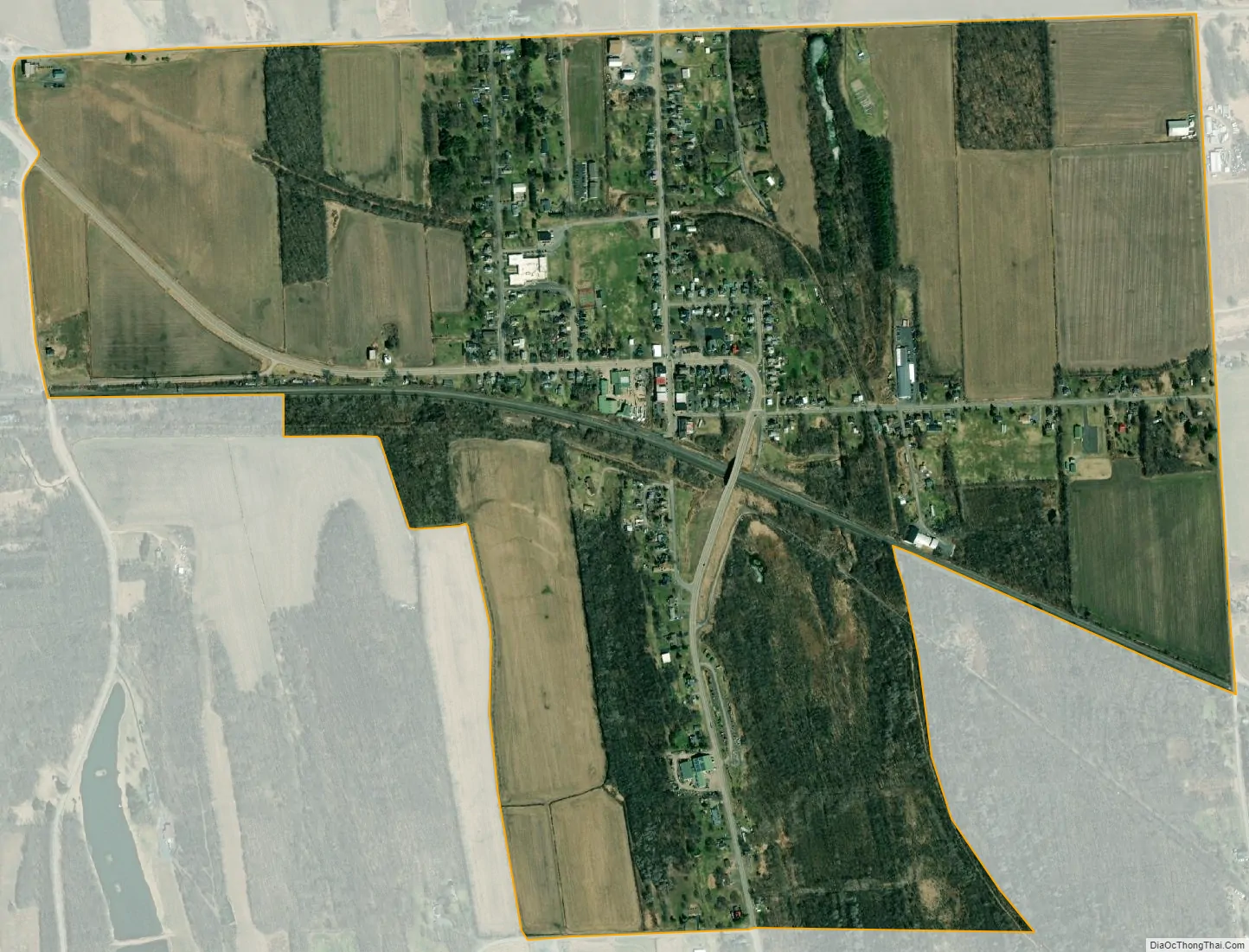
Savannah city Satellite Map
Geography
Savannah is located at 43°04′00″N 76°45′34″W / 43.066710°N 76.759543°W / 43.066710; -76.759543.
According to the United States Census Bureau, the CDP has a total area of 1.2 square miles (3.1 km), all land.
The primary intersection in Savannah is at N.Y. Route 31 and N.Y. Route 89.
See also
Map of New York State and its subdivision:- Albany
- Allegany
- Bronx
- Broome
- Cattaraugus
- Cayuga
- Chautauqua
- Chemung
- Chenango
- Clinton
- Columbia
- Cortland
- Delaware
- Dutchess
- Erie
- Essex
- Franklin
- Fulton
- Genesee
- Greene
- Hamilton
- Herkimer
- Jefferson
- Kings
- Lake Ontario
- Lewis
- Livingston
- Madison
- Monroe
- Montgomery
- Nassau
- New York
- Niagara
- Oneida
- Onondaga
- Ontario
- Orange
- Orleans
- Oswego
- Otsego
- Putnam
- Queens
- Rensselaer
- Richmond
- Rockland
- Saint Lawrence
- Saratoga
- Schenectady
- Schoharie
- Schuyler
- Seneca
- Steuben
- Suffolk
- Sullivan
- Tioga
- Tompkins
- Ulster
- Warren
- Washington
- Wayne
- Westchester
- Wyoming
- Yates
- Alabama
- Alaska
- Arizona
- Arkansas
- California
- Colorado
- Connecticut
- Delaware
- District of Columbia
- Florida
- Georgia
- Hawaii
- Idaho
- Illinois
- Indiana
- Iowa
- Kansas
- Kentucky
- Louisiana
- Maine
- Maryland
- Massachusetts
- Michigan
- Minnesota
- Mississippi
- Missouri
- Montana
- Nebraska
- Nevada
- New Hampshire
- New Jersey
- New Mexico
- New York
- North Carolina
- North Dakota
- Ohio
- Oklahoma
- Oregon
- Pennsylvania
- Rhode Island
- South Carolina
- South Dakota
- Tennessee
- Texas
- Utah
- Vermont
- Virginia
- Washington
- West Virginia
- Wisconsin
- Wyoming