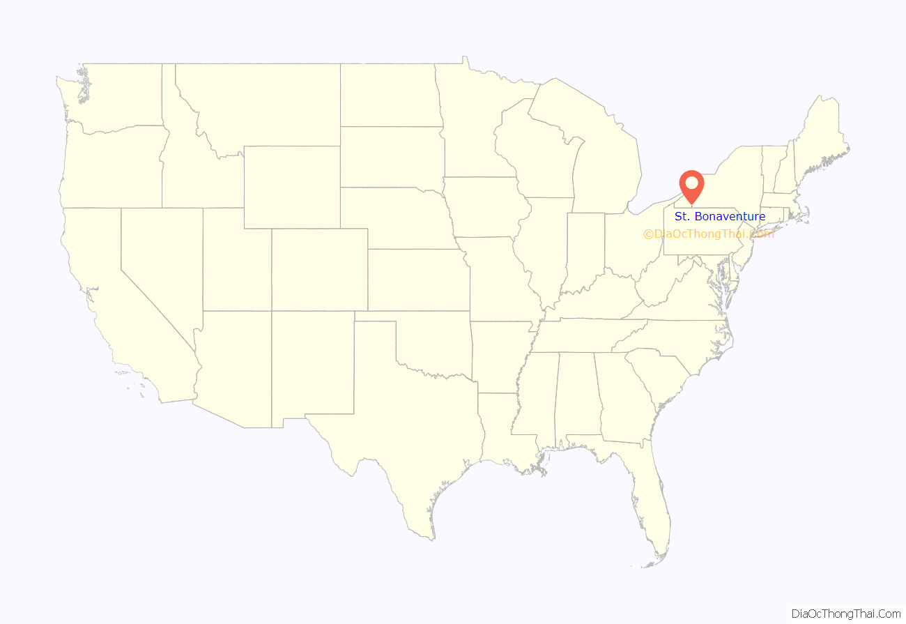
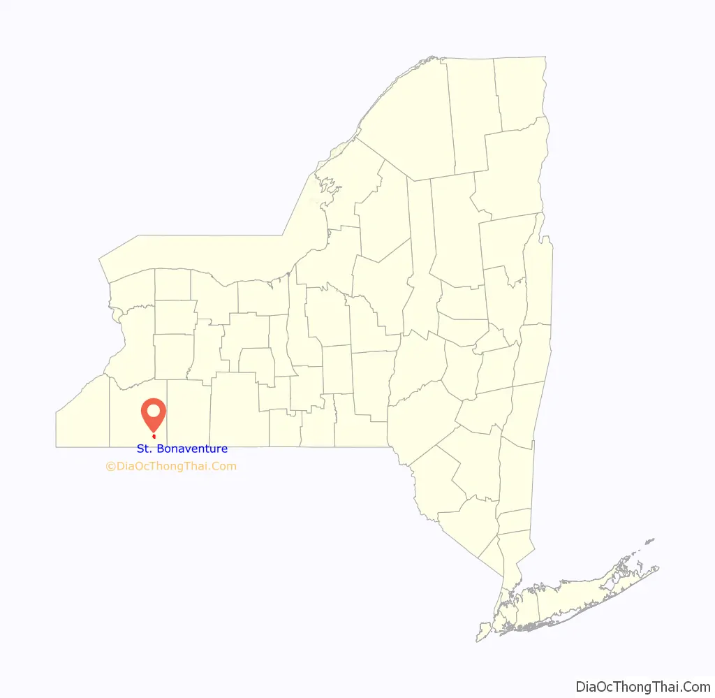
St. Bonaventure is a hamlet and census-designated place (CDP) in the town of Allegany in Cattaraugus County, New York, United States. The population was 1,963 at the 2020 census.
This community, located between the village of Allegany and the city of Olean, is established around St. Bonaventure University. Since the campus comprises the majority of the CDP, it has a much lower per capita income than most communities in the state, as do the several other CDPs statewide that are drawn around college campuses. St. Bonaventure also has its own on-campus post office and ZIP code (14778), separate from those of Allegany and Olean.
| Name: | St. Bonaventure CDP |
|---|---|
| LSAD Code: | 57 |
| LSAD Description: | CDP (suffix) |
| State: | New York |
| County: | Cattaraugus County |
| Elevation: | 1,427 ft (435 m) |
| Total Area: | 2.06 sq mi (5.33 km²) |
| Land Area: | 1.91 sq mi (4.94 km²) |
| Water Area: | 0.15 sq mi (0.39 km²) |
| Total Population: | 1,963 |
| Population Density: | 1,029.91/sq mi (397.62/km²) |
| FIPS code: | 3664551 |
| GNISfeature ID: | 1867415 |
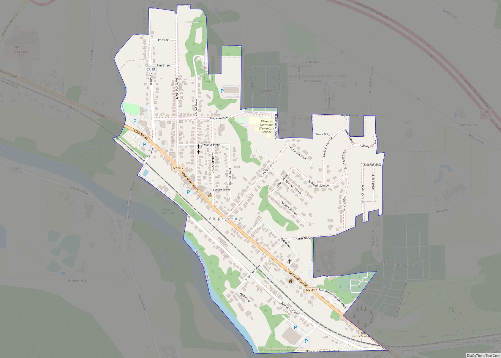
Online Interactive Map
Click on ![]() to view map in "full screen" mode.
to view map in "full screen" mode.
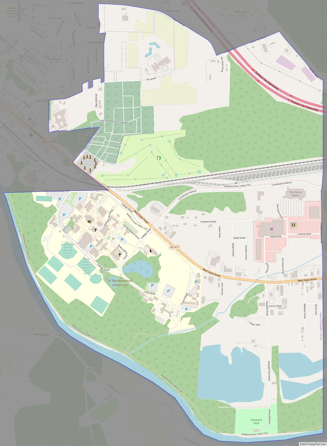
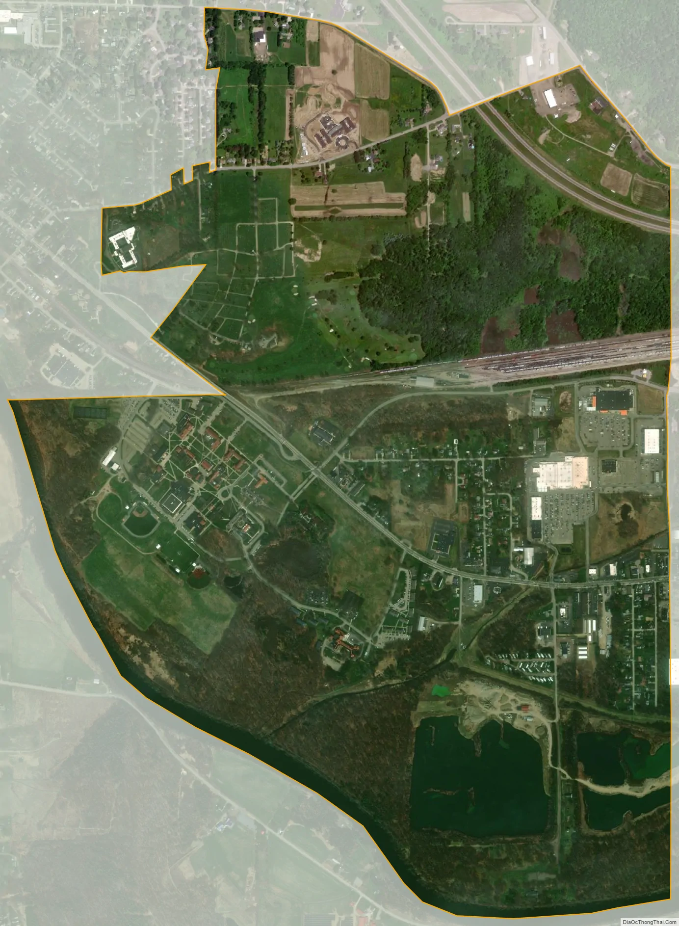
Geography
St. Bonaventure is located at 42°4’49” North, 78°28’30” West (42.080297, -78.474904).
New York State Route 417 passes through the community, which is immediately north of the Allegheny River and south of the Southern Tier Expressway.
According to the United States Census Bureau, the CDP has a total area of 2.1 square miles (5.5 km), of which 2.0 square miles (5.1 km) is land and 0.15 square miles (0.4 km), or 7.16%, is water.
See also
Map of New York State and its subdivision:- Albany
- Allegany
- Bronx
- Broome
- Cattaraugus
- Cayuga
- Chautauqua
- Chemung
- Chenango
- Clinton
- Columbia
- Cortland
- Delaware
- Dutchess
- Erie
- Essex
- Franklin
- Fulton
- Genesee
- Greene
- Hamilton
- Herkimer
- Jefferson
- Kings
- Lake Ontario
- Lewis
- Livingston
- Madison
- Monroe
- Montgomery
- Nassau
- New York
- Niagara
- Oneida
- Onondaga
- Ontario
- Orange
- Orleans
- Oswego
- Otsego
- Putnam
- Queens
- Rensselaer
- Richmond
- Rockland
- Saint Lawrence
- Saratoga
- Schenectady
- Schoharie
- Schuyler
- Seneca
- Steuben
- Suffolk
- Sullivan
- Tioga
- Tompkins
- Ulster
- Warren
- Washington
- Wayne
- Westchester
- Wyoming
- Yates
- Alabama
- Alaska
- Arizona
- Arkansas
- California
- Colorado
- Connecticut
- Delaware
- District of Columbia
- Florida
- Georgia
- Hawaii
- Idaho
- Illinois
- Indiana
- Iowa
- Kansas
- Kentucky
- Louisiana
- Maine
- Maryland
- Massachusetts
- Michigan
- Minnesota
- Mississippi
- Missouri
- Montana
- Nebraska
- Nevada
- New Hampshire
- New Jersey
- New Mexico
- New York
- North Carolina
- North Dakota
- Ohio
- Oklahoma
- Oregon
- Pennsylvania
- Rhode Island
- South Carolina
- South Dakota
- Tennessee
- Texas
- Utah
- Vermont
- Virginia
- Washington
- West Virginia
- Wisconsin
- Wyoming