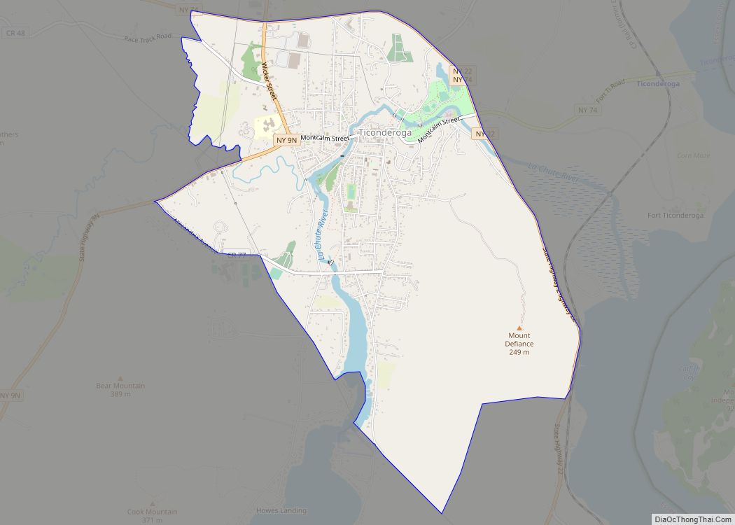
Ticonderoga (/taɪkɒndəˈroʊɡə/) is a hamlet in the southeast part of the town of Ticonderoga, in Essex County, New York, United States. The name is derived from the Haudenosaunee term for “between the two waters”, the two waters being Lake George and Lake Champlain. The hamlet became a census-designated place (CDP) in 2008. As of the 2010 census, the population was 3,382, out of a total 5,042 residents in the town of Ticonderoga.
| Name: | Ticonderoga CDP |
|---|---|
| LSAD Code: | 57 |
| LSAD Description: | CDP (suffix) |
| State: | New York |
| County: | Essex County |
| Incorporated: | May 18, 1889 |
| Elevation: | 154 ft (47 m) |
| Total Area: | 4.35 sq mi (11.27 km²) |
| Land Area: | 4.27 sq mi (11.07 km²) |
| Water Area: | 0.08 sq mi (0.20 km²) |
| Total Population: | 3,250 |
| Population Density: | 760.77/sq mi (293.71/km²) |
| ZIP code: | 12858, 12883 |
| Area code: | 518 |
| FIPS code: | 3673880 |
Online Interactive Map
Click on ![]() to view map in "full screen" mode.
to view map in "full screen" mode.
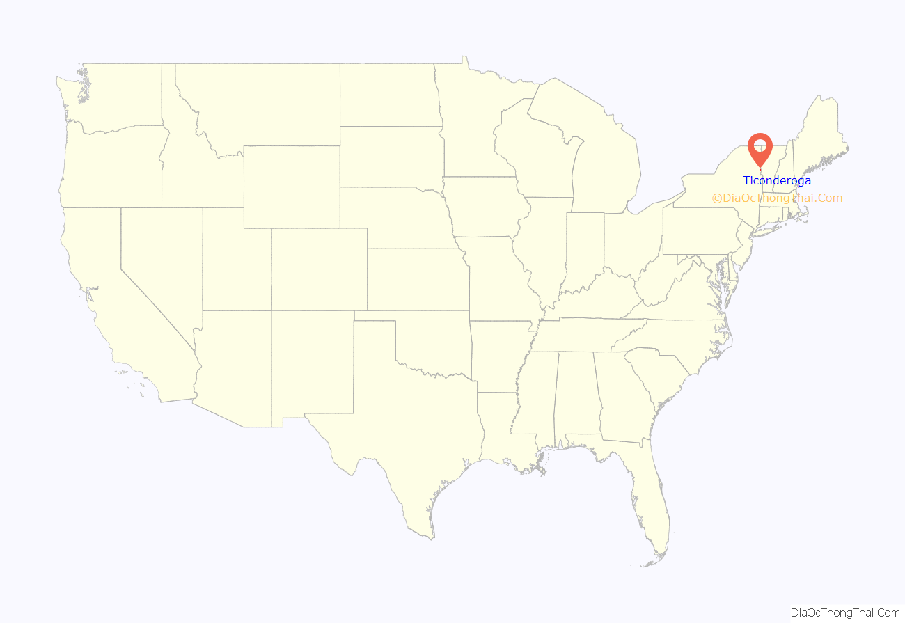
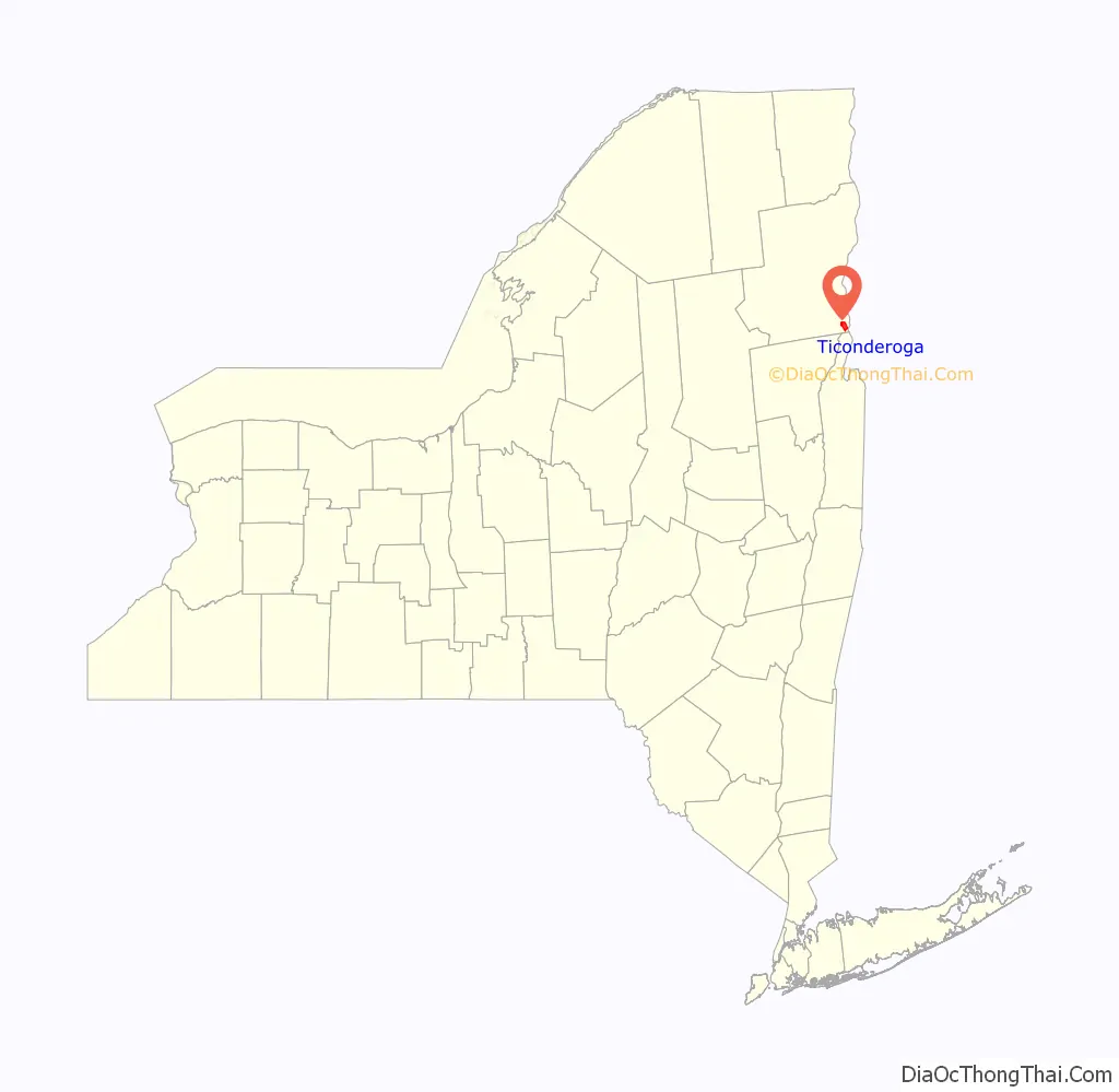
Ticonderoga location map. Where is Ticonderoga CDP?
History
In 1889, the hamlet of Ticonderoga was incorporated as a village within the town of Ticonderoga, but in 1992 residents voted to dissolve the village. The area is an important location for the production of paper and the mining of graphite; the familiar yellow “Ticonderoga pencils” were named after the graphite mines.
Fort Ticonderoga, near the hamlet on Lake Champlain, (the hamlet is on Lake George), was a military outpost that fell into disrepair. The modern fort was built on its ruins.
The 1988 publication, “Ticonderoga (Village) Multiple Resource Area”, presents a history of the village and its historic sites.
The Lake George Steamboat Company continues to operate steamboats from Ticonderoga.
Ticonderoga Road Map
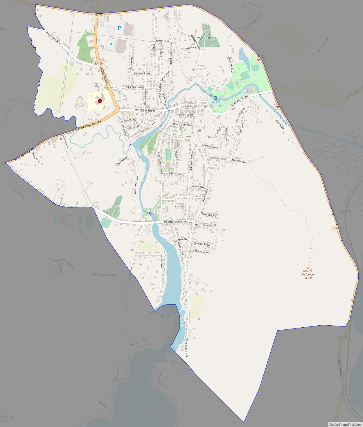
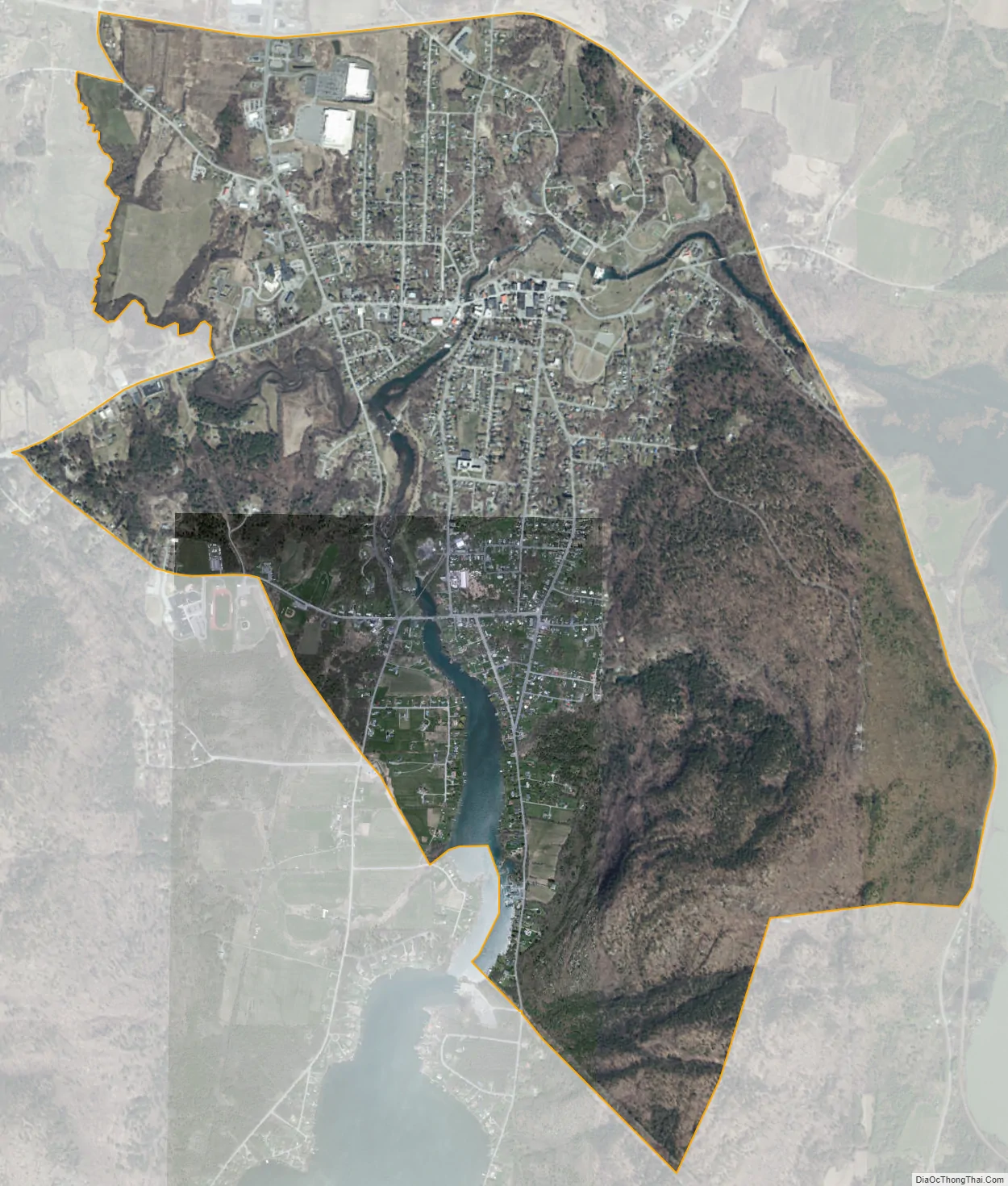
Ticonderoga city Satellite Map
Geography
Ticonderoga is in Upstate New York, south of Plattsburgh, and near the Vermont border. The community lies between Lake George and Lake Champlain on the site of a portage between the two lakes, previously guarded by historic Fort Ticonderoga. The waterway running through this portage is called the La Chute River, which drains the outflow of Lake George into Lake Champlain, and it contains a waterfall at the eastern edge of the hamlet.
During the summer, a diesel-powered cable ferry connects the community to Shoreham, Vermont.
The junction of New York State Route 9N, New York State Route 74, and New York State Route 22 is at the northern edge of the CDP.
According to the U.S. Census Bureau, the CDP has a total area of 4.35 square miles (11.27 km), of which 4.27 square miles (11.07 km) is land and 0.08 square miles (0.20 km), or 1.81%, is water.
See also
Map of New York State and its subdivision:- Albany
- Allegany
- Bronx
- Broome
- Cattaraugus
- Cayuga
- Chautauqua
- Chemung
- Chenango
- Clinton
- Columbia
- Cortland
- Delaware
- Dutchess
- Erie
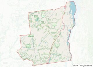
- Essex
- Franklin
- Fulton
- Genesee
- Greene
- Hamilton
- Herkimer
- Jefferson
- Kings
- Lake Ontario
- Lewis
- Livingston
- Madison
- Monroe
- Montgomery
- Nassau
- New York
- Niagara
- Oneida
- Onondaga
- Ontario
- Orange
- Orleans
- Oswego
- Otsego
- Putnam
- Queens
- Rensselaer
- Richmond
- Rockland
- Saint Lawrence
- Saratoga
- Schenectady
- Schoharie
- Schuyler
- Seneca
- Steuben
- Suffolk
- Sullivan
- Tioga
- Tompkins
- Ulster
- Warren
- Washington
- Wayne
- Westchester
- Wyoming
- Yates
- Alabama
- Alaska
- Arizona
- Arkansas
- California
- Colorado
- Connecticut
- Delaware
- District of Columbia
- Florida
- Georgia
- Hawaii
- Idaho
- Illinois
- Indiana
- Iowa
- Kansas
- Kentucky
- Louisiana
- Maine
- Maryland
- Massachusetts
- Michigan
- Minnesota
- Mississippi
- Missouri
- Montana
- Nebraska
- Nevada
- New Hampshire
- New Jersey
- New Mexico
- New York
- North Carolina
- North Dakota
- Ohio
- Oklahoma
- Oregon
- Pennsylvania
- Rhode Island
- South Carolina
- South Dakota
- Tennessee
- Texas
- Utah
- Vermont
- Virginia
- Washington
- West Virginia
- Wisconsin
- Wyoming