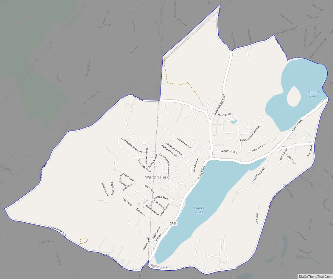
Walton Park is a census-designated place (CDP) in Orange County, New York, United States. As of the 2020 census, the CDP had a total population of 3,907. Walton Park is on the town line separating the towns of Chester and Monroe. Street addresses within Walton Park are usually assigned to Monroe, not Chester.
| Name: | Walton Park CDP |
|---|---|
| LSAD Code: | 57 |
| LSAD Description: | CDP (suffix) |
| State: | New York |
| County: | Orange County |
| Elevation: | 843 ft (257 m) |
| Total Area: | 3.44 sq mi (8.90 km²) |
| Land Area: | 3.08 sq mi (7.99 km²) |
| Water Area: | 0.35 sq mi (0.91 km²) |
| Total Population: | 3,907 |
| Population Density: | 1,266.45/sq mi (489.06/km²) |
| FIPS code: | 3678063 |
| GNISfeature ID: | 0968741 |
Online Interactive Map
Click on ![]() to view map in "full screen" mode.
to view map in "full screen" mode.
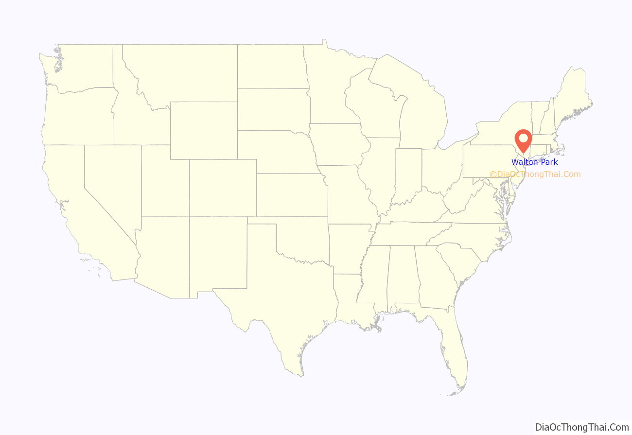
Walton Park location map. Where is Walton Park CDP?
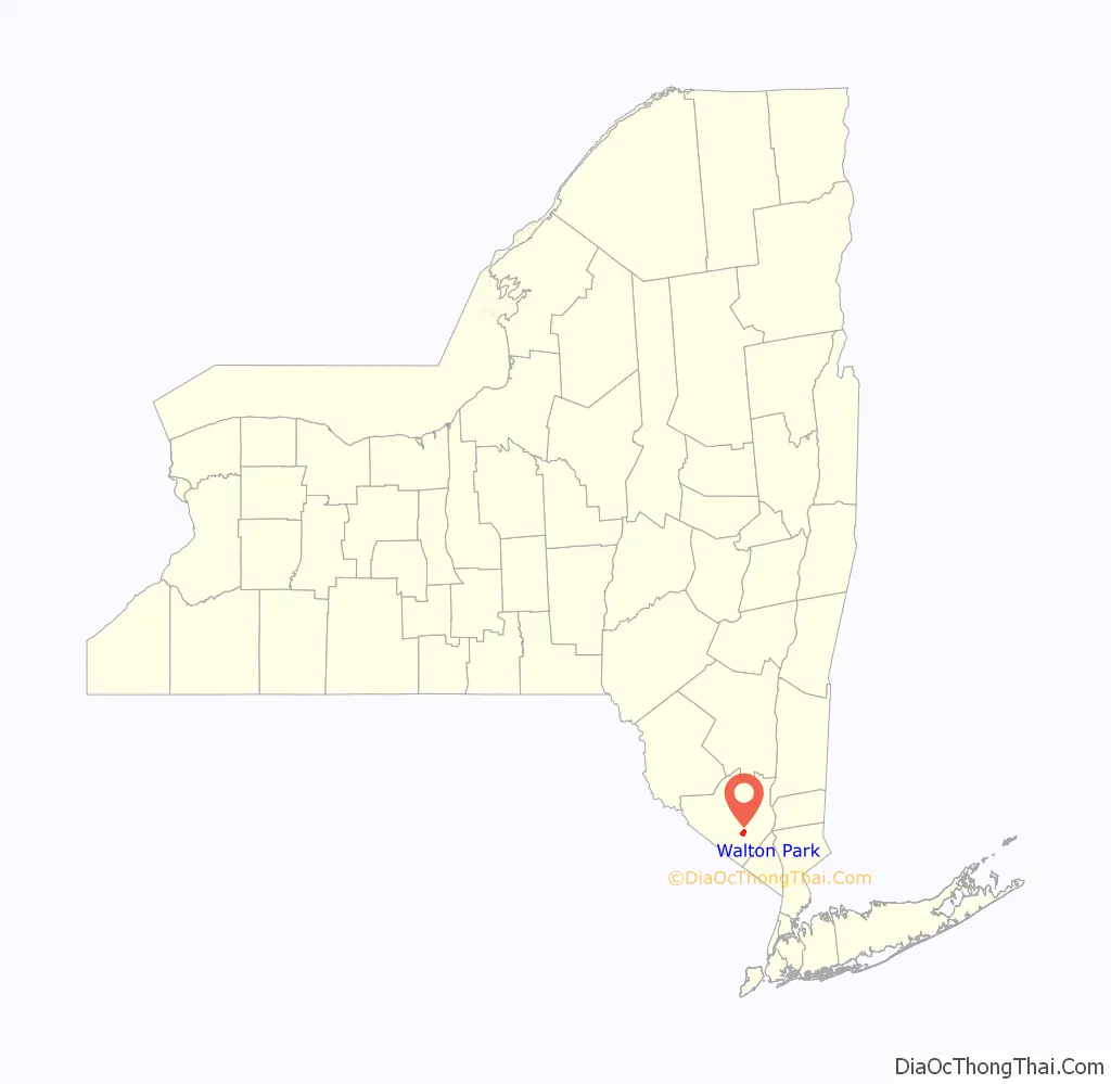
Walton Park Road Map
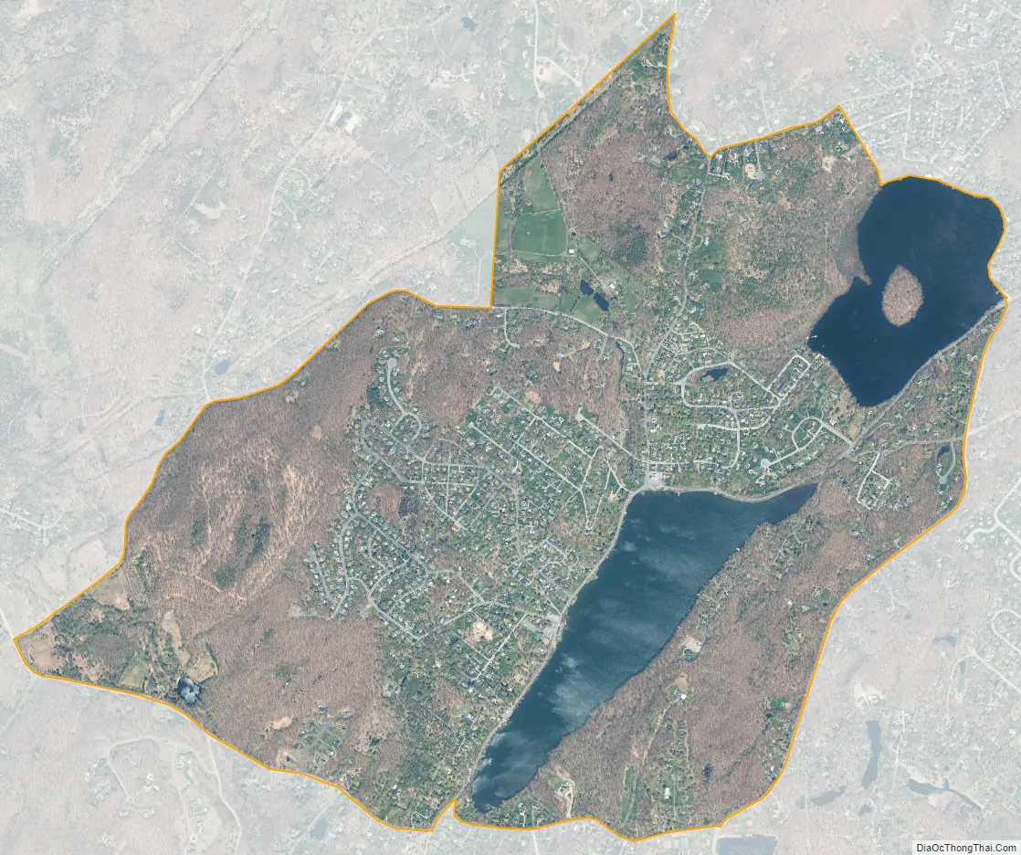
Walton Park city Satellite Map
Geography
Walton Park is located at 41°18′43″N 74°13′26″W / 41.31194°N 74.22389°W / 41.31194; -74.22389 (41.311849, -74.223838).
According to the United States Census Bureau, the CDP has a total area of 2.7 square miles (7.0 km), of which 2.4 square miles (6.2 km) is land and 0.3 square miles (0.78 km) is water. The total area is 11.57% water.
The community is on the west side of Walton Lake.
See also
Map of New York State and its subdivision:- Albany
- Allegany
- Bronx
- Broome
- Cattaraugus
- Cayuga
- Chautauqua
- Chemung
- Chenango
- Clinton
- Columbia
- Cortland
- Delaware
- Dutchess
- Erie
- Essex
- Franklin
- Fulton
- Genesee
- Greene
- Hamilton
- Herkimer
- Jefferson
- Kings
- Lake Ontario
- Lewis
- Livingston
- Madison
- Monroe
- Montgomery
- Nassau
- New York
- Niagara
- Oneida
- Onondaga
- Ontario
- Orange
- Orleans
- Oswego
- Otsego
- Putnam
- Queens
- Rensselaer
- Richmond
- Rockland
- Saint Lawrence
- Saratoga
- Schenectady
- Schoharie
- Schuyler
- Seneca
- Steuben
- Suffolk
- Sullivan
- Tioga
- Tompkins
- Ulster
- Warren
- Washington
- Wayne
- Westchester
- Wyoming
- Yates
- Alabama
- Alaska
- Arizona
- Arkansas
- California
- Colorado
- Connecticut
- Delaware
- District of Columbia
- Florida
- Georgia
- Hawaii
- Idaho
- Illinois
- Indiana
- Iowa
- Kansas
- Kentucky
- Louisiana
- Maine
- Maryland
- Massachusetts
- Michigan
- Minnesota
- Mississippi
- Missouri
- Montana
- Nebraska
- Nevada
- New Hampshire
- New Jersey
- New Mexico
- New York
- North Carolina
- North Dakota
- Ohio
- Oklahoma
- Oregon
- Pennsylvania
- Rhode Island
- South Carolina
- South Dakota
- Tennessee
- Texas
- Utah
- Vermont
- Virginia
- Washington
- West Virginia
- Wisconsin
- Wyoming


