Westvale is a suburban community (and census-designated place) in Onondaga County, New York, United States. The population was 4,963 at the 2010 census.
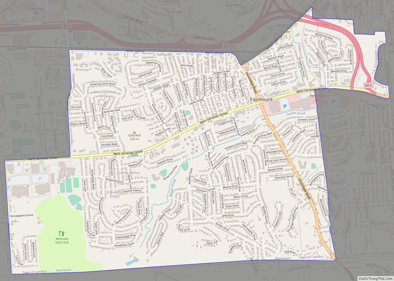
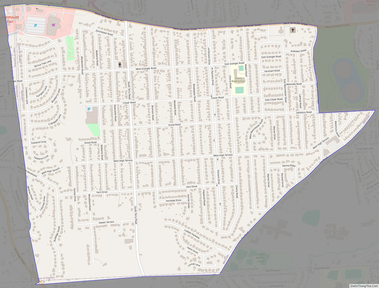
Westvale is in the town of Geddes, lying east of Fairmount and southwest of Solvay. Westvale is a suburb of Syracuse, which is to the east.
| Name: | Westvale CDP |
|---|---|
| LSAD Code: | 57 |
| LSAD Description: | CDP (suffix) |
| State: | New York |
| County: | Onondaga County |
| Elevation: | 505 ft (154 m) |
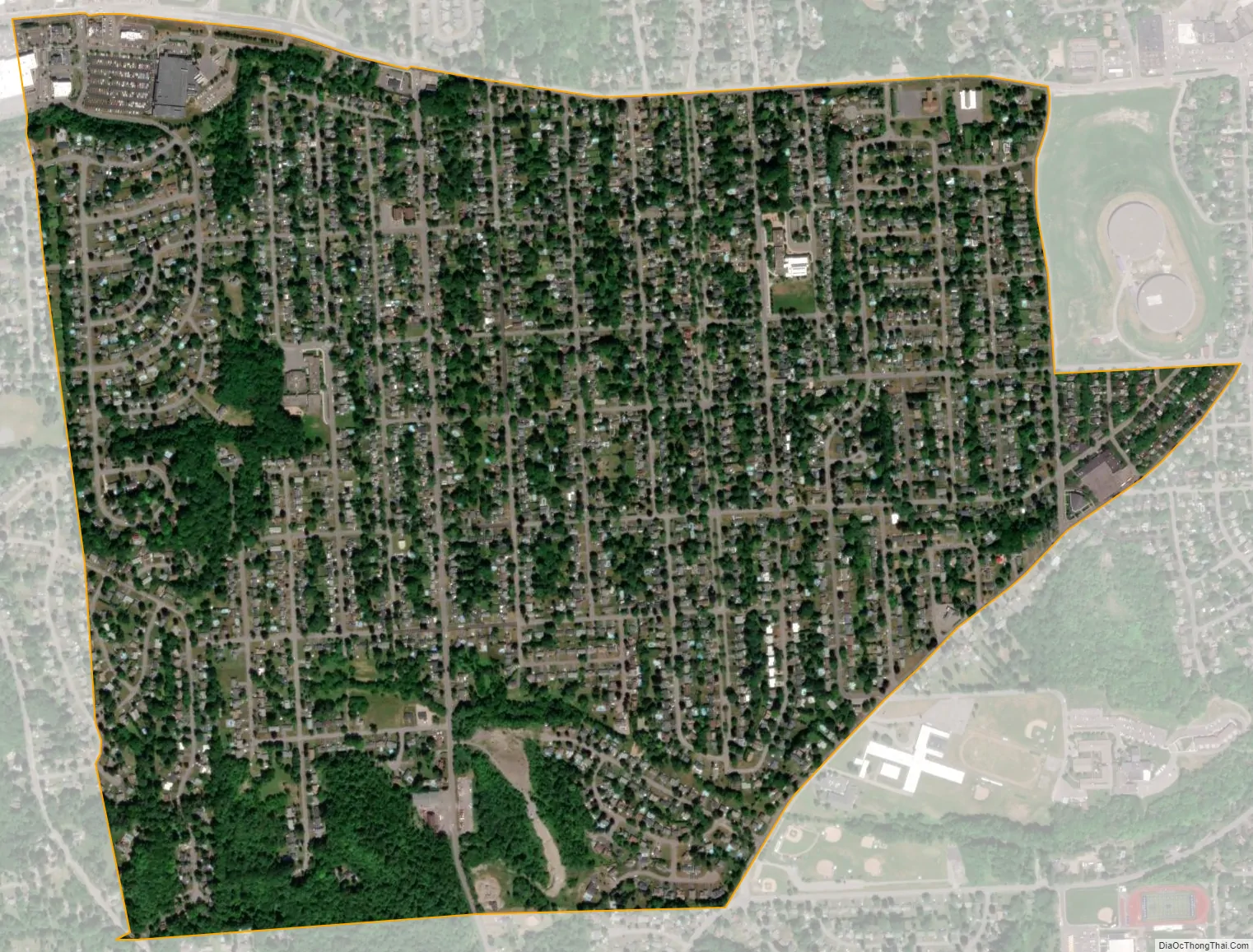
| Total Area: | 1.35 sq mi (3.49 km²) |
| Land Area: | 1.35 sq mi (3.49 km²) |
| Water Area: | 0.00 sq mi (0.00 km²) |
| Total Population: | 5,090 |
| Population Density: | 3,773.17/sq mi (1,457.13/km²) |
| ZIP code: | 13219 |
| Area code: | 315 |
| FIPS code: | 3681127 |
| GNISfeature ID: | 0970945 |
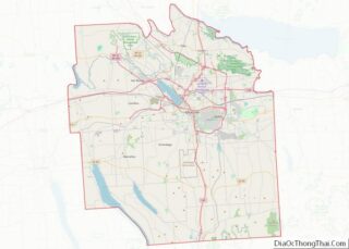
Online Interactive Map
Click on ![]() to view map in "full screen" mode.
to view map in "full screen" mode.
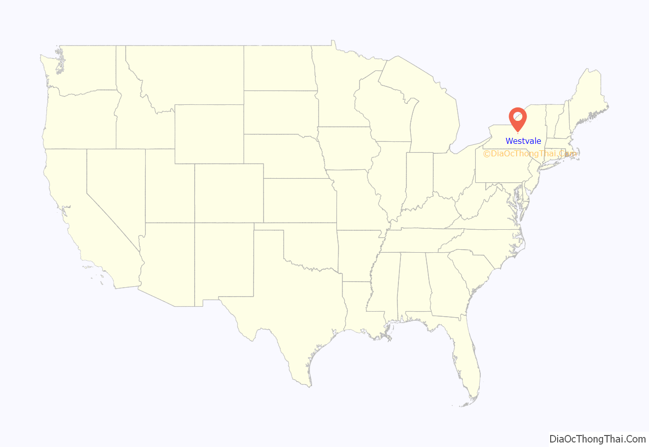
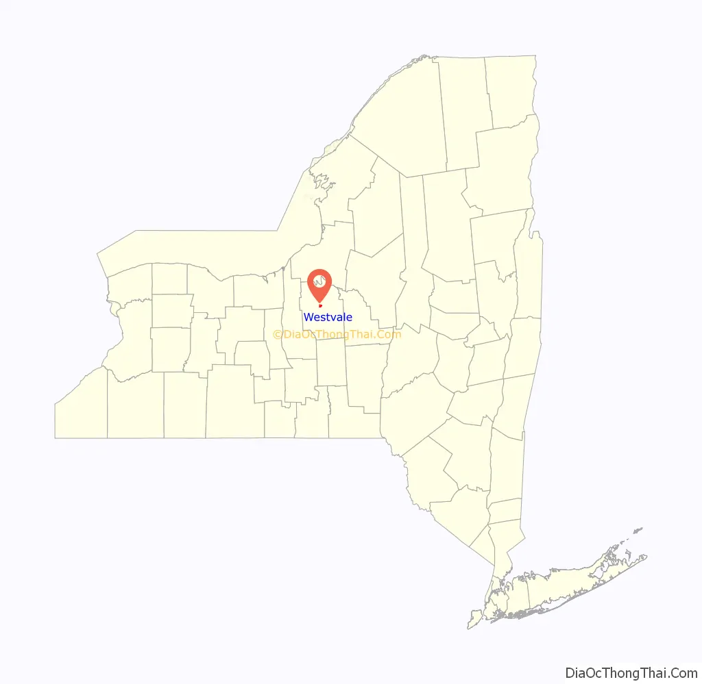
Westvale location map. Where is Westvale CDP?
History
“Westvale” as an identity probably evolved in the early 20th century; it refers to the area west of Wescott Reservoir, accessed by, but mostly south of, West Genesee Street (since the Village of Solvay was to the north). Farther west was Fairmount, which developed earlier than most of Westvale, where the land was held off the market. The “Avery Tract” lay between the reservoir and the City of Syracuse. The Avery Tract became part of the Village of Solvay. The core of Westvale was farmland retained by a major landowning family of New York State, the Schuylers. he branch holding title to much of the property was the Parsons, recalled by Parsons Drive, a centerpiece residential boulevard with a grassy median, off West Genesee Street.
A few Westvale houses predate suburban development. The Parsons farmhouse was replaced by development at the end of the 20th century. West Genesee Street has a few late 19th century residences. Early 20th century streets show houses in styles of the period, especially the 1920s and 1930s. After World War II, development was rapid, and most houses of Westvale now date from the later twentieth century. Westvale Plaza, one of the earliest suburban “malls” of the region, appeared in the Avery Tract shortly after World War II. It is extant as a “strip mall,” while Fairmount Fair, immediately beyond Westvale to the west, came later. Its interior pedestrian concourse was roofed over about 1967, making it the first indoor, climate-controlled shopping mall in Central New York.
The stretch of West Genesee Street between the Avery Tract and Fairmout was spared commercial development through the political activism of the Westvale-Avery Club, a men’s organization.
Westvale was once part of the Village of Solvay school district. Cherry Road School originally served grades K-8, thereafter students walked to Solvay High School. Since 1962, however, Westvale has been served by the Westhill Central School District.
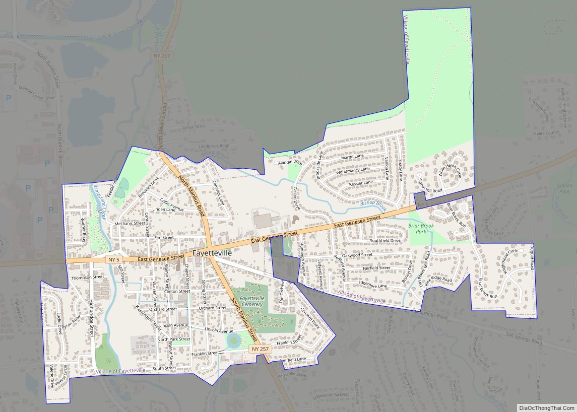
Westvale Road Map
Westvale city Satellite Map
Geography
Westvale is located at 43°2′30″N 76°13′1″W / 43.04167°N 76.21694°W / 43.04167; -76.21694 (43.041716, -76.217073).
According to the United States Census Bureau, Westvale has a total area of 1.4 square miles (3.6 km), all land.
See also
Map of New York State and its subdivision:- Albany
- Allegany
- Bronx
- Broome
- Cattaraugus
- Cayuga
- Chautauqua
- Chemung
- Chenango
- Clinton
- Columbia
- Cortland
- Delaware
- Dutchess
- Erie
- Essex
- Franklin
- Fulton
- Genesee
- Greene
- Hamilton
- Herkimer
- Jefferson
- Kings
- Lake Ontario
- Lewis
- Livingston
- Madison
- Monroe
- Montgomery
- Nassau
- New York
- Niagara
- Oneida
- Onondaga
- Ontario
- Orange
- Orleans
- Oswego
- Otsego
- Putnam
- Queens
- Rensselaer
- Richmond
- Rockland
- Saint Lawrence
- Saratoga
- Schenectady
- Schoharie
- Schuyler
- Seneca
- Steuben
- Suffolk
- Sullivan
- Tioga
- Tompkins
- Ulster
- Warren
- Washington
- Wayne
- Westchester
- Wyoming
- Yates
- Alabama
- Alaska
- Arizona
- Arkansas
- California
- Colorado
- Connecticut
- Delaware
- District of Columbia
- Florida
- Georgia
- Hawaii
- Idaho
- Illinois
- Indiana
- Iowa
- Kansas
- Kentucky
- Louisiana
- Maine
- Maryland
- Massachusetts
- Michigan
- Minnesota
- Mississippi
- Missouri
- Montana
- Nebraska
- Nevada
- New Hampshire
- New Jersey
- New Mexico
- New York
- North Carolina
- North Dakota
- Ohio
- Oklahoma
- Oregon
- Pennsylvania
- Rhode Island
- South Carolina
- South Dakota
- Tennessee
- Texas
- Utah
- Vermont
- Virginia
- Washington
- West Virginia
- Wisconsin
- Wyoming