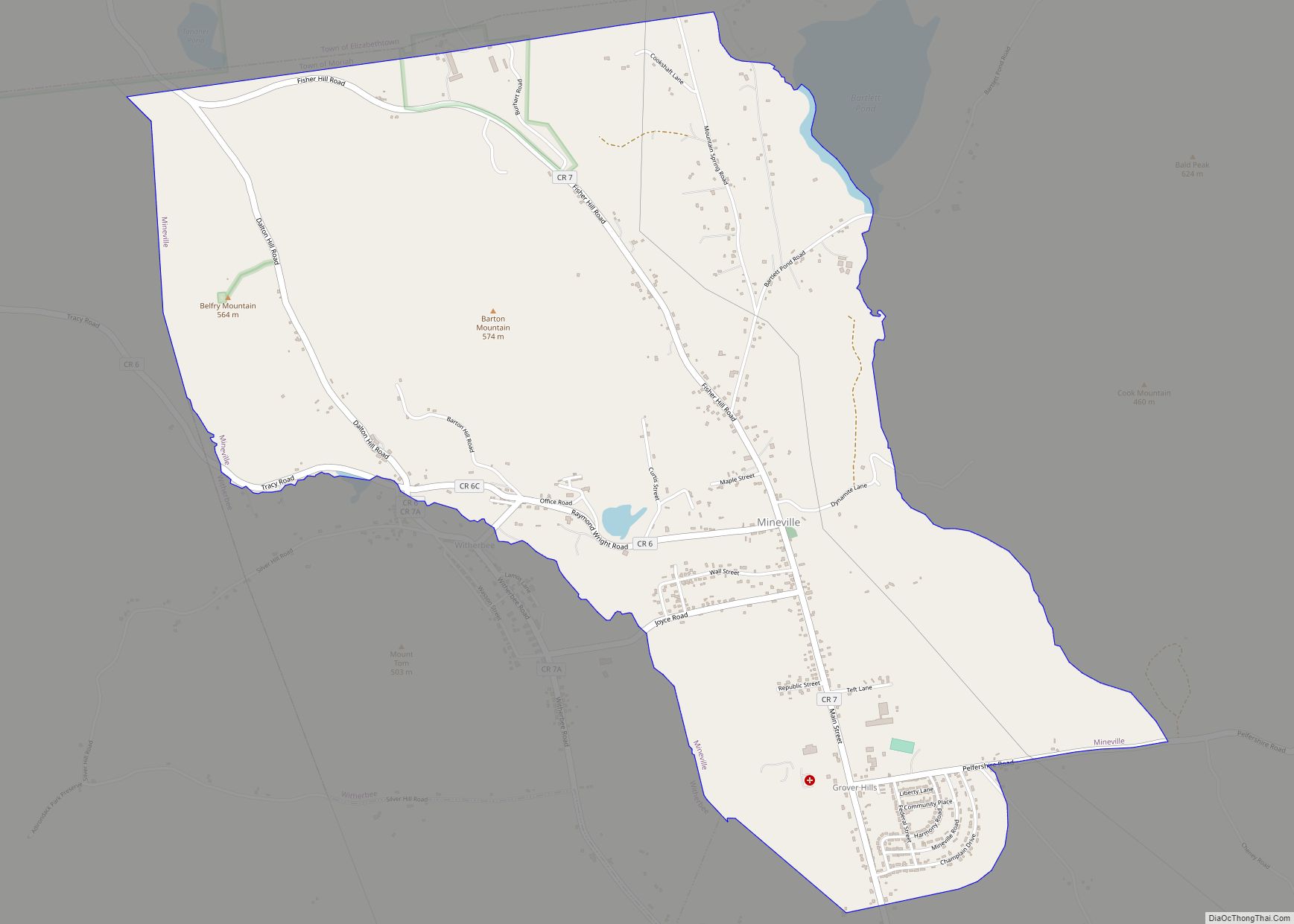
Witherbee is a hamlet and census-designated place (CDP) in the town of Moriah in Essex County, New York, United States. The population of the CDP was 347 at the 2010 census. Prior to 2010 the hamlet was part of the Mineville-Witherbee CDP.
| Name: | Witherbee CDP |
|---|---|
| LSAD Code: | 57 |
| LSAD Description: | CDP (suffix) |
| State: | New York |
| County: | Essex County |
| Elevation: | 1,273 ft (388 m) |
| Total Area: | 0.98 sq mi (2.54 km²) |
| Land Area: | 0.98 sq mi (2.54 km²) |
| Water Area: | 0.00 sq mi (0.00 km²) |
| Total Population: | 385 |
| Population Density: | 393.26/sq mi (151.81/km²) |
| ZIP code: | 12998 |
| FIPS code: | 3682656 |
Online Interactive Map
Click on ![]() to view map in "full screen" mode.
to view map in "full screen" mode.
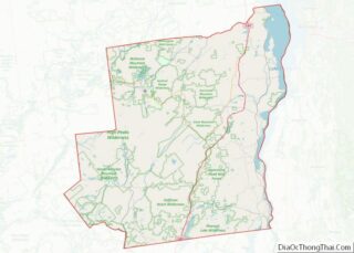
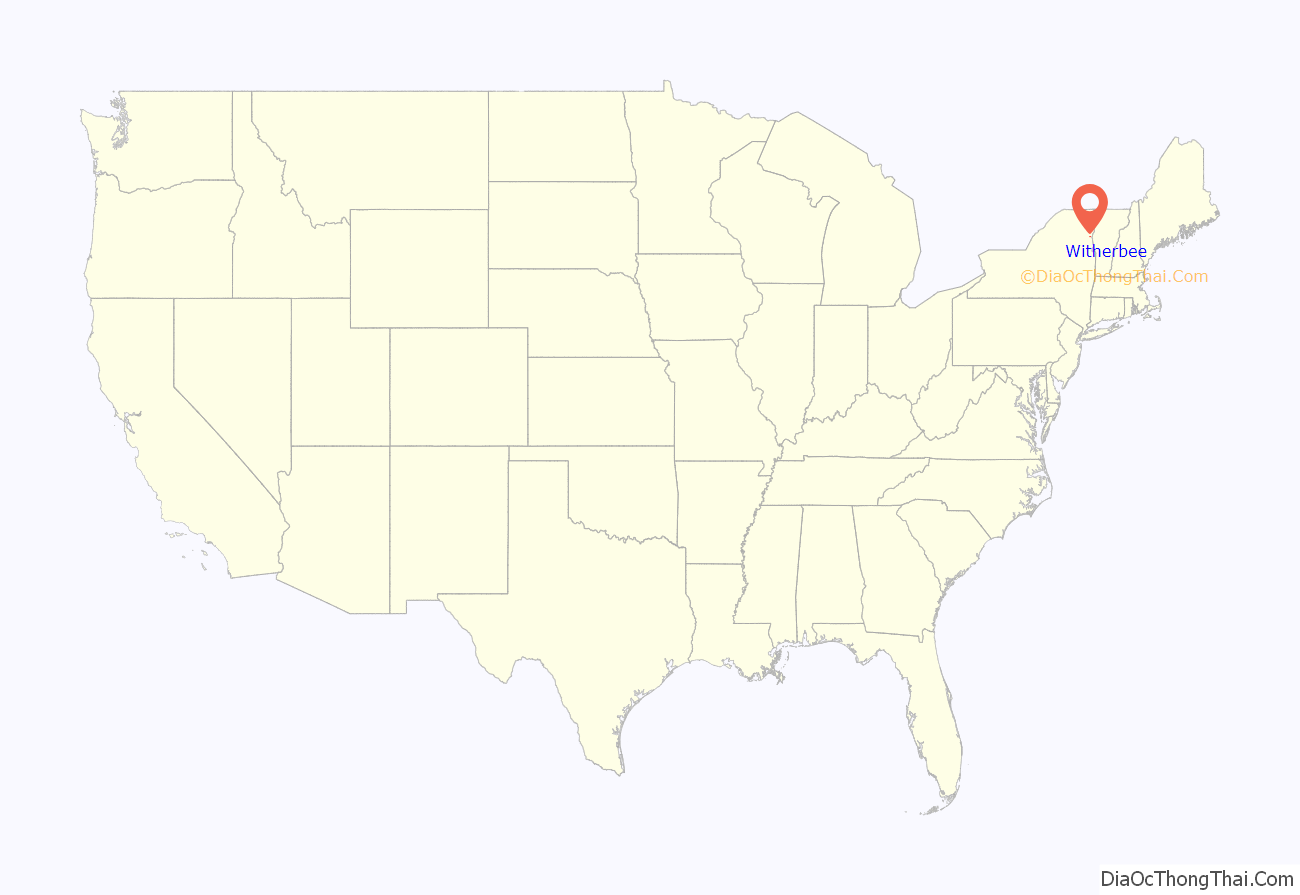
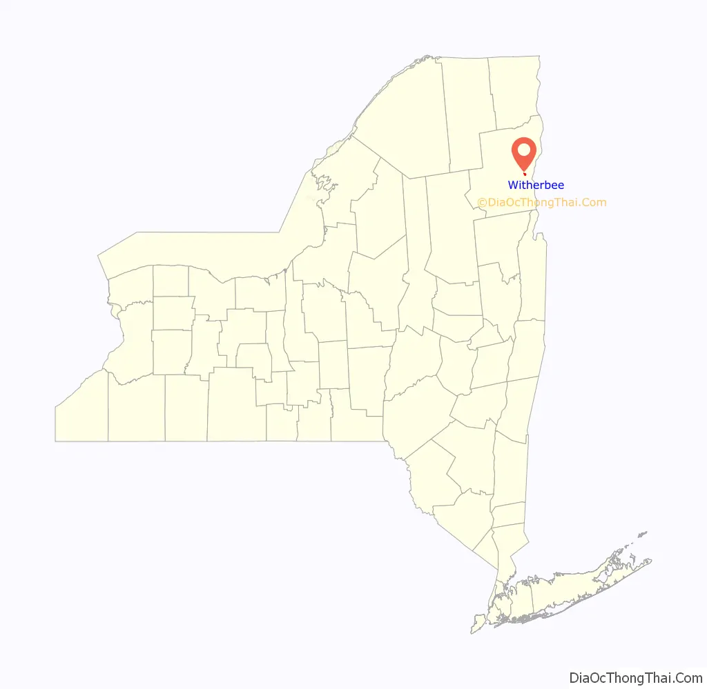
Witherbee location map. Where is Witherbee CDP?
History
Newport Pond, a 25 acre pond beside County Road 6 (Tracy Road) west of Witherbee, is namesake of a former royal fish pond in Newport, Essex, England, original manor of the Howland family ancestor John Howland, 1st Lord Newport Pond of Essex, England (1500-1546). The Witherbee Memorial Hall was listed on the National Register of Historic Places in 1991.
Witherbee Road Map
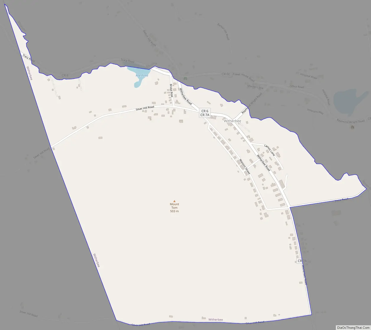
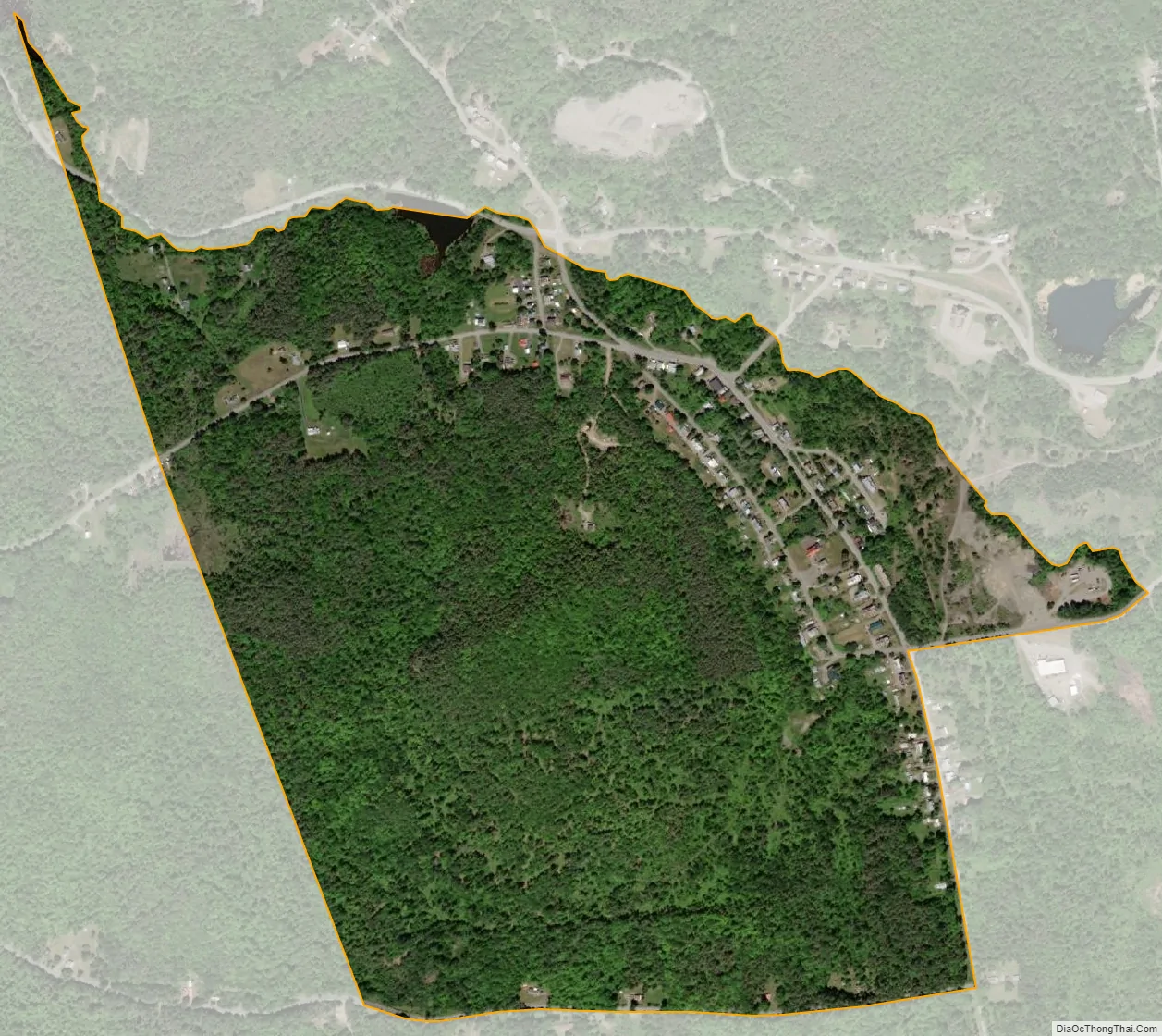
Witherbee city Satellite Map
Geography
Witherbee is located in the northern part of the town of Moriah and is bordered to the north by the hamlet of Mineville. It is 5 miles (8 km) northwest of Port Henry, the largest settlement in the town of Moriah.
According to the United States Census Bureau, the Witherbee CDP has a total area of 0.73 square miles (1.90 km), all land.
See also
Map of New York State and its subdivision:- Albany
- Allegany
- Bronx
- Broome
- Cattaraugus
- Cayuga
- Chautauqua
- Chemung
- Chenango
- Clinton
- Columbia
- Cortland
- Delaware
- Dutchess
- Erie
- Essex
- Franklin
- Fulton
- Genesee
- Greene
- Hamilton
- Herkimer
- Jefferson
- Kings
- Lake Ontario
- Lewis
- Livingston
- Madison
- Monroe
- Montgomery
- Nassau
- New York
- Niagara
- Oneida
- Onondaga
- Ontario
- Orange
- Orleans
- Oswego
- Otsego
- Putnam
- Queens
- Rensselaer
- Richmond
- Rockland
- Saint Lawrence
- Saratoga
- Schenectady
- Schoharie
- Schuyler
- Seneca
- Steuben
- Suffolk
- Sullivan
- Tioga
- Tompkins
- Ulster
- Warren
- Washington
- Wayne
- Westchester
- Wyoming
- Yates
- Alabama
- Alaska
- Arizona
- Arkansas
- California
- Colorado
- Connecticut
- Delaware
- District of Columbia
- Florida
- Georgia
- Hawaii
- Idaho
- Illinois
- Indiana
- Iowa
- Kansas
- Kentucky
- Louisiana
- Maine
- Maryland
- Massachusetts
- Michigan
- Minnesota
- Mississippi
- Missouri
- Montana
- Nebraska
- Nevada
- New Hampshire
- New Jersey
- New Mexico
- New York
- North Carolina
- North Dakota
- Ohio
- Oklahoma
- Oregon
- Pennsylvania
- Rhode Island
- South Carolina
- South Dakota
- Tennessee
- Texas
- Utah
- Vermont
- Virginia
- Washington
- West Virginia
- Wisconsin
- Wyoming