Ashville is a village in Pickaway County, Ohio, United States. The population was 4,621 at the 2020 census. Ashville is located 17 miles south of Columbus and 8 miles north of Circleville.
| Name: | Ashville village |
|---|---|
| LSAD Code: | 47 |
| LSAD Description: | village (suffix) |
| State: | Ohio |
| County: | Pickaway County |
| Elevation: | 715 ft (238 m) |
| Total Area: | 2.23 sq mi (5.78 km²) |
| Land Area: | 2.23 sq mi (5.78 km²) |
| Water Area: | 0.00 sq mi (0.00 km²) |
| Total Population: | 4,529 |
| Population Density: | 2,030.03/sq mi (783.88/km²) |
| ZIP code: | 43103 |
| Area code: | 740, 220 |
| FIPS code: | 3902680 |
| GNISfeature ID: | 1064348 |
| Website: | http://ashvilleohio.gov |
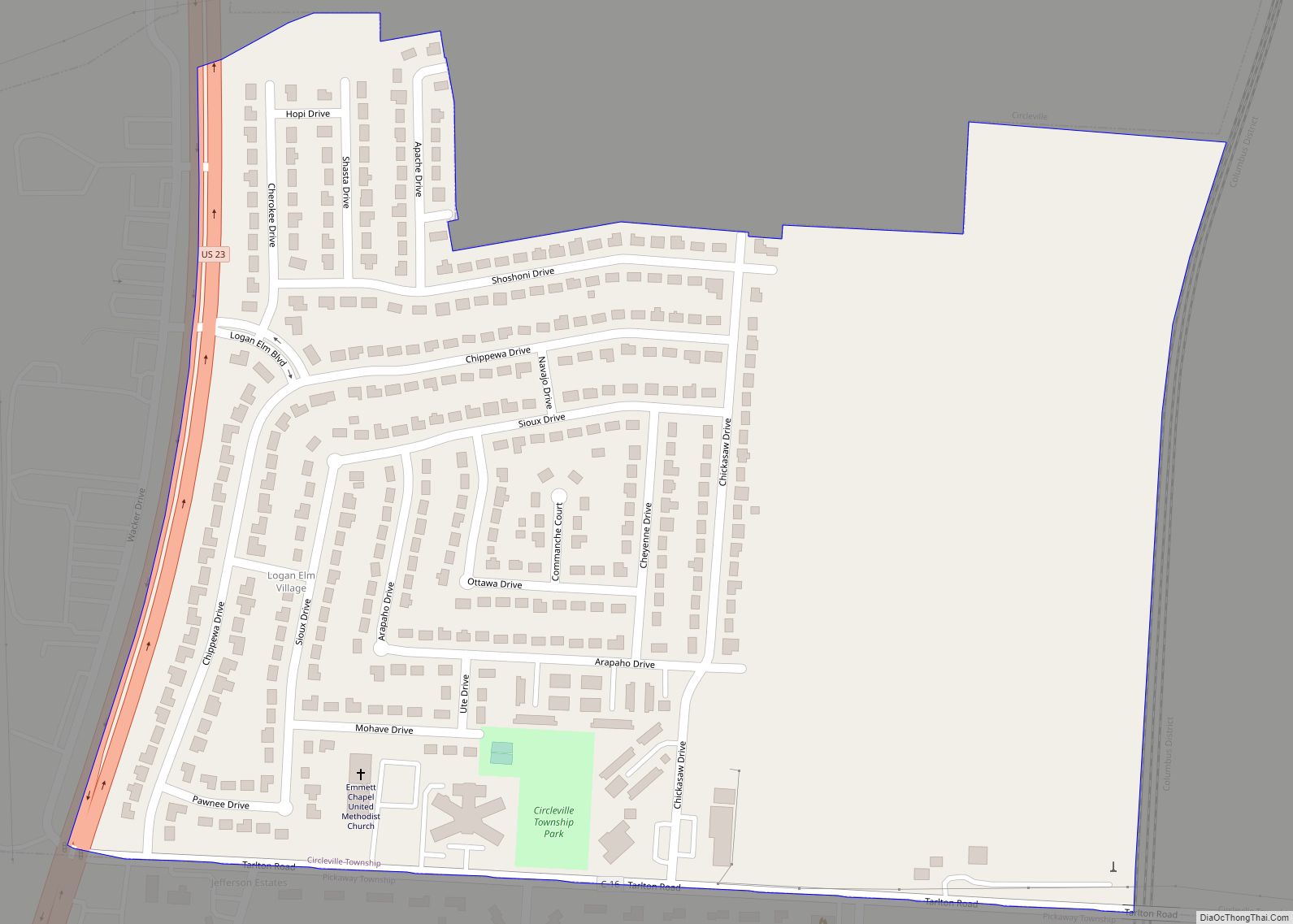
Online Interactive Map
Click on ![]() to view map in "full screen" mode.
to view map in "full screen" mode.
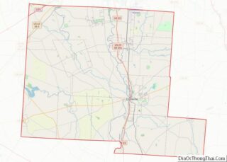
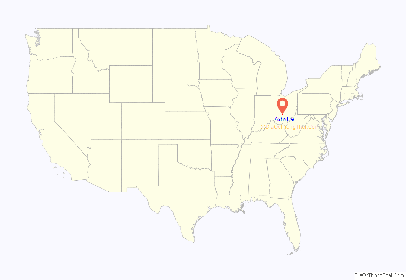
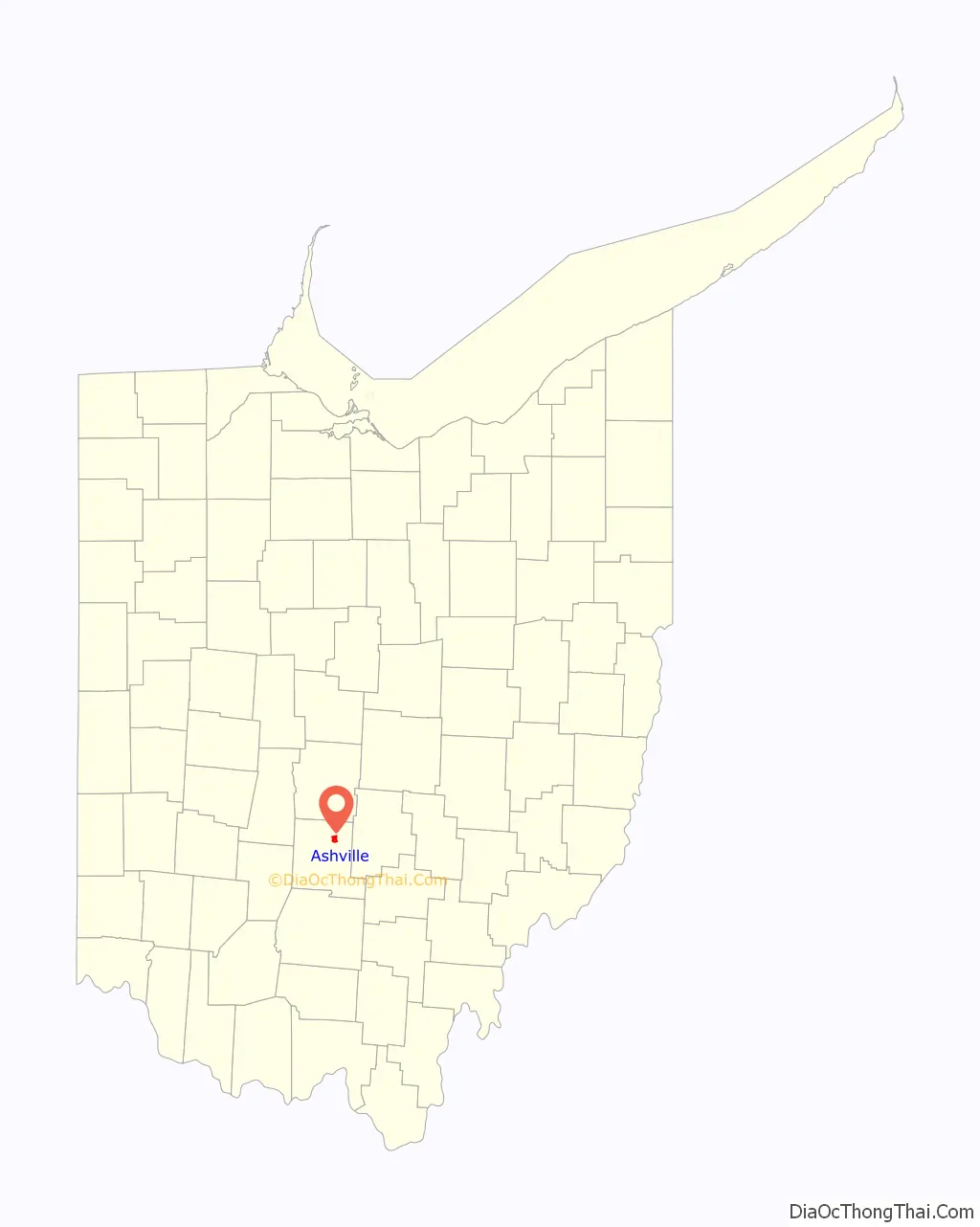
Ashville location map. Where is Ashville village?
History
Long before the American settlement of Ohio, Hopewell Native Americans inhabited the lands that became Ashville. The Snake Den Mounds were constructed a few miles outside of the present day village and were believed to have been built prior to C.E. 500. The site was examined in the late 1890s by Warren K. Moorehead, where he found artifacts of the ancient civilization and skeletal remains.
Centuries later the primary inhabitants were the Pekowi band of the Shawnee. This band of natives was the name sake for Pickaway County. The Pekowi people lived in the area for much of the 18th Century, but eventually left as America pushed westward.
Early American settlement
Ashville sits on land that had been acquired by Great Britain in 1763, following the defeat of France in the French and Indian War, but was prohibited to be settled by white settlers. When the United States claimed the region following the American Revolutionary War, the area became part of the Congress Lands East of Scioto River and was first surveyed in 1799 as part of the Scioto River Base Surveys.
Richard Staige (or Stage) Sr., born in Edinburgh, first settled the land that would become Ashville in 1808, after migrating from Virginia. Following his death in 1811, his sons Richard Jr. and William would each build a distillery on the family’s land, opening them the following year. Richard Jr. bought the 77.57 acres they inhabited from the Chillicothe Land Office on July 6, 1816.
In 1837, Richard Jr. sold his distillery to Mahlon Ashbrook. By 1845, Ashbrook had also built a gristmill on Walnut Creek and owned a large store that was run by his sister Iva “Ivy” and her husband Daniel Kellerman, who went on to be the first postmaster of the town, which was named Ashbrook at the time. That same year, Ashbrook helped lay out the town with the building of 25 new houses.
In 1853, Ashbrook, was voted to the Railroad Committee for the speedy construction for rails to cover Ross, Pickaway, and Franklin Counties. The route of the railroad (like the canals before it) had a great effect on the success of the development of the area. Ashbrook manufactured barrels for the mill and distillery, and also had some outside trade in that line.
The Ashbrook businesses failed in 1855, following his endorsement of a promissory note for a friend. When the friend failed to pay, Ashbrook was in debt for tens of thousands and lost much of his wealth to his creditors. Ashbrook migrated west, leaving part of his family behind.
Like most of America, the town suffered a setback due to the Panic of 1857. The growth of the town was furthered hampered by the onset of the American Civil War.
Railroad boon
The construction of the Scioto Valley Railroad through Ashville, under the supervision of lead engineer Isham Randolph, began in 1874. This caused a new flurry of both population and economic growth, including the building of two new grain elevators. Railroad employees, most notably bridge builders, settled in the northern reaches of Ashville in what has become Little Chicago. A year later, in 1875, the post office was reestablished after it had been closed following the shuttering of the Ashbrook businesses and a train station was opened in 1876. Finally, after nearly 70 years following the original settlement, the village was incorporate as Ashville in the Spring of 1880.
In 1890, the population of Ashville reached 430 citizens and the area’s first volunteer fire department was created, as well as cisterns were built throughout the village. That same year, Norfolk and Western Railway acquired the Scioto Valley Railroad following its demise.
Over the next ten years, the village population grew at a rate of more than 50%. This was aided by the establishment of major businesses, which included the Scioto Valley Canning Factory that was built in 1899. The factory, which canned sweet corn, at its peak, employed 540 employees who were able to produce upwards of 200,000 cans of corn per day. Dozens of other businesses sprang up as well to accommodate the growth, including blacksmiths, a lumber yard, a hotel, and even an opera house.
In 1904, Scioto Valley Traction Company opened a railway in town that powered their engines by electricity using a third rail. This line sent passenger and freight traffic from Columbus to Chillicothe. The line operated until September 1930. The depot remains on West Main Street.
Around 1910, the Chesapeake and Ohio Railway (which later became CSX) was built on the western edge of town. With the construction several gandy dancers settled in Little Chicago. The workers were primarily of Greek and Bulgarian descent according to Census records. The population of the town had ballooned to over 970 by that time.
Following Ashville’s quick growth, it became the second most populated area in Pickaway County.
Small town status
Though the rail lines remained operational, the population growth of the village slowed. Over the next three decades the population grew by only 129 citizens. Additionally, the reduction of growth was compounded by the effects of the Great Depression.
A population spike happened again in the 1950s and 1960s as Ashville became a residential town when new homes started popping up west of Long Street. Though many businesses had fizzled out, new large employers began to target Ashville including Columbus Industries which opened their plant in 1970. During this time Ashville also became the hub of a newly formed school district when Teays Valley Local School District built their high school in 1963 and housed their district offices within the village.
The next major growth step happened in 1994 when home builders, such as M/I Homes, built the first modern subdivisions in Ashville. The two major subdivisions were Ashton Village and Ashton Woods, which are located on the northside of town. Both sites together brought in nearly 100 new homes.
Continued growth
Since 1990, Ashville remains one of the fastest growing areas in Pickaway County. Several new housing developments, apartments, and condominiums have been built and the expansion of Rickenbacker International Airport Global Logistics Park and the Norfolk Southern Railway Intermodal Terminal, that was built in 2008, have created thousands of jobs for the area.
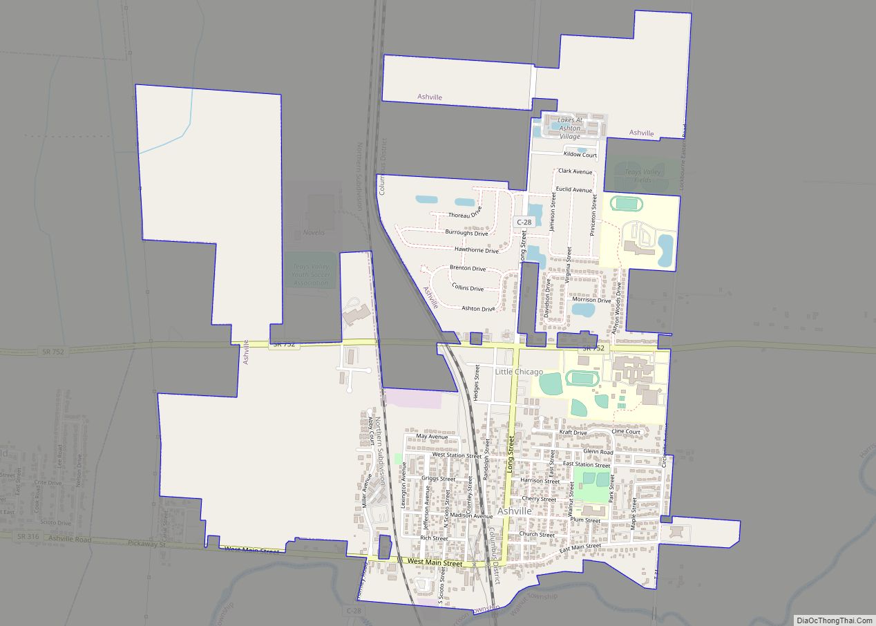
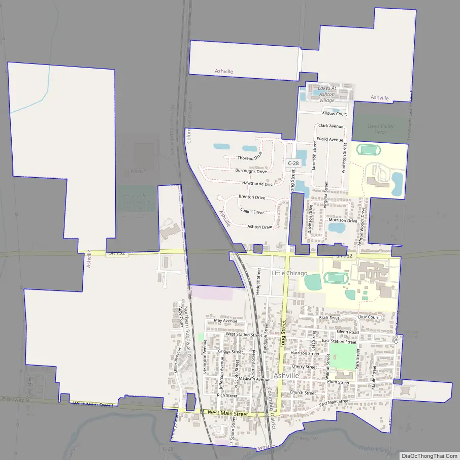
Ashville Road Map
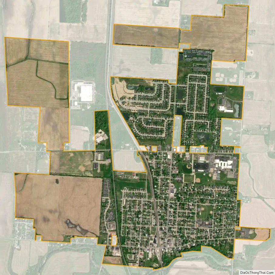
Ashville city Satellite Map
Geography
Ashville is located at 39°43′06″N 82°56′54″W / 39.7183399°N 82.9483270°W / 39.7183399; -82.9483270. It is located in the Scioto River Valley and has an elevation of 715 feet (218 m) above sea level. The village is located in the till plain-area of Western Ohio and borders the Appalachian Plateau. The area is generally viewed to be a fertile region with gently rolling hills created by moraines.
According to the United States Census Bureau, the village has a total area of 2.51 square miles (6.50 km), all of it land.
Glacial activity
The area on which present-day Ashville sits was effected by three glacial periods. Those periods were Pre-Illinoian Glaciation, Illinoian Glaciation, and Wisconsin glaciation.
- Pre-Illinoian Glaciation – The first impact of glaciers in Ashville occurred about 780,000 years ago during the Pleistocene epoch. The glacier, which stopped right at Ashville’s location, dammed the pre-glacial Teays River just south of the village, which created Lake Tight. The former Teays River would go on to become a significant aquifer for the area.
- Illinoian Glaciation – Approximately 190,000 to 130,000 years ago, a glacier once again covered the area. Much of the effects of this glacier were covered by the subsequent Wisconsin glaciation that started 100,000 years later.
- Wisconsin Glaciation – The last ice to be in the area began 35,000 years ago and ended approximately 12,000 years ago. The Laurentide Ice Sheet stretched into Ohio with the Lake Huron lobe being the most prominent major lobe. The Scioto minor lobe, which helped create the Scioto River, stretched over the area and created the modern day terrain.
Rivers, creeks, and brooks
The Village is part of the Walnut Creek watershed. Walnut Creek is a tributary of the Scioto River that forms the southern border of Ashville and runs into the river approximately 2.5 miles southwest of the village. The Walnut Creek is intersected by the Little Walnut Creek approximately .25 miles southeast of the village and by Mud Run, a brook that runs through the western fringes of the village, 1.7 miles southwest.
See also
Map of Ohio State and its subdivision:- Adams
- Allen
- Ashland
- Ashtabula
- Athens
- Auglaize
- Belmont
- Brown
- Butler
- Carroll
- Champaign
- Clark
- Clermont
- Clinton
- Columbiana
- Coshocton
- Crawford
- Cuyahoga
- Darke
- Defiance
- Delaware
- Erie
- Fairfield
- Fayette
- Franklin
- Fulton
- Gallia
- Geauga
- Greene
- Guernsey
- Hamilton
- Hancock
- Hardin
- Harrison
- Henry
- Highland
- Hocking
- Holmes
- Huron
- Jackson
- Jefferson
- Knox
- Lake
- Lake Erie
- Lawrence
- Licking
- Logan
- Lorain
- Lucas
- Madison
- Mahoning
- Marion
- Medina
- Meigs
- Mercer
- Miami
- Monroe
- Montgomery
- Morgan
- Morrow
- Muskingum
- Noble
- Ottawa
- Paulding
- Perry
- Pickaway
- Pike
- Portage
- Preble
- Putnam
- Richland
- Ross
- Sandusky
- Scioto
- Seneca
- Shelby
- Stark
- Summit
- Trumbull
- Tuscarawas
- Union
- Van Wert
- Vinton
- Warren
- Washington
- Wayne
- Williams
- Wood
- Wyandot
- Alabama
- Alaska
- Arizona
- Arkansas
- California
- Colorado
- Connecticut
- Delaware
- District of Columbia
- Florida
- Georgia
- Hawaii
- Idaho
- Illinois
- Indiana
- Iowa
- Kansas
- Kentucky
- Louisiana
- Maine
- Maryland
- Massachusetts
- Michigan
- Minnesota
- Mississippi
- Missouri
- Montana
- Nebraska
- Nevada
- New Hampshire
- New Jersey
- New Mexico
- New York
- North Carolina
- North Dakota
- Ohio
- Oklahoma
- Oregon
- Pennsylvania
- Rhode Island
- South Carolina
- South Dakota
- Tennessee
- Texas
- Utah
- Vermont
- Virginia
- Washington
- West Virginia
- Wisconsin
- Wyoming