Beloit (/bəˈlɔɪt/ bə-LOYT) is a village in southwestern Mahoning County, Ohio, United States. The population was 903 at the 2020 census. It is part of the Youngstown–Warren metropolitan area.
| Name: | Beloit village |
|---|---|
| LSAD Code: | 47 |
| LSAD Description: | village (suffix) |
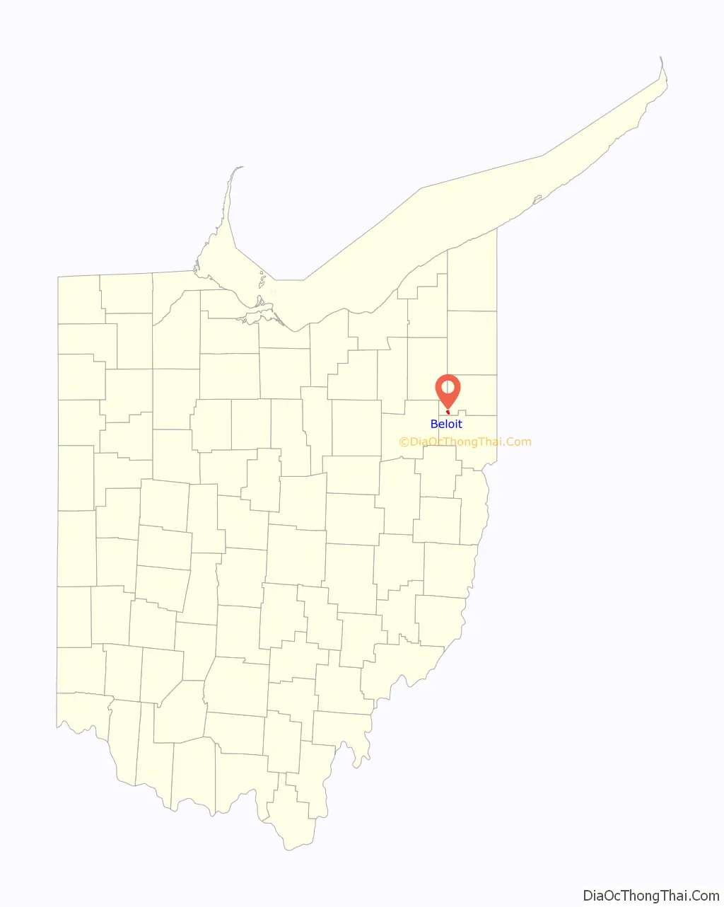
| State: | Ohio |
| County: | Mahoning County |
| Elevation: | 1,129 ft (344 m) |
| Total Area: | 0.98 sq mi (2.55 km²) |
| Land Area: | 0.97 sq mi (2.53 km²) |
| Water Area: | 0.01 sq mi (0.02 km²) |
| Total Population: | 903 |
| Population Density: | 926.15/sq mi (357.54/km²) |
| ZIP code: | 44609 |
| FIPS code: | 3905410 |
| GNISfeature ID: | 1064412 |
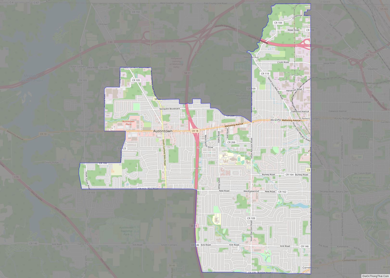
Online Interactive Map
Click on ![]() to view map in "full screen" mode.
to view map in "full screen" mode.
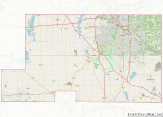
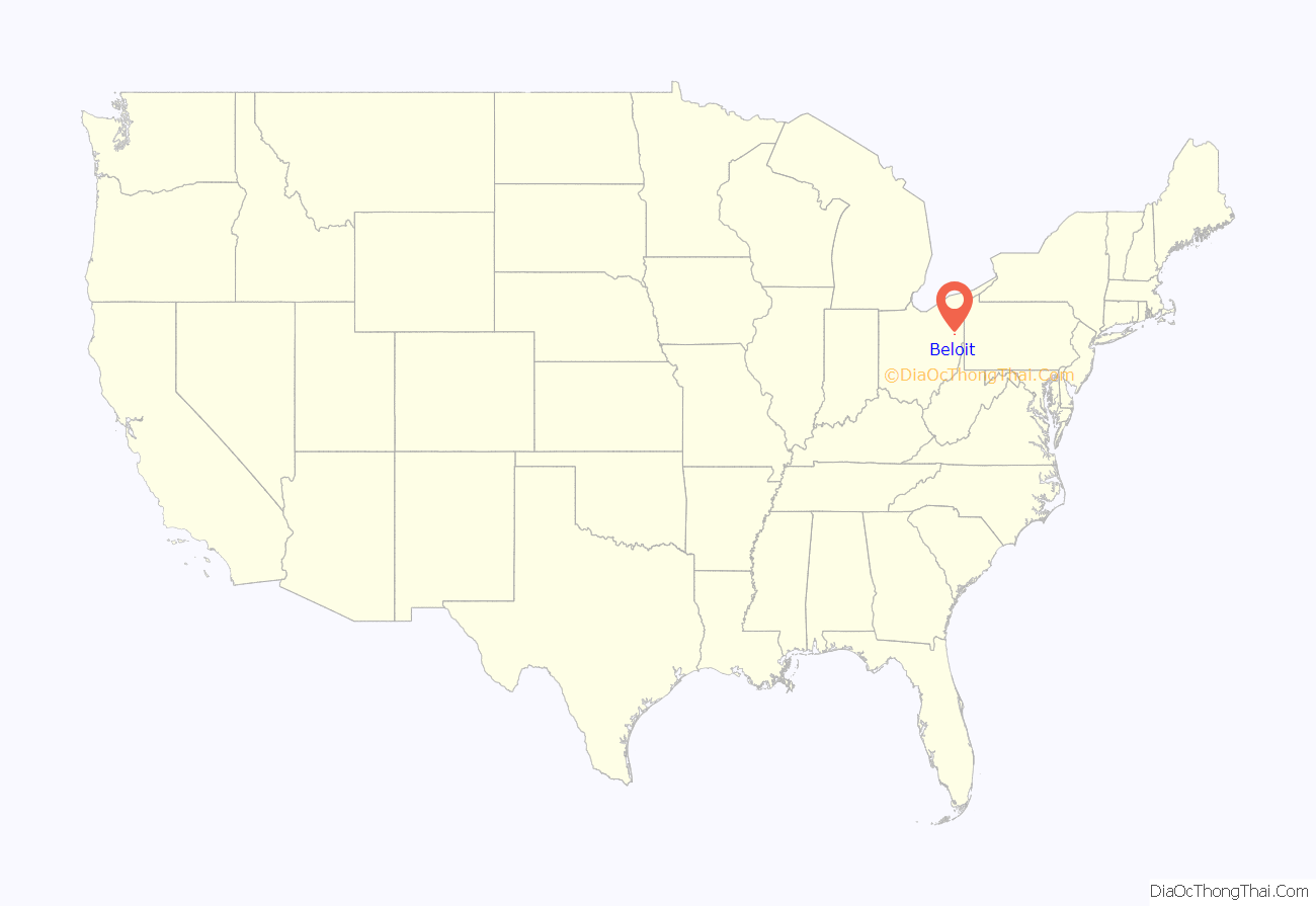
Beloit location map. Where is Beloit village?
History
Beloit had its start in the late 1840s by the building of the railroad through that territory. It was originally called Smithfield Station, and the name Beloit was adopted in 1863. The name Beloit is a transfer from Beloit, Wisconsin.
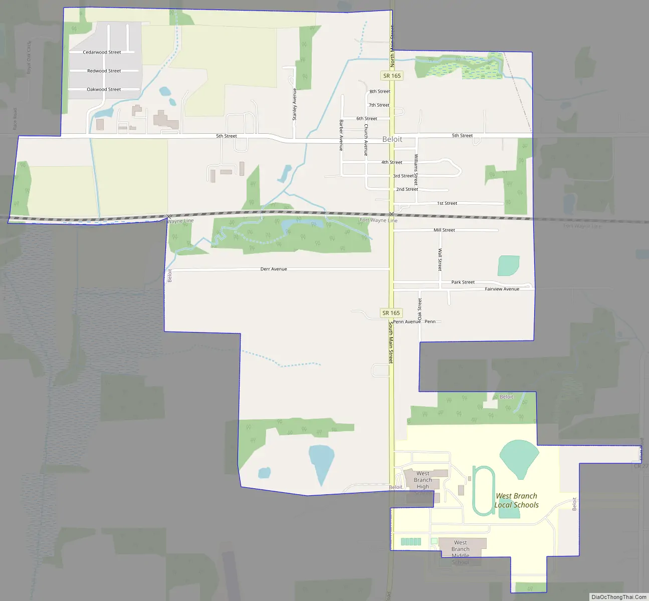
Beloit Road Map
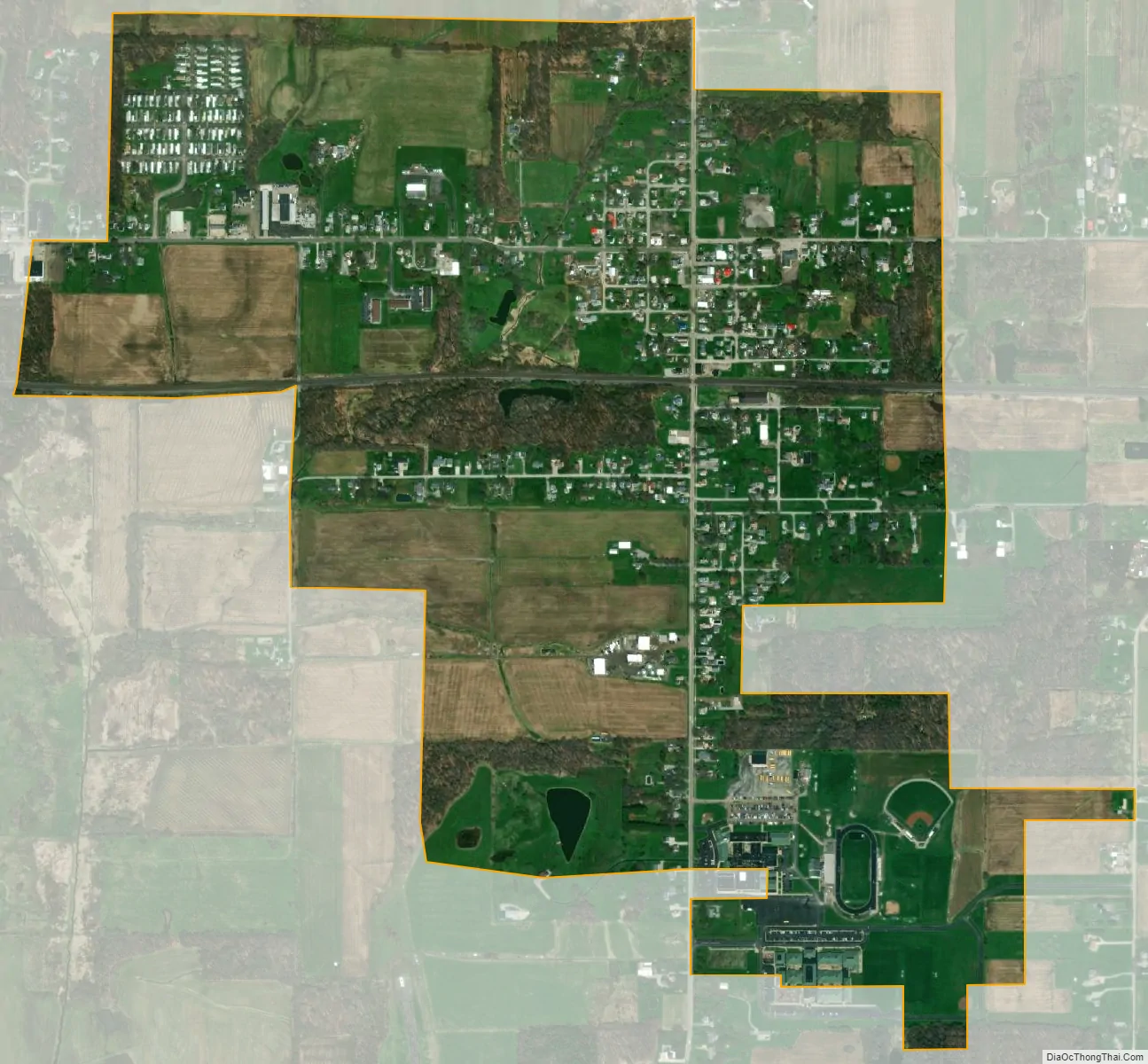
Beloit city Satellite Map
Geography
Beloit is located at 40°55′22″N 80°59′50″W / 40.92278°N 80.99722°W / 40.92278; -80.99722 (40.922866, -80.997176).
According to the United States Census Bureau, the village has a total area of 0.99 square miles (2.56 km), of which 0.98 square miles (2.54 km) is land and 0.01 square miles (0.03 km) is water.
See also
Map of Ohio State and its subdivision:- Adams
- Allen
- Ashland
- Ashtabula
- Athens
- Auglaize
- Belmont
- Brown
- Butler
- Carroll
- Champaign
- Clark
- Clermont
- Clinton
- Columbiana
- Coshocton
- Crawford
- Cuyahoga
- Darke
- Defiance
- Delaware
- Erie
- Fairfield
- Fayette
- Franklin
- Fulton
- Gallia
- Geauga
- Greene
- Guernsey
- Hamilton
- Hancock
- Hardin
- Harrison
- Henry
- Highland
- Hocking
- Holmes
- Huron
- Jackson
- Jefferson
- Knox
- Lake
- Lake Erie
- Lawrence
- Licking
- Logan
- Lorain
- Lucas
- Madison
- Mahoning
- Marion
- Medina
- Meigs
- Mercer
- Miami
- Monroe
- Montgomery
- Morgan
- Morrow
- Muskingum
- Noble
- Ottawa
- Paulding
- Perry
- Pickaway
- Pike
- Portage
- Preble
- Putnam
- Richland
- Ross
- Sandusky
- Scioto
- Seneca
- Shelby
- Stark
- Summit
- Trumbull
- Tuscarawas
- Union
- Van Wert
- Vinton
- Warren
- Washington
- Wayne
- Williams
- Wood
- Wyandot
- Alabama
- Alaska
- Arizona
- Arkansas
- California
- Colorado
- Connecticut
- Delaware
- District of Columbia
- Florida
- Georgia
- Hawaii
- Idaho
- Illinois
- Indiana
- Iowa
- Kansas
- Kentucky
- Louisiana
- Maine
- Maryland
- Massachusetts
- Michigan
- Minnesota
- Mississippi
- Missouri
- Montana
- Nebraska
- Nevada
- New Hampshire
- New Jersey
- New Mexico
- New York
- North Carolina
- North Dakota
- Ohio
- Oklahoma
- Oregon
- Pennsylvania
- Rhode Island
- South Carolina
- South Dakota
- Tennessee
- Texas
- Utah
- Vermont
- Virginia
- Washington
- West Virginia
- Wisconsin
- Wyoming