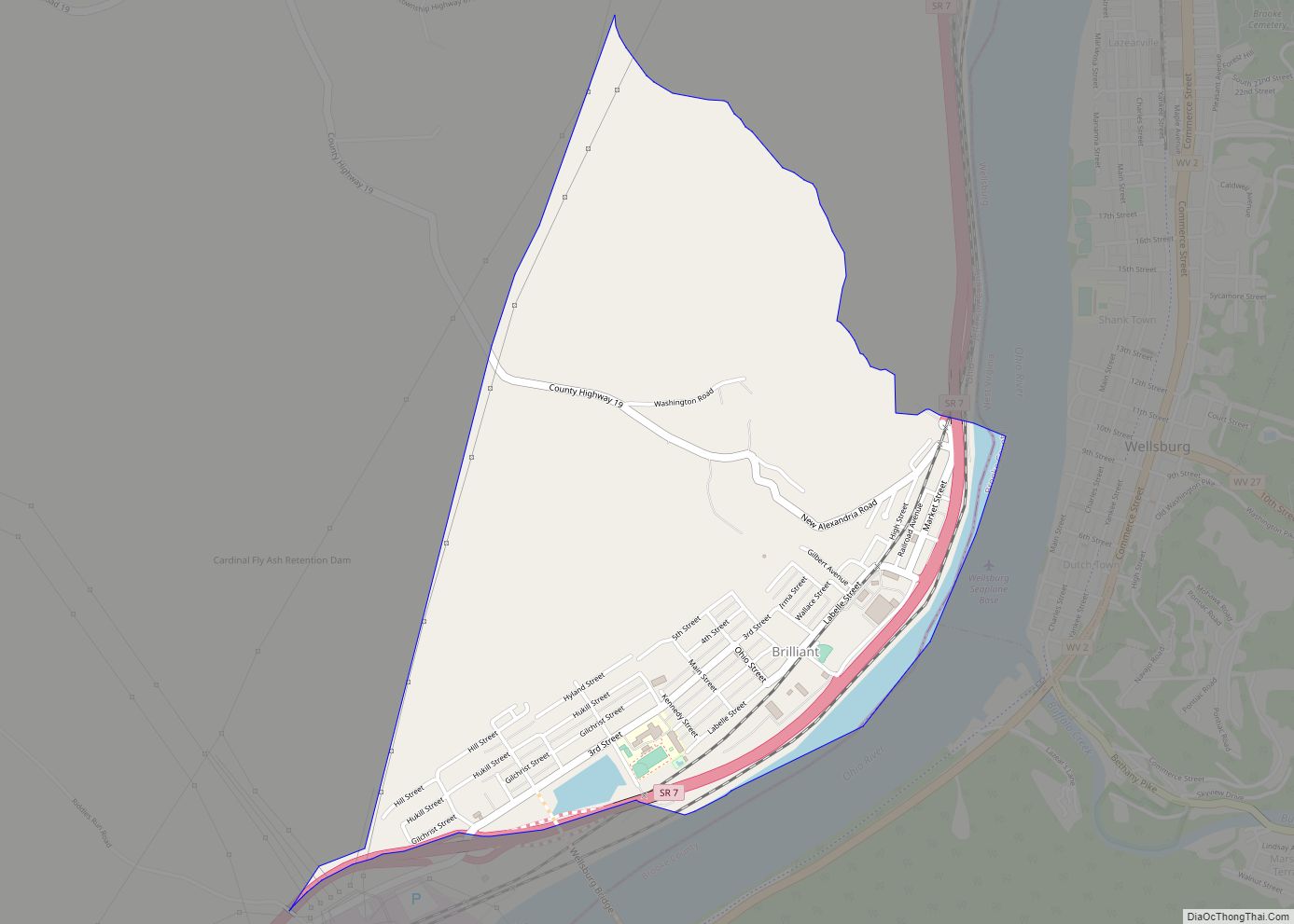
Brilliant is an unincorporated community and census-designated place (CDP) in eastern Jefferson County, Ohio, United States, along the Ohio River. It was named after the Brilliant Glass factory that once was located in the town. The population was 1,317 as of the 2020 census. It is part of the Weirton–Steubenville metropolitan area.
Brilliant was formerly incorporated as a village, but it disincorporated on November 24, 1993.
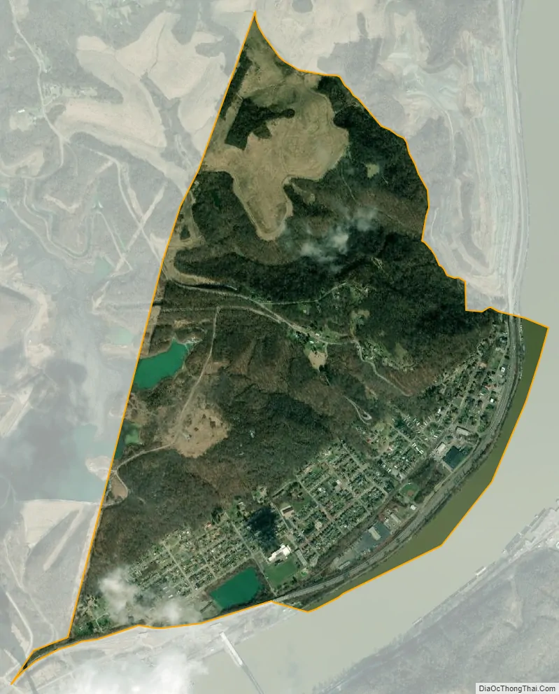
| Name: | Brilliant CDP |
|---|---|
| LSAD Code: | 57 |
| LSAD Description: | CDP (suffix) |
| State: | Ohio |
| County: | Jefferson County |
| Elevation: | 680 ft (210 m) |
| Total Area: | 1.76 sq mi (4.56 km²) |
| Land Area: | 1.75 sq mi (4.52 km²) |
| Water Area: | 0.01 sq mi (0.04 km²) |
| Total Population: | 1,317 |
| Population Density: | 753.86/sq mi (291.14/km²) |
| ZIP code: | 43913 |
| Area code: | 740 |
| FIPS code: | 3908812 |
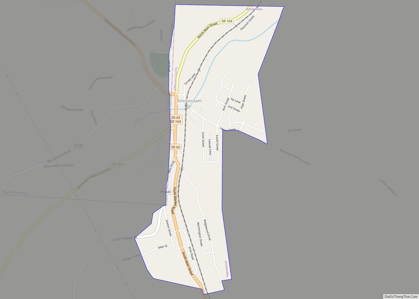
Online Interactive Map
Click on ![]() to view map in "full screen" mode.
to view map in "full screen" mode.
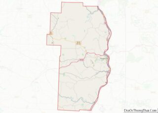
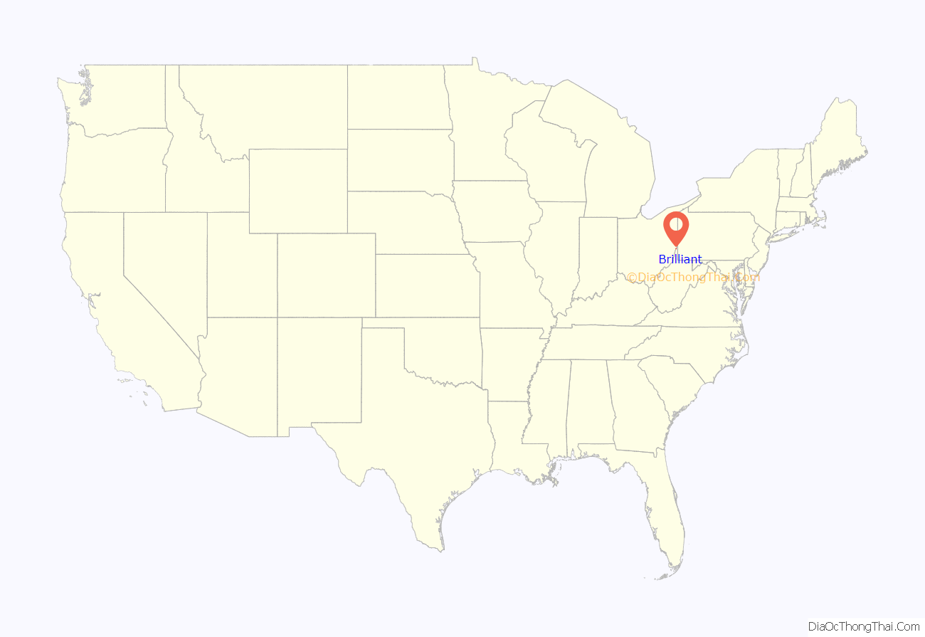
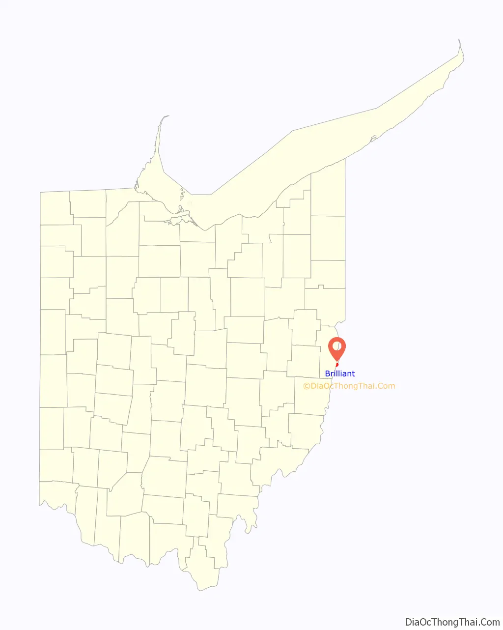
Brilliant location map. Where is Brilliant CDP?
History
Brilliant was laid out in 1819 by western Virginia statesman Philip Doddridge under the name “Philipsburgh”. The location was considered significant to commerce as it was the convergence of many roads in close proximity to the Ohio River and parallel to the Wellsburg wharf. A new addition was laid out in 1836 named “La Grange”, a name also adopted by the railway station in 1856. In 1880, the Brilliant Glass Company was established and a glass factory was built at La Grange. The town later adopted the name of the glass company and was incorporated as “Brilliant”, changing the titles of the railway station and post office.
The Cardinal Power Plant is located south of Brilliant. It commenced operations in 1967.
Brilliant Road Map
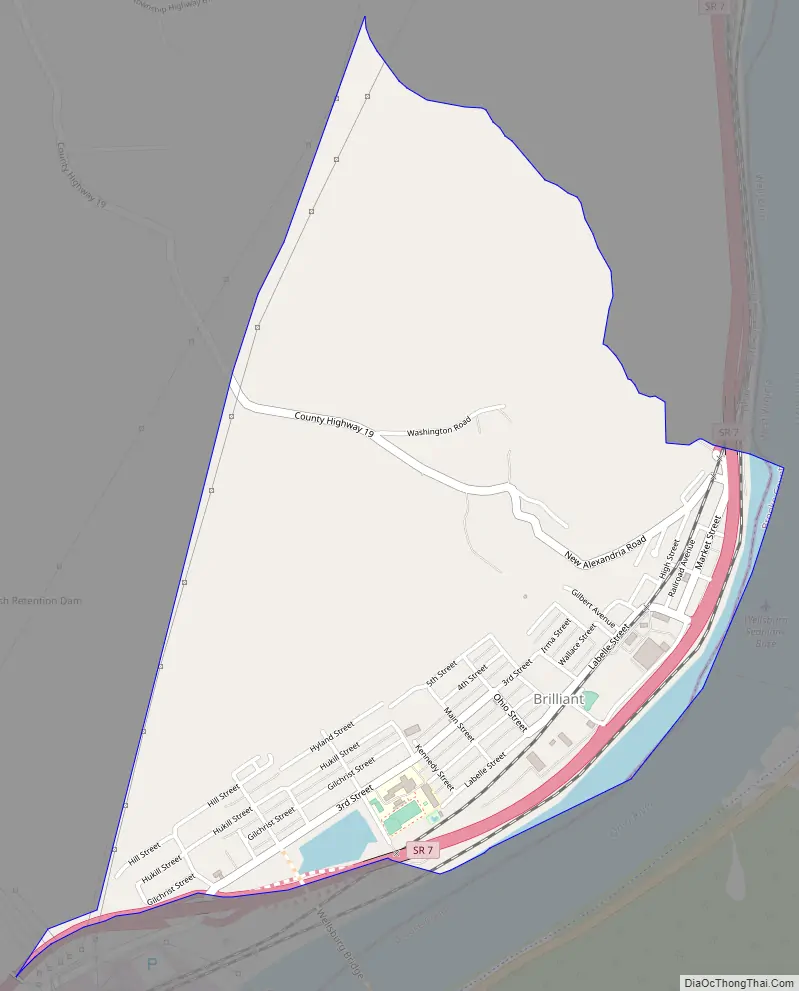
Brilliant city Satellite Map
Geography
Brilliant is in northeastern Wells Township, along the Ohio River 7 miles (11 km) south of Steubenville. Ohio State Route 7, a four-lane freeway, passes through the southeast side of the community, leading north (upriver) to Steubenville and south 16 miles (26 km) to Bridgeport, across the river from Wheeling, West Virginia.
According to the 2010 census, the Brilliant CDP has a total area of 1.77 square miles (4.58 km), of which 1.75 square miles (4.53 km) (or 98.87%) are land and 0.01 square miles (0.03 km) (or 0.56%) are water.
Climate
The climate in this area is characterized by relatively high temperatures and evenly distributed precipitation throughout the year. According to the Köppen Climate Classification system, Brilliant has a Humid subtropical climate, abbreviated “Cfa” on climate maps.
See also
Map of Ohio State and its subdivision:- Adams
- Allen
- Ashland
- Ashtabula
- Athens
- Auglaize
- Belmont
- Brown
- Butler
- Carroll
- Champaign
- Clark
- Clermont
- Clinton
- Columbiana
- Coshocton
- Crawford
- Cuyahoga
- Darke
- Defiance
- Delaware
- Erie
- Fairfield
- Fayette
- Franklin
- Fulton
- Gallia
- Geauga
- Greene
- Guernsey
- Hamilton
- Hancock
- Hardin
- Harrison
- Henry
- Highland
- Hocking
- Holmes
- Huron
- Jackson
- Jefferson
- Knox
- Lake
- Lake Erie
- Lawrence
- Licking
- Logan
- Lorain
- Lucas
- Madison
- Mahoning
- Marion
- Medina
- Meigs
- Mercer
- Miami
- Monroe
- Montgomery
- Morgan
- Morrow
- Muskingum
- Noble
- Ottawa
- Paulding
- Perry
- Pickaway
- Pike
- Portage
- Preble
- Putnam
- Richland
- Ross
- Sandusky
- Scioto
- Seneca
- Shelby
- Stark
- Summit
- Trumbull
- Tuscarawas
- Union
- Van Wert
- Vinton
- Warren
- Washington
- Wayne
- Williams
- Wood
- Wyandot
- Alabama
- Alaska
- Arizona
- Arkansas
- California
- Colorado
- Connecticut
- Delaware
- District of Columbia
- Florida
- Georgia
- Hawaii
- Idaho
- Illinois
- Indiana
- Iowa
- Kansas
- Kentucky
- Louisiana
- Maine
- Maryland
- Massachusetts
- Michigan
- Minnesota
- Mississippi
- Missouri
- Montana
- Nebraska
- Nevada
- New Hampshire
- New Jersey
- New Mexico
- New York
- North Carolina
- North Dakota
- Ohio
- Oklahoma
- Oregon
- Pennsylvania
- Rhode Island
- South Carolina
- South Dakota
- Tennessee
- Texas
- Utah
- Vermont
- Virginia
- Washington
- West Virginia
- Wisconsin
- Wyoming