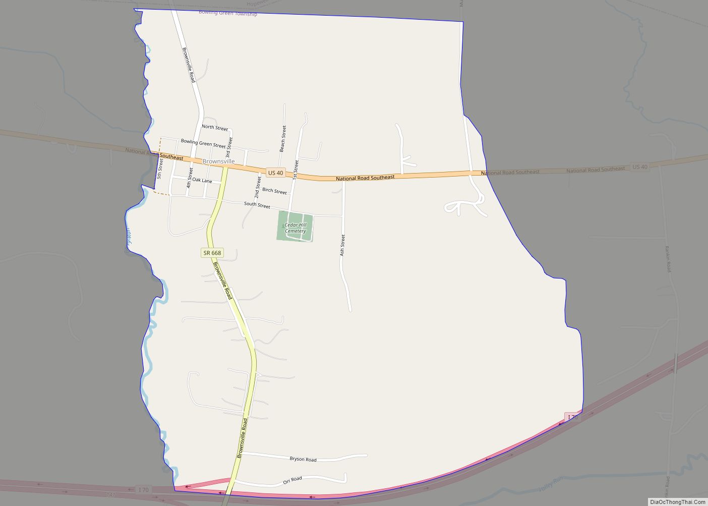
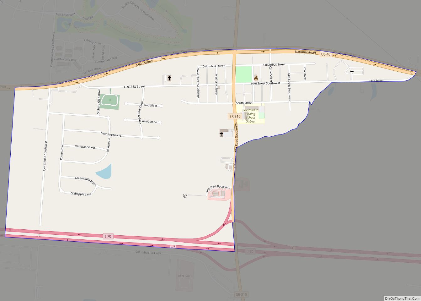
Brownsville is an unincorporated community and census-designated place (CDP) in northeastern Bowling Green Township, Licking County, Ohio, United States. As of the 2010 census, it had a population of 220. It lies at the intersection of U.S. Route 40 with State Route 668.
| Name: | Brownsville CDP |
|---|---|
| LSAD Code: | 57 |
| LSAD Description: | CDP (suffix) |
| State: | Ohio |
| County: | Licking County |
| Elevation: | 948 ft (289 m) |
| Total Area: | 0.89 sq mi (2.31 km²) |
| Land Area: | 0.89 sq mi (2.31 km²) |
| Water Area: | 0.00 sq mi (0.00 km²) |
| Total Population: | 214 |
| Population Density: | 240.18/sq mi (92.77/km²) |
| ZIP code: | 43721 |
| FIPS code: | 3909596 |
| GNISfeature ID: | 1048310 |
Online Interactive Map
Click on ![]() to view map in "full screen" mode.
to view map in "full screen" mode.
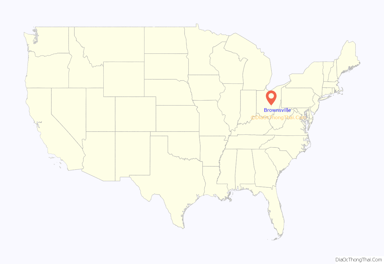
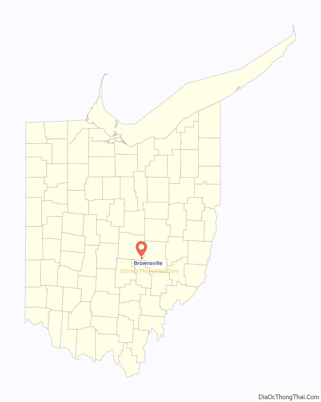
Brownsville location map. Where is Brownsville CDP?
History
Brownsville starts when the National Road was extended to that point. The community was laid out in 1829. Brownsville was named for its founder, Adam Brown. A post office was established in 1830.
Flint Ridge State Memorial is 3 miles (5 km) north of Brownsville.
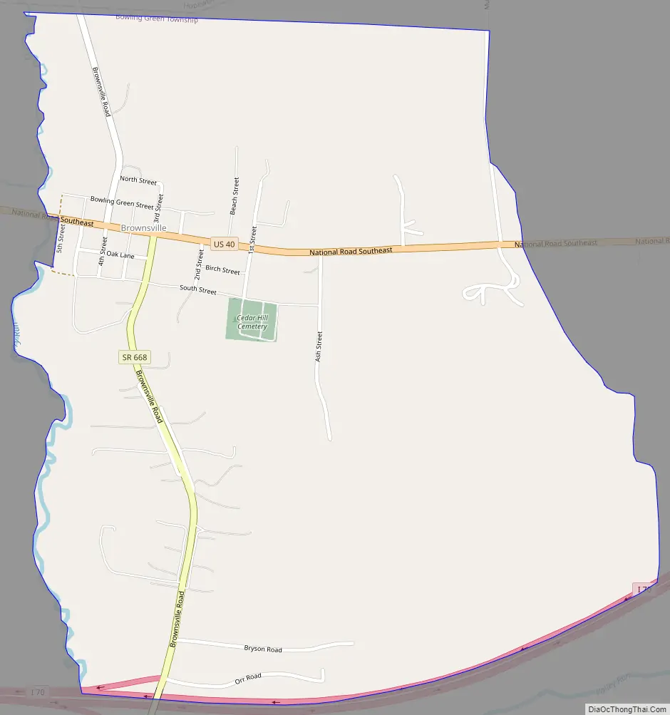
Brownsville Road Map
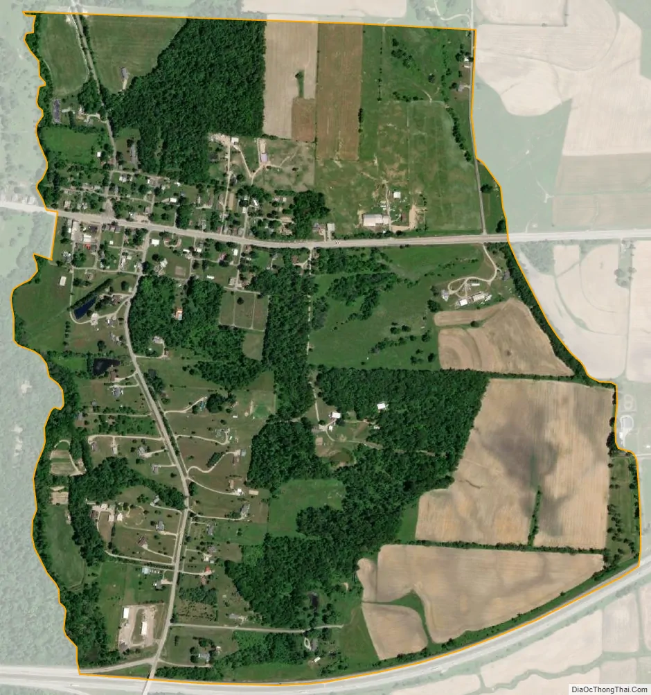
Brownsville city Satellite Map
Geography
Brownsville is in southeastern Licking County, 13 miles (21 km) southeast of Newark, the county seat. The community’s northern border is the boundary between Bowling Green Township and Hopewell Township, and the southern border follows Interstate 70. Access to I-70 is provided by Exit 141, a half-interchange directly south of the town on State Route 668, for traffic traveling to and from the west. A complementary interchange for traffic to and from the east is Exit 142 in Gratiot, 2 miles (3 km) east of Brownsville. Both I-70 and US-40 lead east 13 miles (21 km) to Zanesville and west 41 miles (66 km) to Columbus.
According to the U.S. Census Bureau, the Brownsville CDP has a total area of 0.9 square miles (2.3 km), of which 0.6 acres (2,422 m), or 0.10%, are water. Brownsville is in the valley of Berry Run, a south-flowing tributary of Valley Run, which via Jonathan Creek is part of the Muskingum River watershed flowing south to the Ohio River.
See also
Map of Ohio State and its subdivision:- Adams
- Allen
- Ashland
- Ashtabula
- Athens
- Auglaize
- Belmont
- Brown
- Butler
- Carroll
- Champaign
- Clark
- Clermont
- Clinton
- Columbiana
- Coshocton
- Crawford
- Cuyahoga
- Darke
- Defiance
- Delaware
- Erie
- Fairfield
- Fayette
- Franklin
- Fulton
- Gallia
- Geauga
- Greene
- Guernsey
- Hamilton
- Hancock
- Hardin
- Harrison
- Henry
- Highland
- Hocking
- Holmes
- Huron
- Jackson
- Jefferson
- Knox
- Lake
- Lake Erie
- Lawrence
- Licking
- Logan
- Lorain
- Lucas
- Madison
- Mahoning
- Marion
- Medina
- Meigs
- Mercer
- Miami
- Monroe
- Montgomery
- Morgan
- Morrow
- Muskingum
- Noble
- Ottawa
- Paulding
- Perry
- Pickaway
- Pike
- Portage
- Preble
- Putnam
- Richland
- Ross
- Sandusky
- Scioto
- Seneca
- Shelby
- Stark
- Summit
- Trumbull
- Tuscarawas
- Union
- Van Wert
- Vinton
- Warren
- Washington
- Wayne
- Williams
- Wood
- Wyandot
- Alabama
- Alaska
- Arizona
- Arkansas
- California
- Colorado
- Connecticut
- Delaware
- District of Columbia
- Florida
- Georgia
- Hawaii
- Idaho
- Illinois
- Indiana
- Iowa
- Kansas
- Kentucky
- Louisiana
- Maine
- Maryland
- Massachusetts
- Michigan
- Minnesota
- Mississippi
- Missouri
- Montana
- Nebraska
- Nevada
- New Hampshire
- New Jersey
- New Mexico
- New York
- North Carolina
- North Dakota
- Ohio
- Oklahoma
- Oregon
- Pennsylvania
- Rhode Island
- South Carolina
- South Dakota
- Tennessee
- Texas
- Utah
- Vermont
- Virginia
- Washington
- West Virginia
- Wisconsin
- Wyoming