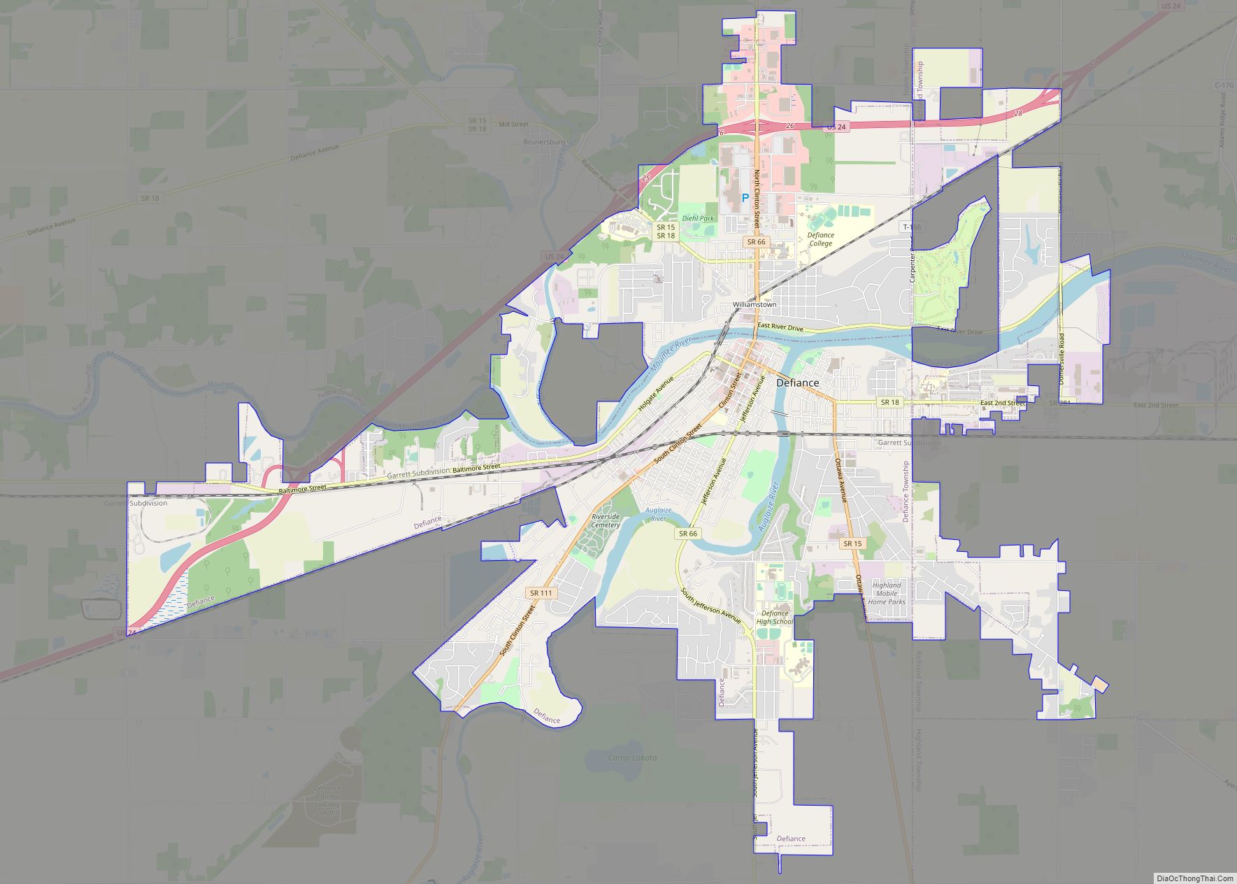
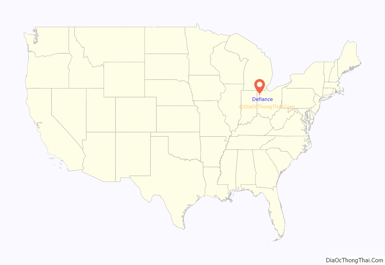
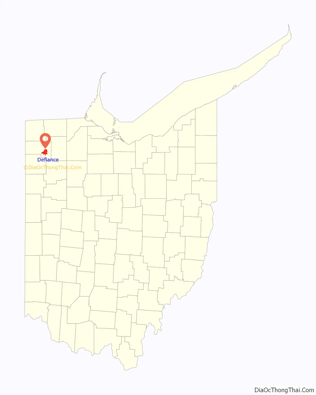
Defiance is a city in and the county seat of Defiance County, Ohio, United States, about 55 miles (89 km) southwest of Toledo and 47 miles (76 km) northeast of Fort Wayne, Indiana, in Ohio’s northwestern corner. The population was 16,494 at the 2010 census.
| Name: | Defiance city |
|---|---|
| LSAD Code: | 25 |
| LSAD Description: | city (suffix) |
| State: | Ohio |
| County: | Defiance County |
| Elevation: | 676 ft (206 m) |
| Total Area: | 13.28 sq mi (34.40 km²) |
| Land Area: | 12.79 sq mi (33.12 km²) |
| Water Area: | 0.49 sq mi (1.28 km²) |
| Total Population: | 17,066 |
| Population Density: | 1,334.74/sq mi (515.34/km²) |
| ZIP code: | 43512 |
| Area code: | 419 |
| FIPS code: | 3921308 |
| GNISfeature ID: | 1064519 |
Online Interactive Map
Click on ![]() to view map in "full screen" mode.
to view map in "full screen" mode.
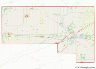
Defiance location map. Where is Defiance city?
History
The city contains the site of Fort Defiance, built by General “Mad” Anthony Wayne in August 1794, during the Northwest Indian War at the confluence of the Auglaize and Maumee rivers. General Wayne surveyed the land and declared to General Scott, “I defy the English, Indians, and all the devils of hell to take it.” Using the fort as a base of operations, Wayne ordered his troops to destroy Native American crops and villages within a radius of 50 miles (80 km) around the fort. Today a pair of cannons outside the city library on the Maumee River overlook the confluence and mark the location of Fort Defiance, along with a mounded outline of the fort walls. The city was named after Fort Defiance.
From Fort Defiance, the U.S. forces moved northeast along the Maumee River to fight the decisive Battle of Fallen Timbers near the current town of Maumee, Ohio. This victory secured for the United States the Northwest Territory, now the states of Ohio, Michigan, Indiana, Illinois, and Wisconsin.
Fort Winchester was built on the same spot during the War of 1812, but it was a larger fort that extended southward somewhat along the Auglaize River. Historical plaques in the sidewalks mark the full extent of Fort Winchester.
In 1822 Defiance was laid out as a town. In 1845 it was made the county seat of the newly created county, and in 1881 it became a city.
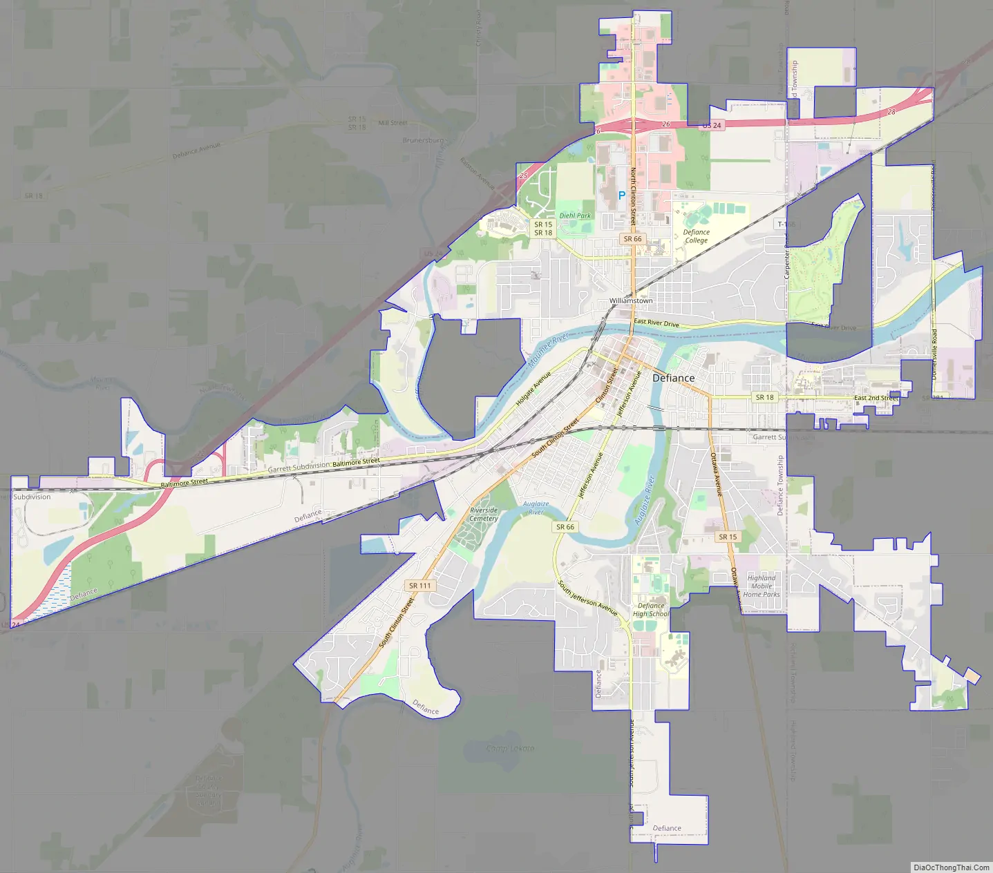
Defiance Road Map
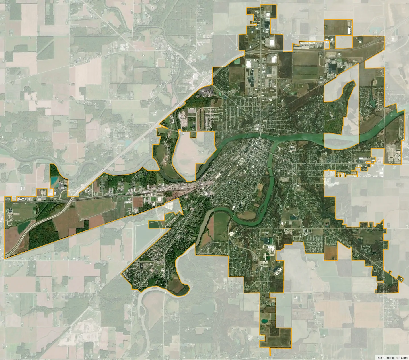
Defiance city Satellite Map
Geography
Defiance is located at 41°16′55″N 84°21′46″W / 41.28194°N 84.36278°W / 41.28194; -84.36278 (41.281891, -84.362856).
According to the United States Census Bureau, the city has a total area of 12.13 square miles (31.42 km), of which, 11.62 square miles (30.10 km) is land and 0.51 square miles (1.32 km) is water.
Defiance lends its name to a distinct end moraine from the Wisconsian glaciation. As Cushing et al. point out, “The Defiance moraine represents the last notable stand of the glacial front in this region.” The moraine varies in width from 2 to 4 miles, and according to Leverett, “it is like a broad wave whose crest stands 20 to 50 feet above the border of the plain outside it.”
Climate
See also
Map of Ohio State and its subdivision:- Adams
- Allen
- Ashland
- Ashtabula
- Athens
- Auglaize
- Belmont
- Brown
- Butler
- Carroll
- Champaign
- Clark
- Clermont
- Clinton
- Columbiana
- Coshocton
- Crawford
- Cuyahoga
- Darke
- Defiance
- Delaware
- Erie
- Fairfield
- Fayette
- Franklin
- Fulton
- Gallia
- Geauga
- Greene
- Guernsey
- Hamilton
- Hancock
- Hardin
- Harrison
- Henry
- Highland
- Hocking
- Holmes
- Huron
- Jackson
- Jefferson
- Knox
- Lake
- Lake Erie
- Lawrence
- Licking
- Logan
- Lorain
- Lucas
- Madison
- Mahoning
- Marion
- Medina
- Meigs
- Mercer
- Miami
- Monroe
- Montgomery
- Morgan
- Morrow
- Muskingum
- Noble
- Ottawa
- Paulding
- Perry
- Pickaway
- Pike
- Portage
- Preble
- Putnam
- Richland
- Ross
- Sandusky
- Scioto
- Seneca
- Shelby
- Stark
- Summit
- Trumbull
- Tuscarawas
- Union
- Van Wert
- Vinton
- Warren
- Washington
- Wayne
- Williams
- Wood
- Wyandot
- Alabama
- Alaska
- Arizona
- Arkansas
- California
- Colorado
- Connecticut
- Delaware
- District of Columbia
- Florida
- Georgia
- Hawaii
- Idaho
- Illinois
- Indiana
- Iowa
- Kansas
- Kentucky
- Louisiana
- Maine
- Maryland
- Massachusetts
- Michigan
- Minnesota
- Mississippi
- Missouri
- Montana
- Nebraska
- Nevada
- New Hampshire
- New Jersey
- New Mexico
- New York
- North Carolina
- North Dakota
- Ohio
- Oklahoma
- Oregon
- Pennsylvania
- Rhode Island
- South Carolina
- South Dakota
- Tennessee
- Texas
- Utah
- Vermont
- Virginia
- Washington
- West Virginia
- Wisconsin
- Wyoming