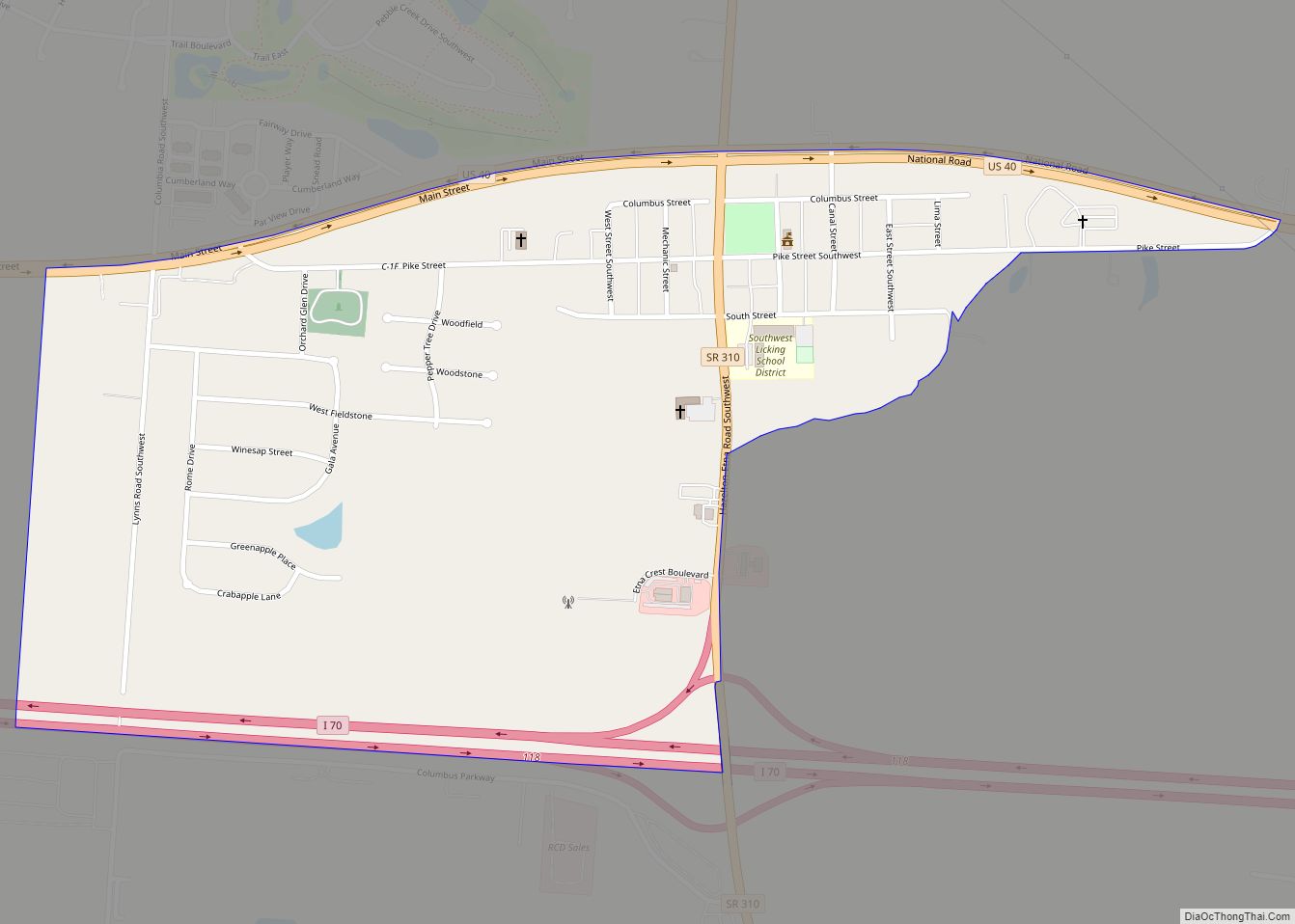
Etna (formerly Carthage) is an unincorporated community and census-designated place (CDP) in Licking County, Ohio, United States. As of the 2010 census it had a population of 1,215. It lies at an elevation of 1,069 feet (326 m) at the intersection of U.S. Route 40 and State Route 310. It was listed as a census-designated place in 2010.
| Name: | Etna CDP |
|---|---|
| LSAD Code: | 57 |
| LSAD Description: | CDP (suffix) |
| State: | Ohio |
| County: | Licking County |
| Elevation: | 1,060 ft (320 m) |
| Total Area: | 0.62 sq mi (1.60 km²) |
| Land Area: | 0.61 sq mi (1.59 km²) |
| Water Area: | 0.00 sq mi (0.01 km²) |
| Total Population: | 1,209 |
| Population Density: | 1,965.85/sq mi (759.11/km²) |
| ZIP code: | 43062 (Pataskala) |
| FIPS code: | 3925676 |
| GNISfeature ID: | 1040239 |
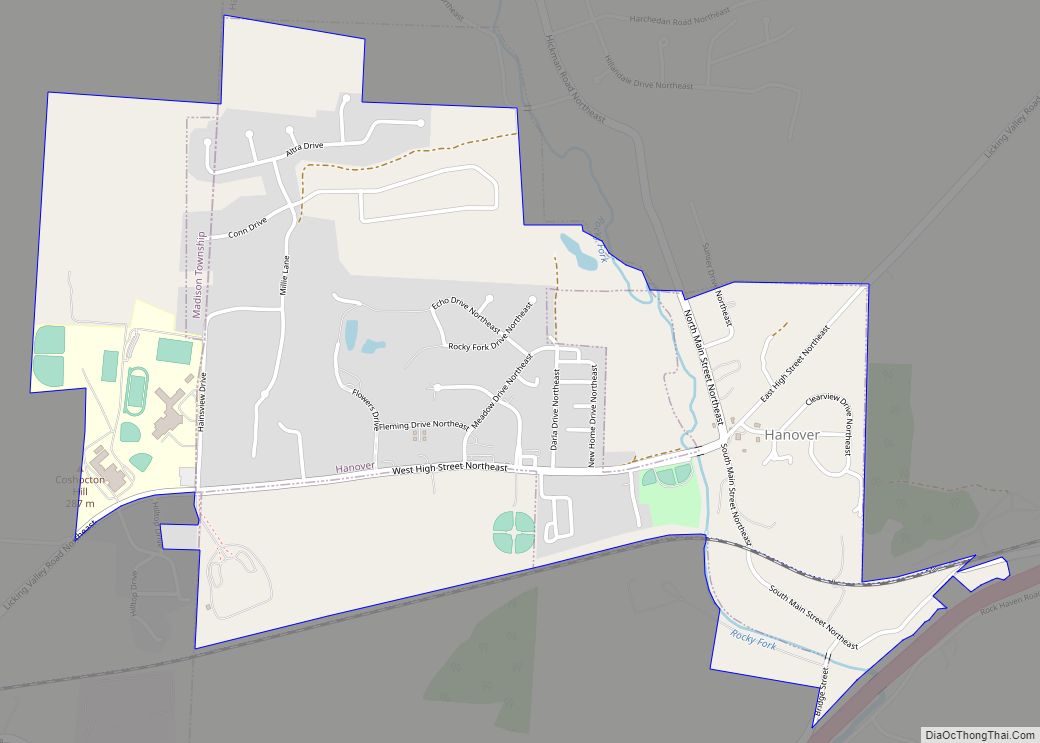
Online Interactive Map
Click on ![]() to view map in "full screen" mode.
to view map in "full screen" mode.
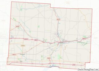
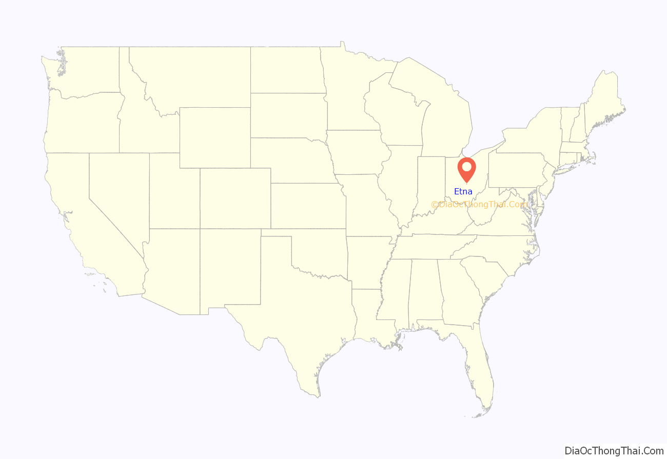
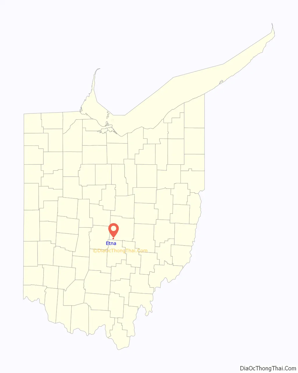
Etna location map. Where is Etna CDP?
History
Etna was originally called “Carthage”, under which name it was laid out in 1832 when the National Road was being built to that point. The present name is derived from Etna Township. A post office called Etna has been in operation since 1833.
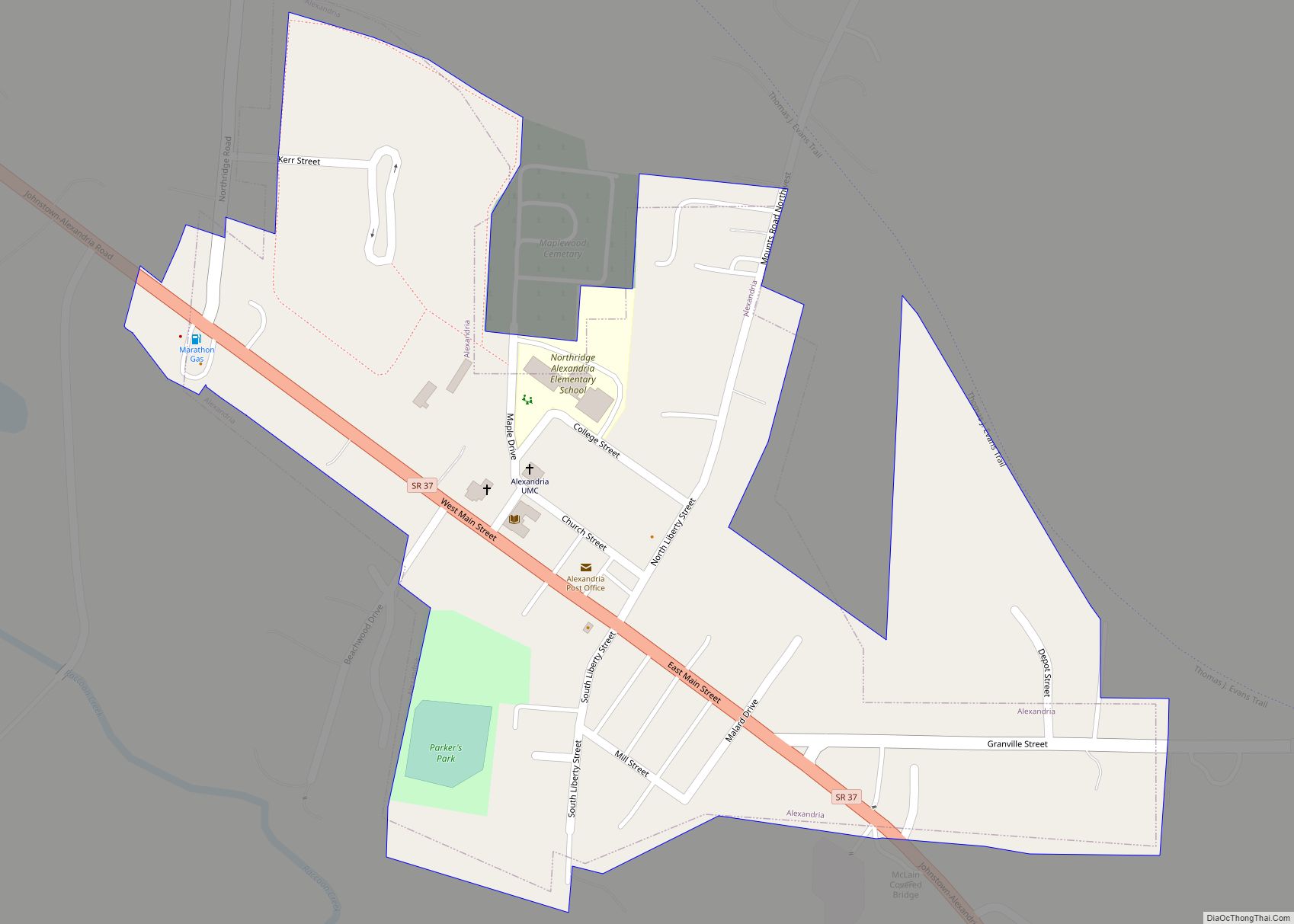
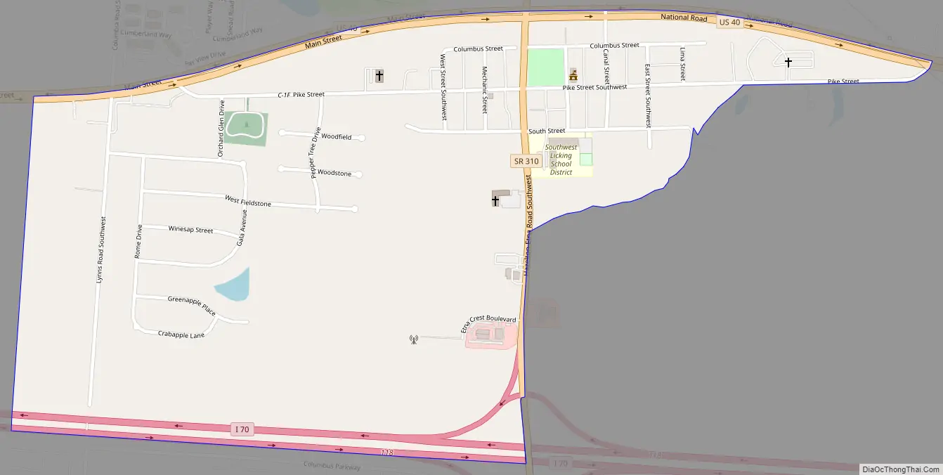
Etna Road Map
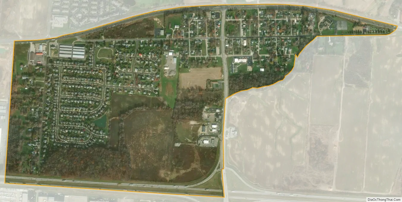
Etna city Satellite Map
Geography
Etna is in southwestern Licking County, in the center of Etna Township. U.S. Route 40 forms the northern edge of the community, and Interstate 70 forms the southern edge. Access from I-70 is via Exit 118 (State Route 310). Both US 40 and I-70 lead west 18 miles (29 km) to Columbus and east 35 miles (56 km) to Zanesville. Newark, the Licking county seat, is 20 miles (32 km) to the northeast.
According to the U.S. Census Bureau, the Etna CDP has a total area of 0.7 square miles (1.7 km), of which 0.04 square miles (0.1 km), or 0.65%, are water. Etna’s surface area drains northeast to the South Fork of the Licking River, an east-flowing tributary of the Muskingum River and part of the Ohio River watershed.
See also
Map of Ohio State and its subdivision:- Adams
- Allen
- Ashland
- Ashtabula
- Athens
- Auglaize
- Belmont
- Brown
- Butler
- Carroll
- Champaign
- Clark
- Clermont
- Clinton
- Columbiana
- Coshocton
- Crawford
- Cuyahoga
- Darke
- Defiance
- Delaware
- Erie
- Fairfield
- Fayette
- Franklin
- Fulton
- Gallia
- Geauga
- Greene
- Guernsey
- Hamilton
- Hancock
- Hardin
- Harrison
- Henry
- Highland
- Hocking
- Holmes
- Huron
- Jackson
- Jefferson
- Knox
- Lake
- Lake Erie
- Lawrence
- Licking
- Logan
- Lorain
- Lucas
- Madison
- Mahoning
- Marion
- Medina
- Meigs
- Mercer
- Miami
- Monroe
- Montgomery
- Morgan
- Morrow
- Muskingum
- Noble
- Ottawa
- Paulding
- Perry
- Pickaway
- Pike
- Portage
- Preble
- Putnam
- Richland
- Ross
- Sandusky
- Scioto
- Seneca
- Shelby
- Stark
- Summit
- Trumbull
- Tuscarawas
- Union
- Van Wert
- Vinton
- Warren
- Washington
- Wayne
- Williams
- Wood
- Wyandot
- Alabama
- Alaska
- Arizona
- Arkansas
- California
- Colorado
- Connecticut
- Delaware
- District of Columbia
- Florida
- Georgia
- Hawaii
- Idaho
- Illinois
- Indiana
- Iowa
- Kansas
- Kentucky
- Louisiana
- Maine
- Maryland
- Massachusetts
- Michigan
- Minnesota
- Mississippi
- Missouri
- Montana
- Nebraska
- Nevada
- New Hampshire
- New Jersey
- New Mexico
- New York
- North Carolina
- North Dakota
- Ohio
- Oklahoma
- Oregon
- Pennsylvania
- Rhode Island
- South Carolina
- South Dakota
- Tennessee
- Texas
- Utah
- Vermont
- Virginia
- Washington
- West Virginia
- Wisconsin
- Wyoming