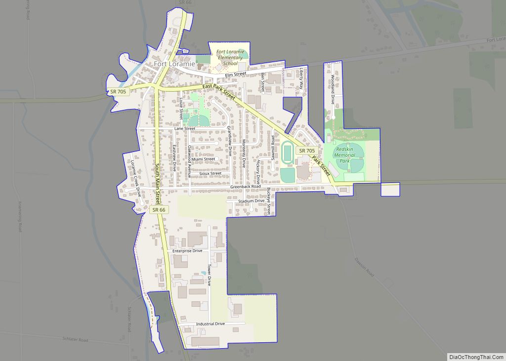
Fort Loramie is a village in Shelby County, Ohio, United States, along Loramie Creek, a tributary of the Great Miami River in southwestern Ohio. It is 42 mi. north-northwest of Dayton and 20 mi. east of the Ohio/Indiana border. The population was 1,478 at the 2010 census. The village was founded in 1837 near the former site of a colonial fort of the same name.
| Name: | Fort Loramie village |
|---|---|
| LSAD Code: | 47 |
| LSAD Description: | village (suffix) |
| State: | Ohio |
| County: | Shelby County |
| Founded: | 1837 |
| Elevation: | 953 ft (290 m) |
| Total Area: | 1.03 sq mi (2.67 km²) |
| Land Area: | 1.03 sq mi (2.67 km²) |
| Water Area: | 0.00 sq mi (0.00 km²) |
| Total Population: | 1,590 |
| Population Density: | 1,540.70/sq mi (595.14/km²) |
| ZIP code: | 45845 |
| Area code: | 937, 326 |
| FIPS code: | 3927832 |
| GNISfeature ID: | 1064665 |
| Website: | http://www.fortloramie.com/ |
Online Interactive Map
Click on ![]() to view map in "full screen" mode.
to view map in "full screen" mode.
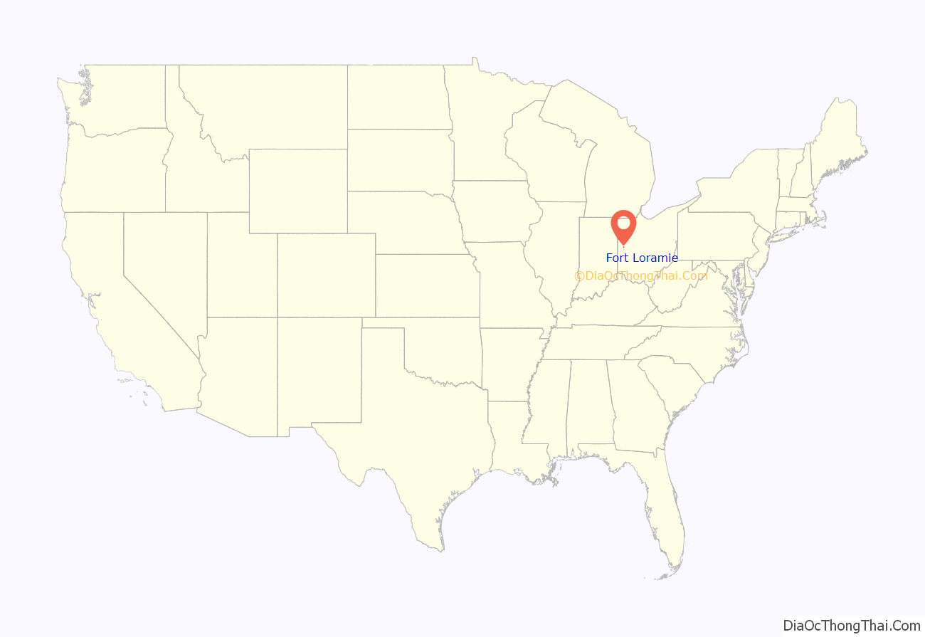
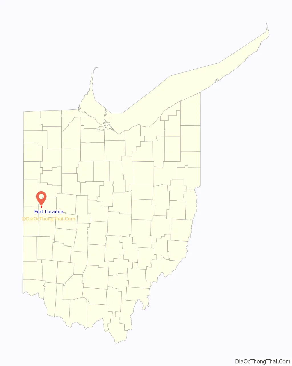
Fort Loramie location map. Where is Fort Loramie village?
History
Fort Loramie was established as a fur trading post in 1769 by Pierre-Louis de Lorimier (usually anglicized to Peter Loramie), a French-Canadian fur trader, British Indian agent and Shawnee agitator, and his father. The Shawnee used the trading post as a staging area for attacks against Americans during the Revolutionary War. During a raid on the Shawnee by George Rogers Clark in Nov. 1782, the trading post was attacked by a detachment of 150 men under Col. Benjamin Logan and burned to the ground. Lorimier escaped and fled west across the Mississippi. The site remained abandoned until 1795.
After victory at Battle of Fallen Timbers in Aug. 1794, which ended the Northwest Indian War, General “Mad” Anthony Wayne ordered a fort built at the site as a supply depot for Fort Adams, Fort Defiance, and Fort Wayne. It was originally a stockade, but Wayne decided that a blockhouse and storage buildings were more vital. Construction was completed in Dec. 1795. The fort stood on the portage between St. Mary’s River and Loramie Creek a half mile north of the present town. It was used as one of the demarcation points in the Treaty of Greenville Aug., 1795. The site was also mentioned in the Treaty of Fort Meigs 1817.
During the War of 1812, Fort Loramie served as a supply depot for forts in northern Ohio, and as a waystation for expeditions against the British in Michigan and Canada. The last officer who had command there was a Capt. Butler, a nephew of Gen. Richard Butler who died at St. Clair’s Defeat in 1791. In 1815, the United States sold the fort to James Furrow, who constructed a post office and tavern out of the buildings. The business had closed by 1820, but a small settlement had grown up around the site. The site today is a farm belonging to the heirs of James Furrow. Nothing remains of the fort or trading post.
Later, a town was laid out nearby and surveyed by Jonathan Counts in 1837. Lots were sold at auction, and the name Berlin was given to the town. Most of the early settlers were German. In 1911, the name of the town was changed to Fort Loramie.
Between 1836 and 1841, the Miami and Erie Canal was built intersecting the town. Canal boats hauled the limestone for the foundation of St. Michael’s Church, built by German Catholic settlers starting in 1849. A log church building from 1838 had preceded the stone and brick church. It was rebuilt again in 1881.
The settlement languished in the early years: the first flour mill and a general store, Willman’s, were built in 1858. Other early businesses were Bruckens and Vogelsang’s Cafe.
With the encroachment of railroads, the canal ceased operation in 1909. One relic is Loramie Lake, the reservoir used to keep the canal filled with water.
A large part of the town was destroyed in the Great Flood of 1913.
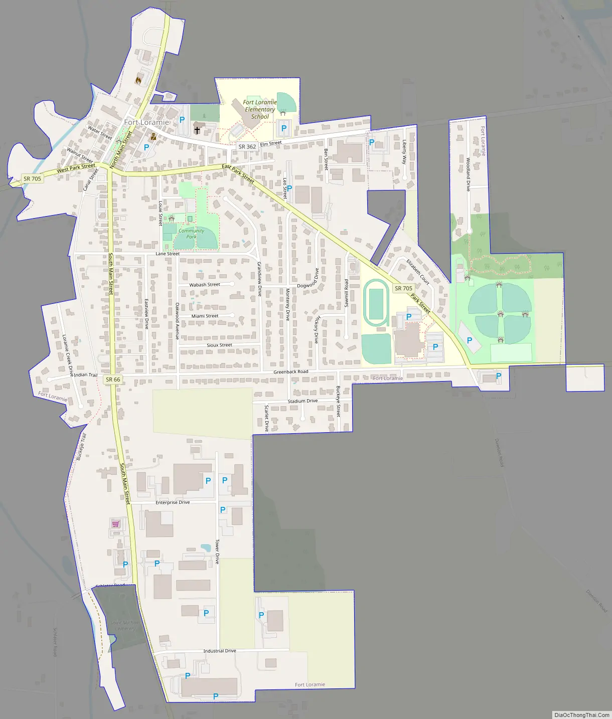
Fort Loramie Road Map
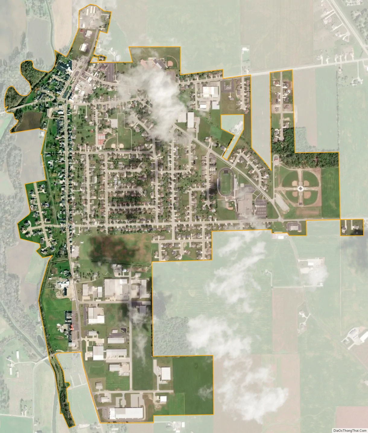
Fort Loramie city Satellite Map
Geography
Fort Loramie is located at 40°20′53″N 84°22′14″W / 40.34806°N 84.37056°W / 40.34806; -84.37056 (40.348043, -84.370600).
According to the United States Census Bureau, the village has a total area of 0.96 square miles (2.49 km), all land. The village is at an elevation of 953 feet (290 m) above sea level.
See also
Map of Ohio State and its subdivision:- Adams
- Allen
- Ashland
- Ashtabula
- Athens
- Auglaize
- Belmont
- Brown
- Butler
- Carroll
- Champaign
- Clark
- Clermont
- Clinton
- Columbiana
- Coshocton
- Crawford
- Cuyahoga
- Darke
- Defiance
- Delaware
- Erie
- Fairfield
- Fayette
- Franklin
- Fulton
- Gallia
- Geauga
- Greene
- Guernsey
- Hamilton
- Hancock
- Hardin
- Harrison
- Henry
- Highland
- Hocking
- Holmes
- Huron
- Jackson
- Jefferson
- Knox
- Lake
- Lake Erie
- Lawrence
- Licking
- Logan
- Lorain
- Lucas
- Madison
- Mahoning
- Marion
- Medina
- Meigs
- Mercer
- Miami
- Monroe
- Montgomery
- Morgan
- Morrow
- Muskingum
- Noble
- Ottawa
- Paulding
- Perry
- Pickaway
- Pike
- Portage
- Preble
- Putnam
- Richland
- Ross
- Sandusky
- Scioto
- Seneca
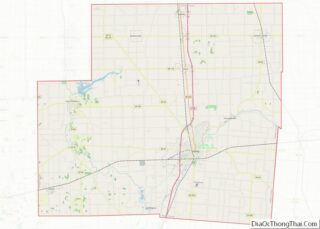
- Shelby
- Stark
- Summit
- Trumbull
- Tuscarawas
- Union
- Van Wert
- Vinton
- Warren
- Washington
- Wayne
- Williams
- Wood
- Wyandot
- Alabama
- Alaska
- Arizona
- Arkansas
- California
- Colorado
- Connecticut
- Delaware
- District of Columbia
- Florida
- Georgia
- Hawaii
- Idaho
- Illinois
- Indiana
- Iowa
- Kansas
- Kentucky
- Louisiana
- Maine
- Maryland
- Massachusetts
- Michigan
- Minnesota
- Mississippi
- Missouri
- Montana
- Nebraska
- Nevada
- New Hampshire
- New Jersey
- New Mexico
- New York
- North Carolina
- North Dakota
- Ohio
- Oklahoma
- Oregon
- Pennsylvania
- Rhode Island
- South Carolina
- South Dakota
- Tennessee
- Texas
- Utah
- Vermont
- Virginia
- Washington
- West Virginia
- Wisconsin
- Wyoming