Garrettsville is a village in northeastern Portage County, Ohio, United States. The population was 2,449 at the 2020 census. It is part of the Akron metropolitan area. The village was formed from portions of Hiram, Nelson, and Freedom townships in the Connecticut Western Reserve.
| Name: | Garrettsville village |
|---|---|
| LSAD Code: | 47 |
| LSAD Description: | village (suffix) |
| State: | Ohio |
| County: | Portage County |
| Elevation: | 994 ft (303 m) |
| Total Area: | 2.56 sq mi (6.62 km²) |
| Land Area: | 2.54 sq mi (6.58 km²) |
| Water Area: | 0.02 sq mi (0.04 km²) |
| Total Population: | 2,449 |
| Population Density: | 964.17/sq mi (372.30/km²) |
| ZIP code: | 44231 |
| Area code: | 330, 234 |
| FIPS code: | 3929442 |
| GNISfeature ID: | 1064704 |
| Website: | garrettsville.org |
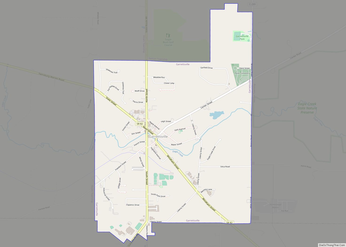
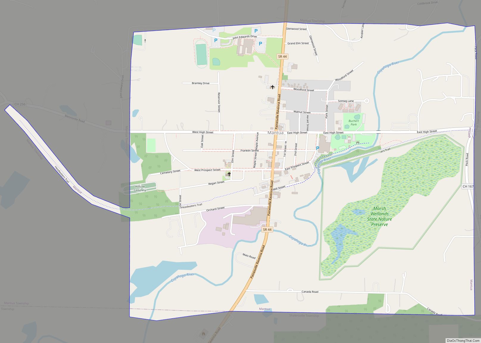
Online Interactive Map
Click on ![]() to view map in "full screen" mode.
to view map in "full screen" mode.
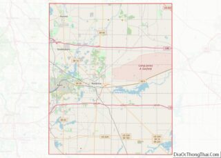
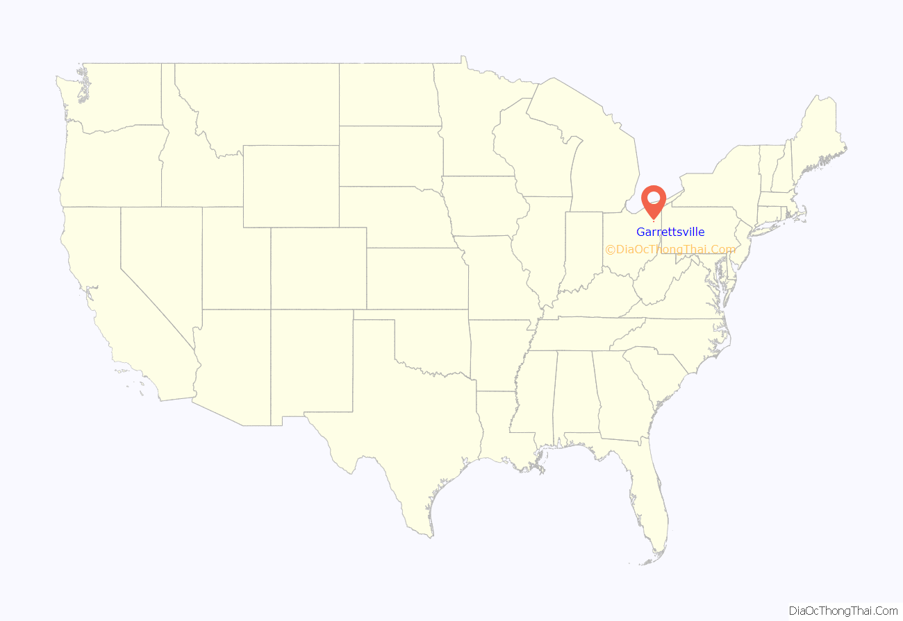
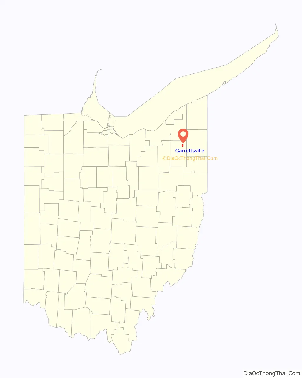
Garrettsville location map. Where is Garrettsville village?
History
Colonel John Garrett III purchased 300 acres (1 214 062 m) of land in Nelson Township, Portage County, Ohio in 1803, the year Ohio became a state. The land was purchased for the price of $1,313, or about $4.40 per acre. In July of the following year, he settled on this land with his family and two slave girls, 6 and 10 years old. These settlers constructed a grist mill, which was to open in January 1806. In this month, however, Garrett died.
In 1806, the Cleveland-Pittsburgh Road was constructed near Garrett’s mill. This improved commerce to the area, and nearby pioneers would mill their grain at the mill, eventually building roads and trails to meet with the Cleveland-Pittsburgh Road. By 1864, residents in the area around the mill had built up a settlement which they hoped to incorporate. This was done, and on September 1, 1864, Garrettsville was incorporated as a village.
In November, 1935, Alvin Karpis robbed a train in Garrettsville. Karpis was a member of Ma Barker’s gang, and was assisted in the robbery by gang member Harry Campbell and at least one other accomplice. Karpis and his gang stole $30,000, and obtained a private airplane to escape to Hot Springs, Arkansas. Karpis was eventually convicted of his crimes, and was imprisoned at Alcatraz longer than any other inmate.
On March 22, 2014, a large fire broke out downtown, burning approximately one city block and 13 businesses to the ground. The local fire department was assisted by 34 fire departments from surrounding communities. Despite the size of the fire nobody was seriously injured; although one Windham firefighter suffered from smoke inhalation. Rick Patrick is the current mayor of Garrettsville.
Maple syrup, Crane family
The Garrettsville-Hiram Chamber of Commerce reports that at the beginning of the 20th century, Garrettsville was the largest center in the world for the processing of maple syrup. This was due largely to the efforts of Arthur Crane, who canned this maple tree product at a cannery on Windham Street. Crane’s son, Clarence Arthur (C.A.) Crane, grew up in Garrettsville. The younger Crane married Grace Edna Hart in the village on June 1, 1898. In 1899, Grace gave birth to Harold Hart Crane, who later became renowned as a poet.
Clarence Crane and his family left Garrettsville in the 1900s. Clarence continued to work in the maple sugar and candies industry, having started out in the industry working for his father. In 1912, Clarence Crane and his company, the Queen Victoria Chocolate Company, invented Life Savers candy.
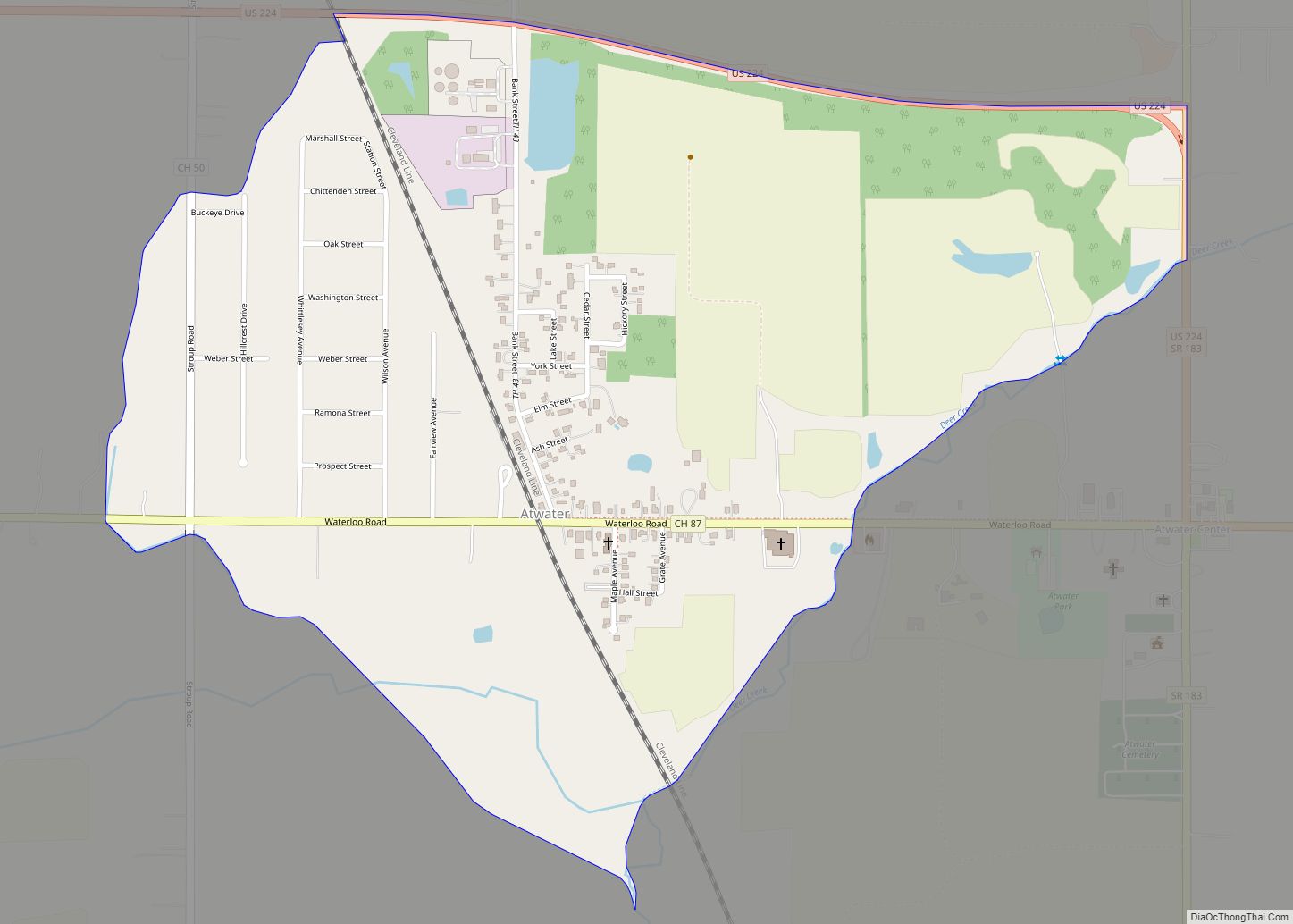
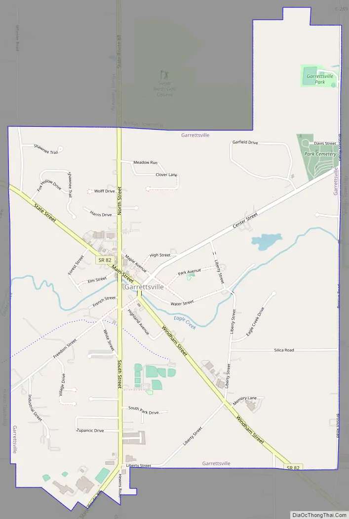
Garrettsville Road Map
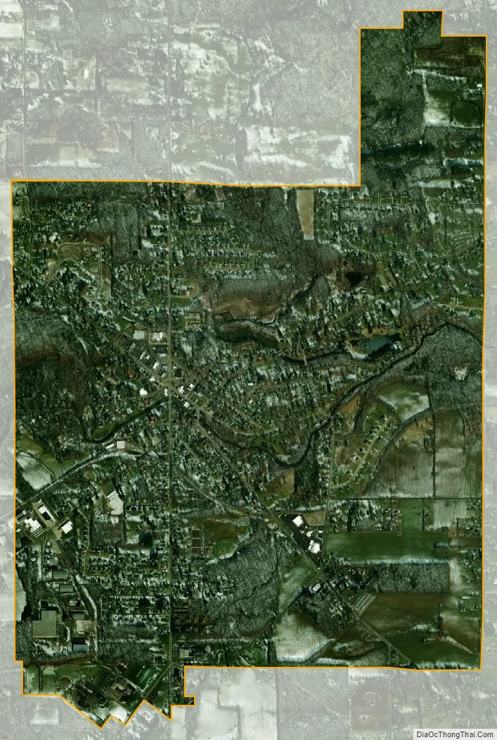
Garrettsville city Satellite Map
Geography
Garrettsville is located at 41°17′2″N 81°5′43″W / 41.28389°N 81.09528°W / 41.28389; -81.09528 (41.283955, -81.095179).
According to the United States Census Bureau, the village has a total area of 2.53 square miles (6.55 km), of which 2.51 square miles (6.50 km) is land and 0.02 square miles (0.05 km) is water.
See also
Map of Ohio State and its subdivision:- Adams
- Allen
- Ashland
- Ashtabula
- Athens
- Auglaize
- Belmont
- Brown
- Butler
- Carroll
- Champaign
- Clark
- Clermont
- Clinton
- Columbiana
- Coshocton
- Crawford
- Cuyahoga
- Darke
- Defiance
- Delaware
- Erie
- Fairfield
- Fayette
- Franklin
- Fulton
- Gallia
- Geauga
- Greene
- Guernsey
- Hamilton
- Hancock
- Hardin
- Harrison
- Henry
- Highland
- Hocking
- Holmes
- Huron
- Jackson
- Jefferson
- Knox
- Lake
- Lake Erie
- Lawrence
- Licking
- Logan
- Lorain
- Lucas
- Madison
- Mahoning
- Marion
- Medina
- Meigs
- Mercer
- Miami
- Monroe
- Montgomery
- Morgan
- Morrow
- Muskingum
- Noble
- Ottawa
- Paulding
- Perry
- Pickaway
- Pike
- Portage
- Preble
- Putnam
- Richland
- Ross
- Sandusky
- Scioto
- Seneca
- Shelby
- Stark
- Summit
- Trumbull
- Tuscarawas
- Union
- Van Wert
- Vinton
- Warren
- Washington
- Wayne
- Williams
- Wood
- Wyandot
- Alabama
- Alaska
- Arizona
- Arkansas
- California
- Colorado
- Connecticut
- Delaware
- District of Columbia
- Florida
- Georgia
- Hawaii
- Idaho
- Illinois
- Indiana
- Iowa
- Kansas
- Kentucky
- Louisiana
- Maine
- Maryland
- Massachusetts
- Michigan
- Minnesota
- Mississippi
- Missouri
- Montana
- Nebraska
- Nevada
- New Hampshire
- New Jersey
- New Mexico
- New York
- North Carolina
- North Dakota
- Ohio
- Oklahoma
- Oregon
- Pennsylvania
- Rhode Island
- South Carolina
- South Dakota
- Tennessee
- Texas
- Utah
- Vermont
- Virginia
- Washington
- West Virginia
- Wisconsin
- Wyoming