Hamilton is a city in and the county seat of Butler County, Ohio, United States. Located 20 miles (32 km) north of Cincinnati, Hamilton is the second largest city in the Greater Cincinnati area and the 10th largest city in Ohio. The population was 63,399 at the 2020 census. Hamilton is governed under a council-manager form of government; the current mayor is Patrick Moeller and the city manager is Joshua Smith. Most of the city is served by the Hamilton City School District.
Hamilton has three designated National Historic Districts: Dayton Lane, German Village, and Rossville. The industrial city is seeking to revitalize through the arts; it declared itself the “City of Sculpture” in 2000. Its initiative has attracted many sculpture installations to the city, which founded the Pyramid Hill Sculpture Park.
| Name: | Hamilton city |
|---|---|
| LSAD Code: | 25 |
| LSAD Description: | city (suffix) |
| State: | Ohio |
| County: | Butler County |
| Elevation: | 597 ft (182 m) |
| Total Area: | 21.89 sq mi (56.70 km²) |
| Land Area: | 21.45 sq mi (55.56 km²) |
| Water Area: | 0.44 sq mi (1.15 km²) |
| Total Population: | 63,399 |
| Population Density: | 2,955.66/sq mi (1,141.18/km²) |
| ZIP code: | 45011-15, 45018 |
| Area code: | 513 |
| FIPS code: | 3933012 |
| GNISfeature ID: | 1064784 |
| Website: | www.hamilton-oh.gov |
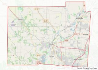
Online Interactive Map
Click on ![]() to view map in "full screen" mode.
to view map in "full screen" mode.
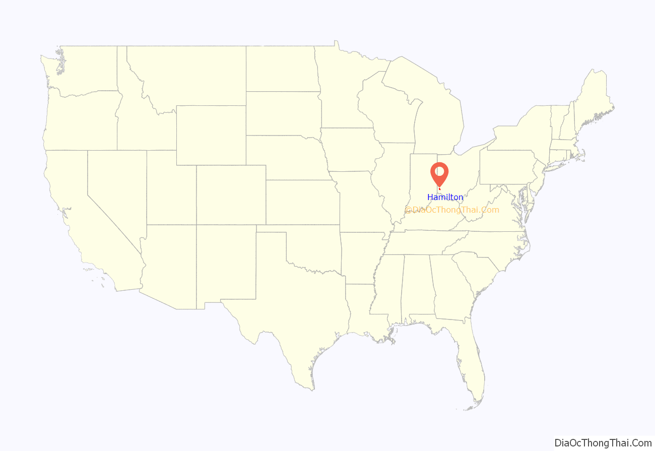
Hamilton location map. Where is Hamilton city?
History
Fort Hamilton
Hamilton started as Fort Hamilton (named to honor Alexander Hamilton, first Secretary of the Treasury), constructed in Sept.-Oct. 1791 by General Arthur St. Clair, governor of the Northwest Territory. The fort was the first of several built north from Fort Washington into Indian territory. The fort was built to serve as a supply station for the troops of general Arthur St. Clair during his campaign in the Northwest Indian War. Later it was used by General “Mad” Anthony Wayne. The fort was located 28 miles (45 km) upstream from the mouth of the Great Miami River where the river is shallow during normal flow and easily forded by men, animals and wagons on its gravelly bottom. In 1792 the fort was enlarged with a stable area by General Wayne. The fort was abandoned in 1796 after the signing of the Treaty of Greenville.
A settlement grew up around the fort and was platted as Fairfield in 1794. By 1800, Hamilton was becoming an agricultural and regional trading town. The town was platted, government was seated, and the town named by 1803.
Hamilton incorporated
Hamilton was first incorporated by act of the Ohio General Assembly in 1810, but lost its status in 1815 for failure to hold elections. It was reincorporated in 1827 with Rossville, the community across the Great Miami River in St. Clair Township. The two places severed their connection in 1831 only to be rejoined in 1854. Designated the county seat, this became a city in 1857. On 14 March 1867, Hamilton withdrew from the townships of Fairfield and St. Clair to form a “paper township”, but the city government is dominant.
On the afternoon of September 17, 1859, Abraham Lincoln arrived at the Hamilton Station (the station is on the city’s Historic Preservation list). He gave a campaign speech in support of his fellow Republican, William Dennison, who was running for Ohio governor. Lincoln’s speech concentrated on popular sovereignty. He began: “This beautiful and far-famed Miami Valley is the garden spot of the world.” It was during this campaign that the relatively unknown Lincoln was first mentioned as a possible presidential contender.
Industrialization
By the mid-19th century, Hamilton had developed as a significant manufacturing city. Its early products were often machines and equipment used to process the region’s farm produce, such as steam engines, hay cutters, reapers and threshers. Other production included machine tools, house hardware, saws for mills, paper, paper making machinery, carriages, guns, whiskey, beer, woolen goods, and myriad and diverse output made from metal, grain, and cloth.
By the early 20th century, the town was a heavy-manufacturing center for vaults and safes, machine tools, cans for vegetables, paper, paper making machinery, locomotives, frogs and switches for railroads, steam engines, diesel engines, foundry products, printing presses, and automobile parts. During the two world wars, its factories manufactured war materiel, Liberty ship engines, and gun lathes. Manufacturers used coke to feed furnaces. Its by-product, gas, fueled street lights. The Great Miami River valley, in which Hamilton was located, had become an industrial giant.
The county courthouse, constructed between 1885 and 1889, has been listed on the National Register of Historic Places because of its monumental architecture. The city has three historic districts: Dayton Lane, German Village and Rossville. Like Cincinnati, Hamilton attracted many German and Italian immigrants from the mid-19th century on, whose influence was expressed in culture, food and architecture. Hamilton also had a Jewish community; with increased immigration by Eastern European Jews, they founded Beth Israel Synagogue in 1901 as an Orthodox alternative to Hamilton’s Reform synagogue. It had been founded by German Jews in the 1880s, when nearby Cincinnati was a center of Reform Judaism in the United States. At the time around 250 Jewish families lived in Hamilton.
In the 1920s, many Chicago gangsters established second homes in Hamilton. This gave Hamilton the nickname “Little Chicago”. Some of these men appeared to have invested in what became an active district of gambling and prostitution. During World War II, the military declared the entire city off-limits to its enlisted personnel because of its numerous gambling and prostitution establishments. Madame Freeze’s and the long row of prostitution houses along Wood Street (now called Pershing Avenue) were notorious among soldiers. Factories in Hamilton converted their operations to support the war effort, manufacturing military supplies, such as tank turrets, Liberty ship and submarine engines, and machined and stamped metal parts.
With the 1950s came the construction of the new interstate highway I-75, part of a nationwide system and one which bypassed the city. A decision made to reduce traffic through the city resulted in cutting it off from the newest transportation network, and businesses were drawn to areas outside with access to the highway. Until 1999, when the Butler County Veterans Highway was built, Hamilton was the second-largest city in the United States without direct interstate access.
On March 30, 1975, Easter Sunday, James Ruppert murdered 11 family members in his mother’s house at 635 Minor Avenue in Hamilton, in what is referred to as the “Easter Sunday Massacre”. The murders shocked the town of Hamilton and the entire country. This was the deadliest shooting inside a private residence in American history.
In the late 20th century, industrial restructuring in heavy manufacturing resulted in widespread loss of jobs in older industrial cities, as operations were merged, relocated, and finally moved offshore. Like other Rust Belt cities in the northern tier, Hamilton has struggled to develop a new economy after such wide-scale changes, but it has retained more of its population than many such cities. In addition, since the late 20th century it has attracted new immigrants, primarily Hispanics from Mexico and Latin America.
In 2009, the city won the Berkeley Springs International Water Tasting Awards for best-tasting municipal water for the United States; and in 2010, a gold medal for the best in the world.
Hamilton Hydraulic
The Hamilton Hydraulic, also called the Hamilton & Rossville Hydraulic, was a system devised to supply water power to shops and mills; it spurred one of Hamilton’s greatest periods of industrial and population growth (1840–1860). Specially built canals and natural reservoirs brought water from the Great Miami River north of Hamilton into the town as a source of power for future industries.
The hydraulic began about four miles north of Hamilton on the river, where a dam was built to divert water into the system. Nearby, two reservoirs stored water for the hydraulic, whose main canal continued south along North Fifth Street to present Market Street. There it took a sharp west turn to the river at the present intersection of Market Street and North Monument Avenue, between the former Hamilton Municipal Building and the present Courtyard by Marriott. The first water passed through the system in January 1845. As the water flowed through the canal, it turned millstones in the hydraulic. The project had been a risky one because there were no shops along its course to use the power when the company was organized in 1842. The gamble paid off. Several small industries were built on the hydraulic in the 1840s. One was the Beckett Paper Co.
The hydraulic remained a principal source of power for Hamilton industries through the 1870s when stationary steam engines became practical and affordable. Later, most of the hydraulic canal was covered and/or filled. The hydraulic attracted auto manufacturer Henry Ford to Hamilton after World War I, when he sought a site for a tractor factory. Ford built a plant—which soon converted to producing auto parts—at the north end of North Fifth Street so it could take advantage of power provided by a branch of the hydraulic.
A Rossville hydraulic also was built, but never achieved the success of the Hamilton system.
1913 flood
Geographic and geological evidence shows that floods have occurred throughout the valley since prehistoric times. Since European-American settlement, diaries, anecdotes, folk tales, letters, and official records have provided documentation of relatively common severe floods in 1814, 1828, 1832, 1847, 1866, 1883, 1897, 1898, and 1907.
In March 1913, the greatest flood occurred. Heavy rain fell over the entire watershed, and the ground was frozen, as well as saturated from previous lighter rains. This resulted in a high rate of run-off from the rain: an estimated 90% flowed directly into the streams, creeks, and rivers. Between 9–11 in (23–28 cm) of rain fell over five days, March 25 to March 29, 1913. An amount equivalent to about 30 days’ discharge of water over Niagara Falls flowed through the Miami Valley during the ensuing flood. In the Great Miami River Valley, 360 persons died, about 200 of whom were from Hamilton. Some drowned, some were washed away and never found, others died from various diseases and complications, and some committed suicide because of severe losses. Damage in the valley was calculated at $100 million, the equivalent of $2 billion in 21st-century value. The flood waters were so powerful that within two hours they destroyed all four of Hamilton’s bridges: Black Street, High-Main Street, Columbia, and the railroad bridge.
In Hamilton, the flood waters rose with unexpected and frightening suddenness, reaching over three to eight feet in depth in downtown, and up to eighteen feet in the North End, along Fifth Street and through South Hamilton Crossing. The waters spread from D Street on the west to what is now Erie Highway on the east. The waters’ rise was so swift that many people were trapped in the upper floors of businesses and houses. In some cases, people had to escape to their attics, and then break through the roof as the waters rose even higher. Temperatures hovered near freezing. The water current varied, but in constricted locations it raced at more than twenty miles per hour. The dead people, more than 1,000 drowned horses, other livestock, and pets, and sewage tainted the water. Nearly one-third of the population was left homeless and displaced: 10,000 of the 35,000 residents of Hamilton. Thousands of houses were destroyed by the flood; afterward, many that were too damaged to repair had to be demolished by city workers.
Miami Conservancy District
Following the disastrous 1913 flood in the Great Miami River Valley, residents realized that the only way to prevent future flooding was to deal with protection on a watershed basis. Citizens from all the major cities in the valley, Piqua, Troy, Dayton, Carlisle, Franklin, Miamisburg, Middletown, and Hamilton, gathered together to find a solution and worked with legislative representatives to draft enabling legislation to create the Miami Conservancy District. It was passed by the state and signed into law by Governor James Cox. Although challenged several times in the courts, the laws withstood those attacks. The law and District have also withstood the tests of time. By 1915, the District hired an engineering staff, which developed plans for valley-long channel improvements, levees, and storage basins to temporarily retain excessive rains. The system was designed to withstand rains and flows that would be up to 40% greater than those of 1913. Waters have been retained more than 1,000 times, thereby preventing flooding. Construction began in 1915 and was completed in 1923. The Miami Conservancy District was the first of its kind in the nation and has been an example of flood control protection. It is unique for having been developed, built, and supported financially just by those who benefit. The Miami Conservancy District is financially supported by an assessment on each property that was affected by the 1913 waters, related to the present value of the property because it is not at risk of flooding. All the other areas within the District are assessed because they benefit by reducing or eliminating danger to infrastructure, commerce, and transportation.
Toxic waste issues
Chem-Dyne is a hazardous waste dump site located on the east side of Hamilton. In 1982, the Justice Department disclosed that the hazardous chemicals at the dump included arsenic, benzene, cyanides, vinyl chloride, naphthalene, chloroform, polychlorinated biphenyls, trichloroethylene and the pesticides aldrin and dieldrin. The Justice Department filed a lawsuit against Chem-Dyne and asked the court to issue an injunction requiring the defendants to help with cleanup as well as to reimburse the government for clearing and safeguarding the site, which the department said had already cost $826,000. The defendants were alleged to have violated the Resource Conservation and Recovery Act and the Superfund Act established to help pay for cleaning up hazardous waste sites. The Justice Department said the out-of-court settlement with the other companies had been reached after four months of negotiations that included Ohio authorities. It did not identify the companies that settled.
Renaming
On May 28, 1986, as part of a plan to increase publicity about Hamilton and aid in city revitalization, the City Council voted 5–1 in favor of adding an exclamation point to the city’s name, similarly to the popular musical Oklahoma!. Thus, Hamilton officially became Hamilton! While at the time used extensively in the city’s documents, letterheads, business cards and on local signage, the United States Board on Geographic Names did not include the exclamation point; nor did Rand McNally maps. The exclamation point is generally no longer used. It is not in use on the Hamilton municipal website.
Hamilton Road Map
Hamilton city Satellite Map
Geography
According to the United States Census Bureau, the city has a total area of 22.08 square miles (57.19 km), of which 21.60 square miles (55.94 km) is land and 0.48 square miles (1.24 km) is water.
See also
Map of Ohio State and its subdivision:- Adams
- Allen
- Ashland
- Ashtabula
- Athens
- Auglaize
- Belmont
- Brown
- Butler
- Carroll
- Champaign
- Clark
- Clermont
- Clinton
- Columbiana
- Coshocton
- Crawford
- Cuyahoga
- Darke
- Defiance
- Delaware
- Erie
- Fairfield
- Fayette
- Franklin
- Fulton
- Gallia
- Geauga
- Greene
- Guernsey
- Hamilton
- Hancock
- Hardin
- Harrison
- Henry
- Highland
- Hocking
- Holmes
- Huron
- Jackson
- Jefferson
- Knox
- Lake
- Lake Erie
- Lawrence
- Licking
- Logan
- Lorain
- Lucas
- Madison
- Mahoning
- Marion
- Medina
- Meigs
- Mercer
- Miami
- Monroe
- Montgomery
- Morgan
- Morrow
- Muskingum
- Noble
- Ottawa
- Paulding
- Perry
- Pickaway
- Pike
- Portage
- Preble
- Putnam
- Richland
- Ross
- Sandusky
- Scioto
- Seneca
- Shelby
- Stark
- Summit
- Trumbull
- Tuscarawas
- Union
- Van Wert
- Vinton
- Warren
- Washington
- Wayne
- Williams
- Wood
- Wyandot
- Alabama
- Alaska
- Arizona
- Arkansas
- California
- Colorado
- Connecticut
- Delaware
- District of Columbia
- Florida
- Georgia
- Hawaii
- Idaho
- Illinois
- Indiana
- Iowa
- Kansas
- Kentucky
- Louisiana
- Maine
- Maryland
- Massachusetts
- Michigan
- Minnesota
- Mississippi
- Missouri
- Montana
- Nebraska
- Nevada
- New Hampshire
- New Jersey
- New Mexico
- New York
- North Carolina
- North Dakota
- Ohio
- Oklahoma
- Oregon
- Pennsylvania
- Rhode Island
- South Carolina
- South Dakota
- Tennessee
- Texas
- Utah
- Vermont
- Virginia
- Washington
- West Virginia
- Wisconsin
- Wyoming
