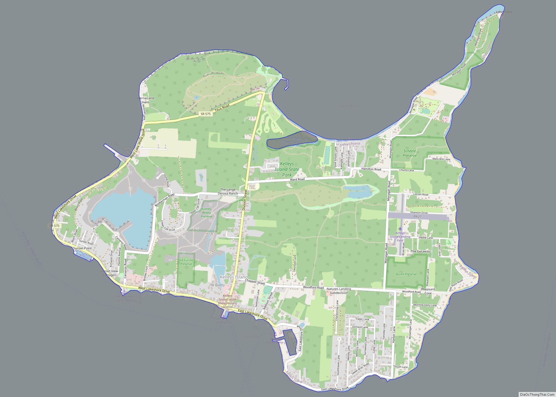
Kelleys Island is both a village in Erie County, Ohio, and the island which it fully occupies in Lake Erie. The British originally called it Sandusky Island. Later the United States took it over and officially designated it as Island Number 6 and Cunningham Island. It was renamed as Kelleys Island in 1840 by brothers Datus and Irad Kelley, who had purchased nearly the entire island.
| Name: | Kelleys Island village |
|---|---|
| LSAD Code: | 47 |
| LSAD Description: | village (suffix) |
| State: | Ohio |
| County: | Erie County |
| Elevation: | 597 ft (182 m) |
| Total Area: | 4.41 sq mi (11.41 km²) |
| Land Area: | 4.35 sq mi (11.26 km²) |
| Water Area: | 0.06 sq mi (0.15 km²) |
| Total Population: | 256 |
| Population Density: | 58.88/sq mi (22.73/km²) |
| ZIP code: | 43438 |
| Area code: | 419 |
| FIPS code: | 3939662 |
| GNISfeature ID: | 1064922 |
| Website: | kelleysisland.us |
Online Interactive Map
Click on ![]() to view map in "full screen" mode.
to view map in "full screen" mode.
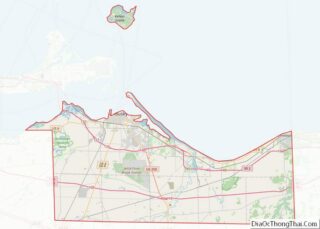
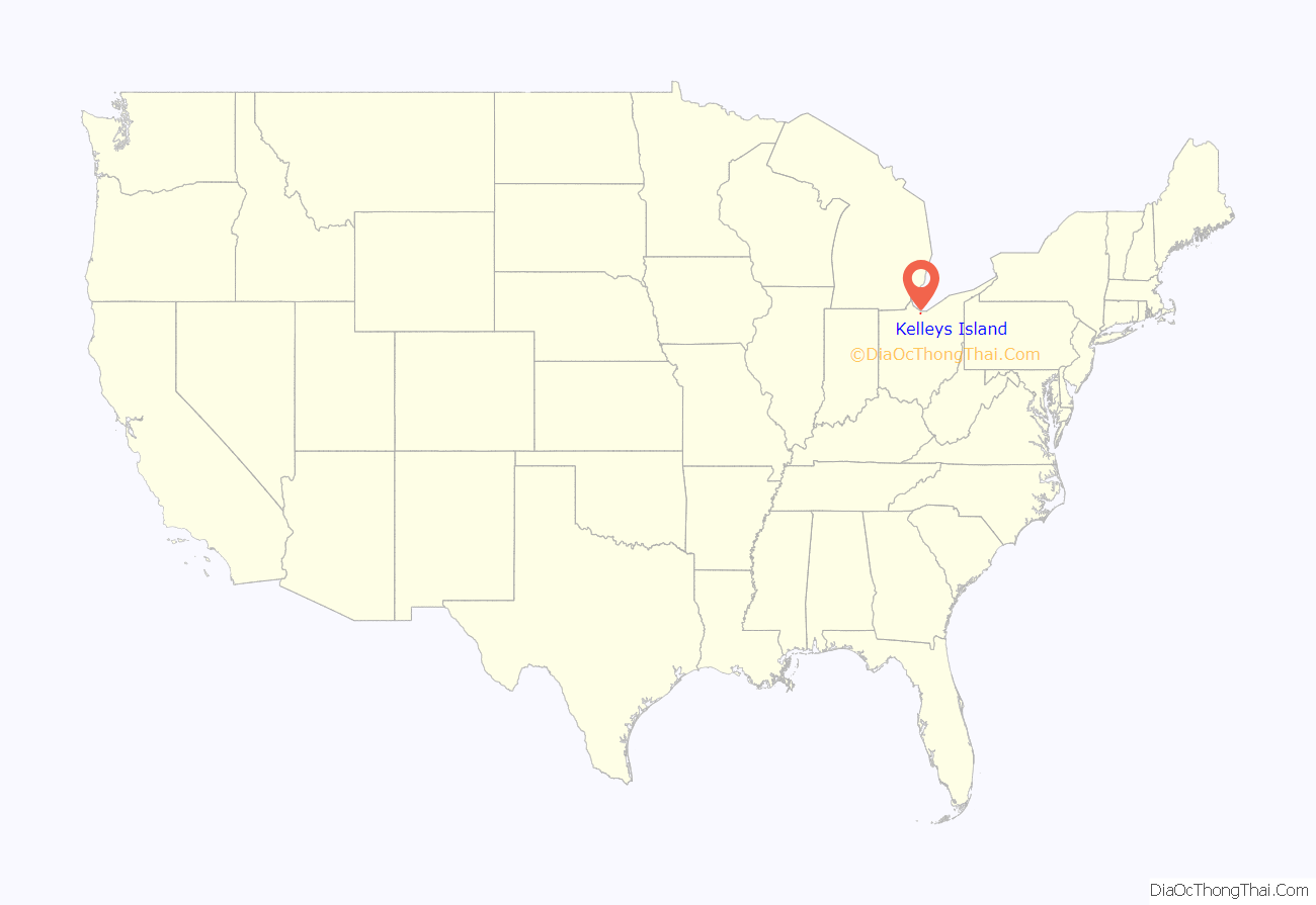
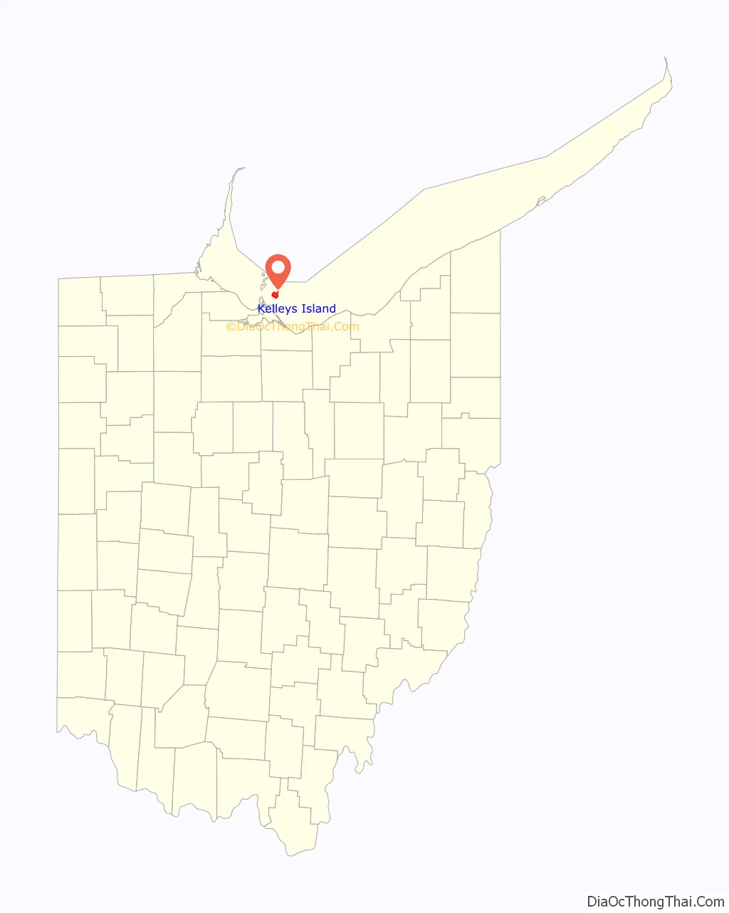
Kelleys Island location map. Where is Kelleys Island village?
History
Kelleys Island was previously occupied by Native Americans of the area. During the beginning of the War of 1812, the island was used as a military rendezvous post, first by the British and later by the U.S. Military. During the early 19th century, the island was mostly uninhabited. After the Kelley brothers purchased the land, there was commercial development through extraction of the island’s limestone and lumber resources, and the population began to grow with workers and families. There was also growing of grapes as a commodity crop. As of the 2010 census, the island’s population was 312.
Today, Kelleys Island is primarily a vacation destination, and is visited by thousands of people each summer. Notable attractions include its various beaches, parks, and campgrounds. Several ferries provide regular transport to the mainland for most travelers; the island also features a number of marinas, as well as a small airfield for private planes. It is the largest of the American Lake Erie Islands, and is a part of the Sandusky, Ohio Metropolitan Statistical Area.
Native Americans and Inscription Rock
Kelleys Island is a Devonian limestone and dolomite ridge carved during the Pleistocene era. The first known occupants of Kelleys Island were either Erie, Native Americans, who lived in the area until 1656.
On the south shore of the island (near what is now the downtown-village area), there is a large limestone rock featuring petroglyphs carved over a number of years by these and earlier indigenous inhabitants; it was later named ‘Inscription Rock’ by scholars in the mid-19th century. The Kelleys Island Historical Association [2] relies on the Henry Rowe Schoolcraft investigations, which dated the carvings to roughly 1643. He theorized that the rock was used by members of “seasonal” Native American tribes, to impart information to one another about how the hunting had been in the area, and where their group would next be traveling.
Many different items and scenes are cut into the large flat top side of the rock, which measures 32 feet (9.8 m) by 21 feet (10 by 6 m). Over time, most of the inscriptions on this rock have been eroded away. The indigenous peoples who are thought to have inscribed these images, are said to have been annihilated about 1665 by Iroquois nations from the New York area, who were trying to conquer territory to control the fur trade.
Early pioneer settlers
This island is called “Sandusky Island” on maps produced in the latter half of the 18th-century. (Prior to U.S. occupation of this area, the name “Cunningham’s Island” seems to have been applied to present-day “Catawba Island”, which was then also a true island.) In the late 1790s the Connecticut Land Company surveyed the south east shore of Lake Erie. A more thorough survey was completed in 1806, when this island was officially designated as “Island Number 6”. Later the name “Cunningham’s Island” was used to refer to this island.
There is a legend that the first European American resident of this island was a man named “Cunningham” (supposedly a “Frenchman” or French-speaking Canadian). He was said to have traveled to the island in 1803 with the intention of making his home there, at a time when it was still inhabited by Native Americans. For a while, Cunningham enjoyed friendly relationship with the native people: he built a log cabin near their village, socialized with their hunters, and traded goods with them on a regular basis. But (as the legend goes) Cunningham had a disagreement with the Native Americans, and a group tore down his home, stole all his possessions, and attempted to kill him. He escaped to the Ohio Peninsula via canoe, but died shortly afterward from his wounds. For many years after his death, the island was known as Cunningham Island. [ However, the legend of Mr. Cunningham might instead apply to present-day Catawba Island, which seems to have been formerly named “Cunningham’s Island” by the British, prior to 1804.) (*-Also note that the surname ‘Cunningham’ is not typically of French origin, but is recorded as of Scottish origin.)] Prior to the War of 1812, several other white adventurers are documented as trying to settle this island, but all of them were eventually being driven away, either by the native people, or by the incoming U.S. pioneers and land-owners. By the time the war had ended, the few remaining Native Americans had finally also vacated the island.
During the War of 1812, the west shore of Cunningham Island was developed as a military rendezvous post by US General William Henry Harrison. In 1818, a man named Killam briefly attempted to start a logging company, but abandoned the island after the large steam-powered boat he used to transport wood to the mainland wrecked and sank. Around 1826, people slowly began settling on the island; by 1830, six families made up its entire population.
About the year 1833, Ben Napier, a French-Canadian veteran of the War of 1812, claimed ownership of this “Cunningham Island” (and also nearby Put-in-Bay), through squatters rights. Napier and his associates often bullied the incoming pioneer settlers, sometimes hijacking their cabins and stealing or killing their livestock. Napier was eventually legally ousted after the court system ruled that he had no ownership rights.
Acquisition by the Kelleys
In 1830, John Clemons and his brother began mining the island’s limestone, and opened its first quarry. They built a dock on the north side in order to ship the rock to the American mainland. Shortly afterward, brothers Datus and Irad Kelley became aware of the island’s potential worth, and slowly began purchasing its land in parcels.
Datus and Irad Kelley were born in Middlefield, Connecticut, on April 24, 1788, and October 24, 1791, respectively. Datus moved to Rocky River, Ohio, in 1811, working as a surveyor and sawmill owner. Irad moved to Cleveland, Ohio, in 1812, eventually becoming a successful merchant, postmaster, sailor, and real-estate investor. Irad Kelley first became aware of the island after being forced to seek shelter there while transporting goods via sloop sailboat from Detroit to his shop in Cleveland. On August 20, 1833, the two began purchasing parcels of land on Cunningham Island at the rate of $1.50 per acre. They eventually owned the entire 3,000-acre (12 km) island, and in 1840 changed its name to Kelleys Island. By this time, the population had risen to 68 people.
The brothers quickly began improving and expanding the island’s docks to export limestone, fruit, and red cedar lumber. Soon, 16 limestone kilns were producing lime. The village’s various industries hired a number of immigrants (including young children), many of whom would work on the island during the summer and return to their homeland during the winter. Among the nationalities working on the island at that time were Irish, Poles, Slavs, Macedonians, Hungarians, Bulgarians, Italians, and Portuguese. Datus Kelley encouraged sobriety, and paid his employees bonuses for abstaining from “intoxifying liquors”.
The quarries were the origin of the Kelley Island Lime & Transport Company, which was once the largest producer of limestone and lime products in the world, operating between 1896 and the early 1960s. Numerous ruins of these operations and quarries now dot the island.
In 1842, Charles Carpenter (son-in-law of Datus Kelley) of Norwich, Connecticut, began growing and harvesting grapes for wine on Kelleys Island. By the early 20th century, the island was annually producing 500,000 gallons of wine per year.
The small village grew quickly, and soon a library and post office were erected. In 1901, the Estes Schoolhouse was built at a cost of $15,000.
Recent history and modern day
Kelleys Island is heavily forested except for several residential areas, some for year-round residents, others for summer vacationers. Some small farms and a small limestone quarry still operate on the island. Each summer since 1974 (typically in August), the island hosts a weekend-long homecoming festival, which includes a theme parade featuring both locals and vacationers, a picnic, and a number of food and craft booths.
Kelleys Island has a cemetery located on Division Street, about a mile north from the center of downtown. Although the cemetery is relatively small, several hundred people are buried or have memorial headstones there. Burials include that of Datus Kelley.
In 1975, 23 acres (9.3 ha) on the island’s southern shore were designated as a historic district, the Kelleys Island South Shore District, and added to the National Register of Historic Places. In 1988, the district was renamed to the Kelleys Island Historic District and expanded to include the entire island.
On August 19, 2010, three downtown businesses on Division Street were destroyed after a fire started in the attic of the Country Store. The fire quickly spread from the convenience store where it began to neighboring businesses in the complex: Papa T’s Ice Cream Shop and Vi’s Island Treasures. The vinyl siding of the neighboring Island House restaurant partially melted during the event. The Country Store had closed following the summer of 2009, and was vacant at the time of the fire. An Ohio state fire marshal later ruled the blaze had started from a work lamp that was left on in the vacant grocery shop’s attic. The Kelleys Island Volunteer Fire Department of 12 people took approximately 15 minutes to arrive on the scene. 15 to 20 additional firefighters were dispatched from the mainland. No one was injured during the fire, but the entire building had to be razed shortly afterward.
Kelleys Island Road Map
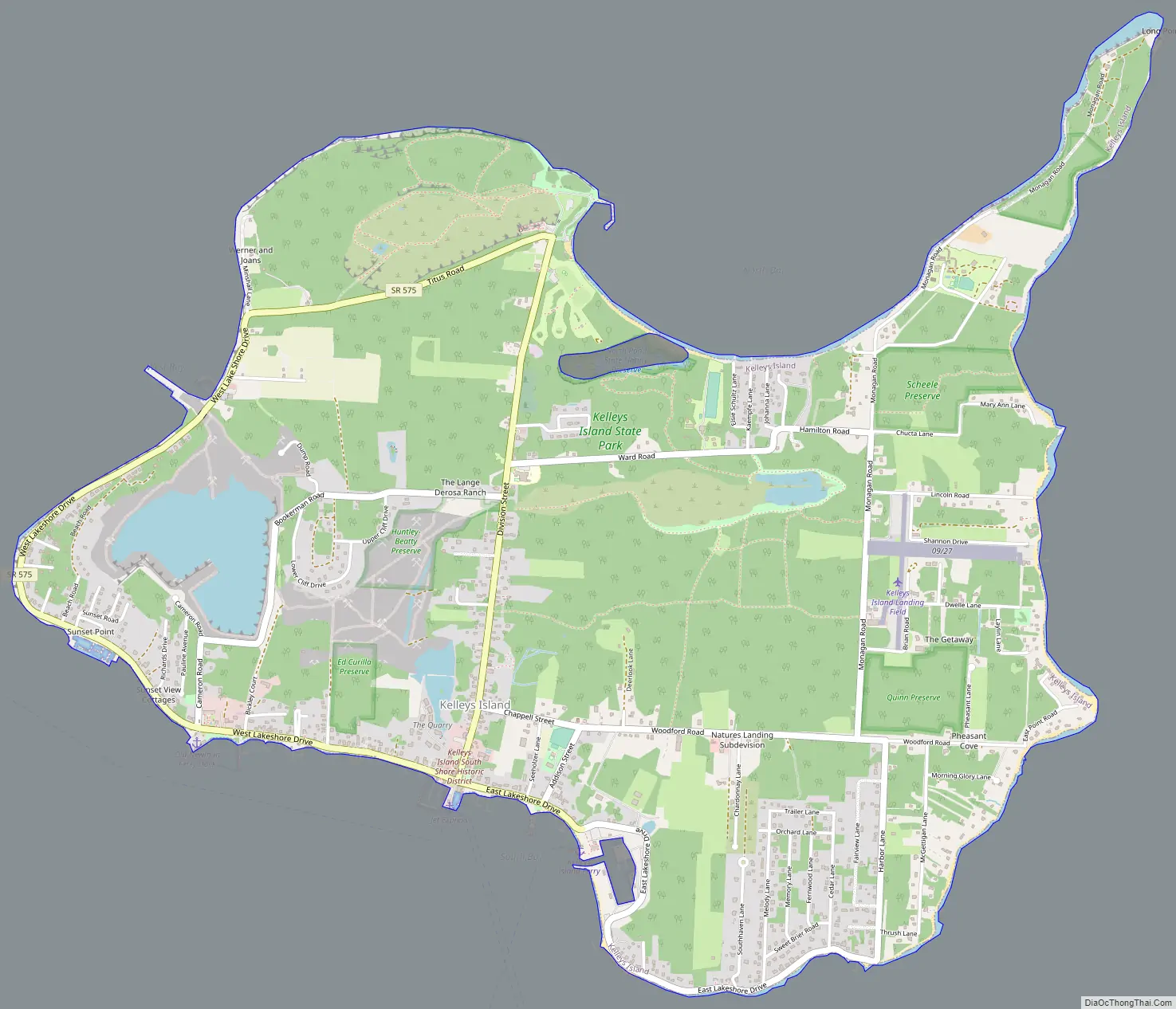
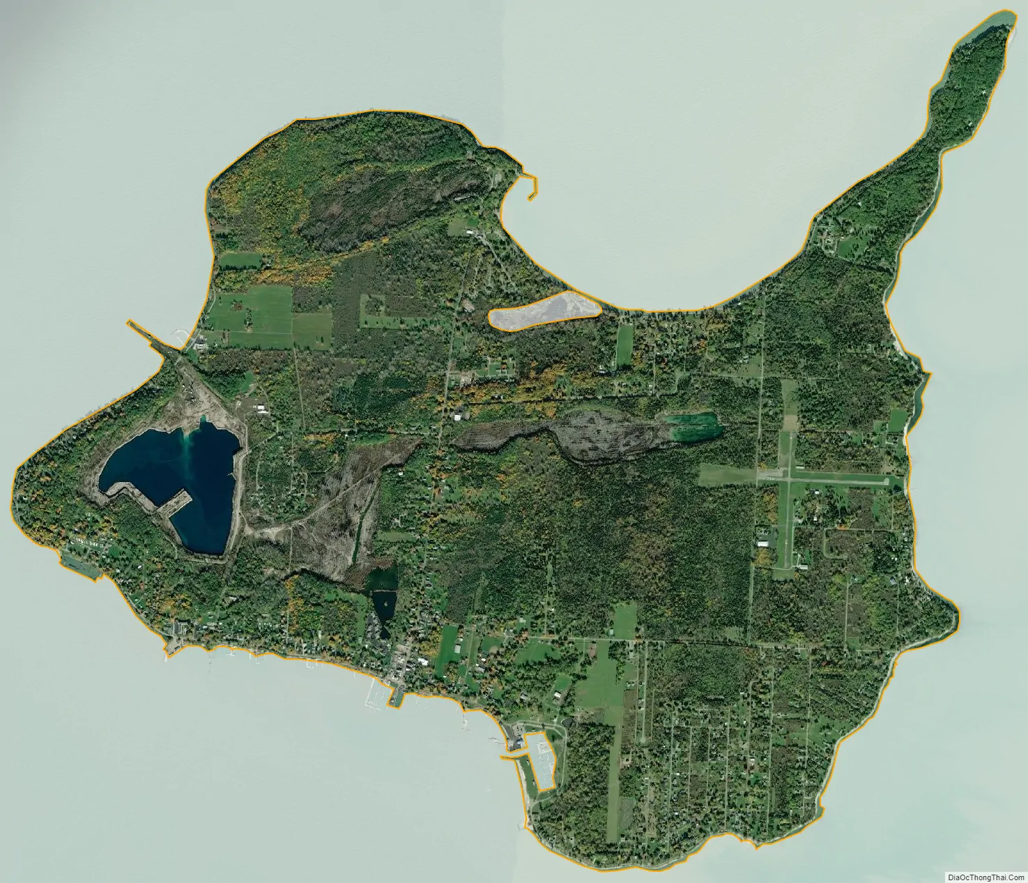
Kelleys Island city Satellite Map
Geography
Kelleys Island is located at 41°36′5″N 82°41′51″W / 41.60139°N 82.69750°W / 41.60139; -82.69750 (41.601343, -82.697442).
According to the United States Census Bureau, the village has a total area of 4.41 square miles (11.42 km), of which 4.35 square miles (11.27 km) is land and 0.06 square miles (0.16 km) is water.
Geology
Kelleys Island consists of Middle Devonian (Eifelian Stage) limestones and dolomites, the Lucas Dolostone, and the Columbus Limestone. The Lucas Dolostone is intensely dolomitized. With the exception of localized algal mounds and stromatoporoids, it is sparsely fossiliferous. Several species of stromatoporoids, which represent four genera, have been recorded from the Lucas Dolostone of Kelleys Island. The Lucas Dolostone accumulated within coastal subtidal to peritidal mudflats. These mudflats were permanently submerged and progressively buried beneath muddy shoal and lagoonal sediments as relative sea level rose and the shoreline shifted westward during the Eifelian Stage.
Overlying the Lucas Dolostone, is the Columbus Limestone, which consists of the lowermost Bellepoint Member, middle Marblehead Member, and uppermost Venice Member. The Bellepoint Member consists of wackestones and packstones, which accumulated as muddy shoals and contain a large number of rugose corals, gastropods, rostroconchs, and brachiopods. The Marblehead Member consists of a lower, thick-bedded, cherty, dolomitic, heavily-burrowed mudstone deposited in lagoonal conditions below mean wave base. These mudstones grade upward into thinner bedded, sparsely fossiliferous packstones and grainstones of this member’s upper part that accumulated as subtidal shoals. A rippled, hardground surface forms the top of the Marblehead Member This hardground represents either a period of subaerial erosion or the lack of sediment accumulation at a shallow depth for a significant interval of time. The Marblehead Member is overlain by mudstones and wackestones of the uppermost Venice Member of the Columbus Limestone. This member accumulated below wave base in the open sea after relative sea level rose again.
The Devonian limestone and dolomite that comprise Kelleys Island has been deeply eroded and scoured by the Laurentide Ice Sheet over the Pleistocene. On the island, the largest exposure of glacial grooves and striations created by glacial erosion is preserved in Glacial Grooves State Memorial, which is associated with Kelleys Island State Park. Within the Memorial, giant glacial grooves in a depression about 9 meters (30 ft) wide and 4.5 meters (15 ft) deep are exposed in an outcrop about 120 meters (390 ft) long. Near the near the east edge of the outcrop, a number of the grooves are relatively straight, smooth, and exhibit striated surfaces. Farther west, the path of the individual grooves becomes far more tortuous, and striations are less distinct and fewer in number.
Munro-Stasiuk and others argue that the giant glacial grooves and the depression, in which they lie, were eroded by highly turbulent, high velocity, sediment-laden meltwater flows. Judging from similar tortuous, giant, glacial grooves, which are found all over, and between, the Lake Erie islands on high and low areas, the erosional features are interpreted to have formed during a subglacial meltwater megaflood that took place before or near the Last Glacial Maximum.
See also
Map of Ohio State and its subdivision:- Adams
- Allen
- Ashland
- Ashtabula
- Athens
- Auglaize
- Belmont
- Brown
- Butler
- Carroll
- Champaign
- Clark
- Clermont
- Clinton
- Columbiana
- Coshocton
- Crawford
- Cuyahoga
- Darke
- Defiance
- Delaware
- Erie
- Fairfield
- Fayette
- Franklin
- Fulton
- Gallia
- Geauga
- Greene
- Guernsey
- Hamilton
- Hancock
- Hardin
- Harrison
- Henry
- Highland
- Hocking
- Holmes
- Huron
- Jackson
- Jefferson
- Knox
- Lake
- Lake Erie
- Lawrence
- Licking
- Logan
- Lorain
- Lucas
- Madison
- Mahoning
- Marion
- Medina
- Meigs
- Mercer
- Miami
- Monroe
- Montgomery
- Morgan
- Morrow
- Muskingum
- Noble
- Ottawa
- Paulding
- Perry
- Pickaway
- Pike
- Portage
- Preble
- Putnam
- Richland
- Ross
- Sandusky
- Scioto
- Seneca
- Shelby
- Stark
- Summit
- Trumbull
- Tuscarawas
- Union
- Van Wert
- Vinton
- Warren
- Washington
- Wayne
- Williams
- Wood
- Wyandot
- Alabama
- Alaska
- Arizona
- Arkansas
- California
- Colorado
- Connecticut
- Delaware
- District of Columbia
- Florida
- Georgia
- Hawaii
- Idaho
- Illinois
- Indiana
- Iowa
- Kansas
- Kentucky
- Louisiana
- Maine
- Maryland
- Massachusetts
- Michigan
- Minnesota
- Mississippi
- Missouri
- Montana
- Nebraska
- Nevada
- New Hampshire
- New Jersey
- New Mexico
- New York
- North Carolina
- North Dakota
- Ohio
- Oklahoma
- Oregon
- Pennsylvania
- Rhode Island
- South Carolina
- South Dakota
- Tennessee
- Texas
- Utah
- Vermont
- Virginia
- Washington
- West Virginia
- Wisconsin
- Wyoming