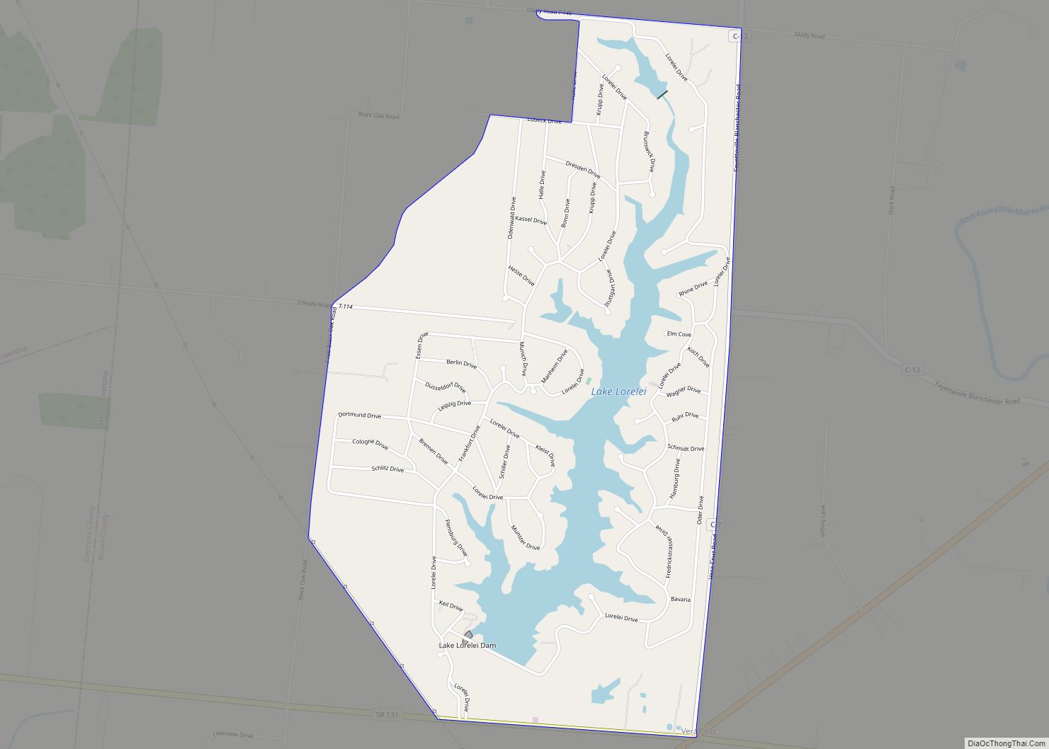
Lake Lorelei is a gated community and census-designated place in Brown County, Ohio, United States, near the village of Fayetteville. As of the 2010 census, it had a population of 1,170.
| Name: | Lake Lorelei CDP |
|---|---|
| LSAD Code: | 57 |
| LSAD Description: | CDP (suffix) |
| State: | Ohio |
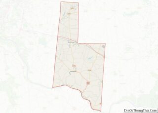
| County: | Brown County |
| Elevation: | 925 ft (282 m) |
| Total Area: | 2.45 sq mi (6.35 km²) |
| Land Area: | 2.20 sq mi (5.70 km²) |
| Water Area: | 0.25 sq mi (0.65 km²) |
| Total Population: | 1,172 |
| Population Density: | 532.49/sq mi (205.56/km²) |
| Area code: | 513 |
| FIPS code: | 3941419 |
| GNISfeature ID: | 2628918 |
Online Interactive Map
Click on ![]() to view map in "full screen" mode.
to view map in "full screen" mode.
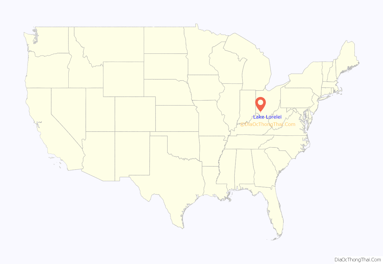
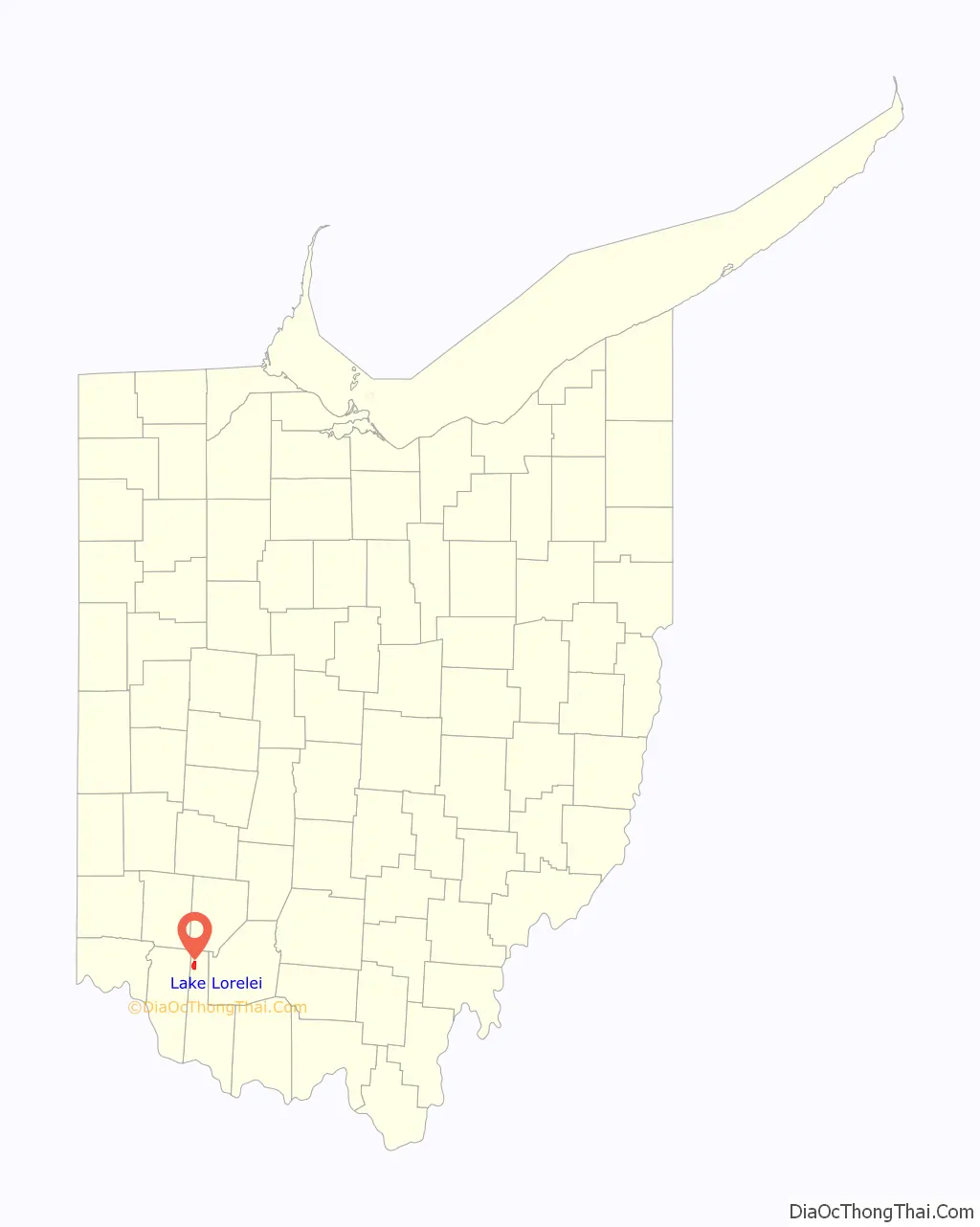
Lake Lorelei location map. Where is Lake Lorelei CDP?
History
Lake Lorelei was started in the late 1960s by property developers as a lakeside planned community.
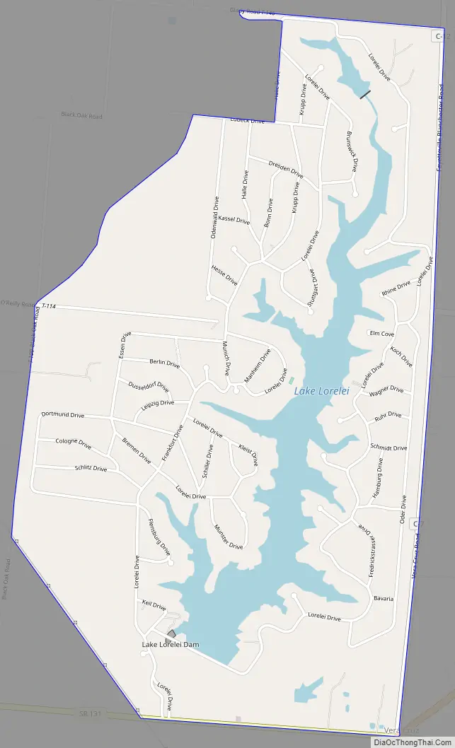
Lake Lorelei Road Map
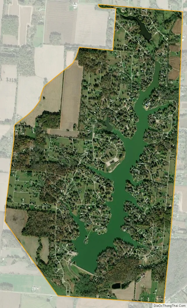
Lake Lorelei city Satellite Map
Geography
Lake Lorelei is located in northern Brown County, in the western part of Perry Township. It consists of a housing development built around Lake Lorelei, a reservoir on Glady Run, a tributary of the East Fork of the Little Miami River.
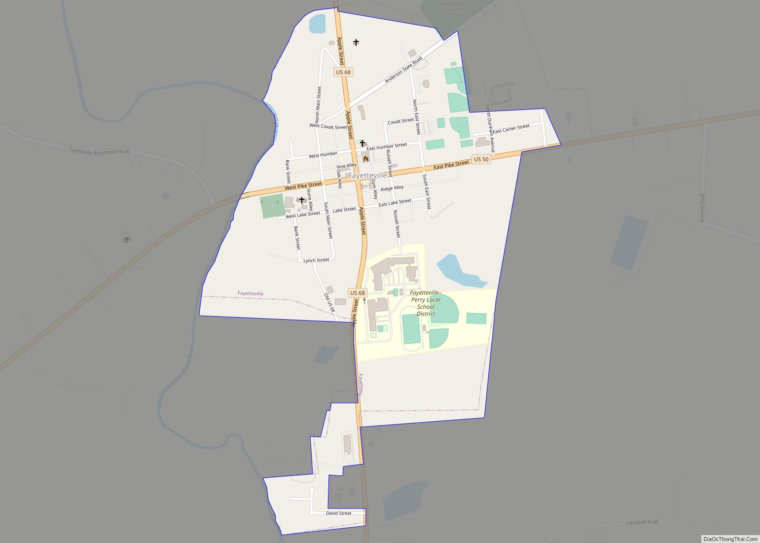
State Route 131 forms the southern border of the CDP, and U.S. Route 50 touches the community’s southeast corner. Lake Lorelei is 3 miles (5 km) west of the village of Fayetteville and 34 miles (55 km) east of downtown Cincinnati.
See also
Map of Ohio State and its subdivision:- Adams
- Allen
- Ashland
- Ashtabula
- Athens
- Auglaize
- Belmont
- Brown
- Butler
- Carroll
- Champaign
- Clark
- Clermont
- Clinton
- Columbiana
- Coshocton
- Crawford
- Cuyahoga
- Darke
- Defiance
- Delaware
- Erie
- Fairfield
- Fayette
- Franklin
- Fulton
- Gallia
- Geauga
- Greene
- Guernsey
- Hamilton
- Hancock
- Hardin
- Harrison
- Henry
- Highland
- Hocking
- Holmes
- Huron
- Jackson
- Jefferson
- Knox
- Lake
- Lake Erie
- Lawrence
- Licking
- Logan
- Lorain
- Lucas
- Madison
- Mahoning
- Marion
- Medina
- Meigs
- Mercer
- Miami
- Monroe
- Montgomery
- Morgan
- Morrow
- Muskingum
- Noble
- Ottawa
- Paulding
- Perry
- Pickaway
- Pike
- Portage
- Preble
- Putnam
- Richland
- Ross
- Sandusky
- Scioto
- Seneca
- Shelby
- Stark
- Summit
- Trumbull
- Tuscarawas
- Union
- Van Wert
- Vinton
- Warren
- Washington
- Wayne
- Williams
- Wood
- Wyandot
- Alabama
- Alaska
- Arizona
- Arkansas
- California
- Colorado
- Connecticut
- Delaware
- District of Columbia
- Florida
- Georgia
- Hawaii
- Idaho
- Illinois
- Indiana
- Iowa
- Kansas
- Kentucky
- Louisiana
- Maine
- Maryland
- Massachusetts
- Michigan
- Minnesota
- Mississippi
- Missouri
- Montana
- Nebraska
- Nevada
- New Hampshire
- New Jersey
- New Mexico
- New York
- North Carolina
- North Dakota
- Ohio
- Oklahoma
- Oregon
- Pennsylvania
- Rhode Island
- South Carolina
- South Dakota
- Tennessee
- Texas
- Utah
- Vermont
- Virginia
- Washington
- West Virginia
- Wisconsin
- Wyoming