Ripley is a village in Union Township, Brown County, Ohio, United States, along the Ohio River 50 miles southeast of Cincinnati. The population was 1,750 at the 2010 census.
| Name: | Ripley village |
|---|---|
| LSAD Code: | 47 |
| LSAD Description: | village (suffix) |
| State: | Ohio |
| County: | Brown County |
| Elevation: | 502 ft (153 m) |
| Total Area: | 2.29 sq mi (5.94 km²) |
| Land Area: | 1.99 sq mi (5.15 km²) |
| Water Area: | 0.31 sq mi (0.79 km²) |
| Total Population: | 1,591 |
| Population Density: | 799.90/sq mi (308.88/km²) |
| ZIP code: | 45167 |
| Area code: | 937, 326 |
| FIPS code: | 3967272 |
| GNISfeature ID: | 1061608 |
| Website: | villageofripley.com |
Online Interactive Map
Click on ![]() to view map in "full screen" mode.
to view map in "full screen" mode.
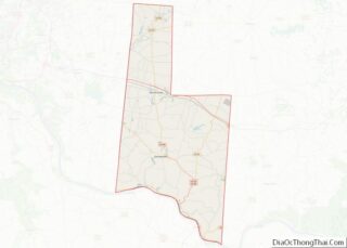
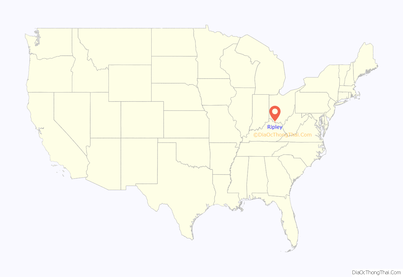
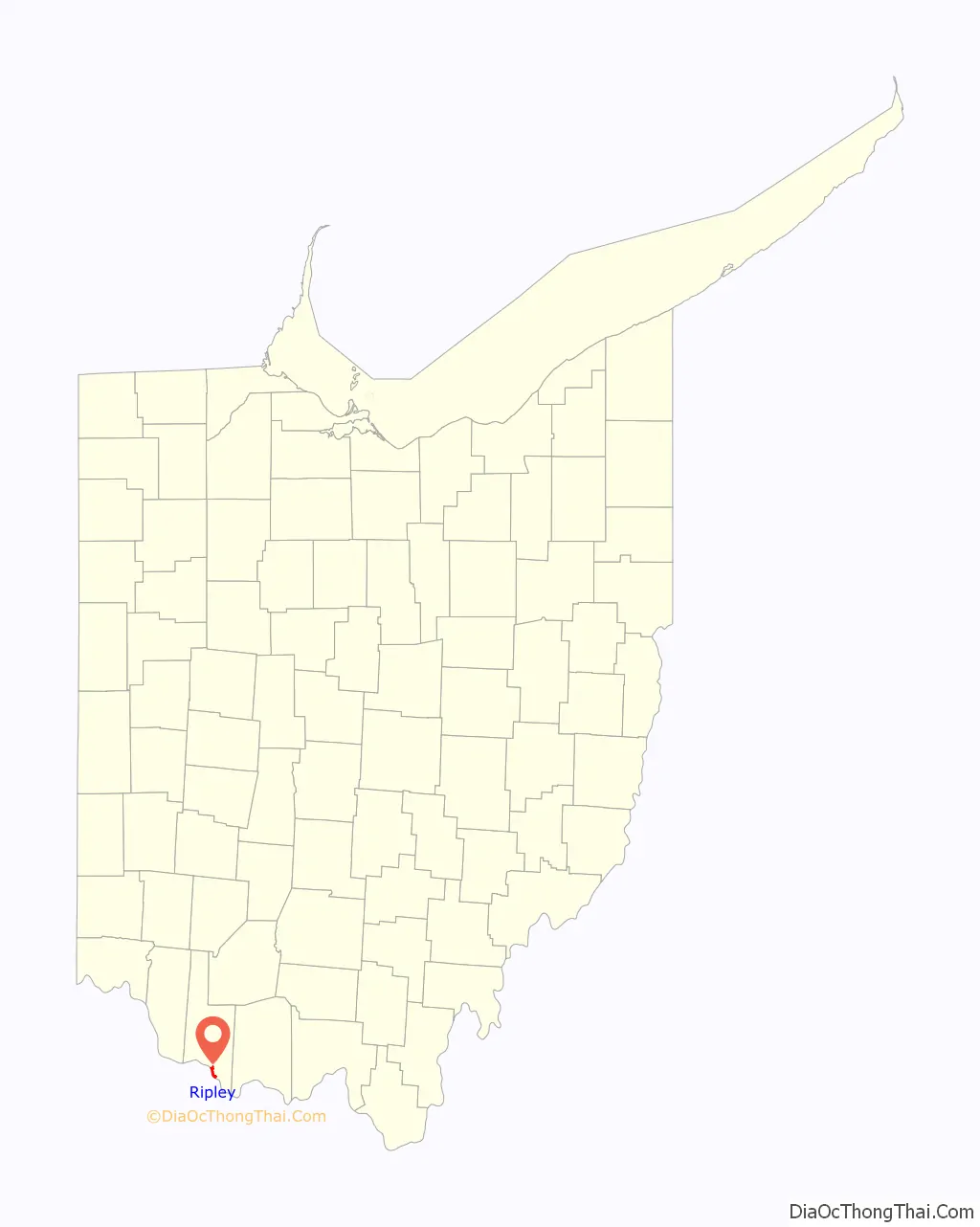
Ripley location map. Where is Ripley village?
History
Colonel James Poage, a veteran of the American Revolution, arrived in the free state of Ohio from Staunton, Virginia in 1804 to claim the 1,000 acres (4.0 km) he had been granted in what was called the Virginia Military District. Poage was among a large group of veterans who received land grants in what was first organized as the Northwest Territory north of the Ohio River for their service in the American Revolutionary War, and freed their slaves when they settled there. Poage and his family laid out the town of Staunton in 1812; it was renamed in 1816 to honor General Eleazar Wheelock Ripley, an American officer of the War of 1812.
Given its location on the river, Ripley became a destination for slaves escaping from slavery in Kentucky on the other side. Both black and white residents developed a network, making Ripley an early stop on the Underground Railroad, to help slaves escape north to freedom. A number of prominent abolitionists lived in the town in the 19th century, mainly on Front Street near the river. John Rankin moved from Kentucky to Ripley in 1822 and later built a house on Liberty Hill overlooking the town, the river, and the Kentucky shore. From there, he signaled escaping slaves with a lantern on a flagpole and provided them shelter. The house is now known as the John Rankin House, and has been designated as a National Historic Landmark. Rankin was also the minister at the Ripley Presbyterian Church for twenty-four years.
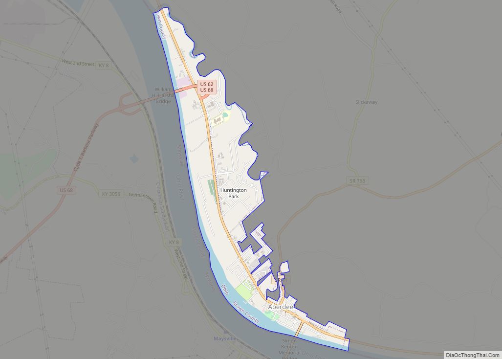
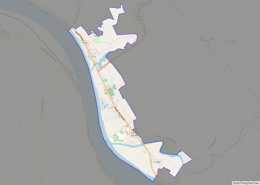
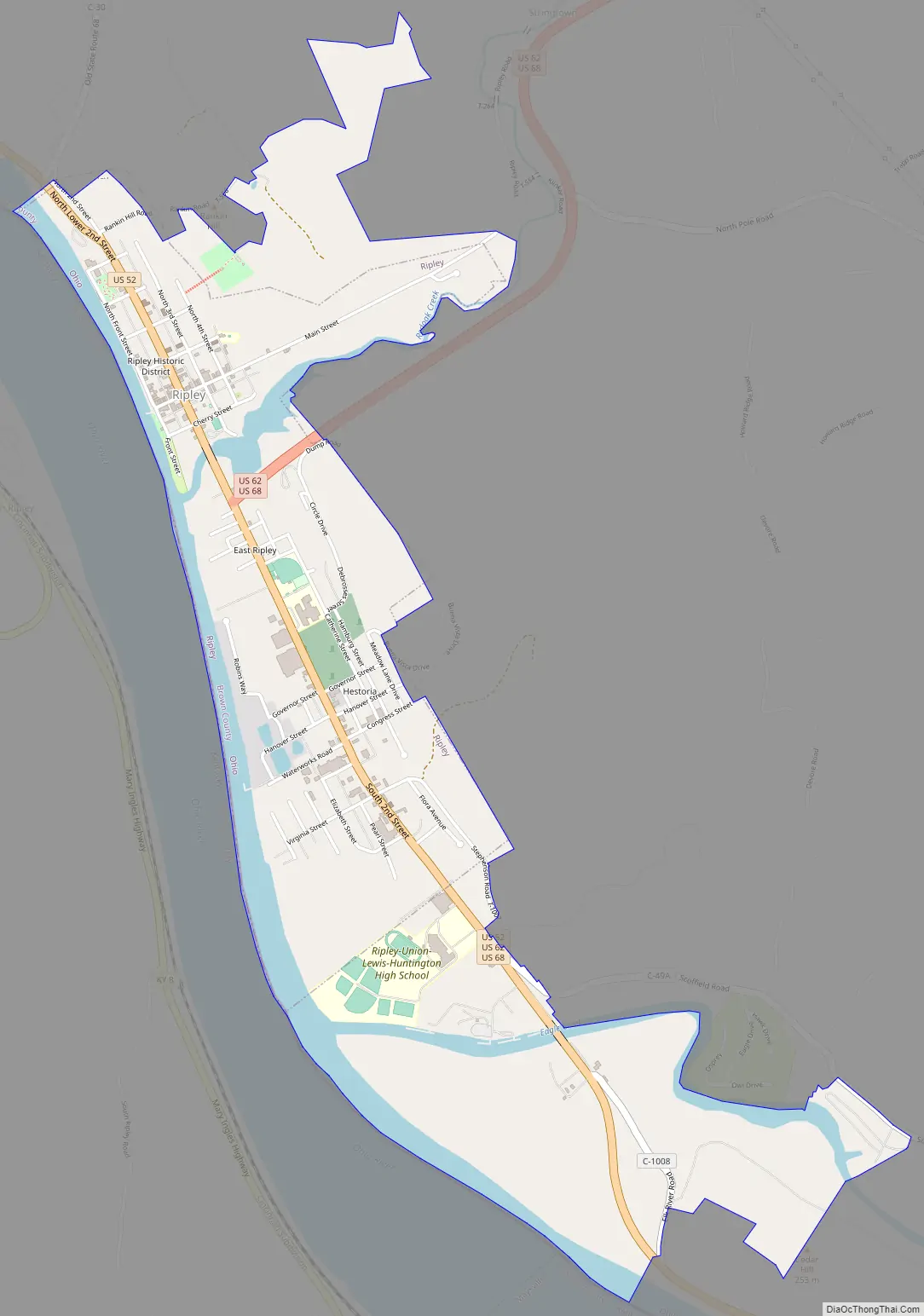
Ripley Road Map
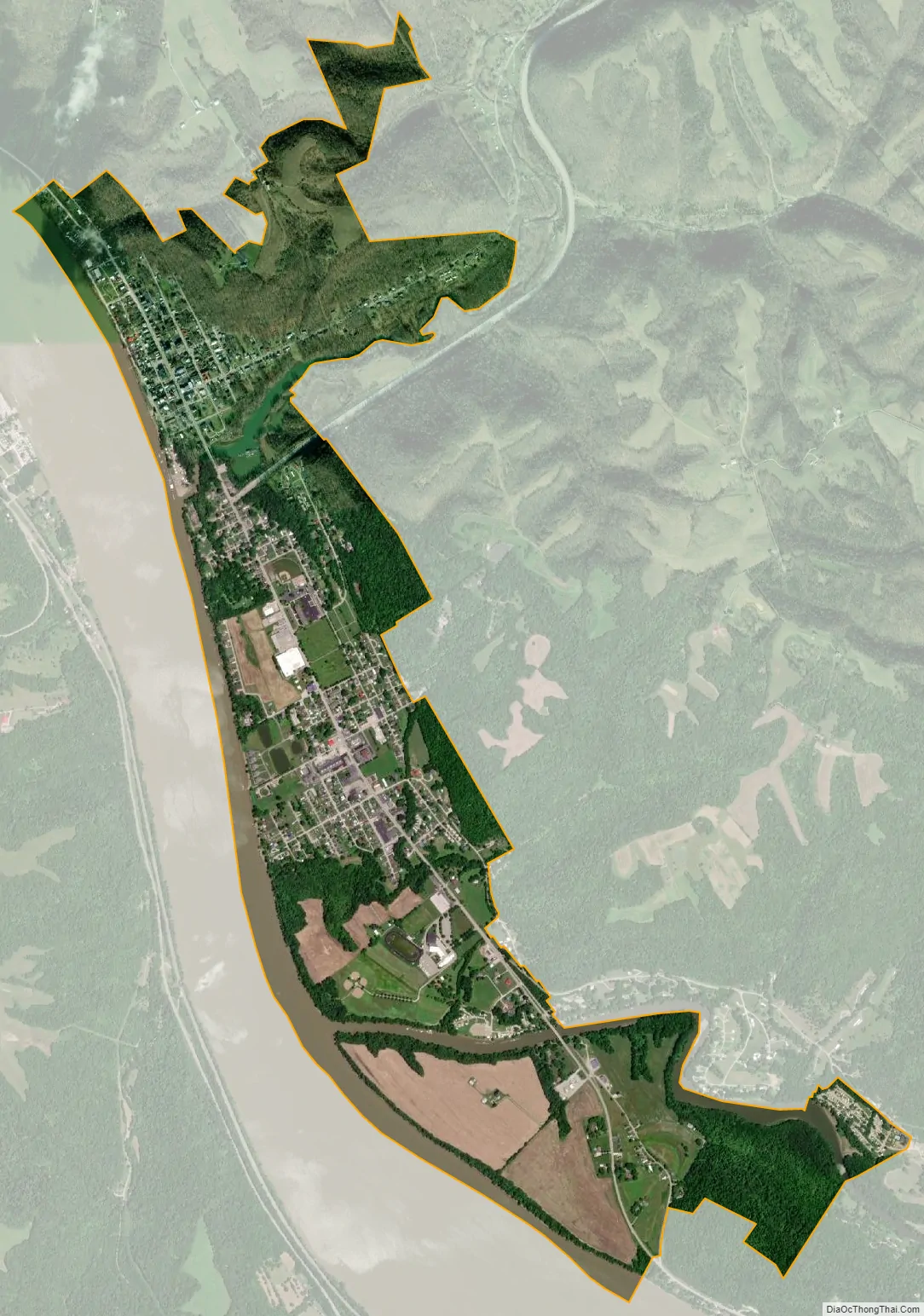
Ripley city Satellite Map
Geography
Ripley is located at 38°44′22″N 83°50′28″W / 38.73944°N 83.84111°W / 38.73944; -83.84111 (38.739416, -83.841102). The town is surrounded by steep, rolling hills on the northeast, Red Oak Creek on the southeast, and the Ohio River on the southwest.
According to the United States Census Bureau, the village has a total area of 2.30 square miles (5.96 km), of which 1.99 square miles (5.15 km) is land and 0.31 square miles (0.80 km) is water.
See also
Map of Ohio State and its subdivision:- Adams
- Allen
- Ashland
- Ashtabula
- Athens
- Auglaize
- Belmont
- Brown
- Butler
- Carroll
- Champaign
- Clark
- Clermont
- Clinton
- Columbiana
- Coshocton
- Crawford
- Cuyahoga
- Darke
- Defiance
- Delaware
- Erie
- Fairfield
- Fayette
- Franklin
- Fulton
- Gallia
- Geauga
- Greene
- Guernsey
- Hamilton
- Hancock
- Hardin
- Harrison
- Henry
- Highland
- Hocking
- Holmes
- Huron
- Jackson
- Jefferson
- Knox
- Lake
- Lake Erie
- Lawrence
- Licking
- Logan
- Lorain
- Lucas
- Madison
- Mahoning
- Marion
- Medina
- Meigs
- Mercer
- Miami
- Monroe
- Montgomery
- Morgan
- Morrow
- Muskingum
- Noble
- Ottawa
- Paulding
- Perry
- Pickaway
- Pike
- Portage
- Preble
- Putnam
- Richland
- Ross
- Sandusky
- Scioto
- Seneca
- Shelby
- Stark
- Summit
- Trumbull
- Tuscarawas
- Union
- Van Wert
- Vinton
- Warren
- Washington
- Wayne
- Williams
- Wood
- Wyandot
- Alabama
- Alaska
- Arizona
- Arkansas
- California
- Colorado
- Connecticut
- Delaware
- District of Columbia
- Florida
- Georgia
- Hawaii
- Idaho
- Illinois
- Indiana
- Iowa
- Kansas
- Kentucky
- Louisiana
- Maine
- Maryland
- Massachusetts
- Michigan
- Minnesota
- Mississippi
- Missouri
- Montana
- Nebraska
- Nevada
- New Hampshire
- New Jersey
- New Mexico
- New York
- North Carolina
- North Dakota
- Ohio
- Oklahoma
- Oregon
- Pennsylvania
- Rhode Island
- South Carolina
- South Dakota
- Tennessee
- Texas
- Utah
- Vermont
- Virginia
- Washington
- West Virginia
- Wisconsin
- Wyoming