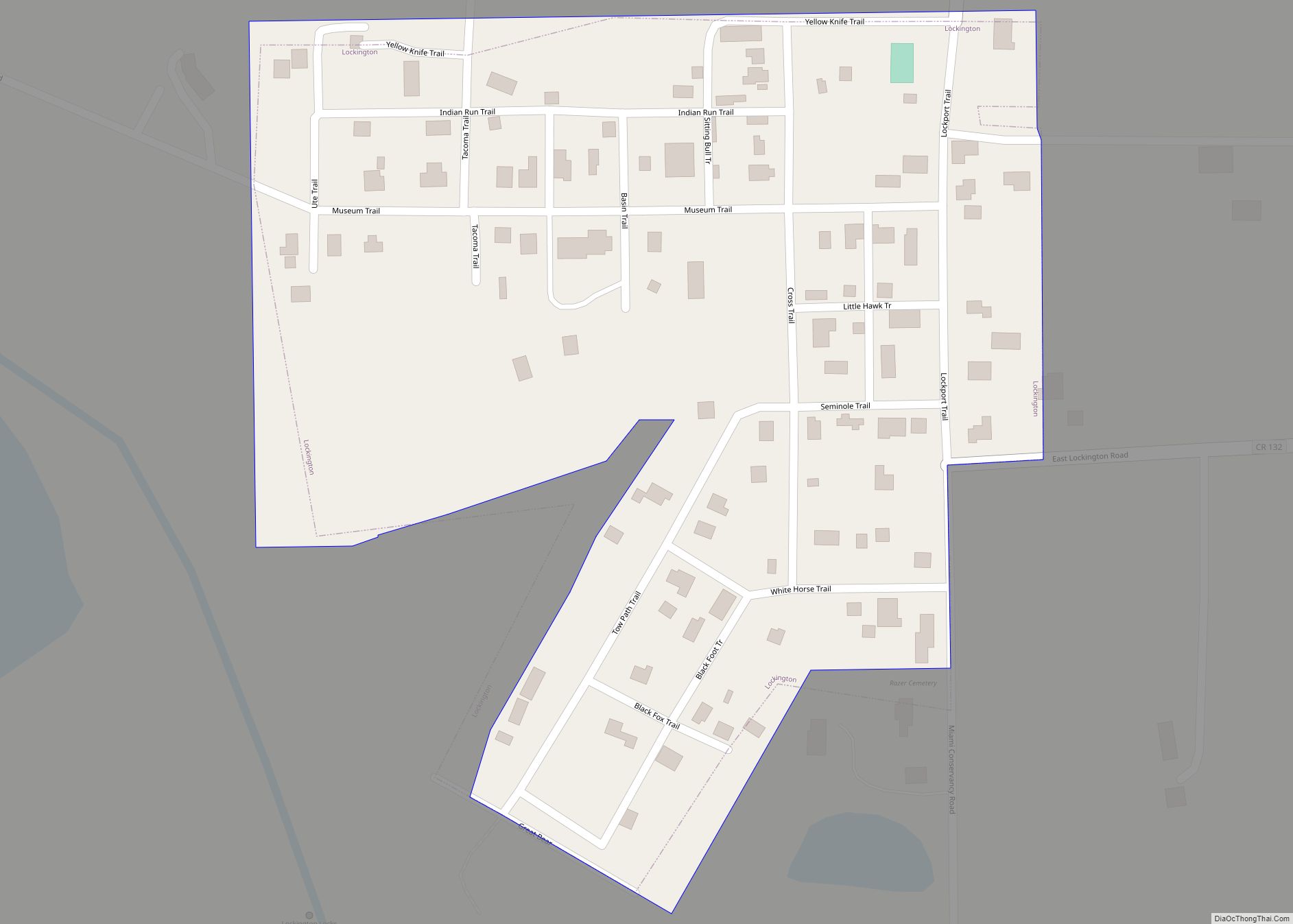
Lockington (originally called Locksport) is a village in Washington Township, Shelby County, Ohio, United States, along Loramie Creek. The population was 141 at the 2010 census.
| Name: | Lockington village |
|---|---|
| LSAD Code: | 47 |
| LSAD Description: | village (suffix) |
| State: | Ohio |
| County: | Shelby County |
| Elevation: | 948 ft (289 m) |
| Total Area: | 0.08 sq mi (0.22 km²) |
| Land Area: | 0.08 sq mi (0.22 km²) |
| Water Area: | 0.00 sq mi (0.00 km²) |
| Total Population: | 162 |
| Population Density: | 1,928.57/sq mi (740.39/km²) |
| FIPS code: | 3944352 |
| GNISfeature ID: | 1065016 |
Online Interactive Map
Click on ![]() to view map in "full screen" mode.
to view map in "full screen" mode.
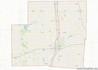
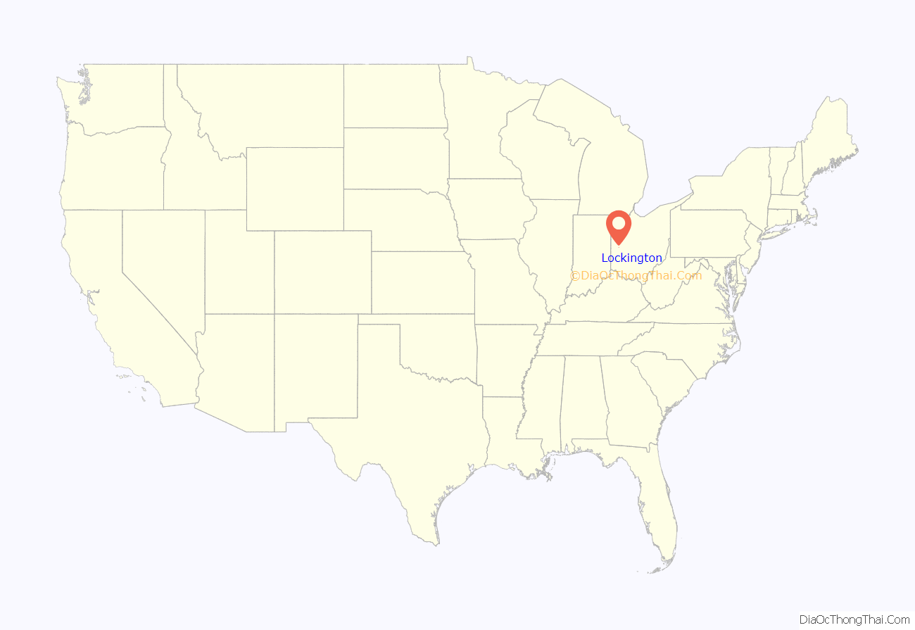
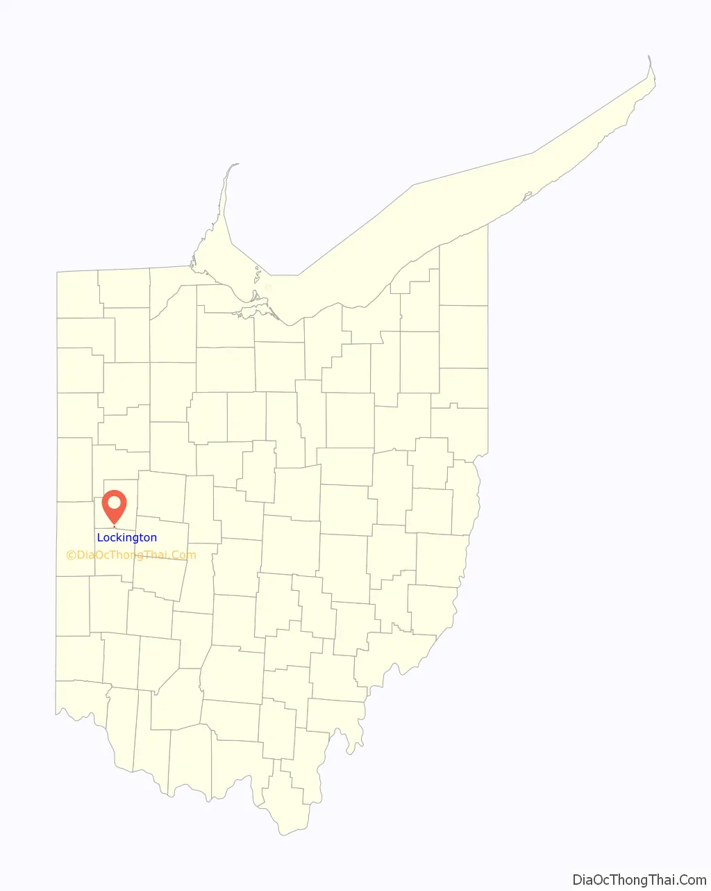
Lockington location map. Where is Lockington village?
History
Around 1830, a flour mill was built on Loramie Creek near where the village is now, and before that there was a sawmill built on the same creek that had been abandoned. In 1837, John Brown owned both of these mills, and built a new wool mill. A small community began to grow around these and other mills built along Loramie Creek later, and when the Miami and Erie Canal was built, a series of 5 canal locks lifted the water 60 feet (18 m) over the creek via an aqueduct. Due to its location near the locks, the community was originally called Locksport. As a crossroads between the main canal and feeders coming from Port Jefferson and Sidney, the community continued to grow.
In 1837, David Mellinger hired Jonathan Counts to survey and plat a new community on his land. The community of Lockington was approved for incorporation by the Shelby County Commissioners on September 9, 1857 and recorded by the Ohio Secretary of State on January 4, 1858. The first elections were help April 1, 1858, with W. S. Burns elected mayor. The Lockington Post Office was established on June 28, 1847. Around 1845, the first sawmill in Lockington was built by William Stephens, and a new mill built on the same site in 1860 with improvements to mill grain. The mill changed owners, but stayed in operation until it burned down around 1900. About 1905, D.K. Gillespie built a grain elevator in the village, which was vastly improved upon by its new owner, C.N. Adlard, in 1912, making it one of the largest in the state by storage capacity. As of 1913, there were also two general stores, a machine shop, a seasonal ice cream shop, and Knights of the Maccabees Tent No. 68. The post office remained in operation until August 30, 1914, mail service now handled through the Piqua branch. The original locks are now part of the Lockington Locks Historical Area.
In 2019, the Ohio Historical Records Advisory Board awarded Lockington a grant to assist in inventorying, organizing, and improving access to the village’s historical documents.
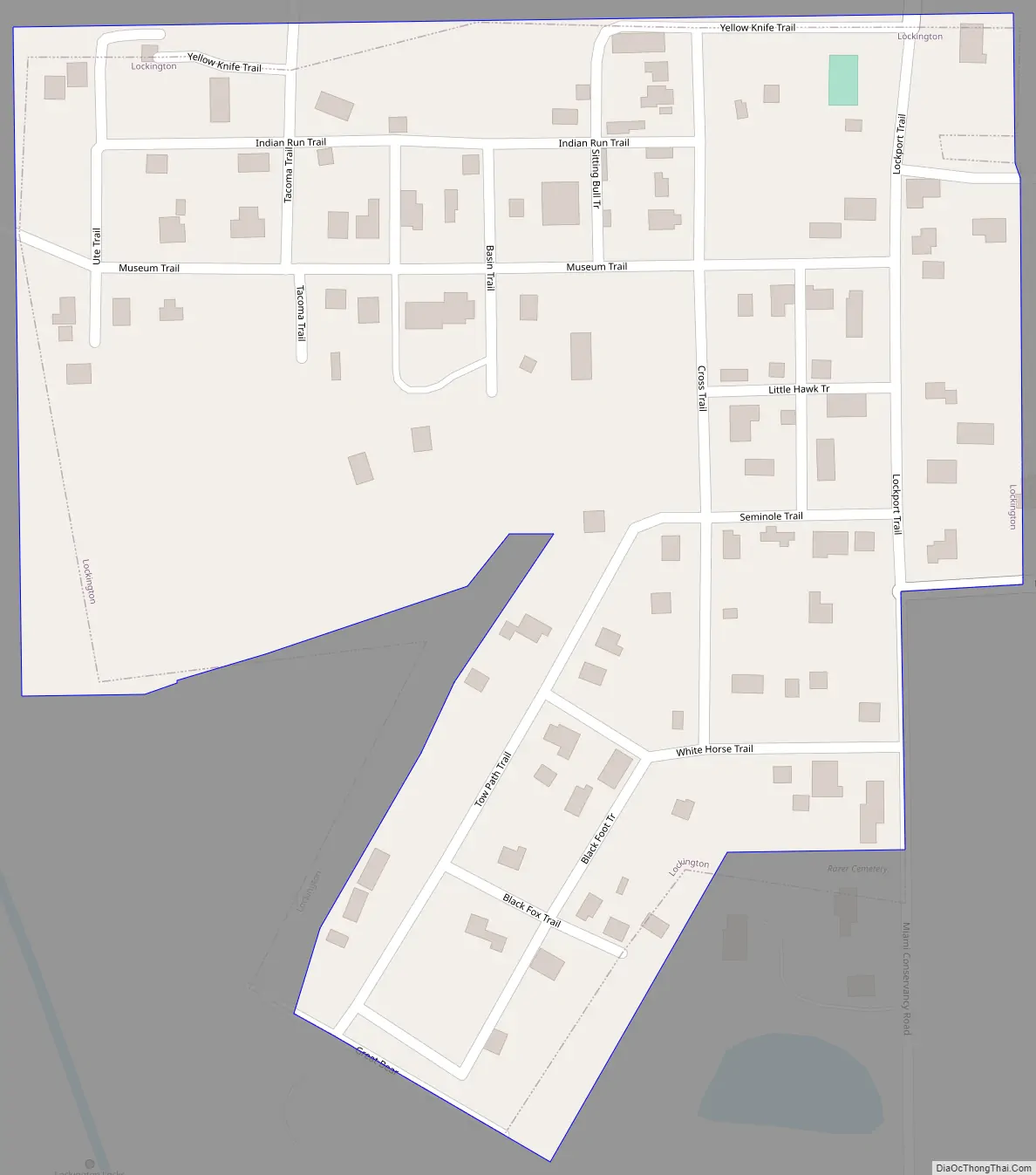
Lockington Road Map
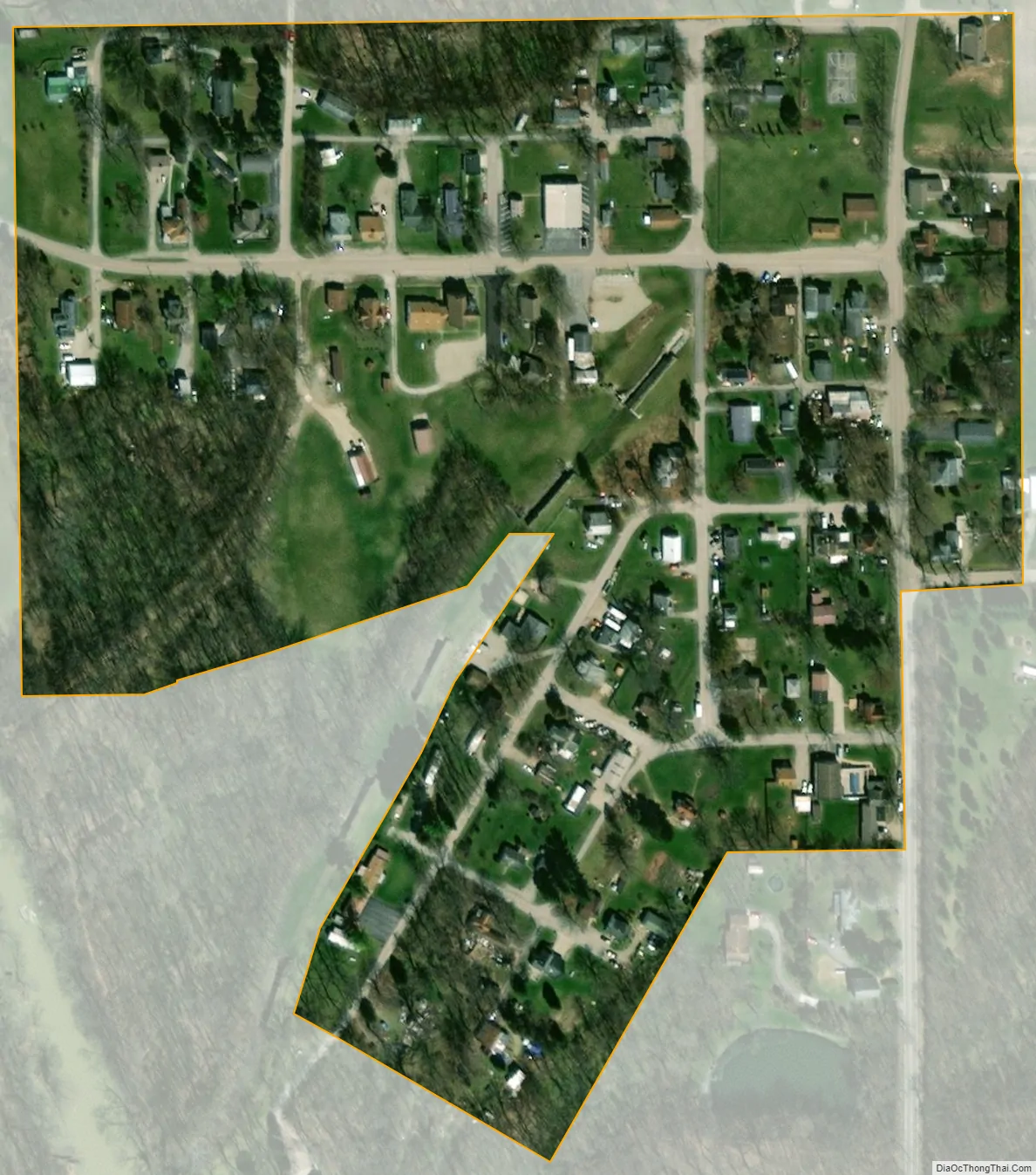
Lockington city Satellite Map
Geography
Lockington is located at 40°12′31″N 84°14′9″W / 40.20861°N 84.23583°W / 40.20861; -84.23583 (40.208681, -84.235779). According to the United States Census Bureau, the village has a total area of 0.08 square miles (0.21 km), all land.
See also
Map of Ohio State and its subdivision:- Adams
- Allen
- Ashland
- Ashtabula
- Athens
- Auglaize
- Belmont
- Brown
- Butler
- Carroll
- Champaign
- Clark
- Clermont
- Clinton
- Columbiana
- Coshocton
- Crawford
- Cuyahoga
- Darke
- Defiance
- Delaware
- Erie
- Fairfield
- Fayette
- Franklin
- Fulton
- Gallia
- Geauga
- Greene
- Guernsey
- Hamilton
- Hancock
- Hardin
- Harrison
- Henry
- Highland
- Hocking
- Holmes
- Huron
- Jackson
- Jefferson
- Knox
- Lake
- Lake Erie
- Lawrence
- Licking
- Logan
- Lorain
- Lucas
- Madison
- Mahoning
- Marion
- Medina
- Meigs
- Mercer
- Miami
- Monroe
- Montgomery
- Morgan
- Morrow
- Muskingum
- Noble
- Ottawa
- Paulding
- Perry
- Pickaway
- Pike
- Portage
- Preble
- Putnam
- Richland
- Ross
- Sandusky
- Scioto
- Seneca
- Shelby
- Stark
- Summit
- Trumbull
- Tuscarawas
- Union
- Van Wert
- Vinton
- Warren
- Washington
- Wayne
- Williams
- Wood
- Wyandot
- Alabama
- Alaska
- Arizona
- Arkansas
- California
- Colorado
- Connecticut
- Delaware
- District of Columbia
- Florida
- Georgia
- Hawaii
- Idaho
- Illinois
- Indiana
- Iowa
- Kansas
- Kentucky
- Louisiana
- Maine
- Maryland
- Massachusetts
- Michigan
- Minnesota
- Mississippi
- Missouri
- Montana
- Nebraska
- Nevada
- New Hampshire
- New Jersey
- New Mexico
- New York
- North Carolina
- North Dakota
- Ohio
- Oklahoma
- Oregon
- Pennsylvania
- Rhode Island
- South Carolina
- South Dakota
- Tennessee
- Texas
- Utah
- Vermont
- Virginia
- Washington
- West Virginia
- Wisconsin
- Wyoming