Miamisburg (/maɪˈæmizbɜːrɡ/ my-AM-eez-burg) is a city in southern Montgomery County, Ohio, United States. The population was 19,923 at the 2020 census. A suburb of Dayton, it is part of the Dayton metropolitan area. Named after the Miami people, Miamisburg is known for its industrial history, particularly its nuclear operations during World War II, and retail factors such as the Dayton Mall and surrounding commercial business area.
| Name: | Miamisburg city |
|---|---|
| LSAD Code: | 25 |
| LSAD Description: | city (suffix) |
| State: | Ohio |
| County: | Montgomery County |
| Founded: | 1797 |
| Incorporated: | 1832 |
| Elevation: | 699 ft (213 m) |
| Total Area: | 12.44 sq mi (32.23 km²) |
| Land Area: | 12.26 sq mi (31.75 km²) |
| Water Area: | 0.18 sq mi (0.48 km²) |
| Total Population: | 19,923 |
| Population Density: | 1,625.31/sq mi (627.54/km²) |
| ZIP code: | 45342-45343 |
| Area code: | 937, 326 |
| FIPS code: | 3949434 |
| GNISfeature ID: | 1085476 |
| Website: | http://www.ci.miamisburg.oh.us/ |
Online Interactive Map
Click on ![]() to view map in "full screen" mode.
to view map in "full screen" mode.
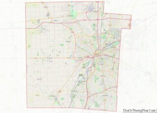
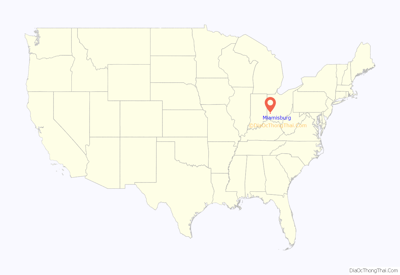
Miamisburg location map. Where is Miamisburg city?
History
European-Americans started calling their first community “Hole’s Station” circa 1797, when Zechariah Hole settled there with his family from Virginia and built a stockade on the west bank of the Miami River opposite the mouth of Bear Creek. The stockade attracted squatters, surveying parties, and other settlers who had taken grants to live in the local cabins until they could build their own; hence the little community became known as “Hole’s Station”. Settlers came west primarily from Pennsylvania. Miamisburg was incorporated in 1832 as a village; it achieved city status in the 1920s.
By 1827, the Miami and Erie Canal was under construction through the community, which improved transportation of people and goods through the region. The formal opening took place in January 1829, when the Governor Brown was the first packet boat to go through the settlement. Also that year the first boats from Cincinnati had arrived and passed through Miamisburg to get to Dayton. By 1834 the canal had been extended to Piqua, and many businesses along the river grew. The 1840s and the 1850s were brought the best of times to the canals.
George Kinder, a local resident, shipped bags of food to Ireland during its Great Famine; these also contained his address, with ads saying that he was hiring immigrant workers. Some Irish immigrants did come to Miamisburg and surrounding cities in search of work.
Miamisburg was the site of one of the first post-war U.S Atomic Energy Commission (AEC) facilities, beginning in 1947. The Dayton area had supported numerous secret operations for the War Department during World War II. As the war ended, the majority of these operations were moved to the Miamisburg Mound Laboratory, which was operated by the Monsanto Chemical Company. The Mound Labs were to monitor all aspects of the US nuclear defense stockpile.
The Mound Plant, built in 1947, was situated on a 306-acre (124 ha) site in the city 10 miles (16 km) south of Dayton. The workers, who numbered more than 2,000 at the height of the production, made plutonium detonators for nuclear weapons. Their work was very classified. The plant had a small army of security guards and was ringed by chain-link fencing and razor wire. When the Cold War ended, the plant discontinued the detonator work, but it continued to make nuclear power generators for space probes.
In May 1993 U.S. Department of Energy decided to end all production at the Mound. This move affected 2,100 employees in the local area. By 1996 cleanup of radioactive and hazardous waste was the main activity at the Plant. The Mound Development Corporation spearheaded the creation of the Mound Advanced Technology Center in the redevelopment of the plant, with the Montgomery County Regional Dispatch Center joining 14 other tenants in March 2009. In December 2010, the Dayton Police Department became the 17th law enforcement agency, along with 11 fire departments, to be dispatched from the regional center.
On September 10, 1978, 15 cars of a Conrail freight train derailed as the result of a hot box, caused by uneven distribution of steel ingots in a gondola loaded at Buffalo, New York by Republic Steel. They demolished a house at the Pearl Street crossing and killed three of its five occupants. As a result of a cooperative investigation by the Miamisburg Police Department and the National Transportation Safety Board, the deaths were ruled homicides by the Montgomery County Coroner.
Eight years later the city was the site of the July 8, 1986 derailment of 15 cars of a Baltimore and Ohio Railroad train, resulting in explosions of tank cars, emitted gas and clouds from phosphorus, on two successive days. The resulting thick white cloud engulfed communities as far north as Yellow Springs, Pitchin, and South Vienna. Rolling in like a massive desert dust storm across the horizon, the chemical cloud hugged the ground and blotted out the sun for several minutes before dissipating, according to the National Transportation Safety Board’s report. The explosions led to the evacuation of an estimated 25,000 to 40,000 residents from Miamisburg and surrounding southern Montgomery County municipalities, at the time this was the largest evacuation in U.S. history resulting from a train accident, according to William E. Loftus, executive director of the Federal Railroad Administration. This was also the largest evacuation in Ohio history.
A nitric oxide distillation column at a local chemical plant known as Isotec exploded on September 21, 2003, causing school and other events to be cancelled. Isotec is a division of Sigma-Aldrich.
World headquarters of JatroDiesel is in Miamisburg. JatroDiesel manufactures biodiesel equipment and produces biodiesel, a sustainable alternative fuel to diesel. The headquarters of National City Mortgage Corporation, a division of National City Corp. was in Miamisburg. In 2009, PNC Bank purchased National City Bank and converted National City Mortgage into PNC Mortgage. The headquarters for PNC Mortgage moved to Downers Grove, Ill, but much of the servicing division remains in Miamisburg. World headquarters of LexisNexis were in Miamisburg. In 2007, the headquarters moved to New York City, but the operations have remained in Ohio.
In 2018, a time vault was opened to celebrate the city’s 200th birthday.
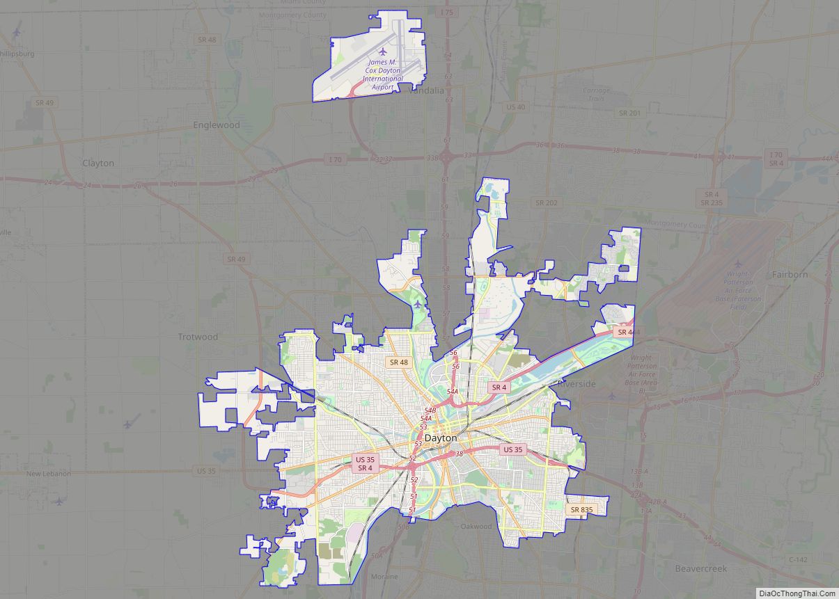
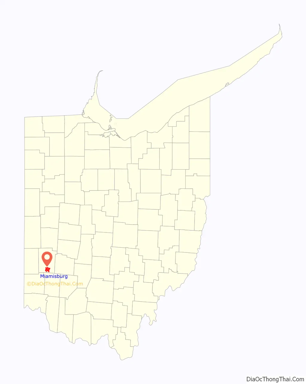
Miamisburg Road Map

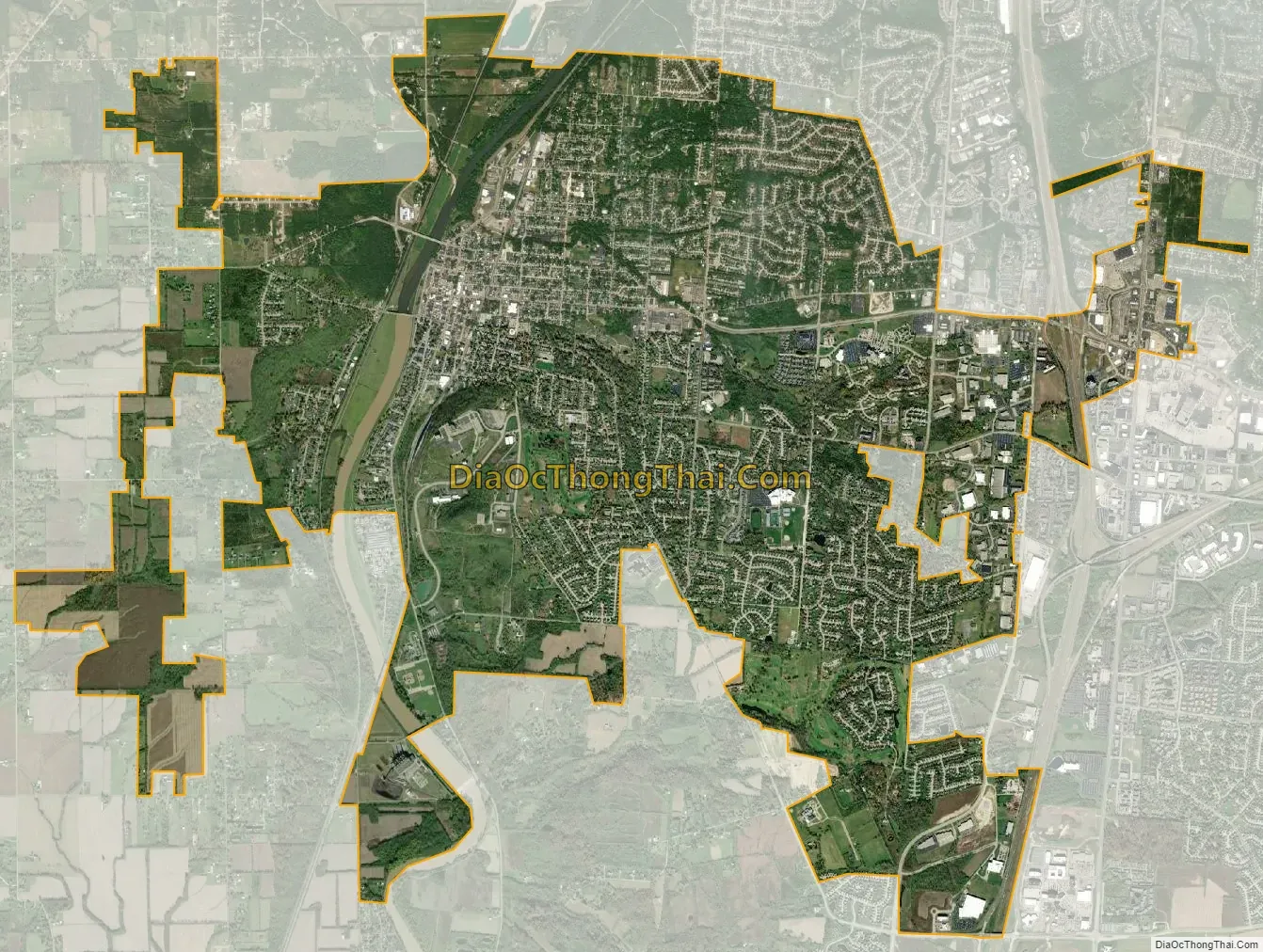
Miamisburg city Satellite Map
Geography
Miamisburg is at 39°38′19″N 84°16′31″W / 39.63861°N 84.27528°W / 39.63861; -84.27528.
According to the United States Census Bureau, the city has a total area of 12.37 square miles (32.04 km), of which 12.18 square miles (31.55 km) is land and 0.19 square miles (0.49 km) is water.
Climate
The climate of Miamisburg and the surrounding region is dominated by a humid-continental climate, characterized by hot, muggy summers and cold, dry winters. Miamisburg is prone to severe weather because of its location in the Midwestern section of the United States. Tornadoes are possible from spring to fall. Floods, blizzards, and severe thunderstorms can also occur.
Miamisburg has suffered some natural disasters. On June 9, 1869, a tornado struck the northwest part of town, reportedly destroying roofs and chimneys, as well as uprooting trees. It also destroyed Linden Avenue Bridge. Blizzards struck the town in 1978, 2004, and 2008.
In 1913, the Great Dayton Flood destroyed much of the city. Not much precipitation is needed to flood locations such as Rice Field(s), which is on the banks of the Great Miami River.
See also
Map of Ohio State and its subdivision:- Adams
- Allen
- Ashland
- Ashtabula
- Athens
- Auglaize
- Belmont
- Brown
- Butler
- Carroll
- Champaign
- Clark
- Clermont
- Clinton
- Columbiana
- Coshocton
- Crawford
- Cuyahoga
- Darke
- Defiance
- Delaware
- Erie
- Fairfield
- Fayette
- Franklin
- Fulton
- Gallia
- Geauga
- Greene
- Guernsey
- Hamilton
- Hancock
- Hardin
- Harrison
- Henry
- Highland
- Hocking
- Holmes
- Huron
- Jackson
- Jefferson
- Knox
- Lake
- Lake Erie
- Lawrence
- Licking
- Logan
- Lorain
- Lucas
- Madison
- Mahoning
- Marion
- Medina
- Meigs
- Mercer
- Miami
- Monroe
- Montgomery
- Morgan
- Morrow
- Muskingum
- Noble
- Ottawa
- Paulding
- Perry
- Pickaway
- Pike
- Portage
- Preble
- Putnam
- Richland
- Ross
- Sandusky
- Scioto
- Seneca
- Shelby
- Stark
- Summit
- Trumbull
- Tuscarawas
- Union
- Van Wert
- Vinton
- Warren
- Washington
- Wayne
- Williams
- Wood
- Wyandot
- Alabama
- Alaska
- Arizona
- Arkansas
- California
- Colorado
- Connecticut
- Delaware
- District of Columbia
- Florida
- Georgia
- Hawaii
- Idaho
- Illinois
- Indiana
- Iowa
- Kansas
- Kentucky
- Louisiana
- Maine
- Maryland
- Massachusetts
- Michigan
- Minnesota
- Mississippi
- Missouri
- Montana
- Nebraska
- Nevada
- New Hampshire
- New Jersey
- New Mexico
- New York
- North Carolina
- North Dakota
- Ohio
- Oklahoma
- Oregon
- Pennsylvania
- Rhode Island
- South Carolina
- South Dakota
- Tennessee
- Texas
- Utah
- Vermont
- Virginia
- Washington
- West Virginia
- Wisconsin
- Wyoming