Olde West Chester is a census-designated place (CDP) in West Chester Township, Butler County, Ohio, United States. The population was 240 at the 2010 census.
| Name: | Olde West Chester CDP |
|---|---|
| LSAD Code: | 57 |
| LSAD Description: | CDP (suffix) |
| State: | Ohio |
| County: | Butler County |
| Elevation: | 669 ft (204 m) |
| Total Area: | 0.36 sq mi (0.93 km²) |
| Land Area: | 0.36 sq mi (0.93 km²) |
| Water Area: | 0.00 sq mi (0.00 km²) |
| Total Population: | 201 |
| Population Density: | 563.03/sq mi (217.27/km²) |
| FIPS code: | 3958149 |
| GNISfeature ID: | 1852239 |
Online Interactive Map
Click on ![]() to view map in "full screen" mode.
to view map in "full screen" mode.
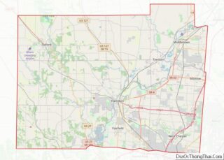
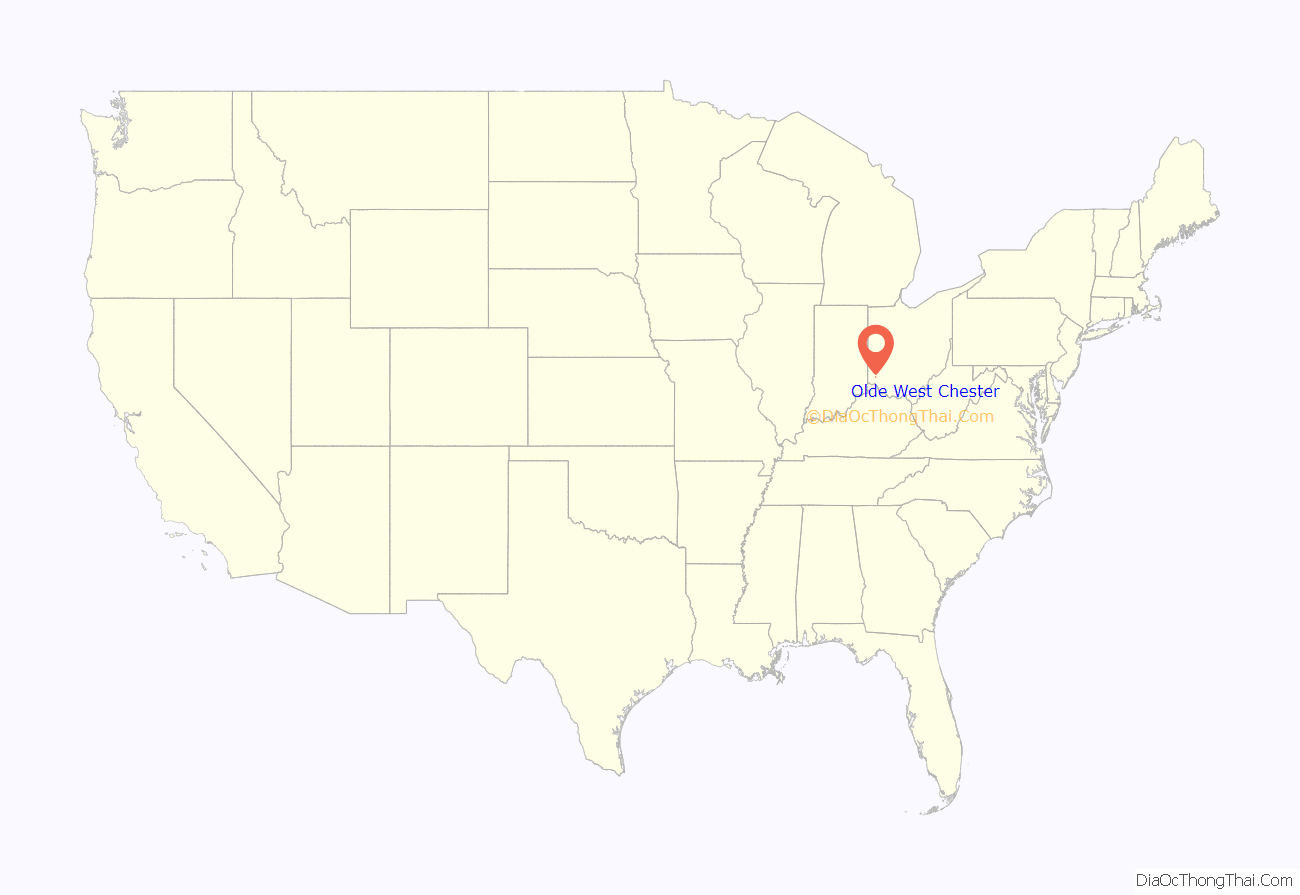
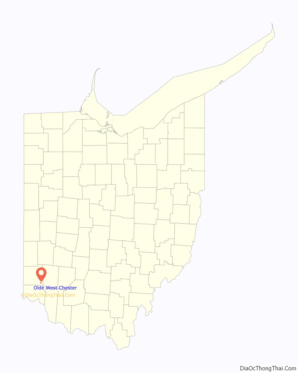
Olde West Chester location map. Where is Olde West Chester CDP?
History
Olde West Chester was originally known as Mechanicsburg, and under the latter name was laid out in 1817 by Hezekiah Smith.
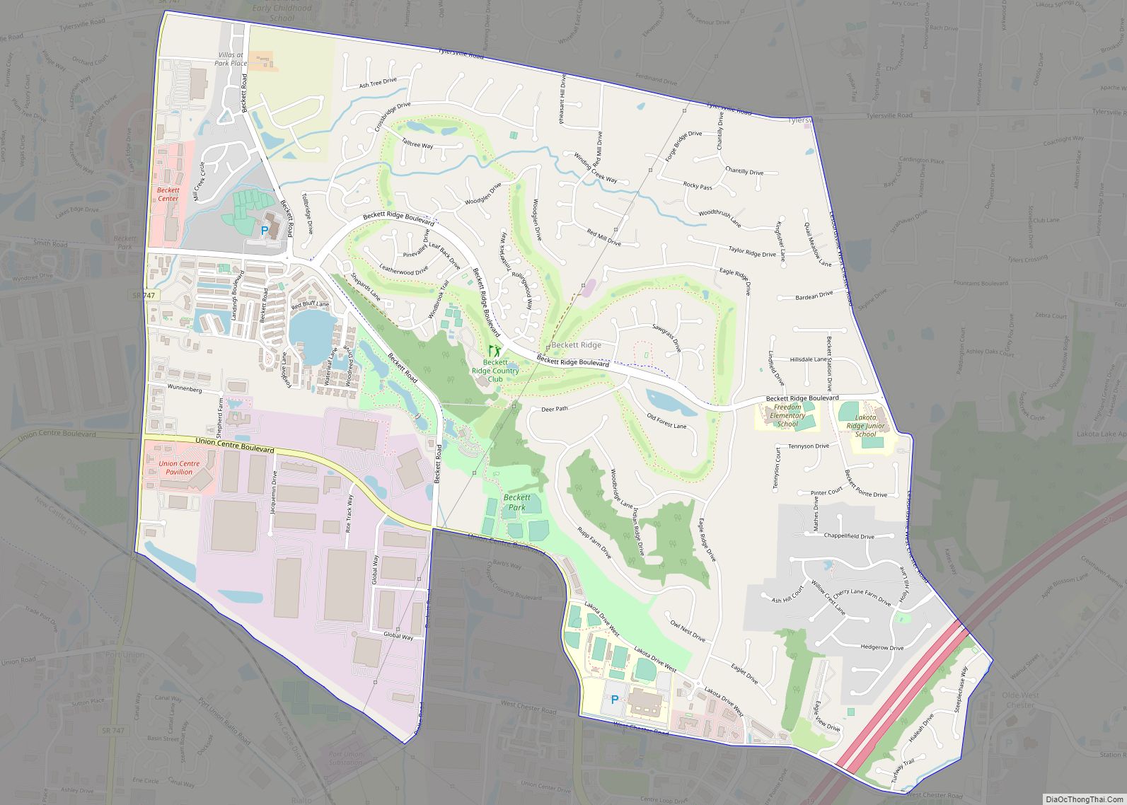
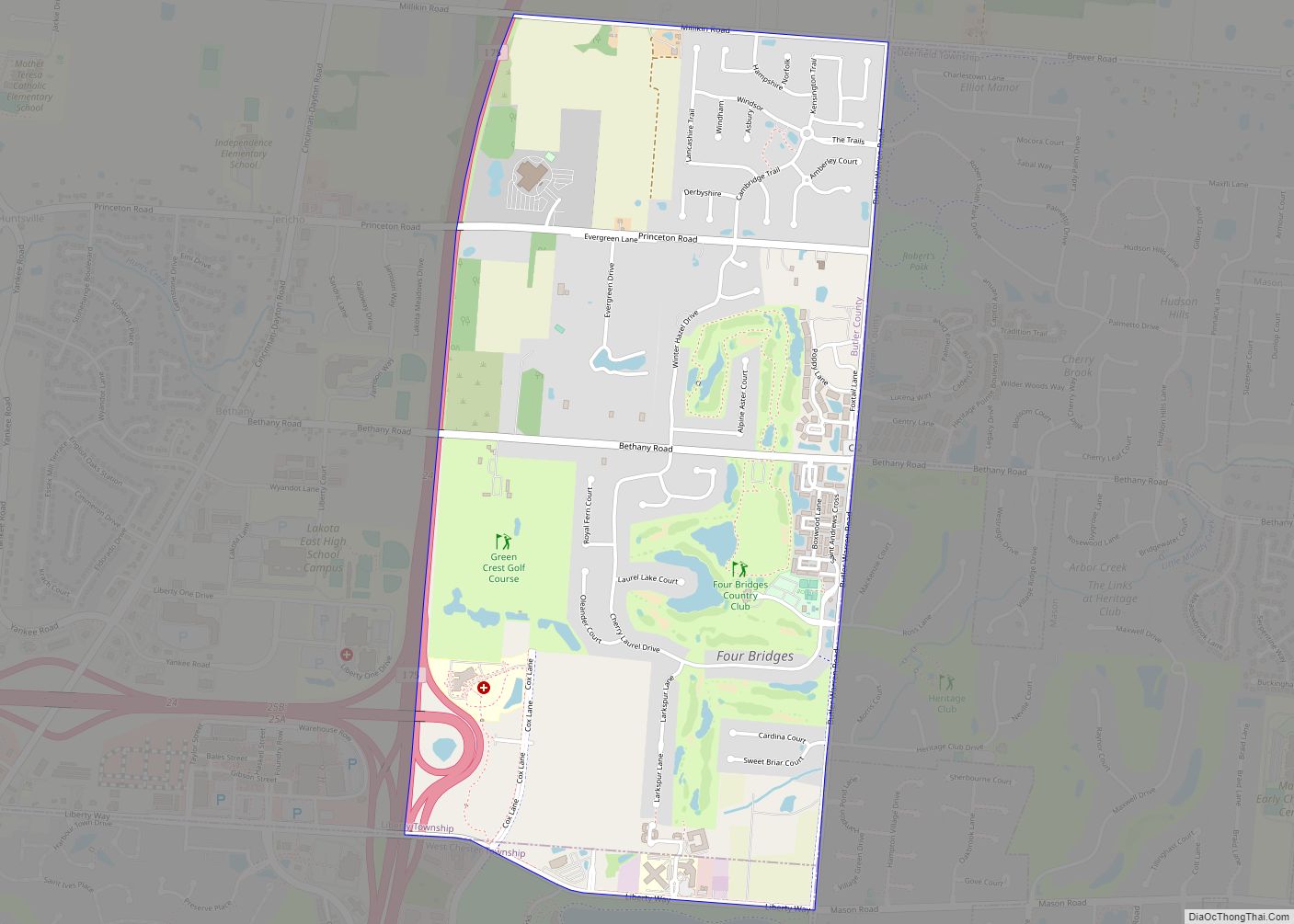
Olde West Chester Road Map
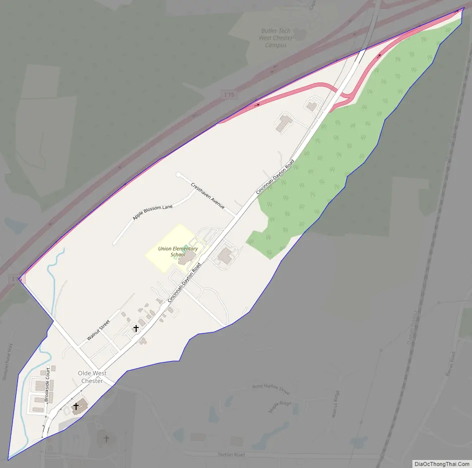
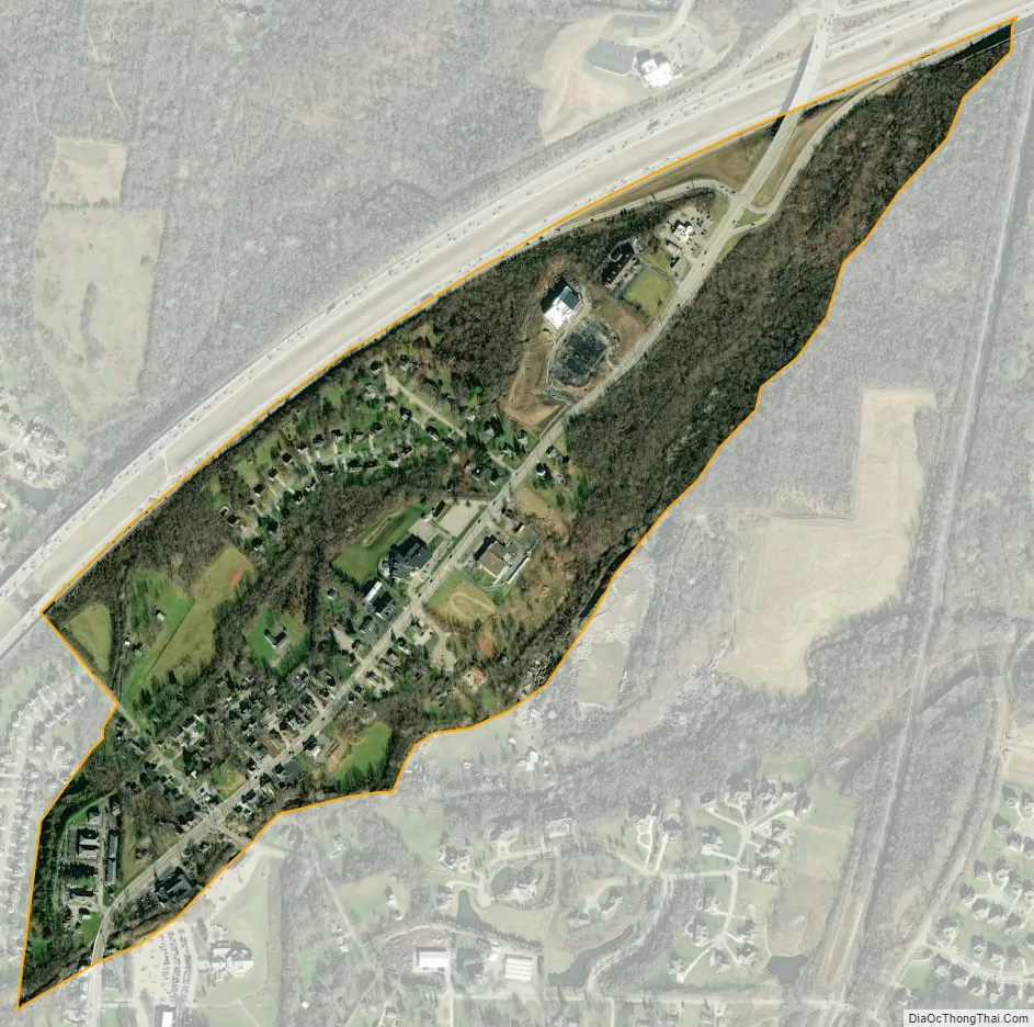
Olde West Chester city Satellite Map
Geography
Originally called simply “West Chester”, Olde West Chester is located in the center of West Chester Township at 39°19′56″N 84°24′26″W / 39.33222°N 84.40722°W / 39.33222; -84.40722 (39.332107, -84.407229). It is bordered to the west by the CDP of Beckett Ridge.
Interstate 75 forms the northwestern edge of the CDP, with access from Exit 21 to the north and Exit 19 to the south. Cincinnati-Dayton Road, formerly U.S. Route 25, the Dixie Highway, is the main street through the community. Downtown Cincinnati is 19 miles (31 km) to the south, and Dayton is 34 miles (55 km) to the north.
According to the United States Census Bureau, the Olde West Chester CDP has a total area of 0.35 square miles (0.9 km), all land.
See also
Map of Ohio State and its subdivision:- Adams
- Allen
- Ashland
- Ashtabula
- Athens
- Auglaize
- Belmont
- Brown
- Butler
- Carroll
- Champaign
- Clark
- Clermont
- Clinton
- Columbiana
- Coshocton
- Crawford
- Cuyahoga
- Darke
- Defiance
- Delaware
- Erie
- Fairfield
- Fayette
- Franklin
- Fulton
- Gallia
- Geauga
- Greene
- Guernsey
- Hamilton
- Hancock
- Hardin
- Harrison
- Henry
- Highland
- Hocking
- Holmes
- Huron
- Jackson
- Jefferson
- Knox
- Lake
- Lake Erie
- Lawrence
- Licking
- Logan
- Lorain
- Lucas
- Madison
- Mahoning
- Marion
- Medina
- Meigs
- Mercer
- Miami
- Monroe
- Montgomery
- Morgan
- Morrow
- Muskingum
- Noble
- Ottawa
- Paulding
- Perry
- Pickaway
- Pike
- Portage
- Preble
- Putnam
- Richland
- Ross
- Sandusky
- Scioto
- Seneca
- Shelby
- Stark
- Summit
- Trumbull
- Tuscarawas
- Union
- Van Wert
- Vinton
- Warren
- Washington
- Wayne
- Williams
- Wood
- Wyandot
- Alabama
- Alaska
- Arizona
- Arkansas
- California
- Colorado
- Connecticut
- Delaware
- District of Columbia
- Florida
- Georgia
- Hawaii
- Idaho
- Illinois
- Indiana
- Iowa
- Kansas
- Kentucky
- Louisiana
- Maine
- Maryland
- Massachusetts
- Michigan
- Minnesota
- Mississippi
- Missouri
- Montana
- Nebraska
- Nevada
- New Hampshire
- New Jersey
- New Mexico
- New York
- North Carolina
- North Dakota
- Ohio
- Oklahoma
- Oregon
- Pennsylvania
- Rhode Island
- South Carolina
- South Dakota
- Tennessee
- Texas
- Utah
- Vermont
- Virginia
- Washington
- West Virginia
- Wisconsin
- Wyoming