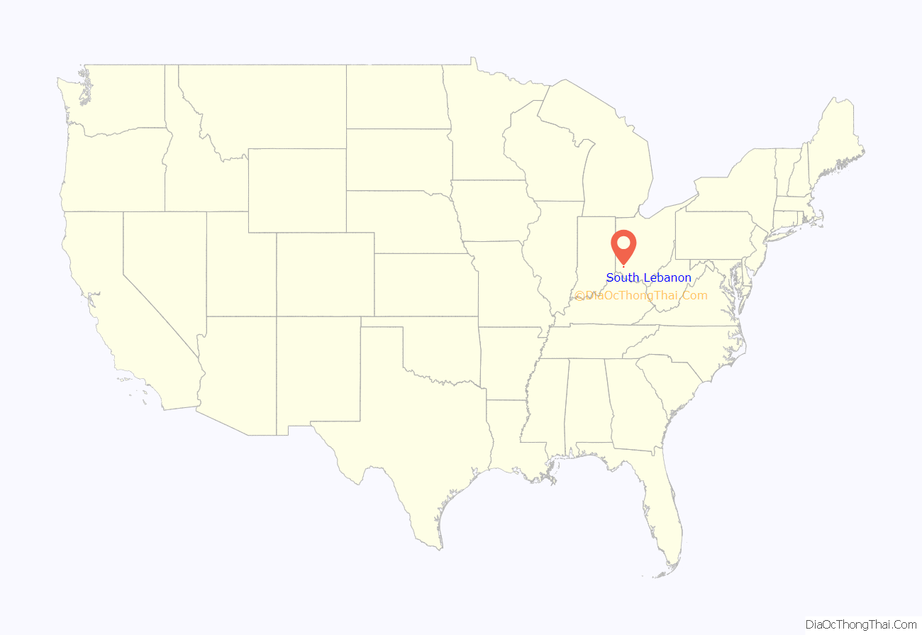
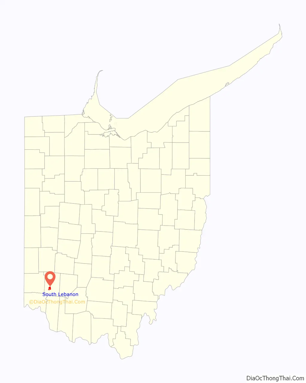
South Lebanon is a city located in Union and Hamilton Townships in central Warren County in the southwestern part of the U.S. state of Ohio. The population was 6,384 at the 2020 census.
| Name: | South Lebanon village |
|---|---|
| LSAD Code: | 47 |
| LSAD Description: | village (suffix) |
| State: | Ohio |
| County: | Warren County |
| Elevation: | 623 ft (190 m) |
| Total Area: | 3.55 sq mi (9.21 km²) |
| Land Area: | 3.43 sq mi (8.88 km²) |
| Water Area: | 0.13 sq mi (0.32 km²) |
| Total Population: | 6,384 |
| Population Density: | 1,861.77/sq mi (718.84/km²) |
| ZIP code: | 45065 |
| Area code: | 513 |
| FIPS code: | 3973446 |
| GNISfeature ID: | 1065348 |
| Website: | www.southlebanonohio.org |
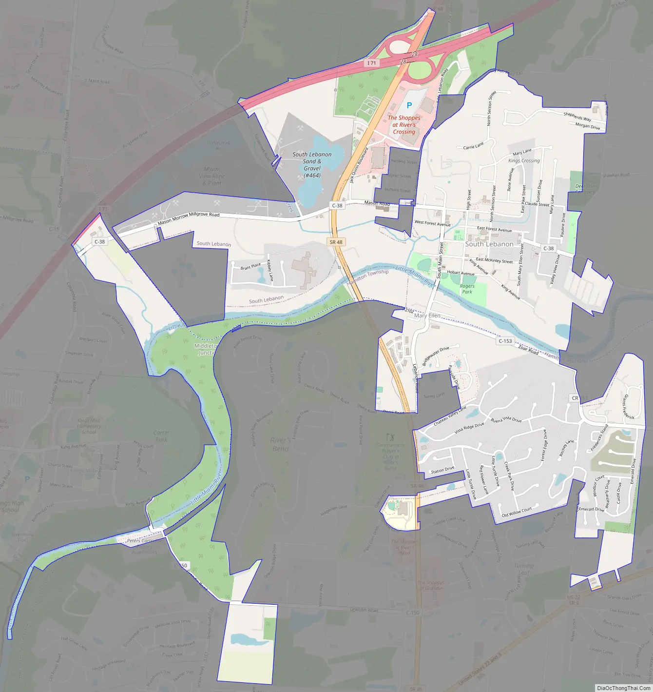
Online Interactive Map
Click on ![]() to view map in "full screen" mode.
to view map in "full screen" mode.
South Lebanon location map. Where is South Lebanon village?
History
The first settlement at South Lebanon was made in the 1790s. The village was originally called “Deerfield” because it was the chief settlement of Deerfield Township, Warren County, Ohio, but renamed because of its proximity to the county seat of Lebanon. The new name of “South Lebanon” was adopted when the railroad was built through the neighborhood. A post office was established under the name Deerfield Village in 1828, and the name of the post office was changed to South Lebanon in 1871.
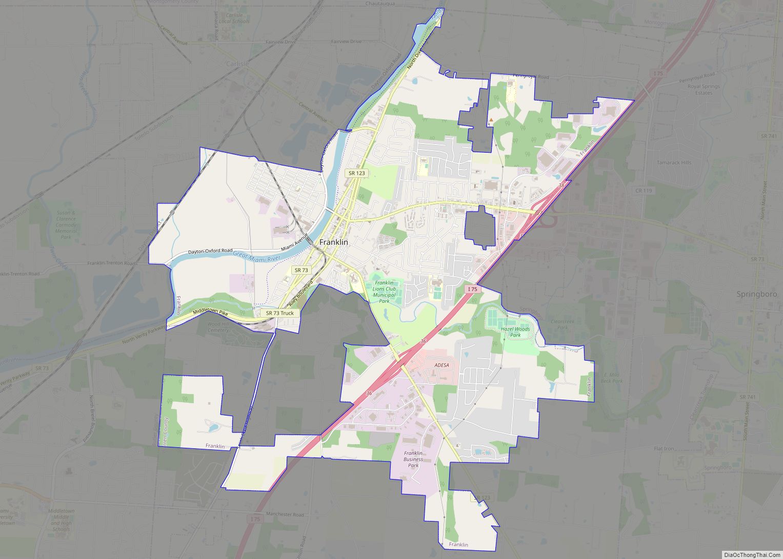
South Lebanon Road Map
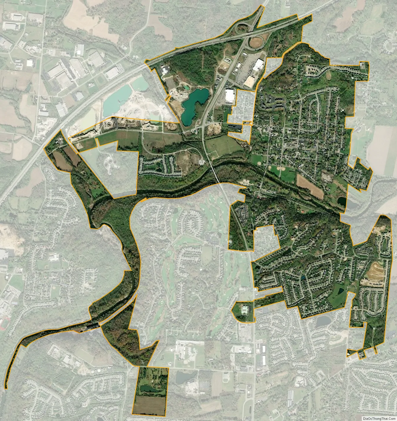
South Lebanon city Satellite Map
Geography
South Lebanon is located at 39°22′14″N 84°12′58″W / 39.37056°N 84.21611°W / 39.37056; -84.21611 (39.370581, -84.216084).
According to the United States Census Bureau, the village has a total area of 2.68 square miles (6.94 km), of which 2.65 square miles (6.86 km) is land and 0.03 square miles (0.08 km) is water.
See also
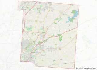
Map of Ohio State and its subdivision:- Adams
- Allen
- Ashland
- Ashtabula
- Athens
- Auglaize
- Belmont
- Brown
- Butler
- Carroll
- Champaign
- Clark
- Clermont
- Clinton
- Columbiana
- Coshocton
- Crawford
- Cuyahoga
- Darke
- Defiance
- Delaware
- Erie
- Fairfield
- Fayette
- Franklin
- Fulton
- Gallia
- Geauga
- Greene
- Guernsey
- Hamilton
- Hancock
- Hardin
- Harrison
- Henry
- Highland
- Hocking
- Holmes
- Huron
- Jackson
- Jefferson
- Knox
- Lake
- Lake Erie
- Lawrence
- Licking
- Logan
- Lorain
- Lucas
- Madison
- Mahoning
- Marion
- Medina
- Meigs
- Mercer
- Miami
- Monroe
- Montgomery
- Morgan
- Morrow
- Muskingum
- Noble
- Ottawa
- Paulding
- Perry
- Pickaway
- Pike
- Portage
- Preble
- Putnam
- Richland
- Ross
- Sandusky
- Scioto
- Seneca
- Shelby
- Stark
- Summit
- Trumbull
- Tuscarawas
- Union
- Van Wert
- Vinton
- Warren
- Washington
- Wayne
- Williams
- Wood
- Wyandot
- Alabama
- Alaska
- Arizona
- Arkansas
- California
- Colorado
- Connecticut
- Delaware
- District of Columbia
- Florida
- Georgia
- Hawaii
- Idaho
- Illinois
- Indiana
- Iowa
- Kansas
- Kentucky
- Louisiana
- Maine
- Maryland
- Massachusetts
- Michigan
- Minnesota
- Mississippi
- Missouri
- Montana
- Nebraska
- Nevada
- New Hampshire
- New Jersey
- New Mexico
- New York
- North Carolina
- North Dakota
- Ohio
- Oklahoma
- Oregon
- Pennsylvania
- Rhode Island
- South Carolina
- South Dakota
- Tennessee
- Texas
- Utah
- Vermont
- Virginia
- Washington
- West Virginia
- Wisconsin
- Wyoming