Sugarcreek is a village in Tuscarawas County, Ohio, United States. The population was 2,373 at the 2020 census. It is known as “The Little Switzerland of Ohio.” Located in Ohio’s Amish Country, the village is part of a large regional tourism industry. In the center of town stands one of the world’s largest cuckoo clocks, which was previously featured on the cover of the Guinness World Records book in 1977.
| Name: | Sugarcreek village |
|---|---|
| LSAD Code: | 47 |
| LSAD Description: | village (suffix) |
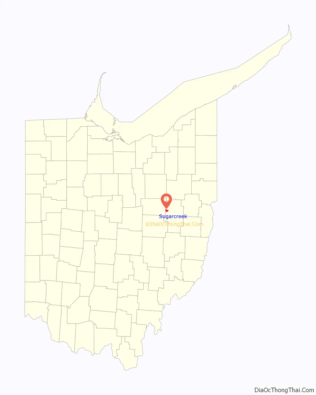
| State: | Ohio |
| County: | Tuscarawas County |
| Elevation: | 1,004 ft (306 m) |
| Total Area: | 3.80 sq mi (9.84 km²) |
| Land Area: | 3.80 sq mi (9.84 km²) |
| Water Area: | 0.00 sq mi (0.00 km²) |
| Total Population: | 2,373 |
| Population Density: | 624.31/sq mi (241.08/km²) |
| ZIP code: | 44681 |
| Area code: | 330 |
| FIPS code: | 3975210 |
| GNISfeature ID: | 1062554 |
| Website: | http://www.villageofsugarcreek.com/ |
Online Interactive Map
Click on ![]() to view map in "full screen" mode.
to view map in "full screen" mode.
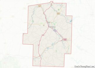
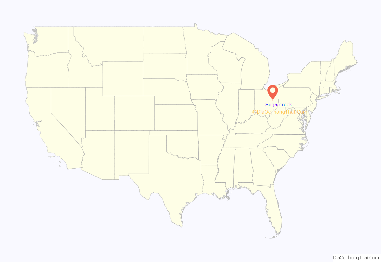
Sugarcreek location map. Where is Sugarcreek village?
History
Sugarcreek’s historical beginnings were rooted in cheese production. Swiss immigrants arrived in the early 1830s and used the milk from Amish dairy farms to produce their cheese and in the 1950s created an annual Ohio Swiss Festival; the success of early festivals as an attraction for tourists resulted in local business leaders transforming the town into a Swiss village starting in 1965. By the early 1970s the first tourist-oriented businesses were opening, and the tourism industry in Sugarcreek was centered not only around the Amish but also around a steam engine passenger train operated by the Ohio Central Railroad which ran between Sugarcreek and Baltic until 2004. Since the train stopped running, tourism in Sugarcreek has decreased. Trollinger theorizes that unlike Walnut Creek and Berlin, which support a nostalgia that reassures tourists that what they are nostalgic for still exists in America, and is therefore a nostalgia of hope, the Swiss theme of Sugarcreek inspires a nostalgia for something that is forever gone—that is, a period in which the United States was a white-majority country—and so does not reassure.
Shanesville was founded in 1814 by Anthony Shane at the intersection of two Indian trails (currently Ohio State Routes 39 and 93). This village was surpassed in size and stature by Sugarcreek (then known as East Shanesville) when the railroads came in the mid-19th century. Shanesville was administratively merged with Sugarcreek in 1969, and took up the current name for the village.[1]
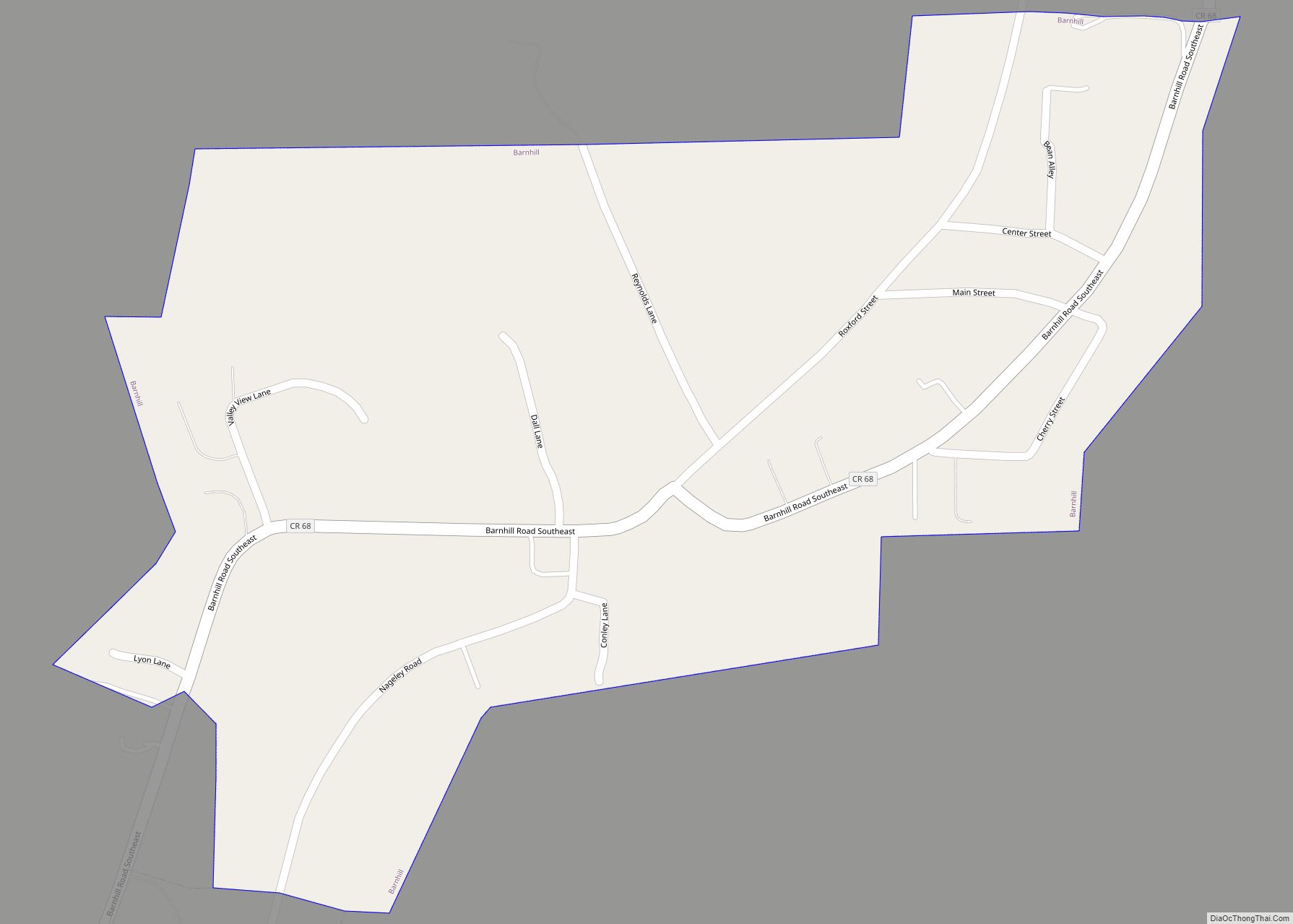
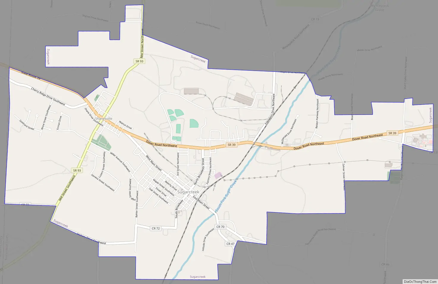
Sugarcreek Road Map
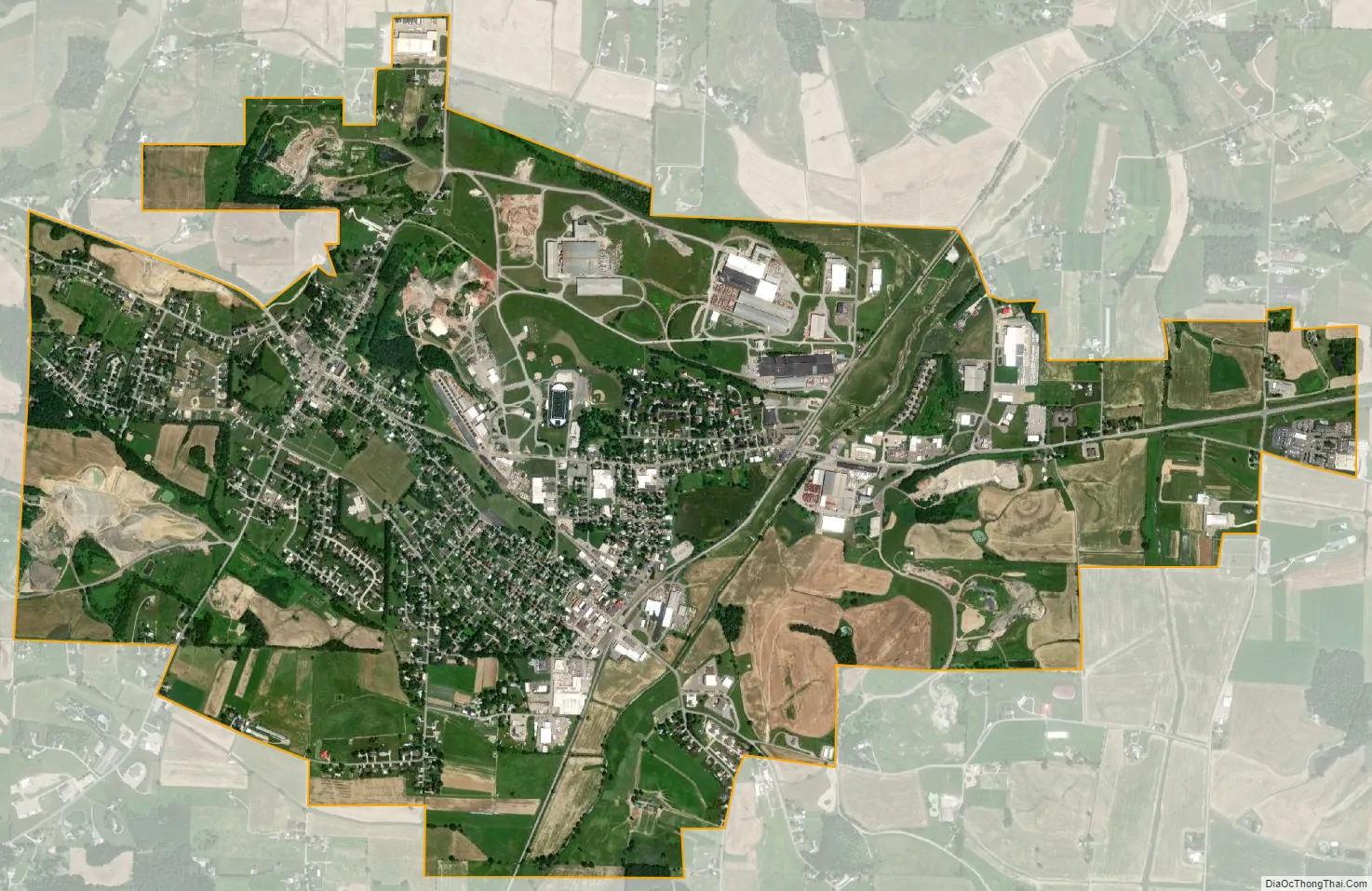
Sugarcreek city Satellite Map
Geography
Sugarcreek is located at 40°30′24″N 81°38′30″W / 40.50667°N 81.64167°W / 40.50667; -81.64167 (40.506637, -81.641728), along the South Fork of Sugar Creek. According to the U.S. Census Bureau, the village has a total area of 3.79 square miles (9.82 km), all land.
See also
Map of Ohio State and its subdivision:- Adams
- Allen
- Ashland
- Ashtabula
- Athens
- Auglaize
- Belmont
- Brown
- Butler
- Carroll
- Champaign
- Clark
- Clermont
- Clinton
- Columbiana
- Coshocton
- Crawford
- Cuyahoga
- Darke
- Defiance
- Delaware
- Erie
- Fairfield
- Fayette
- Franklin
- Fulton
- Gallia
- Geauga
- Greene
- Guernsey
- Hamilton
- Hancock
- Hardin
- Harrison
- Henry
- Highland
- Hocking
- Holmes
- Huron
- Jackson
- Jefferson
- Knox
- Lake
- Lake Erie
- Lawrence
- Licking
- Logan
- Lorain
- Lucas
- Madison
- Mahoning
- Marion
- Medina
- Meigs
- Mercer
- Miami
- Monroe
- Montgomery
- Morgan
- Morrow
- Muskingum
- Noble
- Ottawa
- Paulding
- Perry
- Pickaway
- Pike
- Portage
- Preble
- Putnam
- Richland
- Ross
- Sandusky
- Scioto
- Seneca
- Shelby
- Stark
- Summit
- Trumbull
- Tuscarawas
- Union
- Van Wert
- Vinton
- Warren
- Washington
- Wayne
- Williams
- Wood
- Wyandot
- Alabama
- Alaska
- Arizona
- Arkansas
- California
- Colorado
- Connecticut
- Delaware
- District of Columbia
- Florida
- Georgia
- Hawaii
- Idaho
- Illinois
- Indiana
- Iowa
- Kansas
- Kentucky
- Louisiana
- Maine
- Maryland
- Massachusetts
- Michigan
- Minnesota
- Mississippi
- Missouri
- Montana
- Nebraska
- Nevada
- New Hampshire
- New Jersey
- New Mexico
- New York
- North Carolina
- North Dakota
- Ohio
- Oklahoma
- Oregon
- Pennsylvania
- Rhode Island
- South Carolina
- South Dakota
- Tennessee
- Texas
- Utah
- Vermont
- Virginia
- Washington
- West Virginia
- Wisconsin
- Wyoming