Union is a city in Montgomery and Miami Counties in the U.S. state of Ohio. The population was 6,859 at the time of the 2020 census. It is part of the Dayton Metropolitan Statistical Area.
| Name: | Union city |
|---|---|
| LSAD Code: | 25 |
| LSAD Description: | city (suffix) |
| State: | Ohio |
| County: | Miami County, Montgomery County |
| Founded: | 1806 |
| Incorporated: | 1982 (as city) |
| Elevation: | 922 ft (281 m) |
| Total Area: | 8.38 sq mi (21.69 km²) |
| Land Area: | 8.30 sq mi (21.50 km²) |
| Water Area: | 0.08 sq mi (0.20 km²) |
| Total Population: | 6,859 |
| Population Density: | 826.39/sq mi (319.06/km²) |
| ZIP code: | 45322 and 45377 |
| Area code: | 937, 326 |
| FIPS code: | 3978470 |
| GNISfeature ID: | 1049256 |
| Website: | http://www.unionoh.org/ |
Online Interactive Map
Click on ![]() to view map in "full screen" mode.
to view map in "full screen" mode.
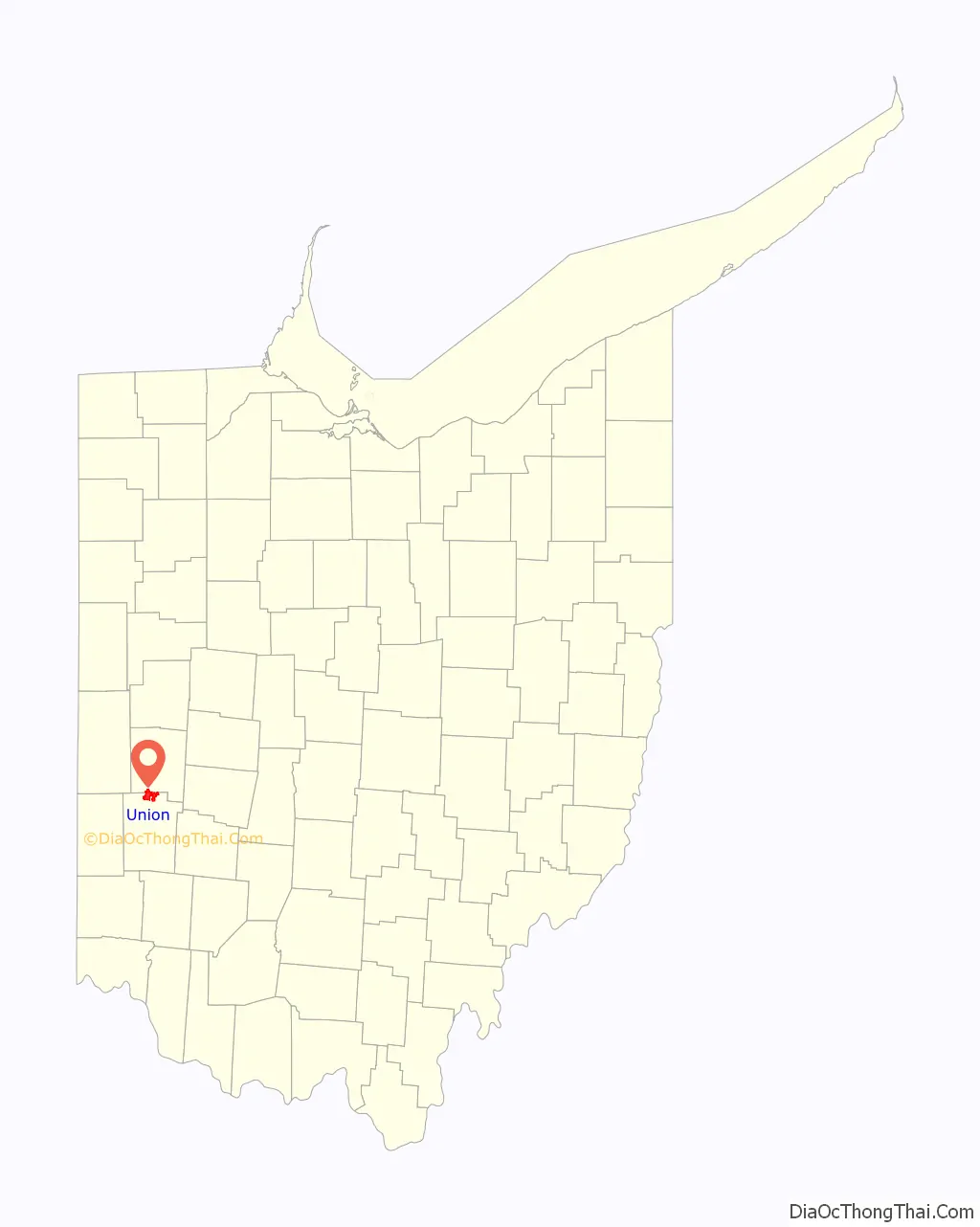
Union location map. Where is Union city?
Union Road Map
Union city Satellite Map
Geography
The coordinates for The City of Union are 39°54′1″N 84°18′49″W / 39.90028°N 84.31361°W / 39.90028; -84.31361 (39.900154, -84.313494).
According to the United States Census Bureau, the city has a total area of 8.602 square miles (22.28 km), of which 8.522 square miles (22.07 km) is land and 0.08 square miles (0.21 km) is water. The Stillwater River runs on its east side.
Ironically, Union lies west of West Union, Ohio, the county seat of Adams County approximately 60 miles east of Cincinnati. Union and West Union are not adjacent to each other, actually being approximately 120 miles from each other.
Transportation
One major state highway, State Route 48, runs through Union. In Union, State Route 48 is known as Main Street. Union is 4 miles north of Interstate 70.
See also
Map of Ohio State and its subdivision:- Adams
- Allen
- Ashland
- Ashtabula
- Athens
- Auglaize
- Belmont
- Brown
- Butler
- Carroll
- Champaign
- Clark
- Clermont
- Clinton
- Columbiana
- Coshocton
- Crawford
- Cuyahoga
- Darke
- Defiance
- Delaware
- Erie
- Fairfield
- Fayette
- Franklin
- Fulton
- Gallia
- Geauga
- Greene
- Guernsey
- Hamilton
- Hancock
- Hardin
- Harrison
- Henry
- Highland
- Hocking
- Holmes
- Huron
- Jackson
- Jefferson
- Knox
- Lake
- Lake Erie
- Lawrence
- Licking
- Logan
- Lorain
- Lucas
- Madison
- Mahoning
- Marion
- Medina
- Meigs
- Mercer
- Miami
- Monroe
- Montgomery
- Morgan
- Morrow
- Muskingum
- Noble
- Ottawa
- Paulding
- Perry
- Pickaway
- Pike
- Portage
- Preble
- Putnam
- Richland
- Ross
- Sandusky
- Scioto
- Seneca
- Shelby
- Stark
- Summit
- Trumbull
- Tuscarawas
- Union
- Van Wert
- Vinton
- Warren
- Washington
- Wayne
- Williams
- Wood
- Wyandot
- Alabama
- Alaska
- Arizona
- Arkansas
- California
- Colorado
- Connecticut
- Delaware
- District of Columbia
- Florida
- Georgia
- Hawaii
- Idaho
- Illinois
- Indiana
- Iowa
- Kansas
- Kentucky
- Louisiana
- Maine
- Maryland
- Massachusetts
- Michigan
- Minnesota
- Mississippi
- Missouri
- Montana
- Nebraska
- Nevada
- New Hampshire
- New Jersey
- New Mexico
- New York
- North Carolina
- North Dakota
- Ohio
- Oklahoma
- Oregon
- Pennsylvania
- Rhode Island
- South Carolina
- South Dakota
- Tennessee
- Texas
- Utah
- Vermont
- Virginia
- Washington
- West Virginia
- Wisconsin
- Wyoming

