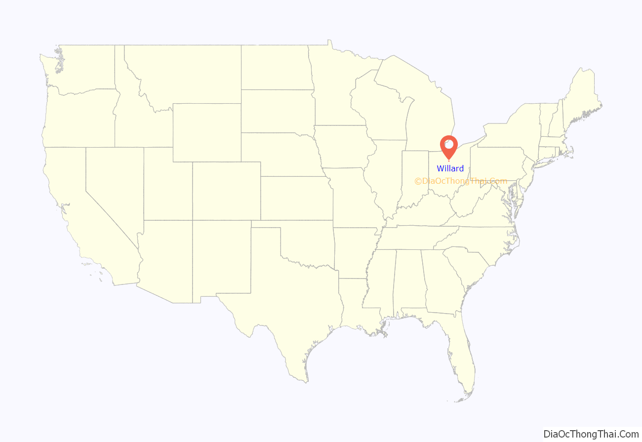
Willard is a city in southwestern Huron County, Ohio, United States, approximately 14 miles (23 km) southwest of Norwalk. The population was 6,236 at the 2010 census.
| Name: | Willard city |
|---|---|
| LSAD Code: | 25 |
| LSAD Description: | city (suffix) |
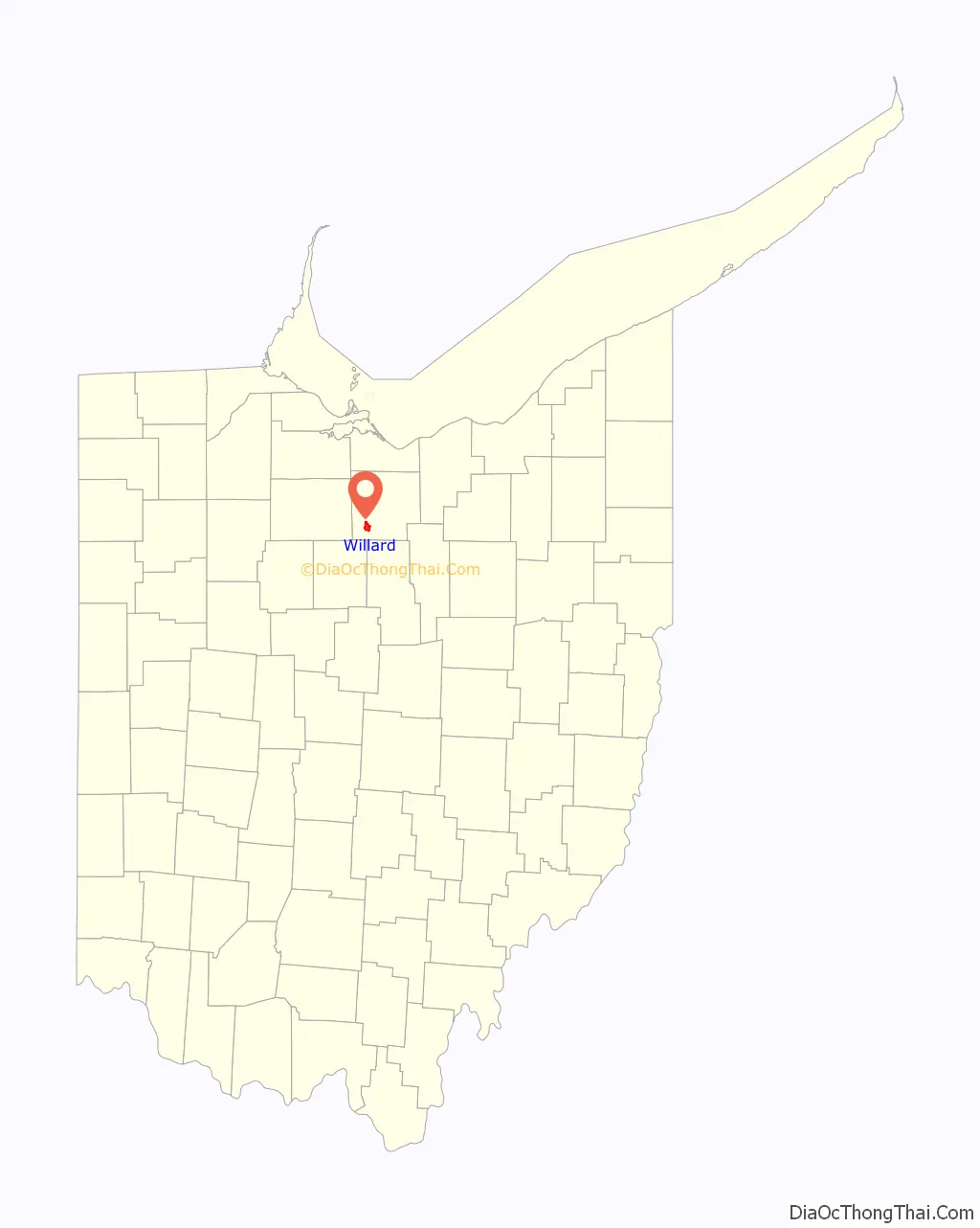
| State: | Ohio |
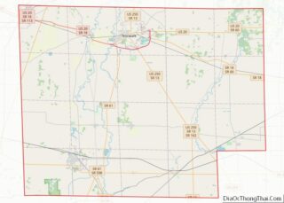
| County: | Huron County |
| Elevation: | 928 ft (283 m) |
| Total Area: | 3.60 sq mi (9.33 km²) |
| Land Area: | 3.58 sq mi (9.27 km²) |
| Water Area: | 0.02 sq mi (0.06 km²) |
| Total Population: | 6,197 |
| Population Density: | 1,731.01/sq mi (668.27/km²) |
| ZIP code: | 44888, 44890 |
| Area code: | 419 |
| FIPS code: | 3985232 |
| GNISfeature ID: | 1058142 |
| Website: | www.willardohio.us |
Online Interactive Map
Click on ![]() to view map in "full screen" mode.
to view map in "full screen" mode.
Willard location map. Where is Willard city?
History
The original name of Willard was Chicago, named for the junction of the Baltimore and Ohio Railroad’s line to Sandusky (the Sandusky, Mansfield and Newark Railroad) and the branch west to Chicago (the Baltimore and Ohio and Chicago Railroad). Later the Akron and Chicago Junction Railroad was built east from the junction, providing a more direct route between the Northeastern United States and Chicago.
With the name “Chicago”, passengers would mistake the community for Chicago, Illinois, so they changed the name to Chicago Junction, however, the word “junction” did not fit on boards at the time so it did not fix the problem. In 1917, to finally rectify the confusion, the town changed its name to Willard, after the then president of the B&O, Daniel Willard. Willard officially became a city in the year of 1960
Willard Road Map
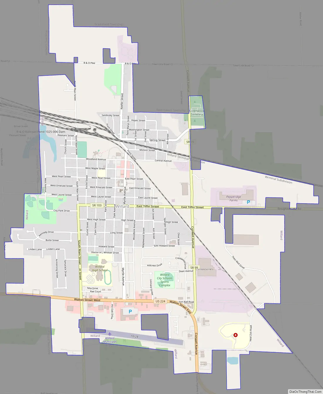
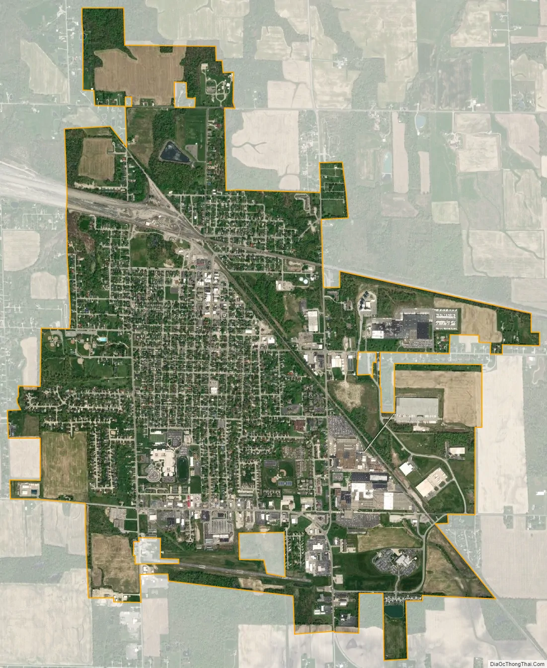
Willard city Satellite Map
Geography
Willard is located at 41°3′17″N 82°43′41″W / 41.05472°N 82.72806°W / 41.05472; -82.72806 (41.054649, -82.727982).
According to the United States Census Bureau, the city has a total area of 3.57 square miles (9.25 km), of which 3.55 square miles (9.19 km) is land and 0.02 square miles (0.05 km) is water.
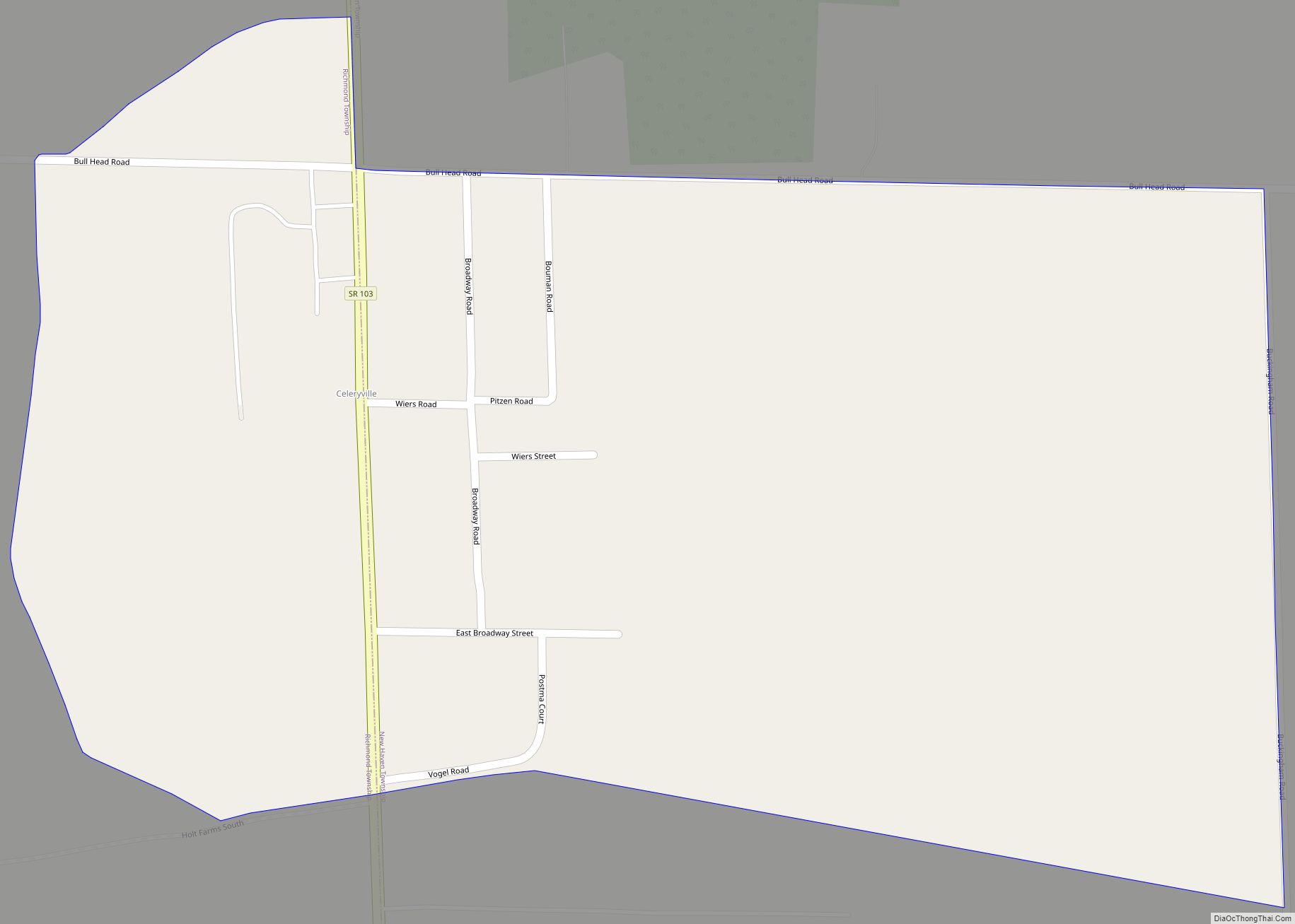
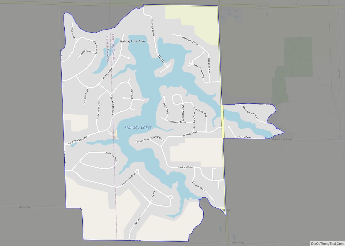
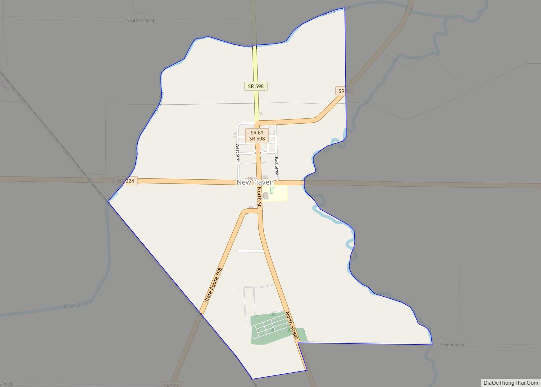
To the south of Willard are located the unincorporated communities of Celeryville and New Haven, plus the planned development of Holiday Lakes to the north.
See also
Map of Ohio State and its subdivision:- Adams
- Allen
- Ashland
- Ashtabula
- Athens
- Auglaize
- Belmont
- Brown
- Butler
- Carroll
- Champaign
- Clark
- Clermont
- Clinton
- Columbiana
- Coshocton
- Crawford
- Cuyahoga
- Darke
- Defiance
- Delaware
- Erie
- Fairfield
- Fayette
- Franklin
- Fulton
- Gallia
- Geauga
- Greene
- Guernsey
- Hamilton
- Hancock
- Hardin
- Harrison
- Henry
- Highland
- Hocking
- Holmes
- Huron
- Jackson
- Jefferson
- Knox
- Lake
- Lake Erie
- Lawrence
- Licking
- Logan
- Lorain
- Lucas
- Madison
- Mahoning
- Marion
- Medina
- Meigs
- Mercer
- Miami
- Monroe
- Montgomery
- Morgan
- Morrow
- Muskingum
- Noble
- Ottawa
- Paulding
- Perry
- Pickaway
- Pike
- Portage
- Preble
- Putnam
- Richland
- Ross
- Sandusky
- Scioto
- Seneca
- Shelby
- Stark
- Summit
- Trumbull
- Tuscarawas
- Union
- Van Wert
- Vinton
- Warren
- Washington
- Wayne
- Williams
- Wood
- Wyandot
- Alabama
- Alaska
- Arizona
- Arkansas
- California
- Colorado
- Connecticut
- Delaware
- District of Columbia
- Florida
- Georgia
- Hawaii
- Idaho
- Illinois
- Indiana
- Iowa
- Kansas
- Kentucky
- Louisiana
- Maine
- Maryland
- Massachusetts
- Michigan
- Minnesota
- Mississippi
- Missouri
- Montana
- Nebraska
- Nevada
- New Hampshire
- New Jersey
- New Mexico
- New York
- North Carolina
- North Dakota
- Ohio
- Oklahoma
- Oregon
- Pennsylvania
- Rhode Island
- South Carolina
- South Dakota
- Tennessee
- Texas
- Utah
- Vermont
- Virginia
- Washington
- West Virginia
- Wisconsin
- Wyoming