Huntingdon is a borough in (and the county seat of) Huntingdon County, Pennsylvania, United States. It is located along the Juniata River, approximately 32 miles (51 km) east of Altoona and 92 miles (148 km) west of Harrisburg. With a population of 7,093 at the 2010 census, it is the largest population center near Raystown Lake, a winding, 28-mile-long (45 km) flood-control reservoir managed by the U.S. Army Corps of Engineers.
The borough is located on the main line of the Norfolk Southern (formerly Pennsylvania) Railway, in an agricultural and outdoor recreational region with extensive forests and scattered deposits of ganister rock, coal, fire clay, and limestone. Historically, the region surrounding Huntingdon was dotted with iron furnaces and forges, consuming limestone, iron ore and wood (for charcoal production) throughout the 19th century. Dairy farms dominate the local agriculture. The town is a regular stop for the daily Amtrak service which connects Pittsburgh with Philadelphia and New York City.
Huntingdon is home to Juniata College, a private liberal arts college founded by members of the Church of the Brethren in 1876.
| Name: | Huntingdon borough |
|---|---|
| LSAD Code: | 21 |
| LSAD Description: | borough (suffix) |
| State: | Pennsylvania |
| County: | Huntingdon County |
| Incorporated: | 1796 |
| Elevation: | 643 ft (196 m) |
| Total Area: | 3.70 sq mi (9.59 km²) |
| Land Area: | 3.62 sq mi (9.37 km²) |
| Water Area: | 0.08 sq mi (0.22 km²) |
| Total Population: | 6,827 |
| Population Density: | 1,887.48/sq mi (728.70/km²) |
| ZIP code: | 16652, 16654 |
| Area code: | 814 |
| FIPS code: | 4236368 |
| Website: | huntingdonboro.com |
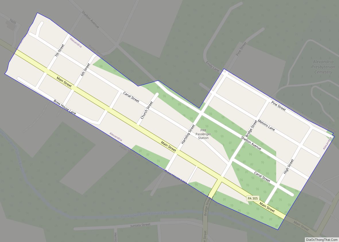
Online Interactive Map
Click on ![]() to view map in "full screen" mode.
to view map in "full screen" mode.
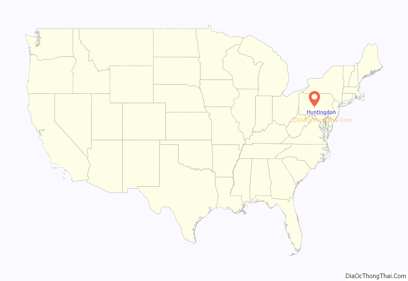
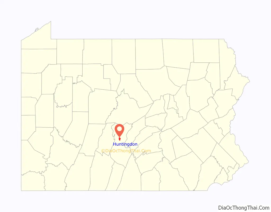
Huntingdon location map. Where is Huntingdon borough?
History
The original inhabitants of Huntingdon and neighboring counties were the Susquehannock. Through a combination of ongoing war with other indigenous nations, such as the Haudenosaunee, disease brought by Europeans, and violence from settlers, the Susquehannock are currently thought to have been entirely wiped out or subsumed by other tribes.
In 1768, Rev. Dr. William Smith began selling lots on the Standing Stone Tract along the Juniata, land he had recently acquired. The tracts’ two prior owners had not attempted to lay out a town, so Dr. Smith is considered the founder. Huntingdon (the name by which he eventually called his town) sits at the site of corn fields that had been cultivated at a date now unknown, next to where Standing Stone Creek flows into the Juniata River. The 100th anniversary of its incorporation was marked by the erection of a “Standing Stone Monument” on Third Street, modeled on a tall, narrow shaft known to have existed before 1750, whose purpose is unclear but may have served as a trail marker. It may be significant that natural sandstone formations (popularly called Pulpit Rocks), which “stand erect”, are on a nearby ridge. A story surfaced during the early 19th century that Smith had renamed Standing Stone Settlement to honor an Englishwoman, Selina Hastings, Countess of Huntingdon. Smith’s descendants vehemently denied the story, and there exists no evidence to support it, despite a wide circulation in published sources. More likely, the Anglican cleric named it after the town of the same name in England; doing so had become a pattern for naming Pennsylvania settlements, Bedford, Carlisle and York being nearby examples of the trend. In 1796, the little village was incorporated as a borough.
Huntingdon long served as the junction of the Huntingdon and Broad Top Mountain Railroad with the Pennsylvania Railroad, and as an important port on the Main Line of Public Works of the Pennsylvania Canal. In past years, Huntingdon boasted of manufacturers of flour, heavy machinery, radiators, furniture, stationery, woolen goods, shirts, shoes, electronic components, finished lumber, fiberglass yarn, matting and underground storage tanks. In the 19th century, J. C. Blair, a native of Shade Gap and a stationer and businessman, popularized the writing tablet and began marketing it nationwide. His factory in downtown Huntingdon was later relocated to nearby Alexandria.
Huntingdon’s Herncane Broom Factory was founded in 1863 by Benjamin F. Herncane. The 1897 Commemorative Biographical Encyclopedia of the Juniata Valley reported that the factory’s output was twenty-five dozens per day and furnished “all the brooms used by the Pennsylvania Railroad Company.” The company employed 14 workers and 3 traveling salesman. The building stood on Fourteenth Street from number 1416 to 1422. On 27 February 1903, the Everett Press reported that the “Herncane Broom Factory of Huntingdon was destroyed by fire last Saturday night. Loss about $1500.” Brothers Walter S. and George B. Herncane, who worked with their father at the broom factory, went on to found the Herncane Bros. general store, which stood at the corner of 6th and Washington.
The vicinity (but not much of the town proper) has been the subject of repeated flooding, in 1889, in 1936, and again in 1972. More recently in 2004, Hurricane Ivan resulted in major flooding close to Huntingdon, the worst since the remnants of Hurricane Agnes stalled over the region in July 1972.
The Huntingdon Borough Historic District was listed on the National Register of Historic Places in 1986.
St. Johns Episcopal Church
Huntingdon County Sheriff’s Office
Mutual Benefit Building at 4th and Washington streets
Post office
From June 8 to 11, 2017, Huntingdon celebrated its 250th anniversary.
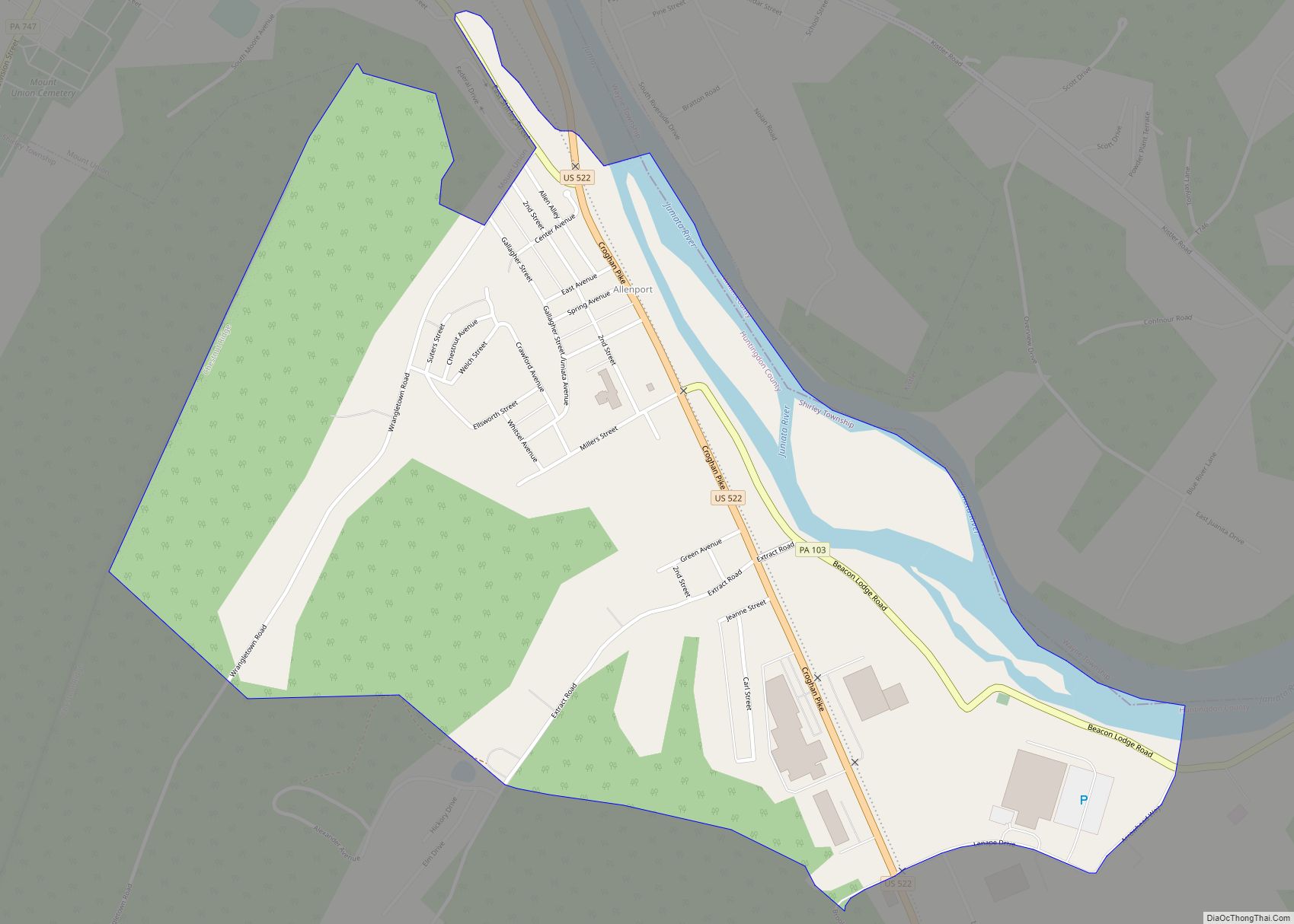
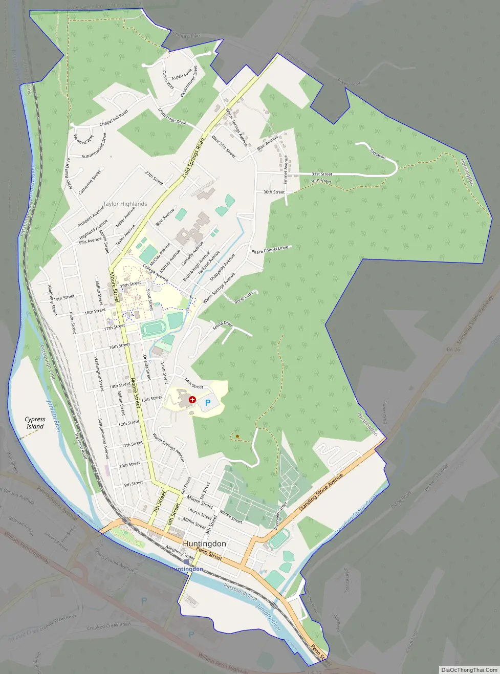
Huntingdon Road Map
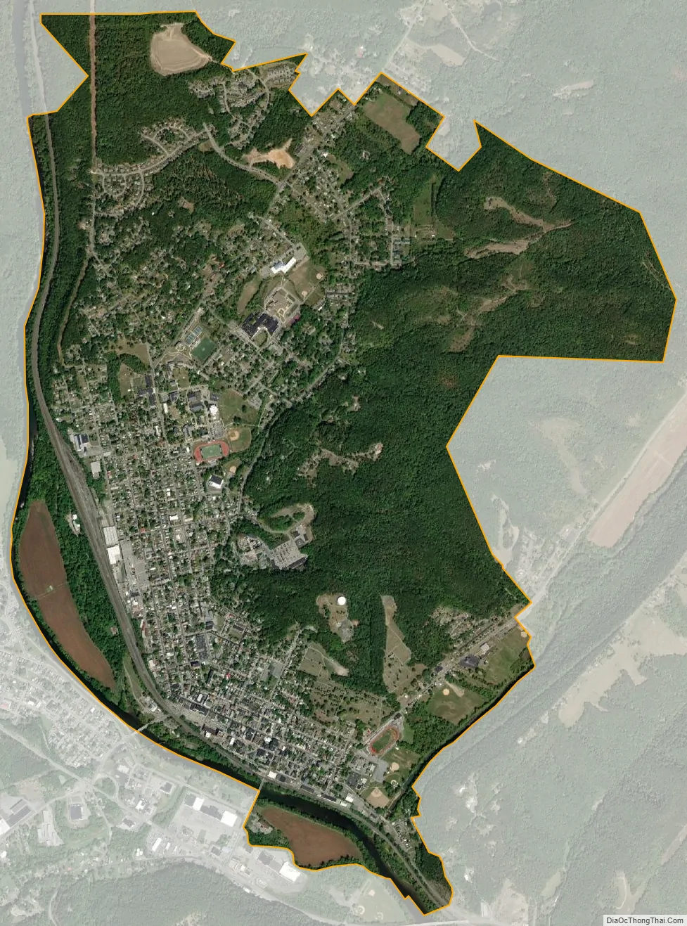
Huntingdon city Satellite Map
Geography
Huntingdon is located north of the center of Huntingdon County at 40°29′43″N 78°0′47″W / 40.49528°N 78.01306°W / 40.49528; -78.01306 (40.495187, -78.013147), on the northeast side of the Juniata River, an east-flowing major tributary of the Susquehanna River.
According to the United States Census Bureau, the borough has a total area of 3.7 square miles (9.6 km), of which 3.6 square miles (9.4 km) are land and 0.1 square miles (0.2 km), or 2.50%, are water.
Adjacent municipalities
The following municipalities are also located in Huntingdon County, bordering on the borough:
- Smithfield Township to the south and west, across the Juniata River
- Henderson Township to the east
- Oneida Township to the north and east
Climate
Huntingdon has a humid continental climate (Köppen Dfa), with warm summers and moderately cold winters.
See also
Map of Pennsylvania State and its subdivision:- Adams
- Allegheny
- Armstrong
- Beaver
- Bedford
- Berks
- Blair
- Bradford
- Bucks
- Butler
- Cambria
- Cameron
- Carbon
- Centre
- Chester
- Clarion
- Clearfield
- Clinton
- Columbia
- Crawford
- Cumberland
- Dauphin
- Delaware
- Elk
- Erie
- Fayette
- Forest
- Franklin
- Fulton
- Greene
- Huntingdon
- Indiana
- Jefferson
- Juniata
- Lackawanna
- Lancaster
- Lawrence
- Lebanon
- Lehigh
- Luzerne
- Lycoming
- Mc Kean
- Mercer
- Mifflin
- Monroe
- Montgomery
- Montour
- Northampton
- Northumberland
- Perry
- Philadelphia
- Pike
- Potter
- Schuylkill
- Snyder
- Somerset
- Sullivan
- Susquehanna
- Tioga
- Union
- Venango
- Warren
- Washington
- Wayne
- Westmoreland
- Wyoming
- York
- Alabama
- Alaska
- Arizona
- Arkansas
- California
- Colorado
- Connecticut
- Delaware
- District of Columbia
- Florida
- Georgia
- Hawaii
- Idaho
- Illinois
- Indiana
- Iowa
- Kansas
- Kentucky
- Louisiana
- Maine
- Maryland
- Massachusetts
- Michigan
- Minnesota
- Mississippi
- Missouri
- Montana
- Nebraska
- Nevada
- New Hampshire
- New Jersey
- New Mexico
- New York
- North Carolina
- North Dakota
- Ohio
- Oklahoma
- Oregon
- Pennsylvania
- Rhode Island
- South Carolina
- South Dakota
- Tennessee
- Texas
- Utah
- Vermont
- Virginia
- Washington
- West Virginia
- Wisconsin
- Wyoming