Alexandria is a borough in Huntingdon County, Pennsylvania, United States. The population was 388 at the 2020 census.
| Name: | Alexandria borough |
|---|---|
| LSAD Code: | 21 |
| LSAD Description: | borough (suffix) |
| State: | Pennsylvania |
| County: | Huntingdon County |
| Elevation: | 699 ft (213 m) |
| Total Area: | 0.11 sq mi (0.29 km²) |
| Land Area: | 0.11 sq mi (0.29 km²) |
| Water Area: | 0.00 sq mi (0.00 km²) |
| Total Population: | 384 |
| Population Density: | 3,368.42/sq mi (1,304.42/km²) |
| Area code: | 814 |
| FIPS code: | 4200756 |
Online Interactive Map
Click on ![]() to view map in "full screen" mode.
to view map in "full screen" mode.
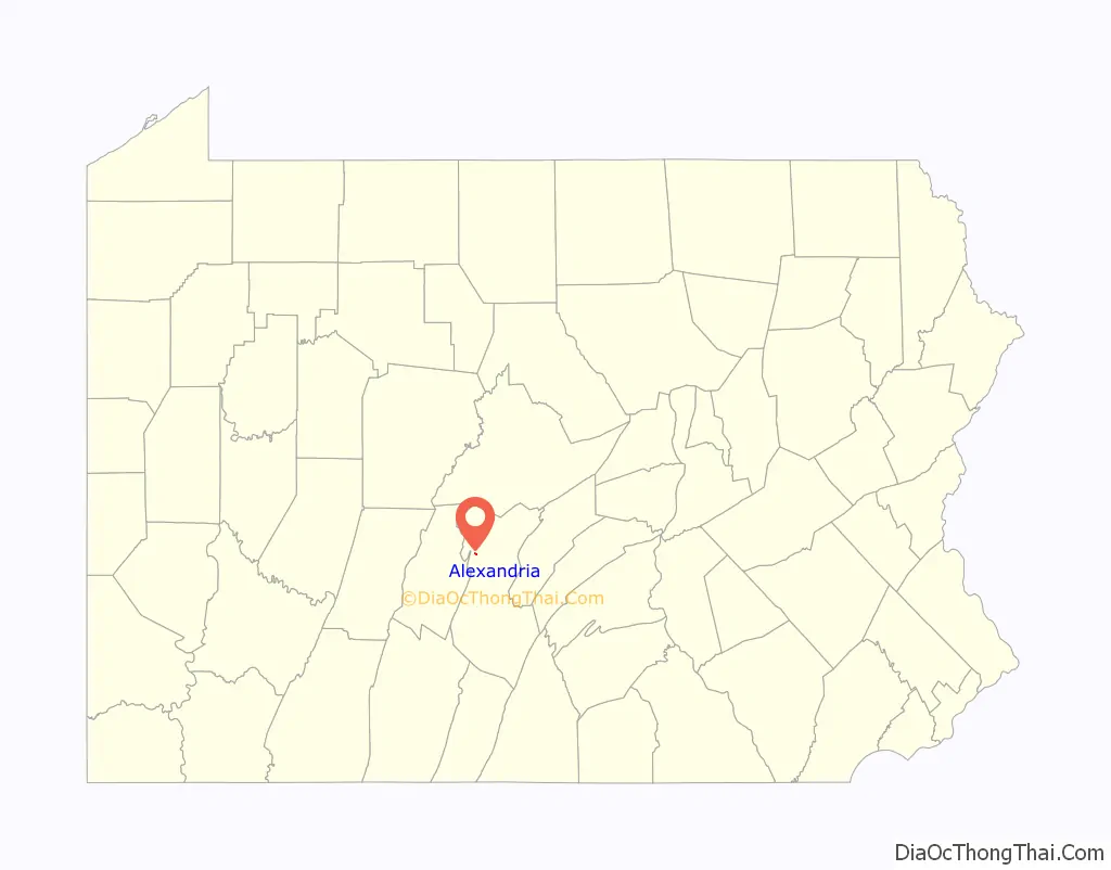
Alexandria location map. Where is Alexandria borough?

History
The year 1744 is the first record of John Hart’s “logg”, near where Alexandria is located now. During the land purchase of 1755 James Sterrat of Carlisle purchased 400 acres including the sleeping place called John Hart’s log on the Juniata River, which is now Alexandria.
Some time in the years before 1785 the first mention of a religious group called Hartslog Presbyterian Congregation was formed. A log worship house, Old Hartslog Church, stood upon the hill one mile (1.6 km) north of the present site of the town of Alexandria, where a burial ground was later made. This was a primitive structure but by 1787 a floor was laid, six large windows set in, a large door constructed, and a pulpit and a communion table made. In 1794 it was laid off into four sections, and fitted with pews. In 1826, the old Hartslog congregation moved to a brick building, referred to by Senator John Scott in his memoirs as the “Brick Church”, which seems to have been located near to the site of the present Reformed Church. The old log worship house was taken down the same year, and some of its logs were used in one or two of the dwellings of Alexandria.
In the late 18th century the primary transportation to and from Alexandria was the Juniata River, suitable only during summer and when the water depth permitted. On May 3, 1808, the new road from Harrisburg to Alexandria opened, permitting a more reliable connection with the outside world. In 1833 the Juniata Division of the Pennsylvania Canal was opened, the promise of better transportation started a mini housing boom in Alexandria. By 1875 the canal was abandoned and the Pennsylvania Railroad managed the transportation needs of the area. Around this time the growth of the area slowed, while the populations of Huntingdon and Hollidaysburg grew.
Old railway station
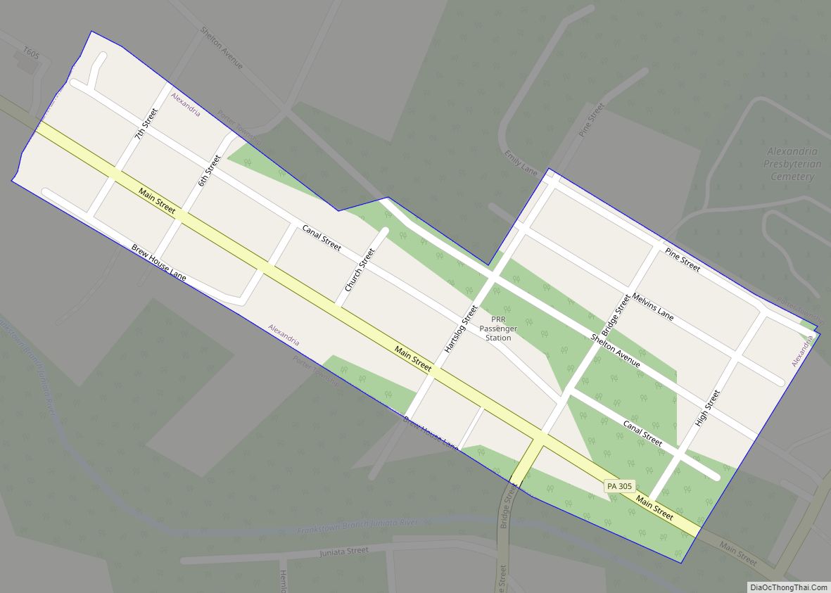
Alexandria Road Map

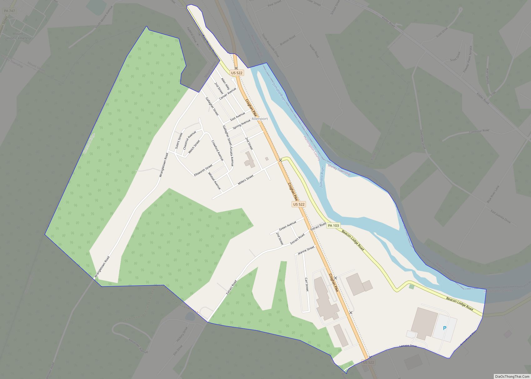
Alexandria city Satellite Map

Geography
According to the United States Census Bureau, the borough has a total area of 0.1 square miles (0.3 km), all land.
See also
Map of Pennsylvania State and its subdivision:- Adams
- Allegheny
- Armstrong
- Beaver
- Bedford
- Berks
- Blair
- Bradford
- Bucks
- Butler
- Cambria
- Cameron
- Carbon
- Centre
- Chester
- Clarion
- Clearfield
- Clinton
- Columbia
- Crawford
- Cumberland
- Dauphin
- Delaware
- Elk
- Erie
- Fayette
- Forest
- Franklin
- Fulton
- Greene
- Huntingdon
- Indiana
- Jefferson
- Juniata
- Lackawanna
- Lancaster
- Lawrence
- Lebanon
- Lehigh
- Luzerne
- Lycoming
- Mc Kean
- Mercer
- Mifflin
- Monroe
- Montgomery
- Montour
- Northampton
- Northumberland
- Perry
- Philadelphia
- Pike
- Potter
- Schuylkill
- Snyder
- Somerset
- Sullivan
- Susquehanna
- Tioga
- Union
- Venango
- Warren
- Washington
- Wayne
- Westmoreland
- Wyoming
- York
- Alabama
- Alaska
- Arizona
- Arkansas
- California
- Colorado
- Connecticut
- Delaware
- District of Columbia
- Florida
- Georgia
- Hawaii
- Idaho
- Illinois
- Indiana
- Iowa
- Kansas
- Kentucky
- Louisiana
- Maine
- Maryland
- Massachusetts
- Michigan
- Minnesota
- Mississippi
- Missouri
- Montana
- Nebraska
- Nevada
- New Hampshire
- New Jersey
- New Mexico
- New York
- North Carolina
- North Dakota
- Ohio
- Oklahoma
- Oregon
- Pennsylvania
- Rhode Island
- South Carolina
- South Dakota
- Tennessee
- Texas
- Utah
- Vermont
- Virginia
- Washington
- West Virginia
- Wisconsin
- Wyoming