Akaska (/əˈkæskə/; ə-KAS-kə) is a town in Walworth County, South Dakota, United States. The population was 77 at the 2020 census. The community name derives from a Sioux word meaning “uncertain”.
| Name: | Akaska town |
|---|---|
| LSAD Code: | 43 |
| LSAD Description: | town (suffix) |
| State: | South Dakota |
| County: | Walworth County |
| Incorporated: | 1907 |
| Elevation: | 1,778 ft (542 m) |
| Total Area: | 0.61 sq mi (1.58 km²) |
| Land Area: | 0.61 sq mi (1.58 km²) |
| Water Area: | 0.00 sq mi (0.00 km²) |
| Total Population: | 77 |
| Population Density: | 126.02/sq mi (48.68/km²) |
| ZIP code: | 57420 |
| Area code: | 605 |
| FIPS code: | 4600540 |
| GNISfeature ID: | 1265103 |
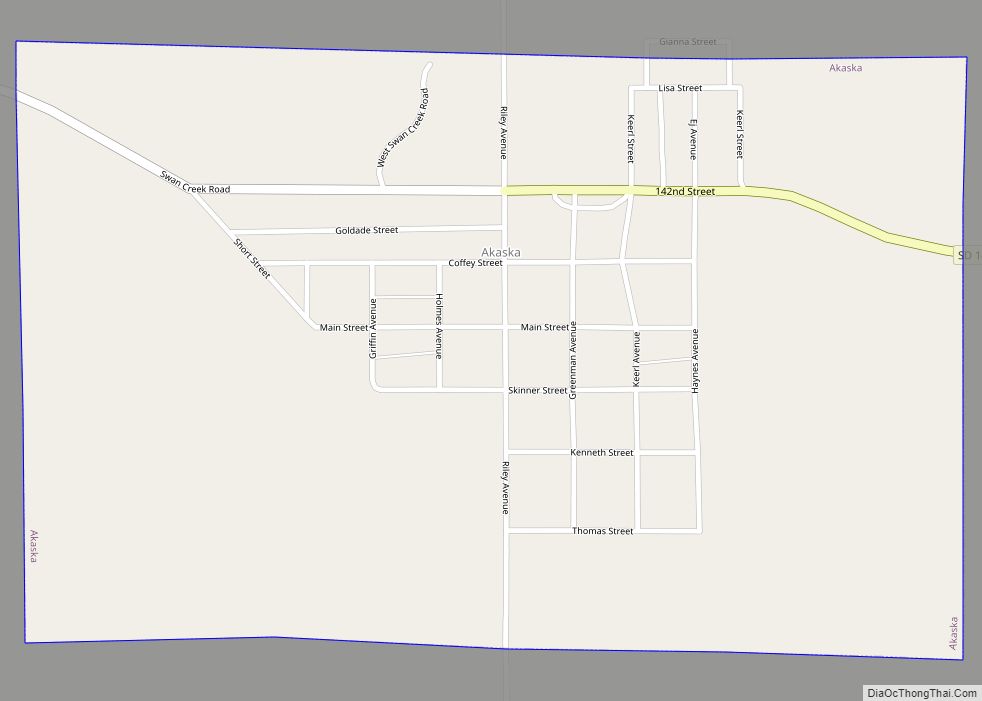
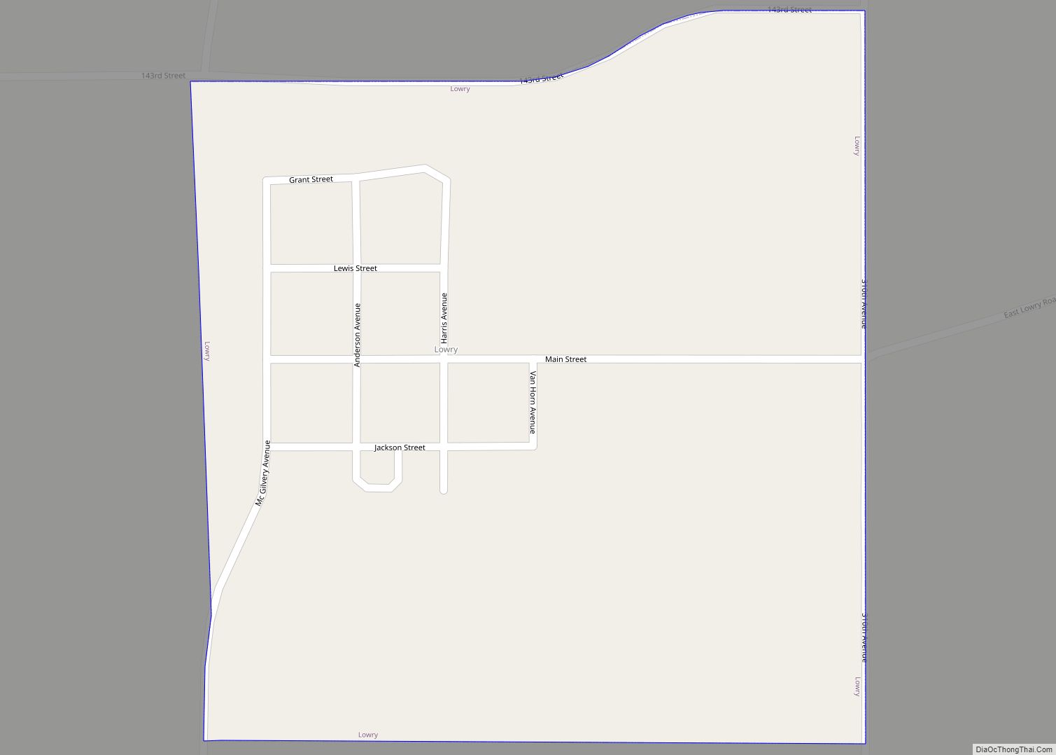
Online Interactive Map
Click on ![]() to view map in "full screen" mode.
to view map in "full screen" mode.
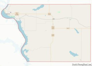
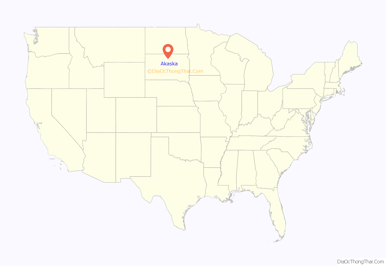
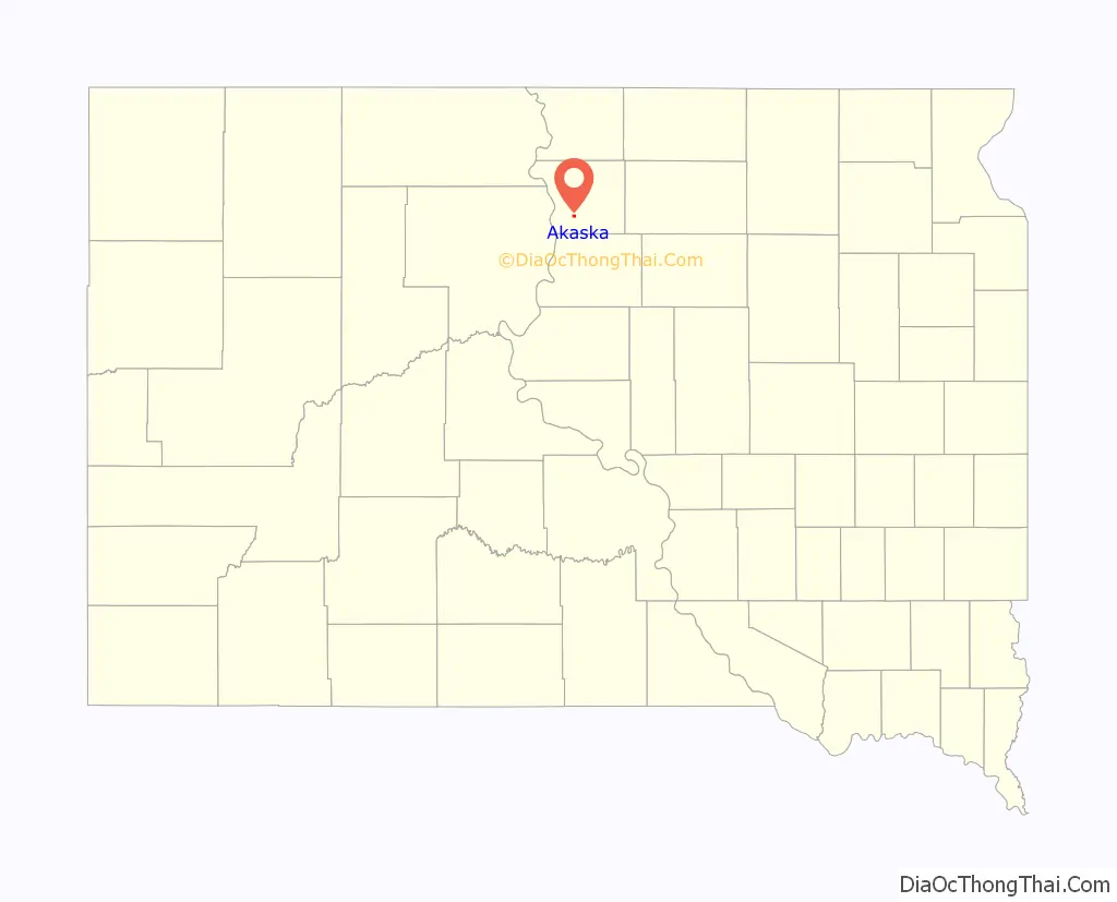
Akaska location map. Where is Akaska town?
History
Akaska was founded in 1907 as a station stop on a branch line of the Minneapolis and St. Louis Railway built that year between Conde and LeBeau, South Dakota. Railway service to Akaska ended in 1940.
Akaska Road Map
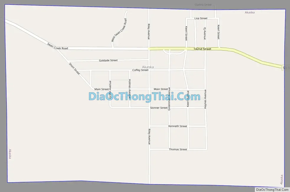
Akaska city Satellite Map

Geography
Akaska is located at 45°19′55″N 100°7′11″W / 45.33194°N 100.11972°W / 45.33194; -100.11972 (45.331844, -100.119717).
According to the United States Census Bureau, the town has a total area of 0.61 square miles (1.58 km), all land.
Akaska has been assigned the ZIP code 57420, and the FIPS place code 00540.
See also
Map of South Dakota State and its subdivision:- Aurora
- Beadle
- Bennett
- Bon Homme
- Brookings
- Brown
- Brule
- Buffalo
- Butte
- Campbell
- Charles Mix
- Clark
- Clay
- Codington
- Corson
- Custer
- Davison
- Day
- Deuel
- Dewey
- Douglas
- Edmunds
- Fall River
- Faulk
- Grant
- Gregory
- Haakon
- Hamlin
- Hand
- Hanson
- Harding
- Hughes
- Hutchinson
- Hyde
- Jackson
- Jerauld
- Jones
- Kingsbury
- Lake
- Lawrence
- Lincoln
- Lyman
- Marshall
- McCook
- McPherson
- Meade
- Mellette
- Miner
- Minnehaha
- Moody
- Pennington
- Perkins
- Potter
- Roberts
- Sanborn
- Shannon
- Spink
- Stanley
- Sully
- Todd
- Tripp
- Turner
- Union
- Walworth
- Yankton
- Ziebach
- Alabama
- Alaska
- Arizona
- Arkansas
- California
- Colorado
- Connecticut
- Delaware
- District of Columbia
- Florida
- Georgia
- Hawaii
- Idaho
- Illinois
- Indiana
- Iowa
- Kansas
- Kentucky
- Louisiana
- Maine
- Maryland
- Massachusetts
- Michigan
- Minnesota
- Mississippi
- Missouri
- Montana
- Nebraska
- Nevada
- New Hampshire
- New Jersey
- New Mexico
- New York
- North Carolina
- North Dakota
- Ohio
- Oklahoma
- Oregon
- Pennsylvania
- Rhode Island
- South Carolina
- South Dakota
- Tennessee
- Texas
- Utah
- Vermont
- Virginia
- Washington
- West Virginia
- Wisconsin
- Wyoming