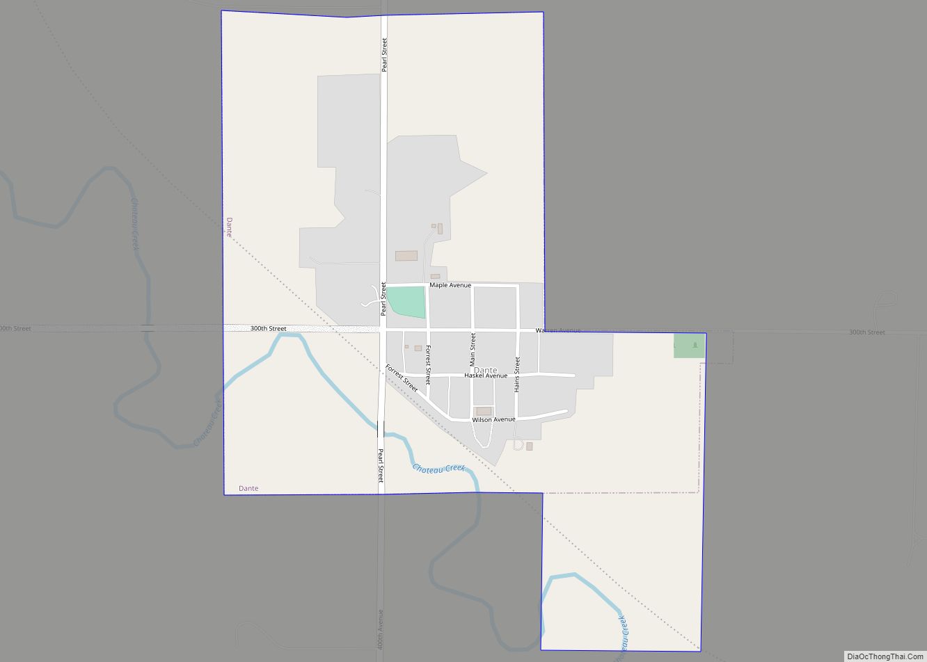
Dante is a town in Charles Mix County, South Dakota, United States. The population was 75 at the 2020 census.
| Name: | Dante town |
|---|---|
| LSAD Code: | 43 |
| LSAD Description: | town (suffix) |
| State: | South Dakota |
| County: | Charles Mix County |
| Elevation: | 1,391 ft (424 m) |
| Total Area: | 0.50 sq mi (1.29 km²) |
| Land Area: | 0.50 sq mi (1.29 km²) |
| Water Area: | 0.00 sq mi (0.00 km²) |
| Total Population: | 75 |
| Population Density: | 150.30/sq mi (57.98/km²) |
| ZIP code: | 57329 |
| Area code: | 605 |
| FIPS code: | 4615420 |
| GNISfeature ID: | 1254601 |
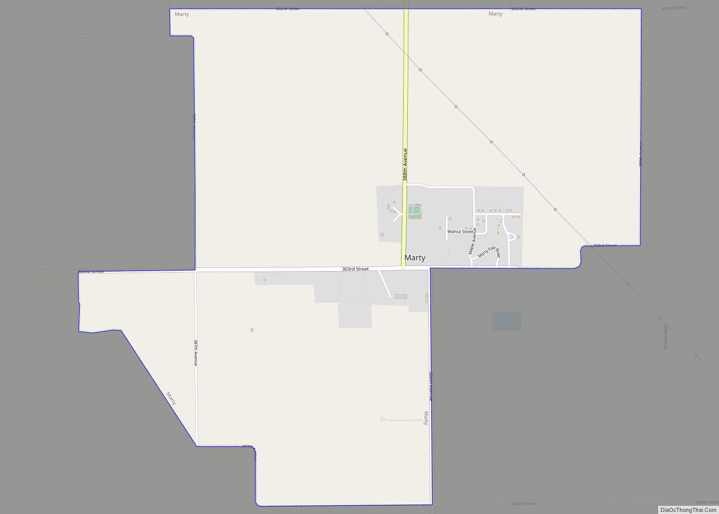
Online Interactive Map
Click on ![]() to view map in "full screen" mode.
to view map in "full screen" mode.
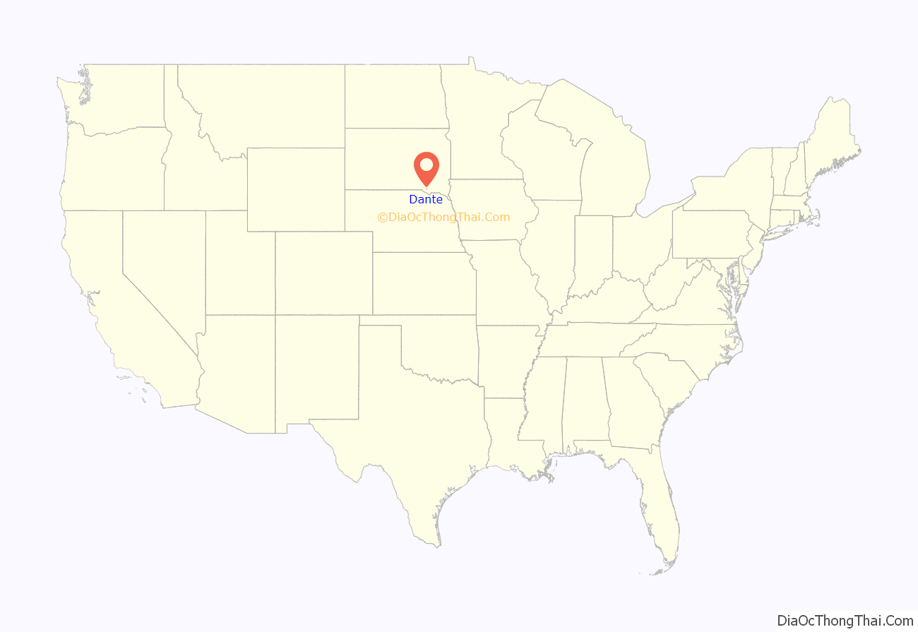
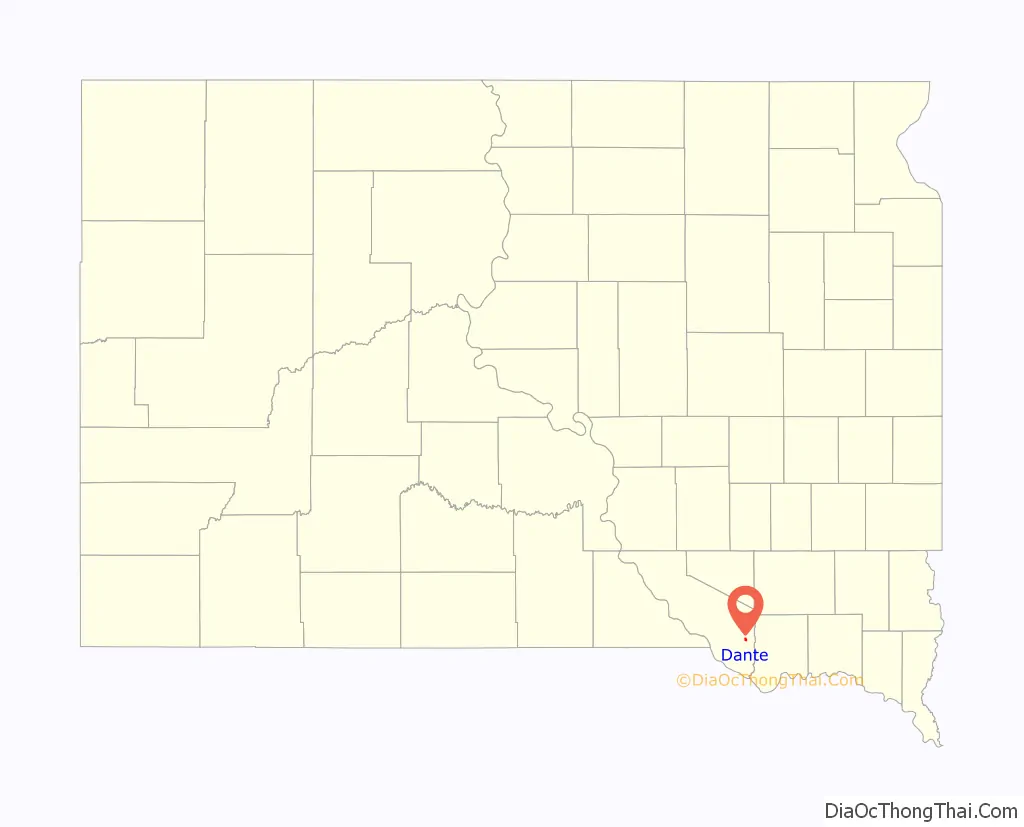
Dante location map. Where is Dante town?
History
Dante was originally called Mayo, and under the latter name was laid out in 1908, and named for H.T. Mayo, an early settler. However, in 1910 when the railroad came to the town, officials balked at building a depot in a town named Mayo (a name which for unclear reasons, railroad officials found undignified). The railroad requested citizens rename the town. H.T. Mayo replied that he didn’t care what they renamed it, sarcastically suggesting, “You can call it Dante’s Inferno for all I care.”
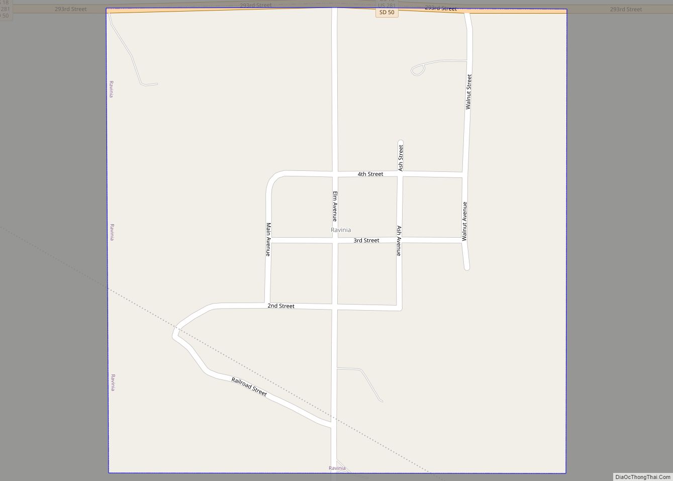
Dante Road Map
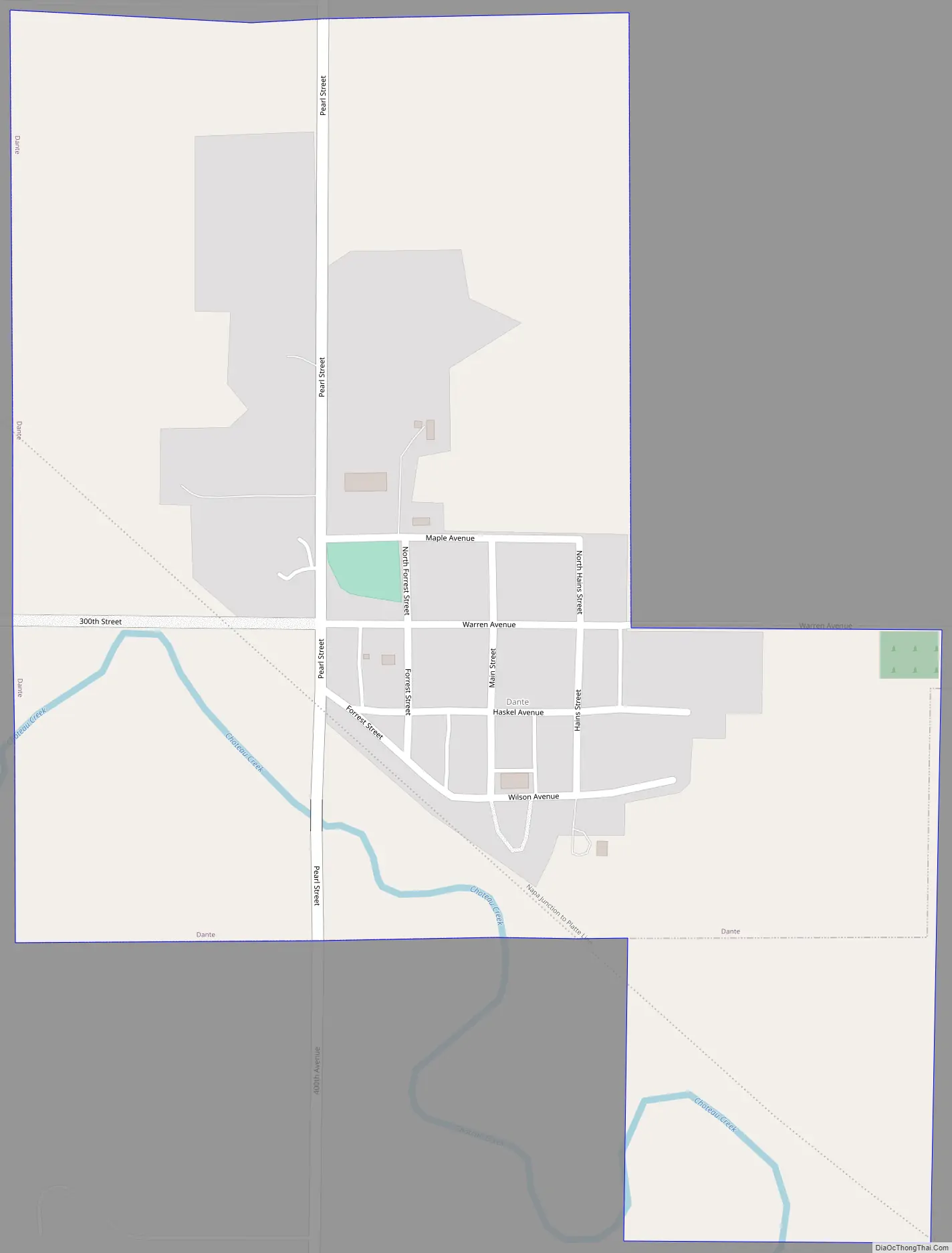
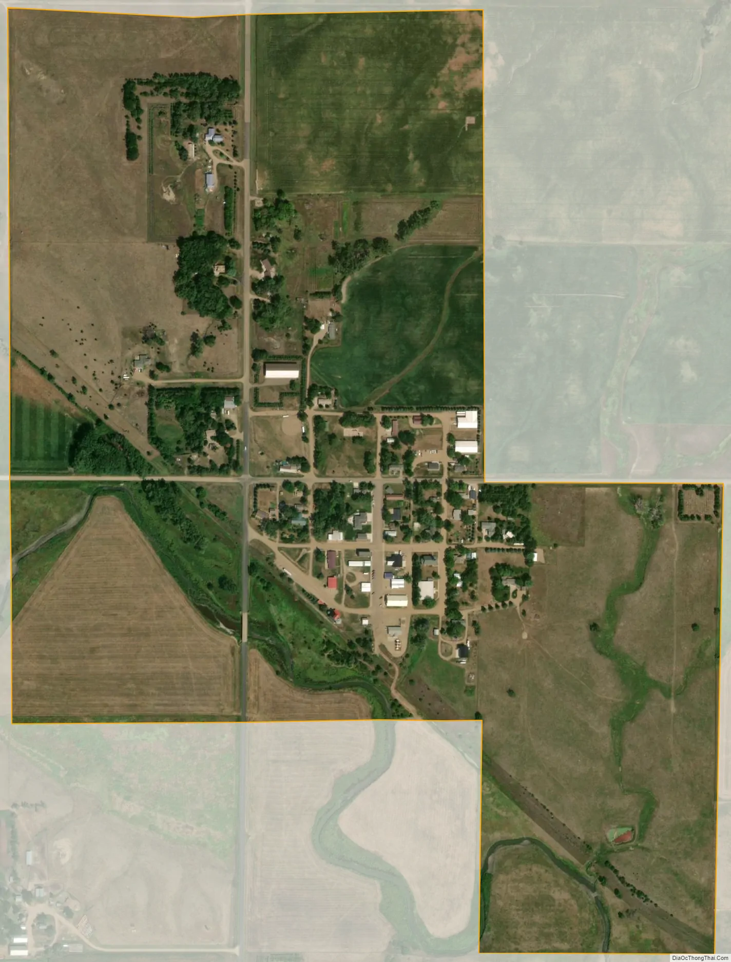
Dante city Satellite Map
Geography
Dante is located at 43°2′20″N 98°11′8″W / 43.03889°N 98.18556°W / 43.03889; -98.18556 (43.038942, -98.185463).
According to the United States Census Bureau, the town has a total area of 0.44 square miles (1.14 km), all land.
See also
Map of South Dakota State and its subdivision:- Aurora
- Beadle
- Bennett
- Bon Homme
- Brookings
- Brown
- Brule
- Buffalo
- Butte
- Campbell
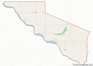
- Charles Mix
- Clark
- Clay
- Codington
- Corson
- Custer
- Davison
- Day
- Deuel
- Dewey
- Douglas
- Edmunds
- Fall River
- Faulk
- Grant
- Gregory
- Haakon
- Hamlin
- Hand
- Hanson
- Harding
- Hughes
- Hutchinson
- Hyde
- Jackson
- Jerauld
- Jones
- Kingsbury
- Lake
- Lawrence
- Lincoln
- Lyman
- Marshall
- McCook
- McPherson
- Meade
- Mellette
- Miner
- Minnehaha
- Moody
- Pennington
- Perkins
- Potter
- Roberts
- Sanborn
- Shannon
- Spink
- Stanley
- Sully
- Todd
- Tripp
- Turner
- Union
- Walworth
- Yankton
- Ziebach
- Alabama
- Alaska
- Arizona
- Arkansas
- California
- Colorado
- Connecticut
- Delaware
- District of Columbia
- Florida
- Georgia
- Hawaii
- Idaho
- Illinois
- Indiana
- Iowa
- Kansas
- Kentucky
- Louisiana
- Maine
- Maryland
- Massachusetts
- Michigan
- Minnesota
- Mississippi
- Missouri
- Montana
- Nebraska
- Nevada
- New Hampshire
- New Jersey
- New Mexico
- New York
- North Carolina
- North Dakota
- Ohio
- Oklahoma
- Oregon
- Pennsylvania
- Rhode Island
- South Carolina
- South Dakota
- Tennessee
- Texas
- Utah
- Vermont
- Virginia
- Washington
- West Virginia
- Wisconsin
- Wyoming