Gettysburg is a city and county seat of Potter County, South Dakota, United States, along the 45th parallel. The population was 1,104 at the 2020 census.
| Name: | Gettysburg city |
|---|---|
| LSAD Code: | 25 |
| LSAD Description: | city (suffix) |
| State: | South Dakota |
| County: | Potter County |
| Incorporated: | 1907 |
| Elevation: | 2,064 ft (629 m) |
| Total Area: | 1.92 sq mi (4.97 km²) |
| Land Area: | 1.92 sq mi (4.97 km²) |
| Water Area: | 0.00 sq mi (0.00 km²) |
| Total Population: | 1,104 |
| Population Density: | 574.70/sq mi (221.92/km²) |
| ZIP code: | 57442 |
| Area code: | 605 |
| FIPS code: | 4624260 |
| GNISfeature ID: | 1255235 |
| Website: | cityofgettysburgsd.com |
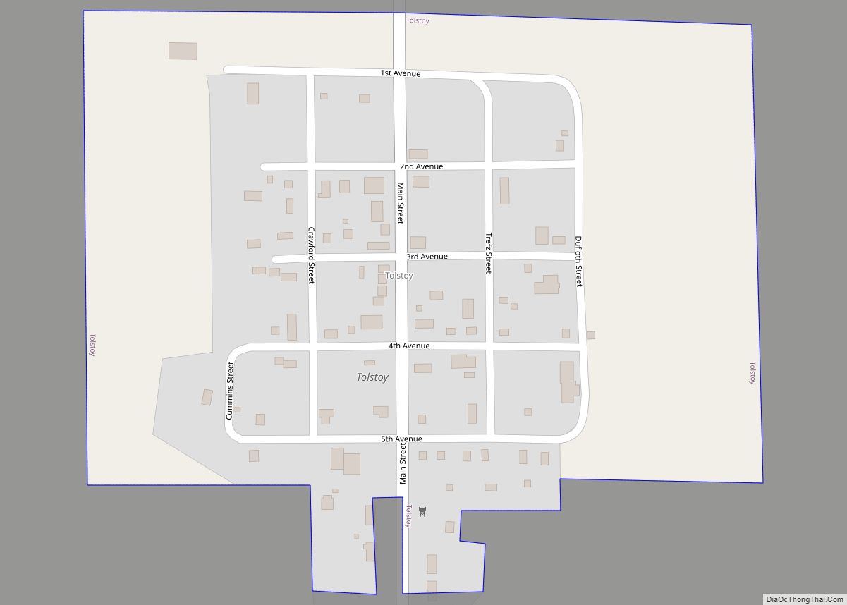
Online Interactive Map
Click on ![]() to view map in "full screen" mode.
to view map in "full screen" mode.
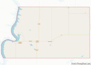
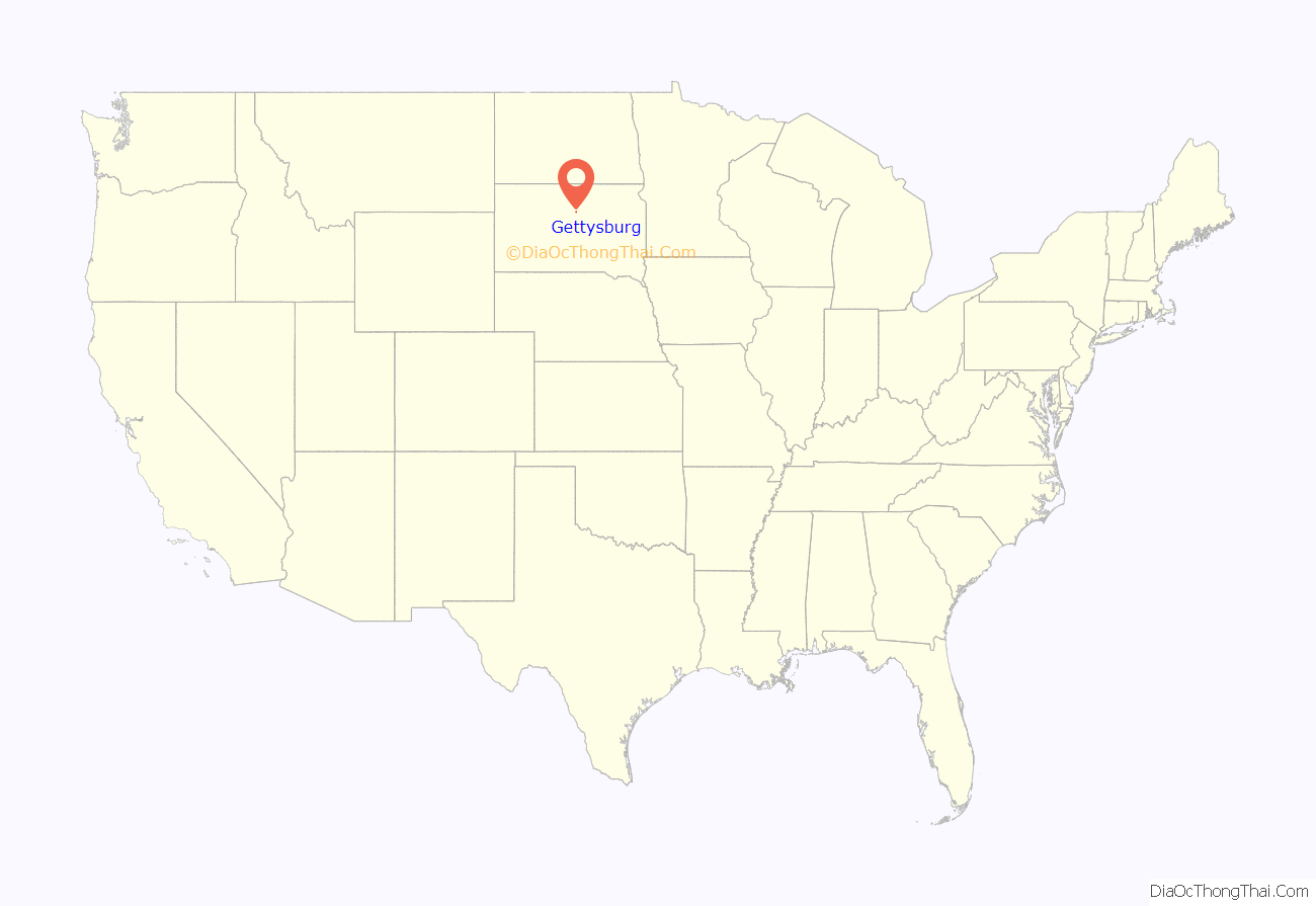
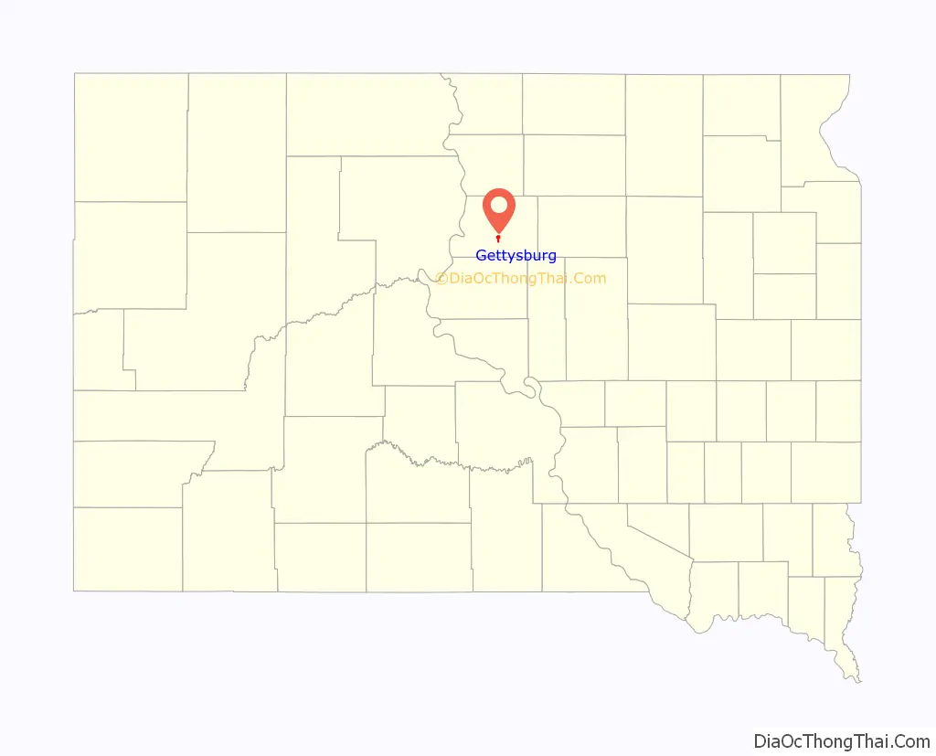
Gettysburg location map. Where is Gettysburg city?
History
Gettysburg was platted in 1884. The city was named in commemoration of the Battle of Gettysburg. A large share of the early settlers were Civil War veterans of the Union Army. Gettysburg was once home to Gettysburg Air Force Station which closed in 1968.
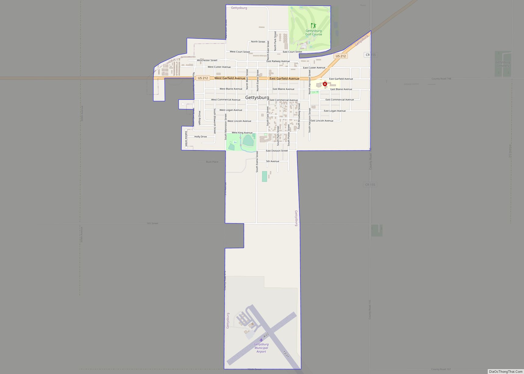
Gettysburg Road Map
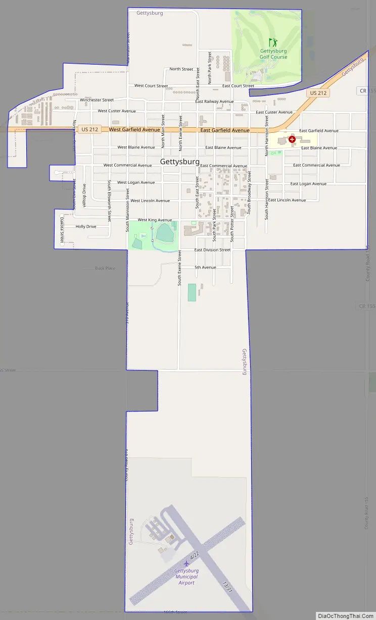
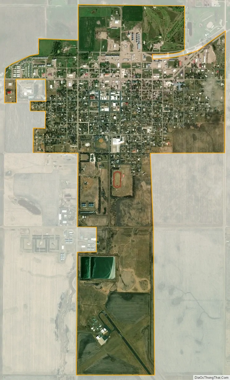
Gettysburg city Satellite Map
Geography
Gettysburg is located at 45°00′43″N 99°57′19″W / 45.011819°N 99.955386°W / 45.011819; -99.955386.
According to the United States Census Bureau, the city has a total area of 1.89 square miles (4.90 km), all land.
Gettysburg has been assigned the ZIP code 57442 and the FIPS place code 24260.
Climate
With a precipitation slightly above 465 mm, the city can be considered the watershed between the dry climates of the American West to the humid climates of the American East, although closer to the former, with a center characterized by the steppes and medium precipitation marking the east limit of the group B of dry climates (except for the hot versions on the subcontinent) for the 99.9 °W meridian. From the climatic map of the University of Melbourne, Gettysburg is the easternmost city in North America with a semi-arid cold climate (Köppen: Bsk). The average high temperature is 12.7 °C and the low average is -0.4 °C, which makes temperatures below the freezing point predominate for at least part of the year. The annual average snow is of 99 cm. For the official data of the NOAA/Weather Service: the average annual precipitation is of 501 mm, by which it strengthens its role of confluence. The wettest months range from May to July ranging from 72 to 88 mm and the driest January (only 9 mm). The amount of snow is average in proportion to its cold weather surpassing the 20 cm between February and March.
See also
Map of South Dakota State and its subdivision:- Aurora
- Beadle
- Bennett
- Bon Homme
- Brookings
- Brown
- Brule
- Buffalo
- Butte
- Campbell
- Charles Mix
- Clark
- Clay
- Codington
- Corson
- Custer
- Davison
- Day
- Deuel
- Dewey
- Douglas
- Edmunds
- Fall River
- Faulk
- Grant
- Gregory
- Haakon
- Hamlin
- Hand
- Hanson
- Harding
- Hughes
- Hutchinson
- Hyde
- Jackson
- Jerauld
- Jones
- Kingsbury
- Lake
- Lawrence
- Lincoln
- Lyman
- Marshall
- McCook
- McPherson
- Meade
- Mellette
- Miner
- Minnehaha
- Moody
- Pennington
- Perkins
- Potter
- Roberts
- Sanborn
- Shannon
- Spink
- Stanley
- Sully
- Todd
- Tripp
- Turner
- Union
- Walworth
- Yankton
- Ziebach
- Alabama
- Alaska
- Arizona
- Arkansas
- California
- Colorado
- Connecticut
- Delaware
- District of Columbia
- Florida
- Georgia
- Hawaii
- Idaho
- Illinois
- Indiana
- Iowa
- Kansas
- Kentucky
- Louisiana
- Maine
- Maryland
- Massachusetts
- Michigan
- Minnesota
- Mississippi
- Missouri
- Montana
- Nebraska
- Nevada
- New Hampshire
- New Jersey
- New Mexico
- New York
- North Carolina
- North Dakota
- Ohio
- Oklahoma
- Oregon
- Pennsylvania
- Rhode Island
- South Carolina
- South Dakota
- Tennessee
- Texas
- Utah
- Vermont
- Virginia
- Washington
- West Virginia
- Wisconsin
- Wyoming