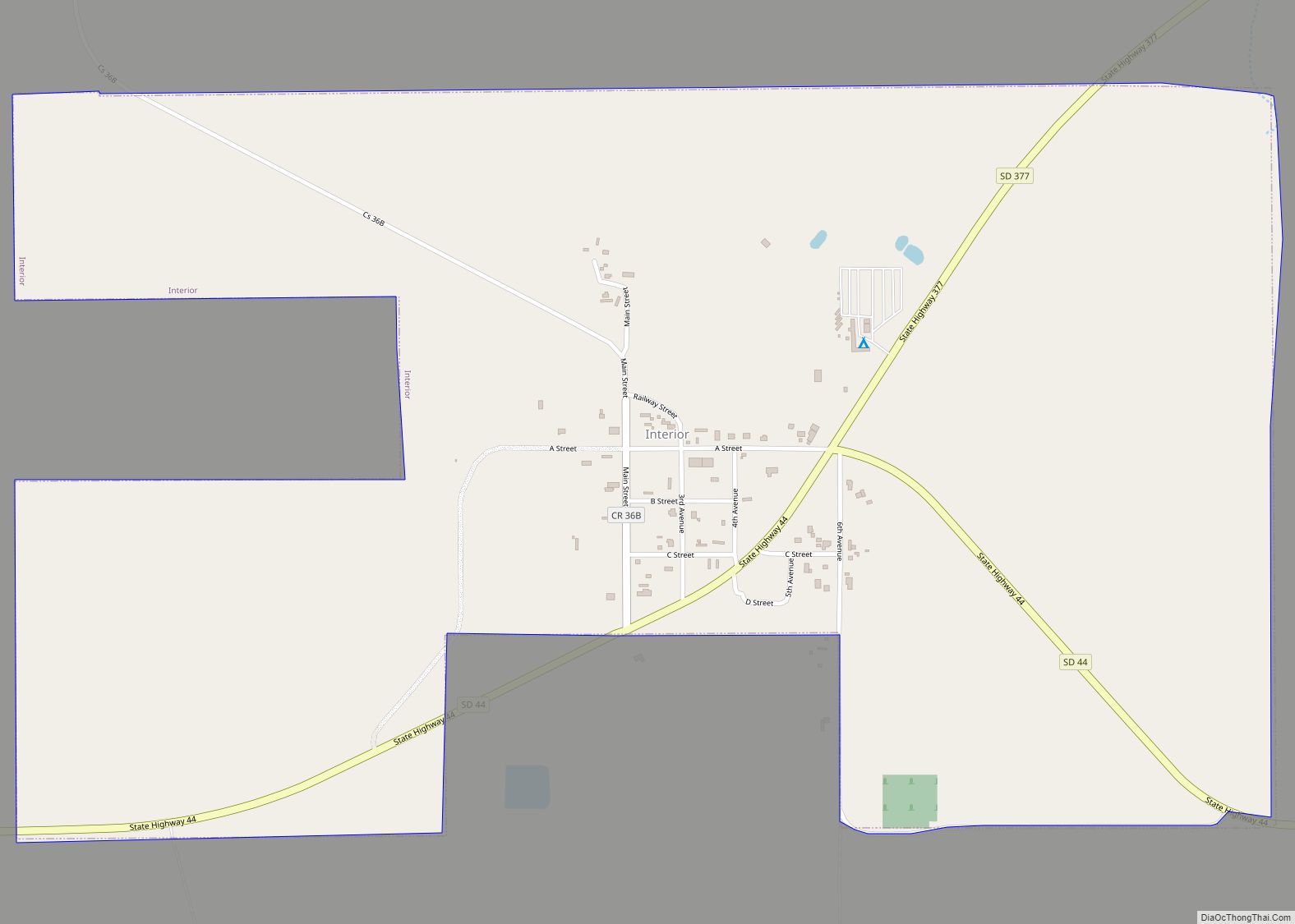
Interior (Lakota: makȟóšiča otȟúŋwahe; “Badlands village”) is a town in Jackson County, South Dakota, United States. The population was 65 at the 2020 census.
Interior got its start in 1907 when the Milwaukee Railroad was extended to that point.
| Name: | Interior town |
|---|---|
| LSAD Code: | 43 |
| LSAD Description: | town (suffix) |
| State: | South Dakota |
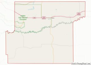
| County: | Jackson County |
| Incorporated: | 1907 |
| Elevation: | 2,382 ft (726 m) |
| Total Area: | 1.34 sq mi (3.48 km²) |
| Land Area: | 1.34 sq mi (3.47 km²) |
| Water Area: | 0.01 sq mi (0.01 km²) |
| Total Population: | 65 |
| Population Density: | 48.54/sq mi (18.75/km²) |
| ZIP code: | 57750 |
| Area code: | 605 |
| FIPS code: | 4631620 |
| GNISfeature ID: | 1261866 |
Online Interactive Map
Click on ![]() to view map in "full screen" mode.
to view map in "full screen" mode.
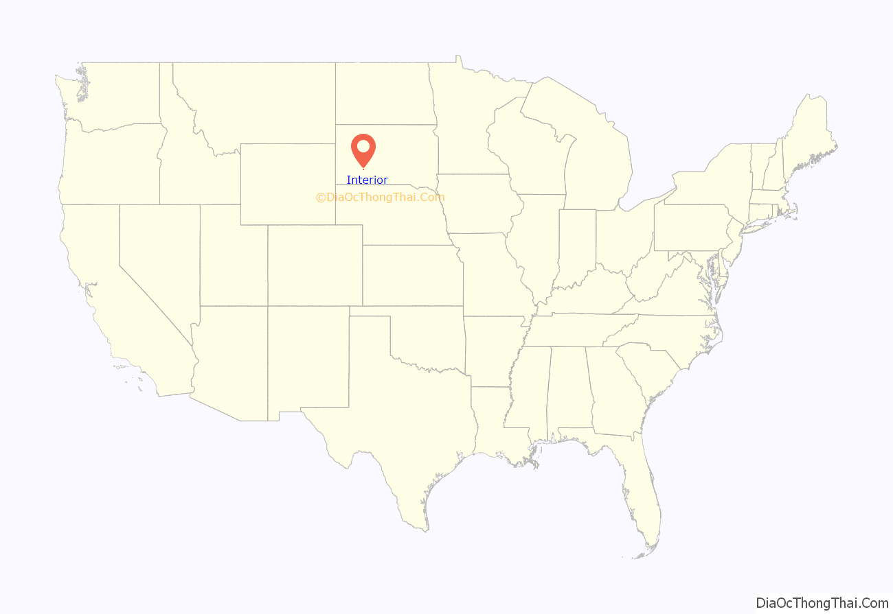
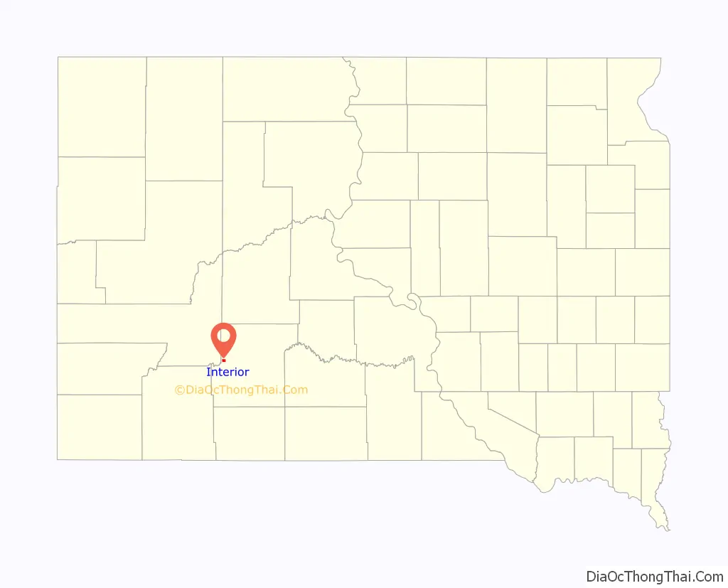
Interior location map. Where is Interior town?
History
Norwegian immigrants George and Louis Johnson moved from Chamberlain, South Dakota to the banks of the White River just north of the Pine Ridge Reservation in 1883 to establish a way-station for freighting between Chamberlain and the Black Hills. In 1886, the area was connected by rail to Gordon, Nebraska. In 1891, the former way-station was called Black with Mary Johnson as its first postmaster. In 1893, the town was renamed “Interior” by George Johnson because he did not think the name “Black” fit the description of the White River that surrounded the town. In 1907 and 1908, the town was moved two miles and half northwest along the White River to meet the Milwaukee Railroad. The former location of the town became known as “old Interior”.
The town went through major developments in the 1910s: in 1910, an efficient water system transporting water directly from the White River to Interior was installed and an electric grid was installed in 1912. Now with unlimited freshwater combined with being situated along the Milwaukee Railroad and near the Badlands, local committees seized the opportunity to use the town’s advantage. In 1919, 21 and 22, the town hosted roundups that tourists traveled by train as far from Minneapolis to see. The events hosted cowboys from across the country and Native Americans in traditional clothing also participating.
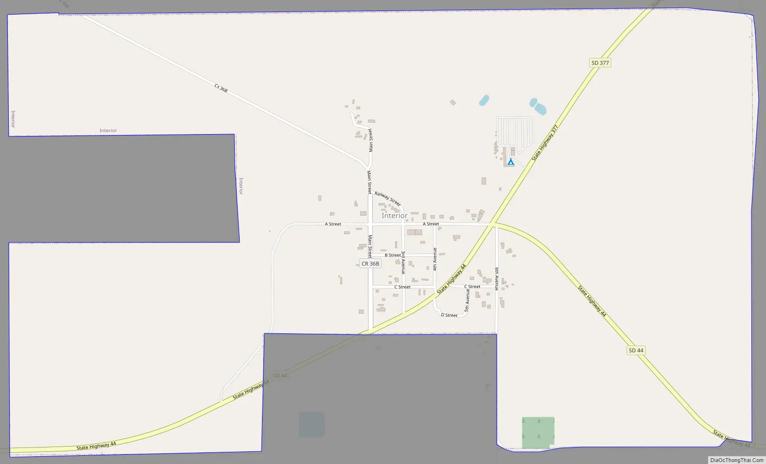
Interior Road Map
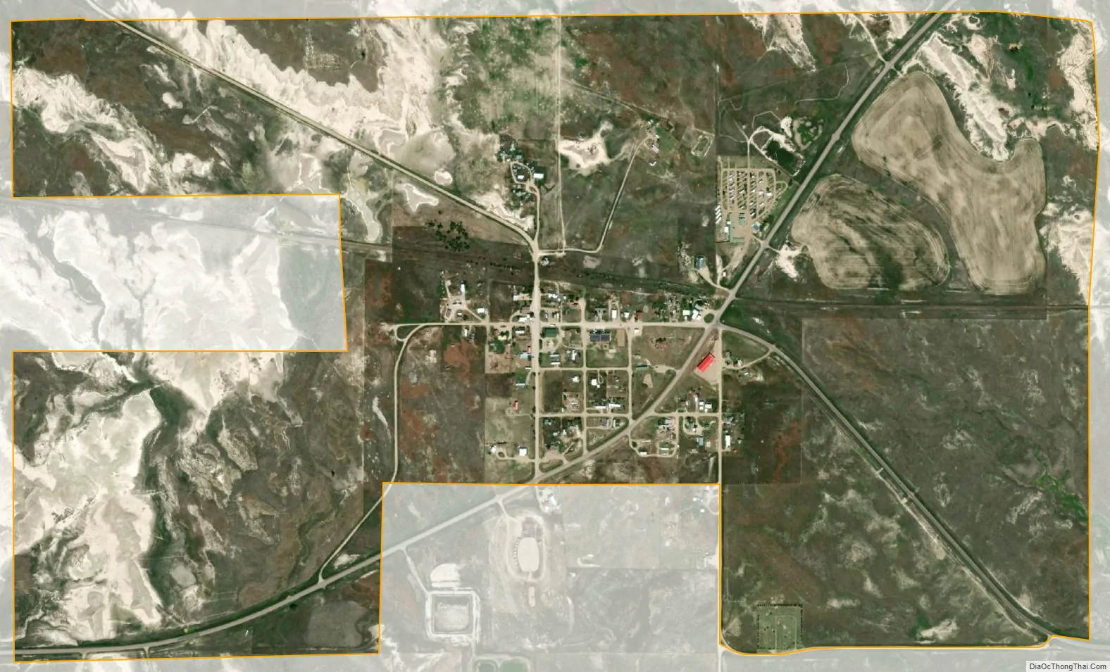
Interior city Satellite Map
Geography
Interior is located along the White River and situated at 43°43′31″N 101°58′59″W / 43.72528°N 101.98306°W / 43.72528; -101.98306 (43.725197, -101.983114), approximately one mile from Badlands National Park.
According to the United States Census Bureau, the town has a total area of 1.35 square miles (3.50 km), of which 1.34 square miles (3.47 km) is land and 0.01 square miles (0.03 km) is water.
Interior has been assigned the ZIP code 57750 and the FIPS place code 31620.
Climate
See also
Map of South Dakota State and its subdivision:- Aurora
- Beadle
- Bennett
- Bon Homme
- Brookings
- Brown
- Brule
- Buffalo
- Butte
- Campbell
- Charles Mix
- Clark
- Clay
- Codington
- Corson
- Custer
- Davison
- Day
- Deuel
- Dewey
- Douglas
- Edmunds
- Fall River
- Faulk
- Grant
- Gregory
- Haakon
- Hamlin
- Hand
- Hanson
- Harding
- Hughes
- Hutchinson
- Hyde
- Jackson
- Jerauld
- Jones
- Kingsbury
- Lake
- Lawrence
- Lincoln
- Lyman
- Marshall
- McCook
- McPherson
- Meade
- Mellette
- Miner
- Minnehaha
- Moody
- Pennington
- Perkins
- Potter
- Roberts
- Sanborn
- Shannon
- Spink
- Stanley
- Sully
- Todd
- Tripp
- Turner
- Union
- Walworth
- Yankton
- Ziebach
- Alabama
- Alaska
- Arizona
- Arkansas
- California
- Colorado
- Connecticut
- Delaware
- District of Columbia
- Florida
- Georgia
- Hawaii
- Idaho
- Illinois
- Indiana
- Iowa
- Kansas
- Kentucky
- Louisiana
- Maine
- Maryland
- Massachusetts
- Michigan
- Minnesota
- Mississippi
- Missouri
- Montana
- Nebraska
- Nevada
- New Hampshire
- New Jersey
- New Mexico
- New York
- North Carolina
- North Dakota
- Ohio
- Oklahoma
- Oregon
- Pennsylvania
- Rhode Island
- South Carolina
- South Dakota
- Tennessee
- Texas
- Utah
- Vermont
- Virginia
- Washington
- West Virginia
- Wisconsin
- Wyoming