Mitchell is a city in and the county seat of Davison County, South Dakota, United States. The population was 15,660 at the 2020 census making it the sixth most populous city in South Dakota.
Mitchell is the principal city of the Mitchell Micropolitan Statistical Area, which includes all of Davison and Hanson counties.
| Name: | Mitchell city |
|---|---|
| LSAD Code: | 25 |
| LSAD Description: | city (suffix) |
| State: | South Dakota |
| County: | Davison County |
| Incorporated: | 1883 |
| Elevation: | 1,312 ft (400 m) |
| Land Area: | 11.24 sq mi (29.10 km²) |
| Water Area: | 1.06 sq mi (2.75 km²) |
| Population Density: | 1,393.61/sq mi (538.07/km²) |
| ZIP code: | 57301 |
| Area code: | 605 |
| FIPS code: | 4643100 |
| GNISfeature ID: | 1256500 |
Online Interactive Map
Click on ![]() to view map in "full screen" mode.
to view map in "full screen" mode.
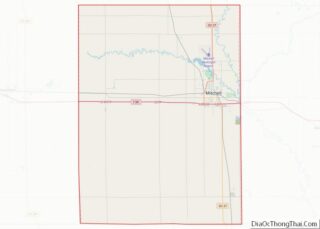
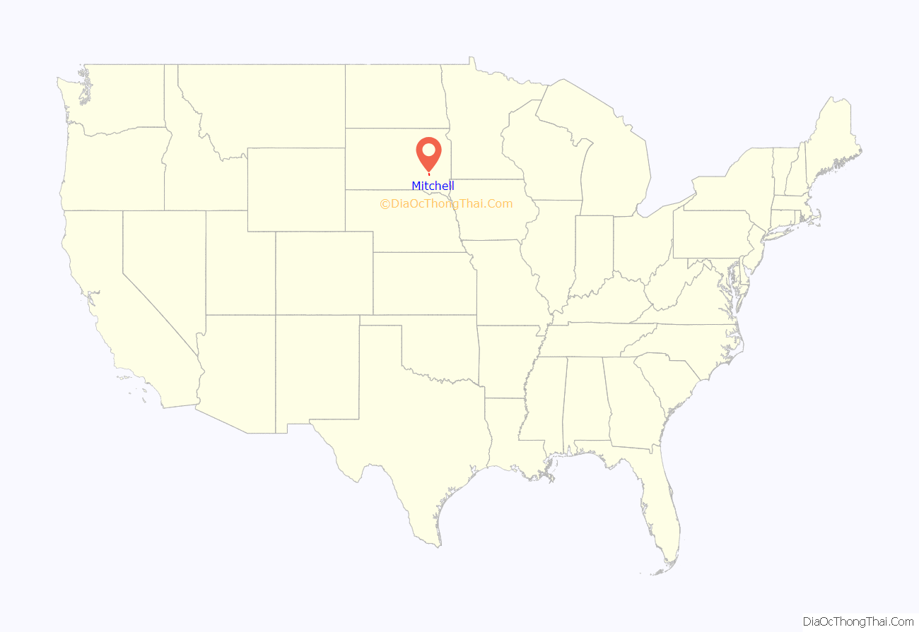
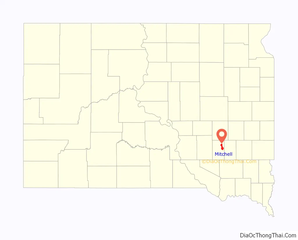
Mitchell location map. Where is Mitchell city?
History
The first settlement at Mitchell was made in 1879. Mitchell was incorporated in 1883. It was named for Milwaukee banker Alexander Mitchell, President of the Chicago, Milwaukee, and St. Paul Railroad (Milwaukee Road).
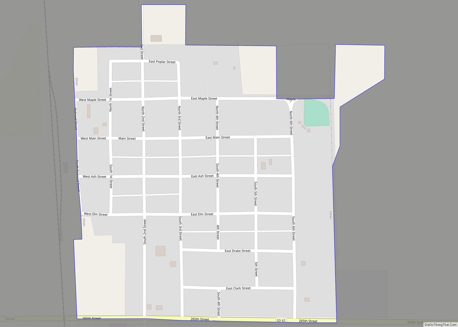
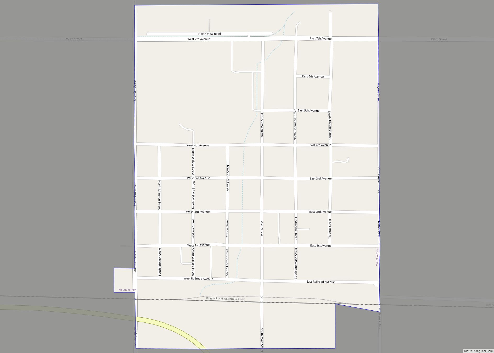
Mitchell Road Map
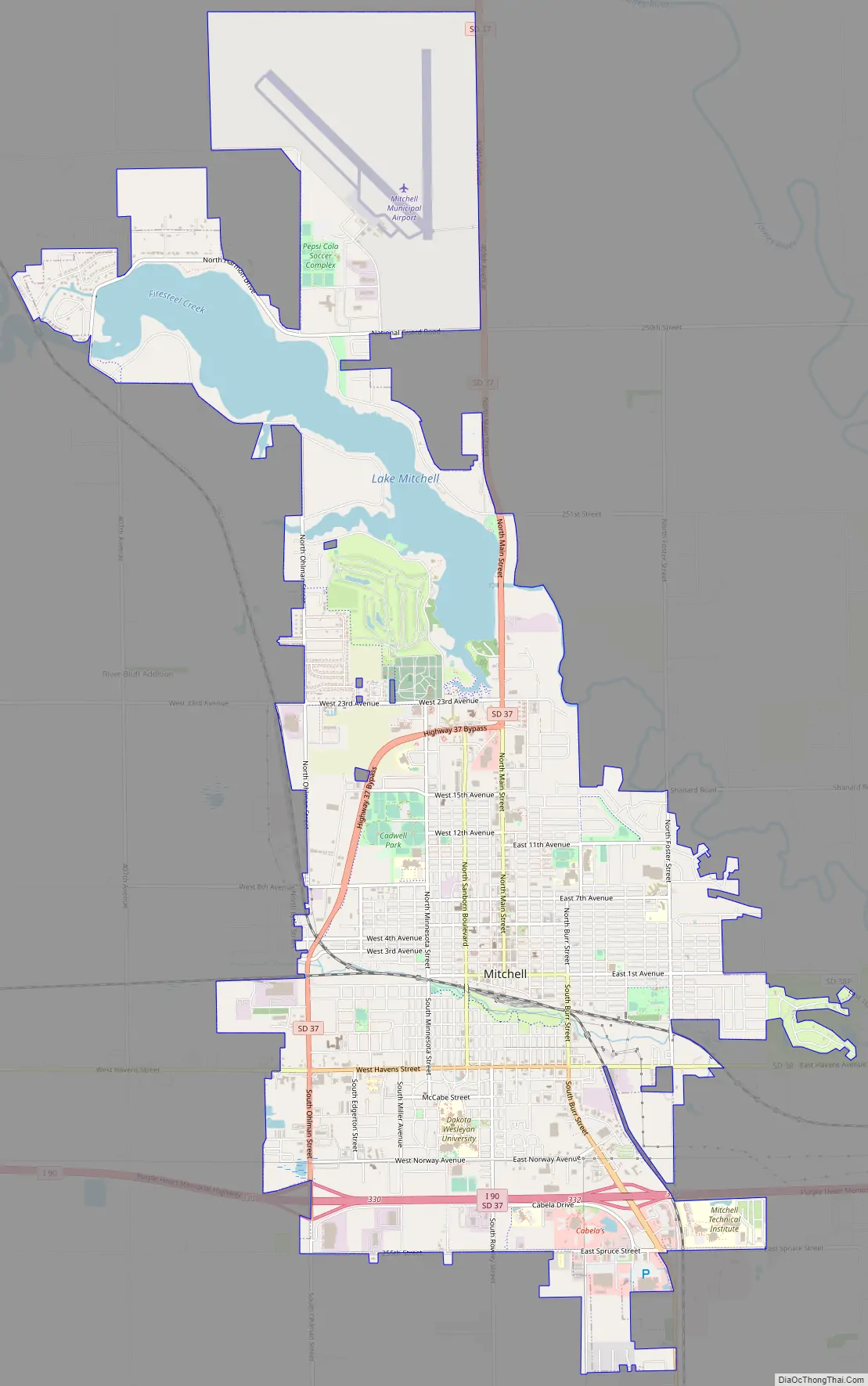
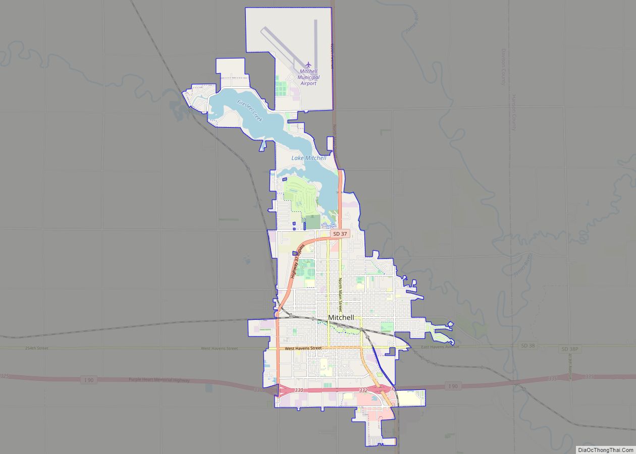
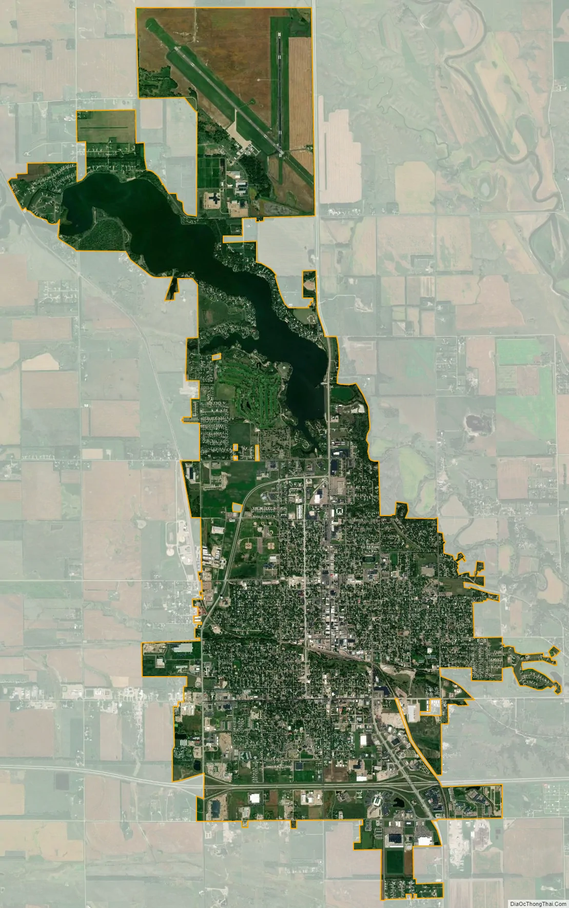
Mitchell city Satellite Map
Geography
Mitchell is located at 43°42′50″N 98°1′35″W / 43.71389°N 98.02639°W / 43.71389; -98.02639 (43.713896, -98.026282), on the James River.
According to the United States Census Bureau, the city has a total area of 12.14 square miles (31.44 km), of which 11.14 square miles (28.85 km) is land and 1.00 square mile (2.59 km) is water.
Mitchell has been assigned the ZIP code 57301 and the FIPS place code 43100.
See also
Map of South Dakota State and its subdivision:- Aurora
- Beadle
- Bennett
- Bon Homme
- Brookings
- Brown
- Brule
- Buffalo
- Butte
- Campbell
- Charles Mix
- Clark
- Clay
- Codington
- Corson
- Custer
- Davison
- Day
- Deuel
- Dewey
- Douglas
- Edmunds
- Fall River
- Faulk
- Grant
- Gregory
- Haakon
- Hamlin
- Hand
- Hanson
- Harding
- Hughes
- Hutchinson
- Hyde
- Jackson
- Jerauld
- Jones
- Kingsbury
- Lake
- Lawrence
- Lincoln
- Lyman
- Marshall
- McCook
- McPherson
- Meade
- Mellette
- Miner
- Minnehaha
- Moody
- Pennington
- Perkins
- Potter
- Roberts
- Sanborn
- Shannon
- Spink
- Stanley
- Sully
- Todd
- Tripp
- Turner
- Union
- Walworth
- Yankton
- Ziebach
- Alabama
- Alaska
- Arizona
- Arkansas
- California
- Colorado
- Connecticut
- Delaware
- District of Columbia
- Florida
- Georgia
- Hawaii
- Idaho
- Illinois
- Indiana
- Iowa
- Kansas
- Kentucky
- Louisiana
- Maine
- Maryland
- Massachusetts
- Michigan
- Minnesota
- Mississippi
- Missouri
- Montana
- Nebraska
- Nevada
- New Hampshire
- New Jersey
- New Mexico
- New York
- North Carolina
- North Dakota
- Ohio
- Oklahoma
- Oregon
- Pennsylvania
- Rhode Island
- South Carolina
- South Dakota
- Tennessee
- Texas
- Utah
- Vermont
- Virginia
- Washington
- West Virginia
- Wisconsin
- Wyoming