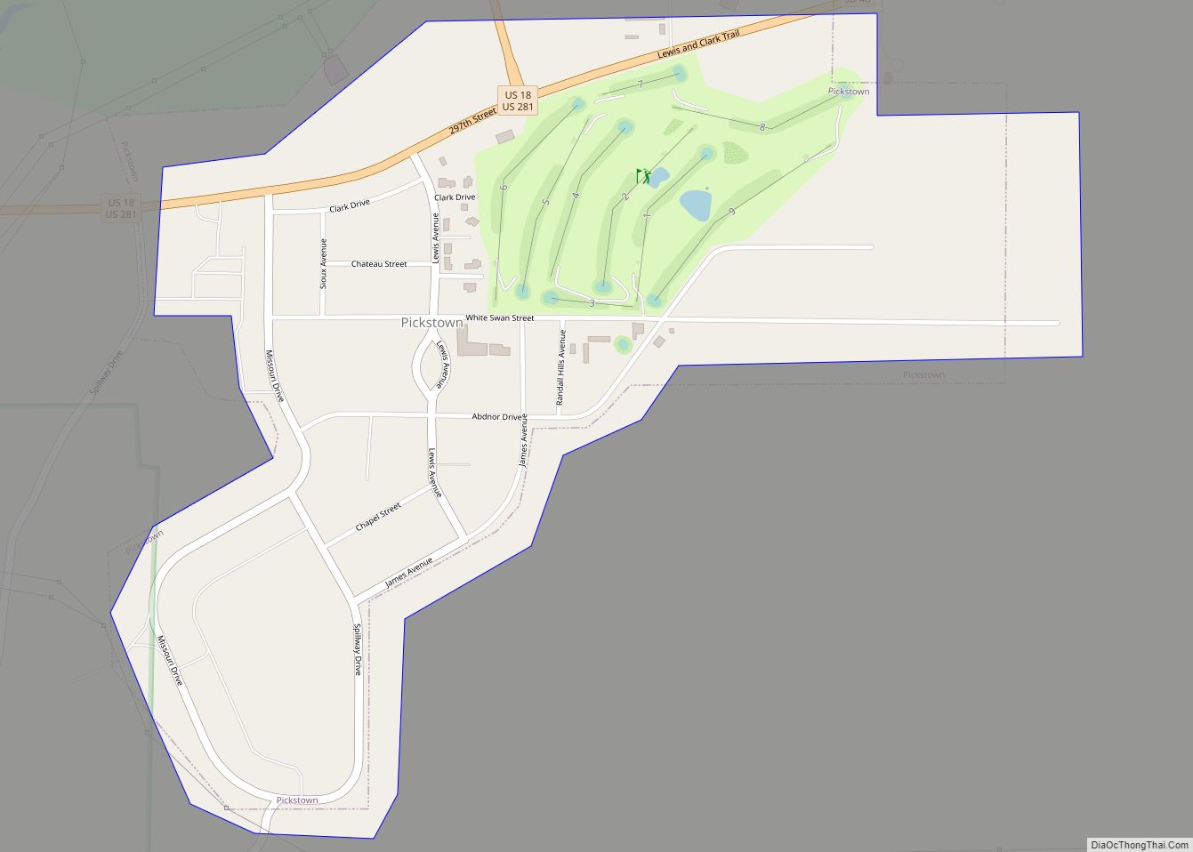
Pickstown is a town in southern Charles Mix County, South Dakota, United States. The population was 230 at the 2020 census. It was named after U.S. Army General Lewis A. Pick, former director of the Missouri River Office of the United States Army Corps of Engineers.
| Name: | Pickstown town |
|---|---|
| LSAD Code: | 43 |
| LSAD Description: | town (suffix) |
| State: | South Dakota |
| County: | Charles Mix County |
| Elevation: | 1,480 ft (450 m) |
| Total Area: | 0.61 sq mi (1.58 km²) |
| Land Area: | 0.61 sq mi (1.58 km²) |
| Water Area: | 0.00 sq mi (0.00 km²) |
| Total Population: | 230 |
| Population Density: | 376.43/sq mi (145.23/km²) |
| ZIP code: | 57367 |
| Area code: | 605 |
| FIPS code: | 4649460 |
| Website: | www.pickstown-sd.net |
Online Interactive Map
Click on ![]() to view map in "full screen" mode.
to view map in "full screen" mode.
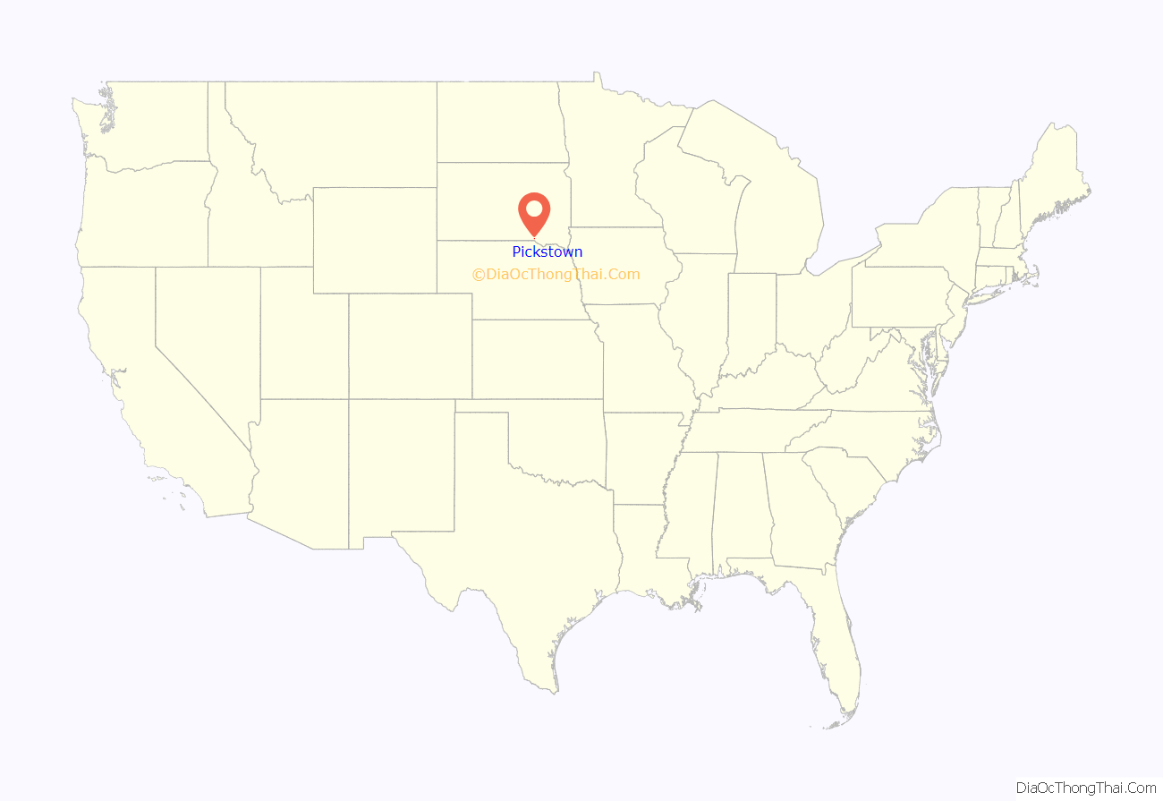
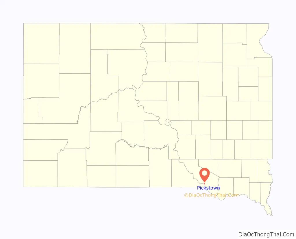
Pickstown location map. Where is Pickstown town?
History
Pickstown began as a government town for U.S. Army Corps of Engineers employees building and then operating nearby Fort Randall Dam. United States Air Force officers and airmen arrived in the 1950s to operate a Strategic Air Command radar base built on a hill three miles east of town, locally known as “Radar Hill”. Air Force personnel left in the 1970s after the base closed. Currently, the “Fort Randall Casino and Hotel” owned and operated by the Yankton Sioux Tribe is located at the abandoned radar base.
The U.S. Army Corps of Engineers owned Pickstown until the town incorporated in 1985.
Pickstown Road Map
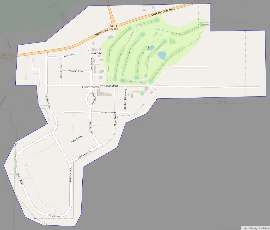
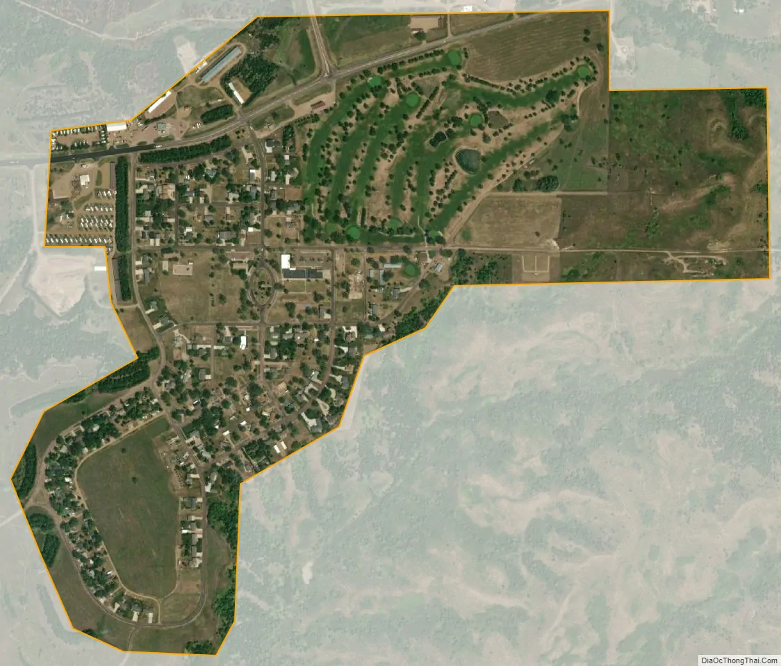
Pickstown city Satellite Map
Geography
Pickstown is located adjacent to the east side of the Fort Randall Dam on the Missouri River. The town is served by U.S. Route 18, U.S. Route 281 and South Dakota Highway 46.
According to the United States Census Bureau, the town has a total area of 0.65 square miles (1.68 km), all land.
See also
Map of South Dakota State and its subdivision:- Aurora
- Beadle
- Bennett
- Bon Homme
- Brookings
- Brown
- Brule
- Buffalo
- Butte
- Campbell
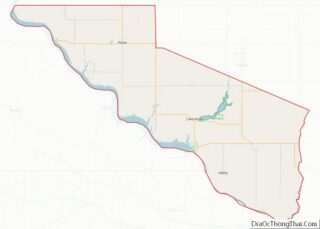
- Charles Mix
- Clark
- Clay
- Codington
- Corson
- Custer
- Davison
- Day
- Deuel
- Dewey
- Douglas
- Edmunds
- Fall River
- Faulk
- Grant
- Gregory
- Haakon
- Hamlin
- Hand
- Hanson
- Harding
- Hughes
- Hutchinson
- Hyde
- Jackson
- Jerauld
- Jones
- Kingsbury
- Lake
- Lawrence
- Lincoln
- Lyman
- Marshall
- McCook
- McPherson
- Meade
- Mellette
- Miner
- Minnehaha
- Moody
- Pennington
- Perkins
- Potter
- Roberts
- Sanborn
- Shannon
- Spink
- Stanley
- Sully
- Todd
- Tripp
- Turner
- Union
- Walworth
- Yankton
- Ziebach
- Alabama
- Alaska
- Arizona
- Arkansas
- California
- Colorado
- Connecticut
- Delaware
- District of Columbia
- Florida
- Georgia
- Hawaii
- Idaho
- Illinois
- Indiana
- Iowa
- Kansas
- Kentucky
- Louisiana
- Maine
- Maryland
- Massachusetts
- Michigan
- Minnesota
- Mississippi
- Missouri
- Montana
- Nebraska
- Nevada
- New Hampshire
- New Jersey
- New Mexico
- New York
- North Carolina
- North Dakota
- Ohio
- Oklahoma
- Oregon
- Pennsylvania
- Rhode Island
- South Carolina
- South Dakota
- Tennessee
- Texas
- Utah
- Vermont
- Virginia
- Washington
- West Virginia
- Wisconsin
- Wyoming