Pollock is a town in Campbell County, South Dakota, United States. The population was 224 at the time of the 2020 census.
| Name: | Pollock town |
|---|---|
| LSAD Code: | 43 |
| LSAD Description: | town (suffix) |
| State: | South Dakota |
| County: | Campbell County |
| Founded: | 1901 |
| Elevation: | 1,654 ft (504 m) |
| Total Area: | 0.32 sq mi (0.83 km²) |
| Land Area: | 0.32 sq mi (0.83 km²) |
| Water Area: | 0.00 sq mi (0.00 km²) |
| Total Population: | 224 |
| Population Density: | 697.82/sq mi (269.07/km²) |
| ZIP code: | 57648 |
| Area code: | 605 |
| FIPS code: | 4651260 |
| GNISfeature ID: | 1265684 |
| Website: | http://www.pollocksouthdakota.com/ |
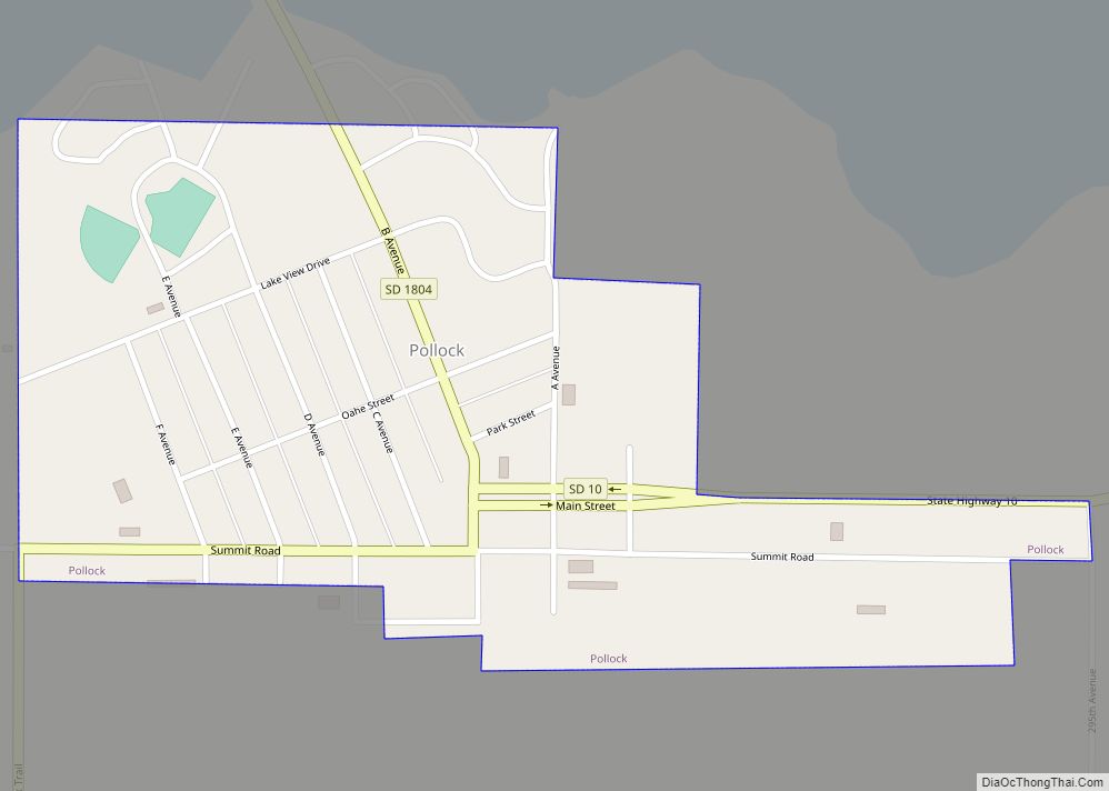
Online Interactive Map
Click on ![]() to view map in "full screen" mode.
to view map in "full screen" mode.
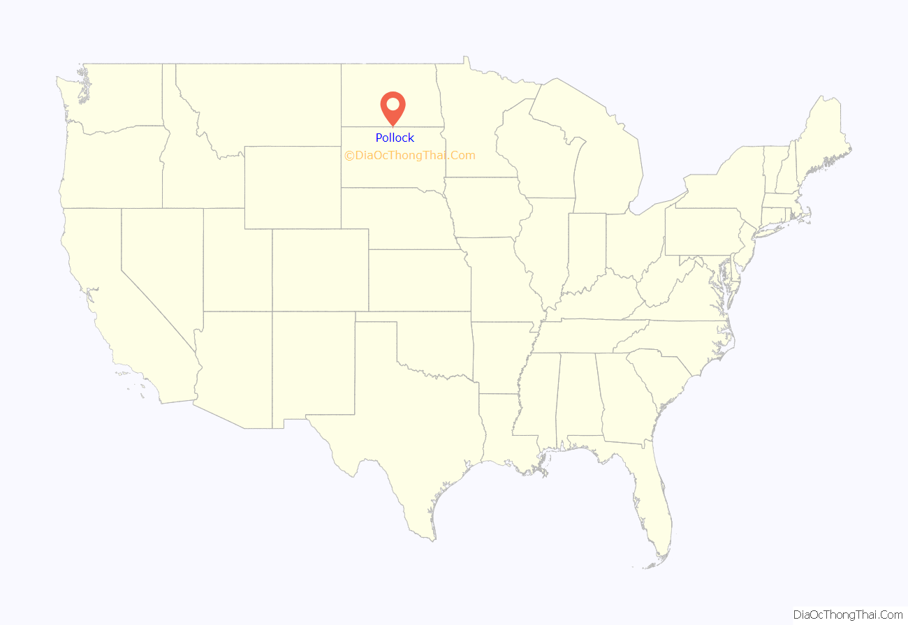
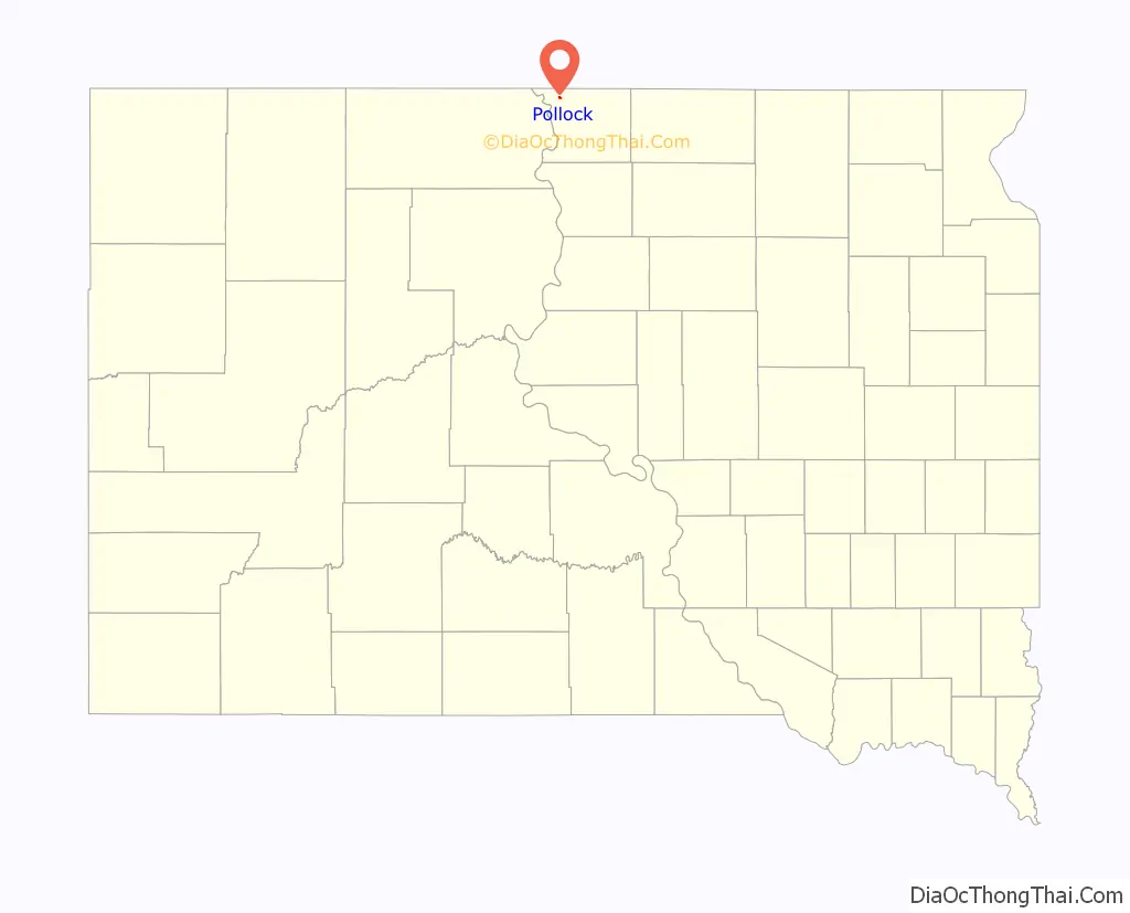
Pollock location map. Where is Pollock town?
History
Pollock was laid out in 1901 in anticipation of the arrival of a branch of the Soo Line, and named in honor of a first settler with the last name Pollock. The Pollock Depot, a wood-frame former railroad station, is listed on the National Register of Historic Places.
As the roads in the county improved, there was more freight and passenger transportation by truck and automobile. Lower demand for rail freight led to the branch line being partially abandoned.
Pollock Road Map
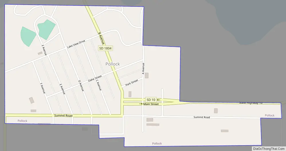
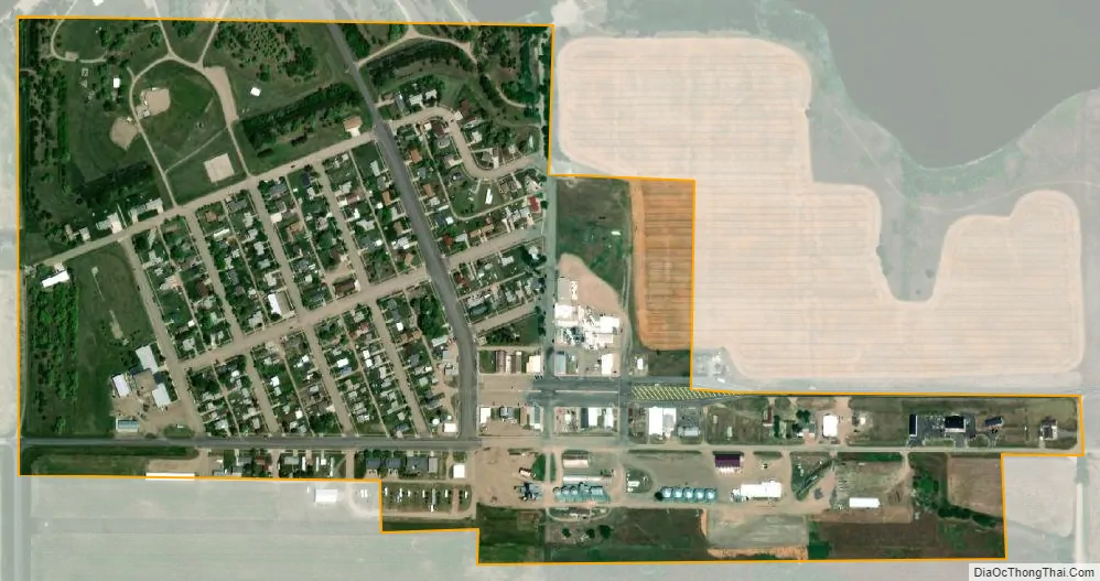
Pollock city Satellite Map
Geography
Pollock is located at 45°54′59″N 100°17′18″W / 45.91639°N 100.28833°W / 45.91639; -100.28833 (45.899975, -100.288405).
According to the United States Census Bureau, the town has a total area of 0.32 square miles (0.83 km), all land.
Pollock has been assigned the ZIP code 57648 and the FIPS place code 51260.
Climate
See also
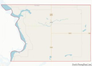
Map of South Dakota State and its subdivision:- Aurora
- Beadle
- Bennett
- Bon Homme
- Brookings
- Brown
- Brule
- Buffalo
- Butte
- Campbell
- Charles Mix
- Clark
- Clay
- Codington
- Corson
- Custer
- Davison
- Day
- Deuel
- Dewey
- Douglas
- Edmunds
- Fall River
- Faulk
- Grant
- Gregory
- Haakon
- Hamlin
- Hand
- Hanson
- Harding
- Hughes
- Hutchinson
- Hyde
- Jackson
- Jerauld
- Jones
- Kingsbury
- Lake
- Lawrence
- Lincoln
- Lyman
- Marshall
- McCook
- McPherson
- Meade
- Mellette
- Miner
- Minnehaha
- Moody
- Pennington
- Perkins
- Potter
- Roberts
- Sanborn
- Shannon
- Spink
- Stanley
- Sully
- Todd
- Tripp
- Turner
- Union
- Walworth
- Yankton
- Ziebach
- Alabama
- Alaska
- Arizona
- Arkansas
- California
- Colorado
- Connecticut
- Delaware
- District of Columbia
- Florida
- Georgia
- Hawaii
- Idaho
- Illinois
- Indiana
- Iowa
- Kansas
- Kentucky
- Louisiana
- Maine
- Maryland
- Massachusetts
- Michigan
- Minnesota
- Mississippi
- Missouri
- Montana
- Nebraska
- Nevada
- New Hampshire
- New Jersey
- New Mexico
- New York
- North Carolina
- North Dakota
- Ohio
- Oklahoma
- Oregon
- Pennsylvania
- Rhode Island
- South Carolina
- South Dakota
- Tennessee
- Texas
- Utah
- Vermont
- Virginia
- Washington
- West Virginia
- Wisconsin
- Wyoming