Timber Lake (Lakota: blečháŋ; “Tree Lake”) is a city in and the county seat of Dewey County, South Dakota, United States. The population was 509 at the 2020 census.
| Name: | Timber Lake city |
|---|---|
| LSAD Code: | 25 |
| LSAD Description: | city (suffix) |
| State: | South Dakota |
| County: | Dewey County |
| Incorporated: | 1910 |
| Elevation: | 2,169 ft (661 m) |
| Total Area: | 0.61 sq mi (1.58 km²) |
| Land Area: | 0.61 sq mi (1.58 km²) |
| Water Area: | 0.00 sq mi (0.00 km²) |
| Total Population: | 509 |
| Population Density: | 833.06/sq mi (321.78/km²) |
| ZIP code: | 57656 |
| Area code: | 605 |
| FIPS code: | 4663620 |
| GNISfeature ID: | 1258560 |
| Website: | www.timberlakesouthdakota.com |
Online Interactive Map
Click on ![]() to view map in "full screen" mode.
to view map in "full screen" mode.
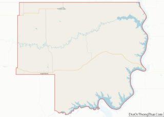
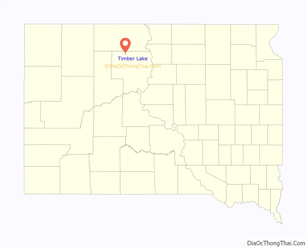
Timber Lake location map. Where is Timber Lake city?

History
Timber Lake was founded in 1910 with the arrival of the Chicago, Milwaukee, St. Paul and Pacific Railroad into the area. Despite the name, very few trees grew at the lake near the town site. During drought, the lake is a mere mudhole.
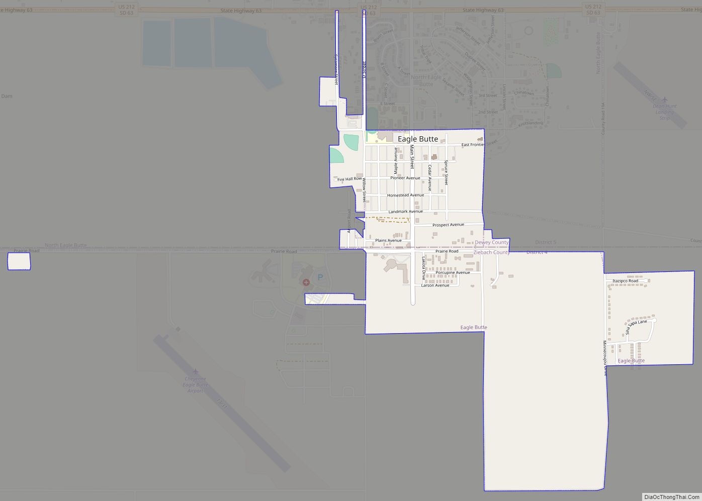
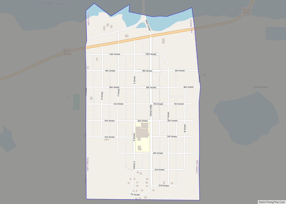
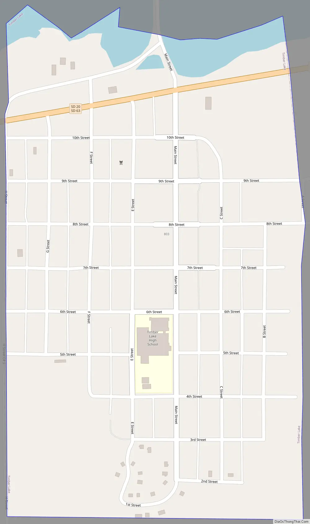
Timber Lake Road Map
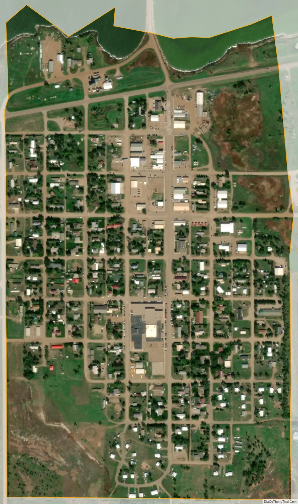
Timber Lake city Satellite Map
Geography
Timber Lake is located at 45°25′43″N 101°4′29″W / 45.42861°N 101.07472°W / 45.42861; -101.07472 (45.428682, -101.074606).
According to the United States Census Bureau, the city has a total area of 0.41 square miles (1.06 km), all land.
Timber Lake has been assigned the ZIP code 57656 and the FIPS place code 63629.
See also
Map of South Dakota State and its subdivision:- Aurora
- Beadle
- Bennett
- Bon Homme
- Brookings
- Brown
- Brule
- Buffalo
- Butte
- Campbell
- Charles Mix
- Clark
- Clay
- Codington
- Corson
- Custer
- Davison
- Day
- Deuel
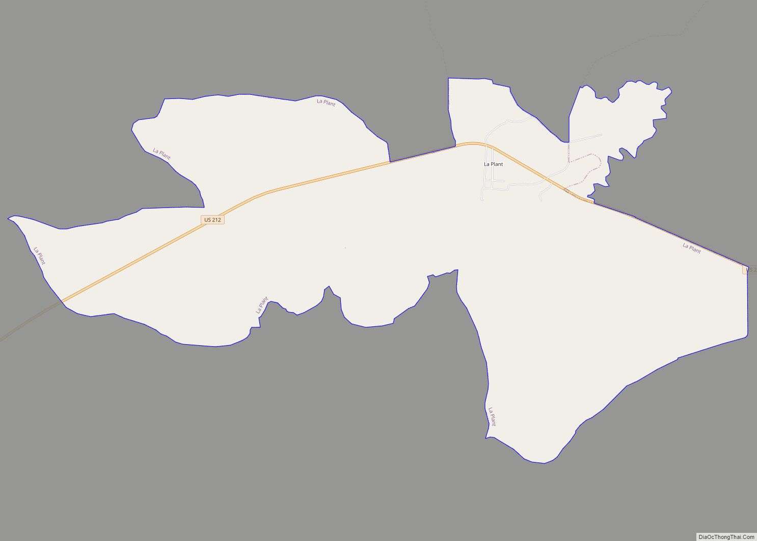
- Dewey
- Douglas
- Edmunds
- Fall River
- Faulk
- Grant
- Gregory
- Haakon
- Hamlin
- Hand
- Hanson
- Harding
- Hughes
- Hutchinson
- Hyde
- Jackson
- Jerauld
- Jones
- Kingsbury
- Lake
- Lawrence
- Lincoln
- Lyman
- Marshall
- McCook
- McPherson
- Meade
- Mellette
- Miner
- Minnehaha
- Moody
- Pennington
- Perkins
- Potter
- Roberts
- Sanborn
- Shannon
- Spink
- Stanley
- Sully
- Todd
- Tripp
- Turner
- Union
- Walworth
- Yankton
- Ziebach
- Alabama
- Alaska
- Arizona
- Arkansas
- California
- Colorado
- Connecticut
- Delaware
- District of Columbia
- Florida
- Georgia
- Hawaii
- Idaho
- Illinois
- Indiana
- Iowa
- Kansas
- Kentucky
- Louisiana
- Maine
- Maryland
- Massachusetts
- Michigan
- Minnesota
- Mississippi
- Missouri
- Montana
- Nebraska
- Nevada
- New Hampshire
- New Jersey
- New Mexico
- New York
- North Carolina
- North Dakota
- Ohio
- Oklahoma
- Oregon
- Pennsylvania
- Rhode Island
- South Carolina
- South Dakota
- Tennessee
- Texas
- Utah
- Vermont
- Virginia
- Washington
- West Virginia
- Wisconsin
- Wyoming