Volga is a city in Brookings County, South Dakota, United States with a population of 2,113 at the 2020 census.
| Name: | Volga city |
|---|---|
| LSAD Code: | 25 |
| LSAD Description: | city (suffix) |
| State: | South Dakota |
| County: | Brookings County |
| Incorporated: | 1903 |
| Elevation: | 1,634 ft (498 m) |
| Total Area: | 1.14 sq mi (2.95 km²) |
| Land Area: | 1.14 sq mi (2.95 km²) |
| Water Area: | 0.00 sq mi (0.00 km²) |
| Total Population: | 2,113 |
| Population Density: | 1,855.14/sq mi (716.32/km²) |
| ZIP code: | 57071 |
| Area code: | 605 |
| FIPS code: | 4667700 |
| GNISfeature ID: | 1258770 |
| Website: | www.volgacity.com |
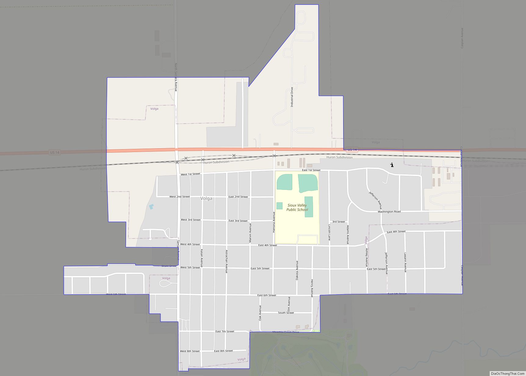
Online Interactive Map
Click on ![]() to view map in "full screen" mode.
to view map in "full screen" mode.
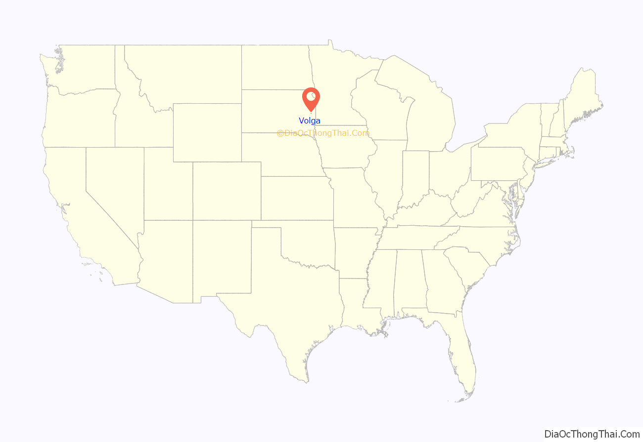
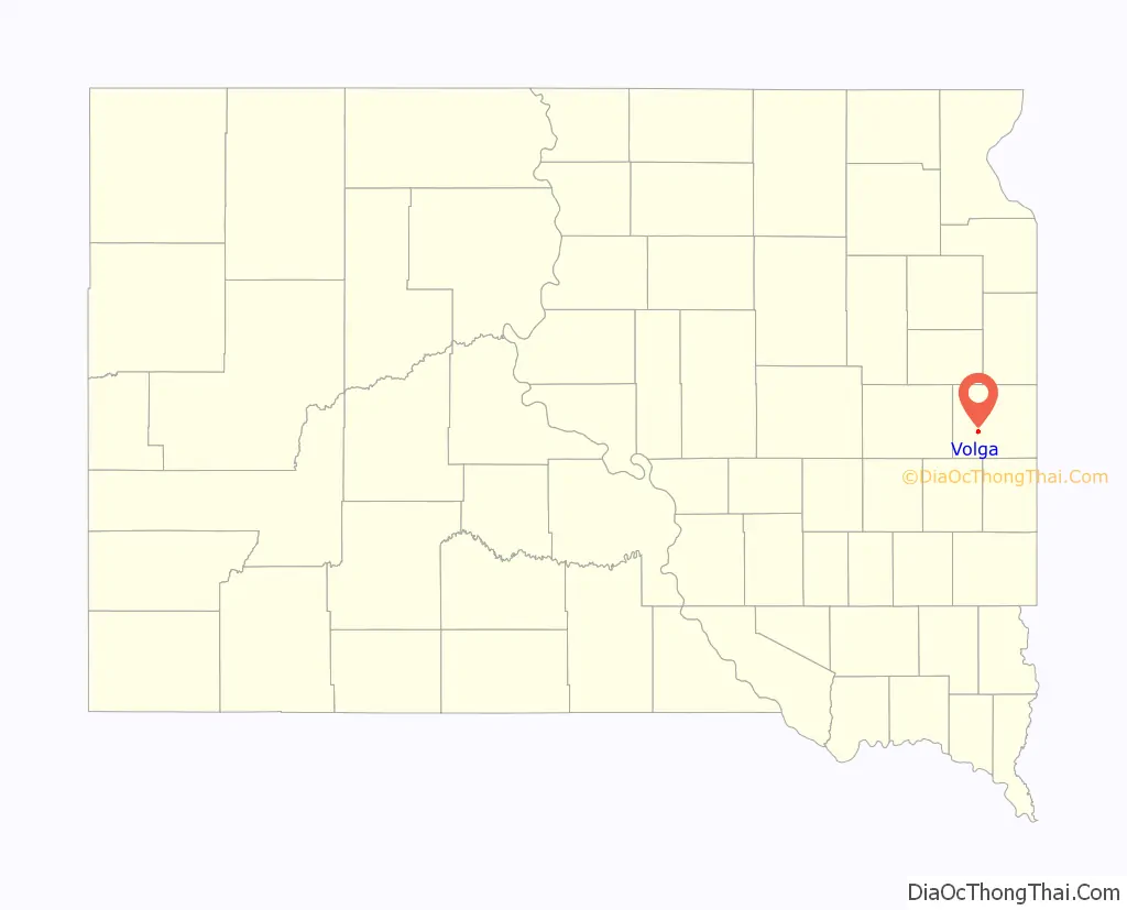
Volga location map. Where is Volga city?
History
Volga was founded by the Western Town Lot Company on December 27, 1879, by Col. Arthur Jacoby. It was originally named “Bandy Town” after the Bandy family, early settlers there. Later, in 1880, the railroad assigned it the name “Volga”, after the Volga River, in Russia.
Volga is mentioned in the juvenile novel The Long Winter by Laura Ingalls Wilder in the chapter titled “Pa Goes to Volga”.
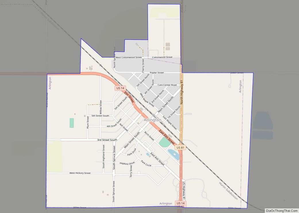
Volga Road Map
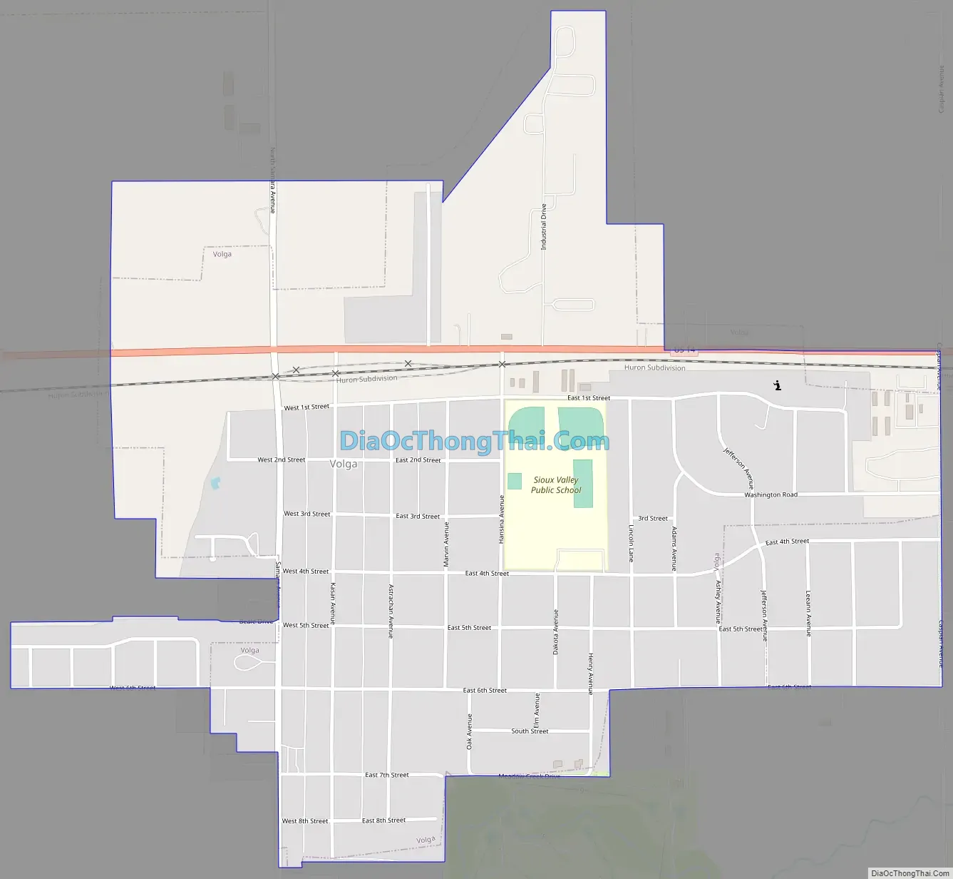
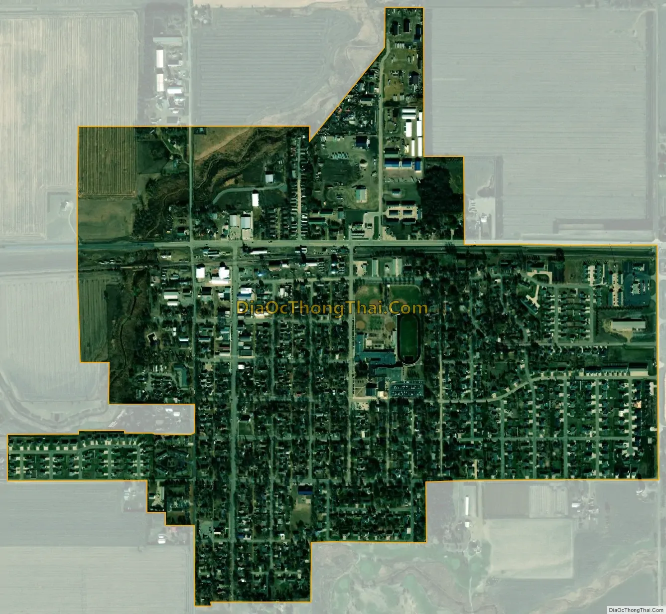
Volga city Satellite Map
Geography
Volga is located at 44°19′19″N 96°55′28″W / 44.32194°N 96.92444°W / 44.32194; -96.92444 (44.321994, -96.924565).
According to the United States Census Bureau, the city has a total area of 0.91 square miles (2.36 km), all land.
Volga has been assigned the ZIP code 57071 and the FIPS place code 67700.
See also
Map of South Dakota State and its subdivision:- Aurora
- Beadle
- Bennett
- Bon Homme
- Brookings
- Brown
- Brule
- Buffalo
- Butte
- Campbell
- Charles Mix
- Clark
- Clay
- Codington
- Corson
- Custer
- Davison
- Day
- Deuel
- Dewey
- Douglas
- Edmunds
- Fall River
- Faulk
- Grant
- Gregory
- Haakon
- Hamlin
- Hand
- Hanson
- Harding
- Hughes
- Hutchinson
- Hyde
- Jackson
- Jerauld
- Jones
- Kingsbury
- Lake
- Lawrence
- Lincoln
- Lyman
- Marshall
- McCook
- McPherson
- Meade
- Mellette
- Miner
- Minnehaha
- Moody
- Pennington
- Perkins
- Potter
- Roberts
- Sanborn
- Shannon
- Spink
- Stanley
- Sully
- Todd
- Tripp
- Turner
- Union
- Walworth
- Yankton
- Ziebach
- Alabama
- Alaska
- Arizona
- Arkansas
- California
- Colorado
- Connecticut
- Delaware
- District of Columbia
- Florida
- Georgia
- Hawaii
- Idaho
- Illinois
- Indiana
- Iowa
- Kansas
- Kentucky
- Louisiana
- Maine
- Maryland
- Massachusetts
- Michigan
- Minnesota
- Mississippi
- Missouri
- Montana
- Nebraska
- Nevada
- New Hampshire
- New Jersey
- New Mexico
- New York
- North Carolina
- North Dakota
- Ohio
- Oklahoma
- Oregon
- Pennsylvania
- Rhode Island
- South Carolina
- South Dakota
- Tennessee
- Texas
- Utah
- Vermont
- Virginia
- Washington
- West Virginia
- Wisconsin
- Wyoming