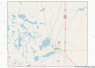
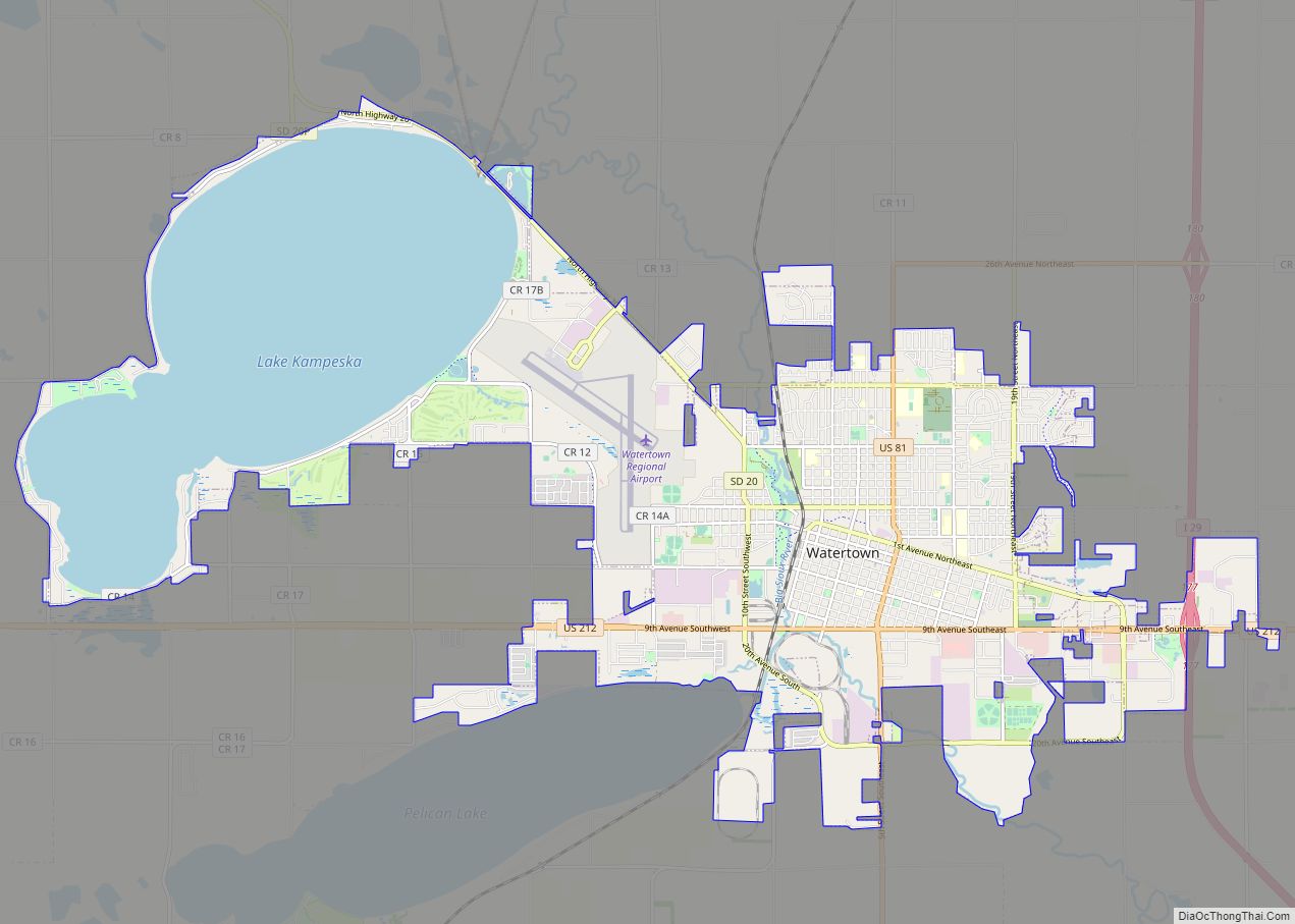
Watertown is a city in and the county seat of Codington County, South Dakota, United States. Watertown is home to the Redlin Art Center which houses many of the original art works produced by Terry Redlin, one of America’s most popular wildlife artists. Watertown is located between Pelican Lake and Lake Kampeska, from which Redlin derived inspiration for his artwork.
The population was 22,655 at the 2020 census, making Watertown the 5th largest city in South Dakota. It is also the principal city of the Watertown Micropolitan Statistical Area, which includes all of Codington and Hamlin counties. Watertown also is home to the Bramble Park Zoo. Watertown’s residential real estate is considered the most expensive in South Dakota for cities of its size; the median price for a home in Watertown is approximately $200,000.
| Name: | Watertown city |
|---|---|
| LSAD Code: | 25 |
| LSAD Description: | city (suffix) |
| State: | South Dakota |
| County: | Codington County |
| Founded: | 1879 |
| Incorporated: | 1885 |
| Elevation: | 1,732 ft (528 m) |
| Land Area: | 18.37 sq mi (47.57 km²) |
| Water Area: | 7.98 sq mi (20.66 km²) |
| Population Density: | 1,233.46/sq mi (476.25/km²) |
| ZIP code: | 57201 |
| Area code: | 605 |
| FIPS code: | 4669300 |
| GNISfeature ID: | 1258841 |
| Website: | watertownsd.us |
Online Interactive Map
Click on ![]() to view map in "full screen" mode.
to view map in "full screen" mode.
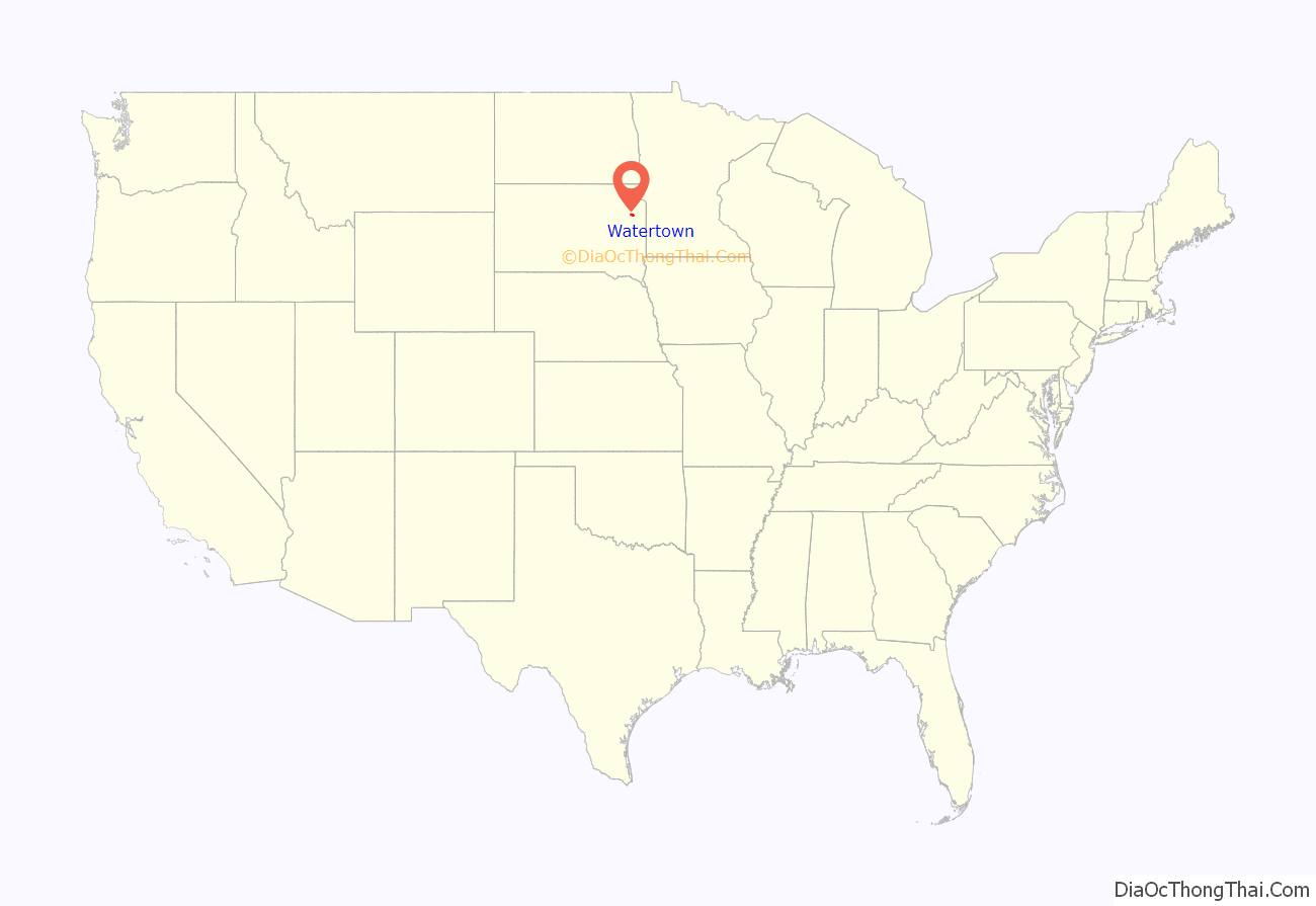
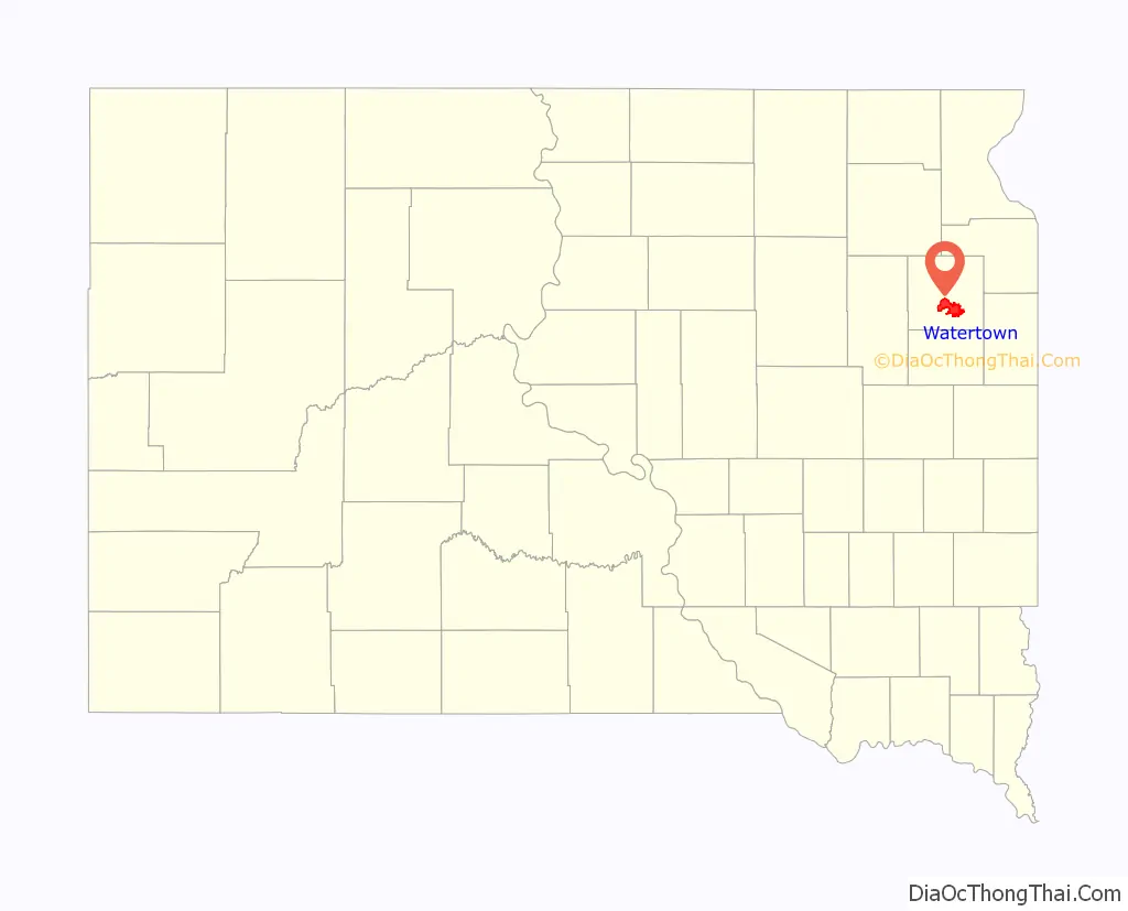
Watertown location map. Where is Watertown city?
History
Watertown was founded in 1879 as a rail terminus when the Chicago & Northwestern Railroad reactivated part of a line it had constructed to Lake Kampeska. Despite the prominence of rivers and lakes in the area, the city was named after Watertown, New York, the hometown of brothers John E. Kemp and Oscar P. Kemp, two of the city’s founders. The town’s name was originally planned to be named Kampeska.
During the 1880s, Watertown prospered as a transportation hub after the railroads had been extended farther west. Along with several other cities, Watertown had been a candidate as capital of the new state of South Dakota, although it lost out to the more centrally located Pierre. The city’s current newspaper, the Watertown Public Opinion, began publishing in 1887.
In the mid-20th century, Interstate 29 was constructed through eastern South Dakota. The route included a slight bend to bring the interstate closer to Watertown. The interstate’s construction has been a major economic benefit to Watertown and the large communities next to it.
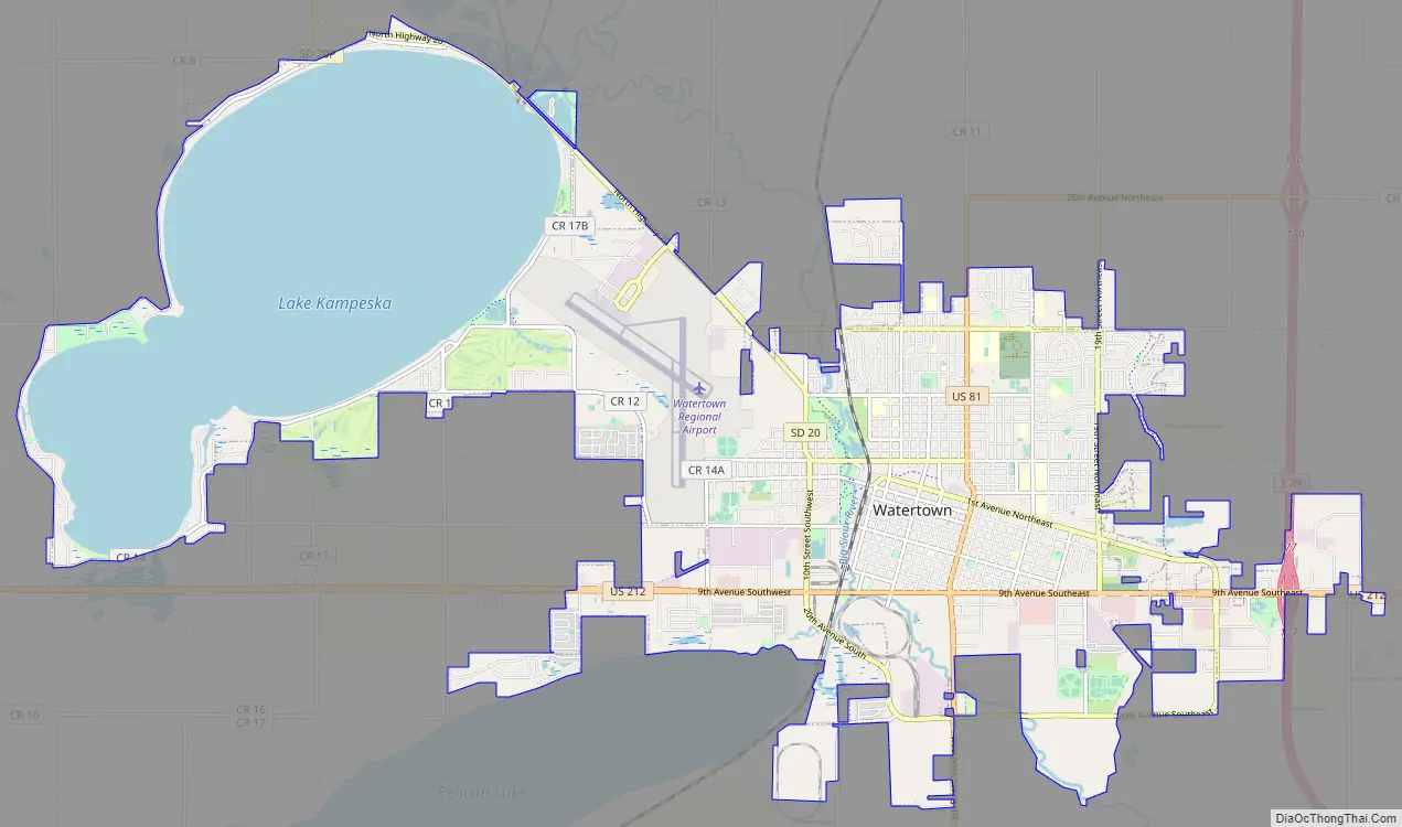
Watertown Road Map
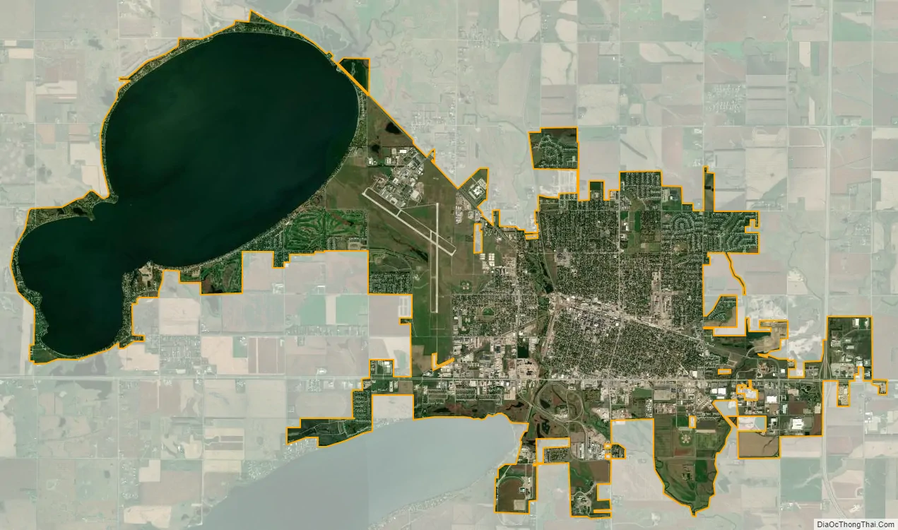
Watertown city Satellite Map
Geography
Watertown is located at 44°54′12″N 97°7′14″W / 44.90333°N 97.12056°W / 44.90333; -97.12056 (44.903433, -97.120437), along the Big Sioux River.
According to the United States Census Bureau, the city has a total area of 25.04 square miles (64.85 km), of which 17.45 square miles (45.20 km) is land and 7.59 square miles (19.66 km) is water. Watertown sits on the Big Sioux River and two major lakes, Pelican Lake and Lake Kampeska. Most of Watertown also sits upon a short plateau. The elevation at Watertown Regional Airport is 1,745 feet.
Watertown has been assigned the ZIP code 57201 and the FIPS place code 69300.
See also
Map of South Dakota State and its subdivision:- Aurora
- Beadle
- Bennett
- Bon Homme
- Brookings
- Brown
- Brule
- Buffalo
- Butte
- Campbell
- Charles Mix
- Clark
- Clay
- Codington
- Corson
- Custer
- Davison
- Day
- Deuel
- Dewey
- Douglas
- Edmunds
- Fall River
- Faulk
- Grant
- Gregory
- Haakon
- Hamlin
- Hand
- Hanson
- Harding
- Hughes
- Hutchinson
- Hyde
- Jackson
- Jerauld
- Jones
- Kingsbury
- Lake
- Lawrence
- Lincoln
- Lyman
- Marshall
- McCook
- McPherson
- Meade
- Mellette
- Miner
- Minnehaha
- Moody
- Pennington
- Perkins
- Potter
- Roberts
- Sanborn
- Shannon
- Spink
- Stanley
- Sully
- Todd
- Tripp
- Turner
- Union
- Walworth
- Yankton
- Ziebach
- Alabama
- Alaska
- Arizona
- Arkansas
- California
- Colorado
- Connecticut
- Delaware
- District of Columbia
- Florida
- Georgia
- Hawaii
- Idaho
- Illinois
- Indiana
- Iowa
- Kansas
- Kentucky
- Louisiana
- Maine
- Maryland
- Massachusetts
- Michigan
- Minnesota
- Mississippi
- Missouri
- Montana
- Nebraska
- Nevada
- New Hampshire
- New Jersey
- New Mexico
- New York
- North Carolina
- North Dakota
- Ohio
- Oklahoma
- Oregon
- Pennsylvania
- Rhode Island
- South Carolina
- South Dakota
- Tennessee
- Texas
- Utah
- Vermont
- Virginia
- Washington
- West Virginia
- Wisconsin
- Wyoming