Woonsocket is a city in Sanborn County, South Dakota. The population was 631 at the 2020 census. It is the county seat of Sanborn County.
| Name: | Woonsocket city |
|---|---|
| LSAD Code: | 25 |
| LSAD Description: | city (suffix) |
| State: | South Dakota |
| County: | Sanborn County |
| Incorporated: | 1888 |
| Elevation: | 1,306 ft (398 m) |
| Total Area: | 0.80 sq mi (2.06 km²) |
| Land Area: | 0.78 sq mi (2.03 km²) |
| Water Area: | 0.01 sq mi (0.03 km²) |
| Total Population: | 631 |
| Population Density: | 804.85/sq mi (310.70/km²) |
| ZIP code: | 57385 |
| Area code: | 605 |
| FIPS code: | 4672700 |
| GNISfeature ID: | 1259083 |
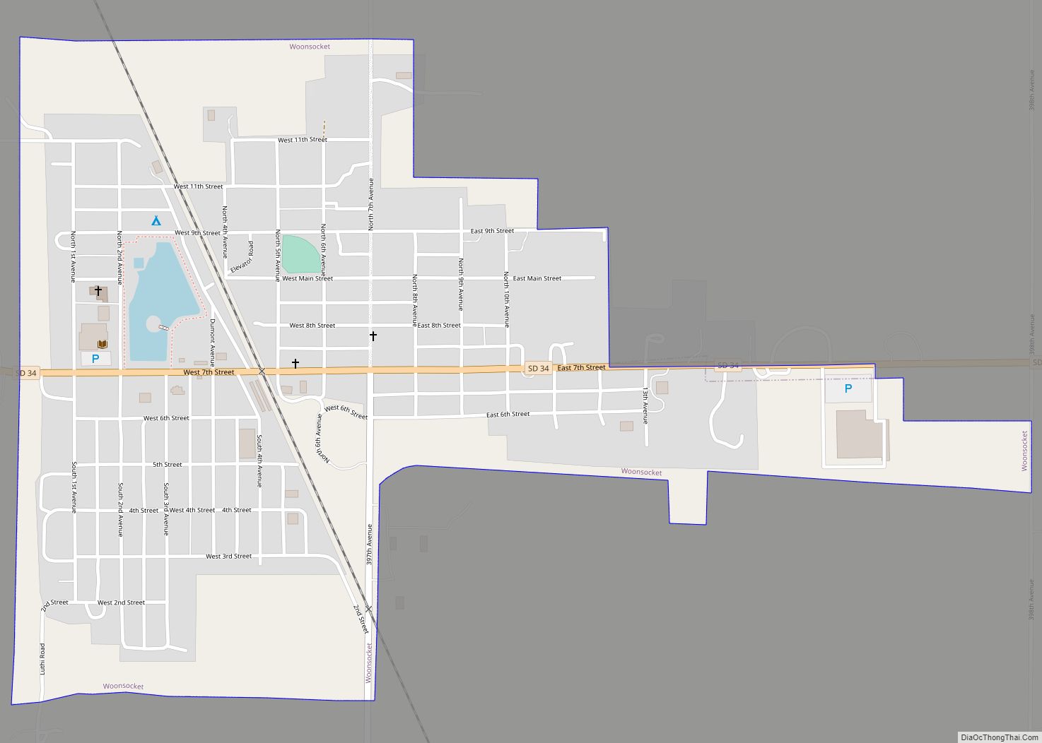
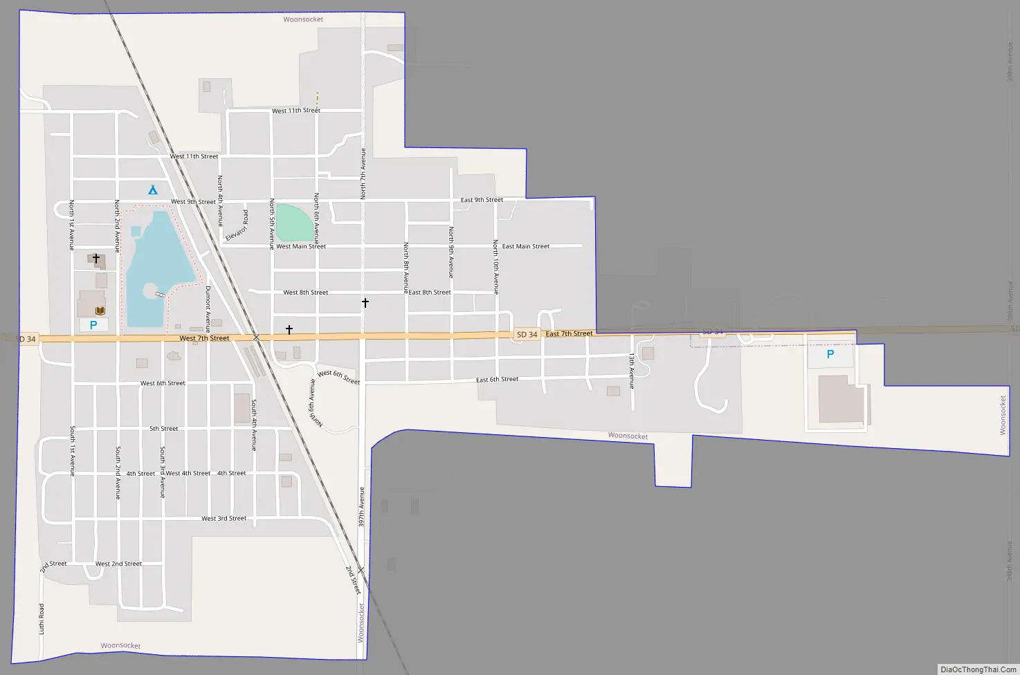
Online Interactive Map
Click on ![]() to view map in "full screen" mode.
to view map in "full screen" mode.
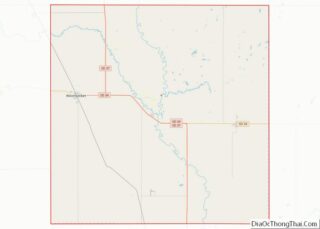
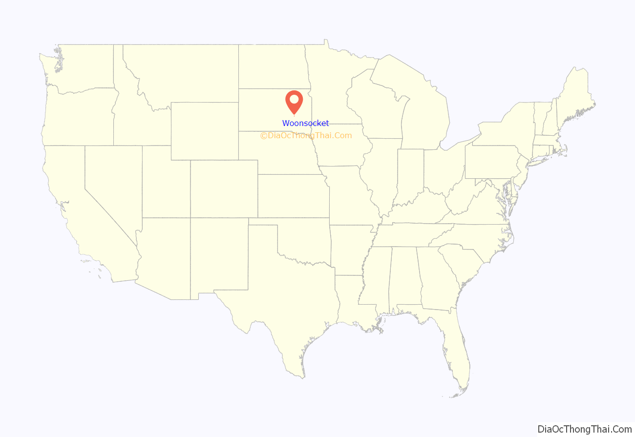
Woonsocket location map. Where is Woonsocket city?
History
Woonsocket was developed in 1883 as a railroad town because of its location at the junction on the Chicago, Milwaukee and Saint Paul Railroad. C.H. Prior, the superintendent of the railroad, named the town Woonsocket after his home town of Woonsocket, Rhode Island. The town was incorporated in 1888.
Woonsocket was known for an artesian well which was drilled in 1888. It was claimed that in its prime, the well flowed over 8,000 gallons per minute out of the six inch wide pipe. The well was capped off in 1906.
2003 South Dakota tornado outbreak
On June 24, 2003, an F3 tornado passed just west of town; it was one of 67 tornadoes that touched down on June 24, holding a record for “Most tornadoes to touch down in the state in one day”.
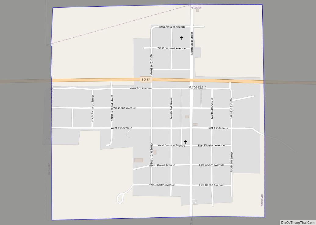
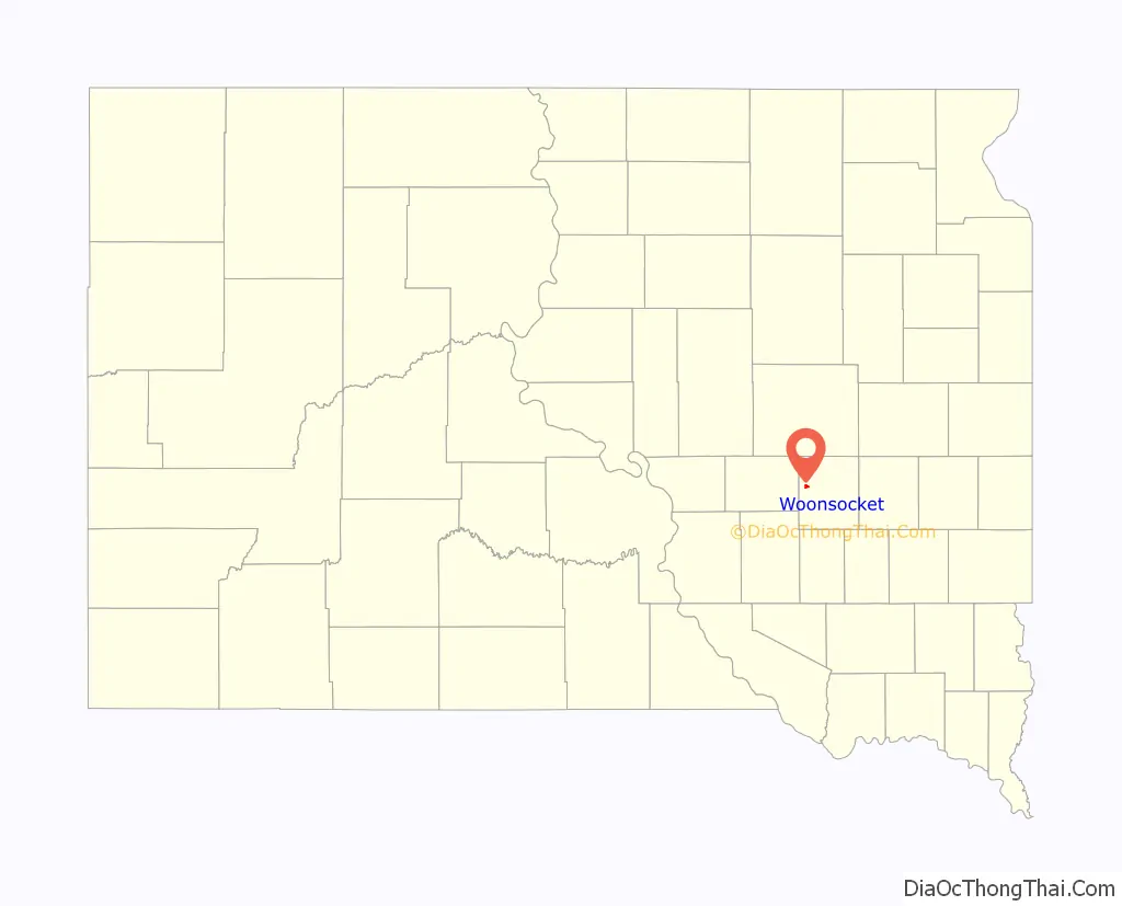
Woonsocket Road Map
Woonsocket city Satellite Map
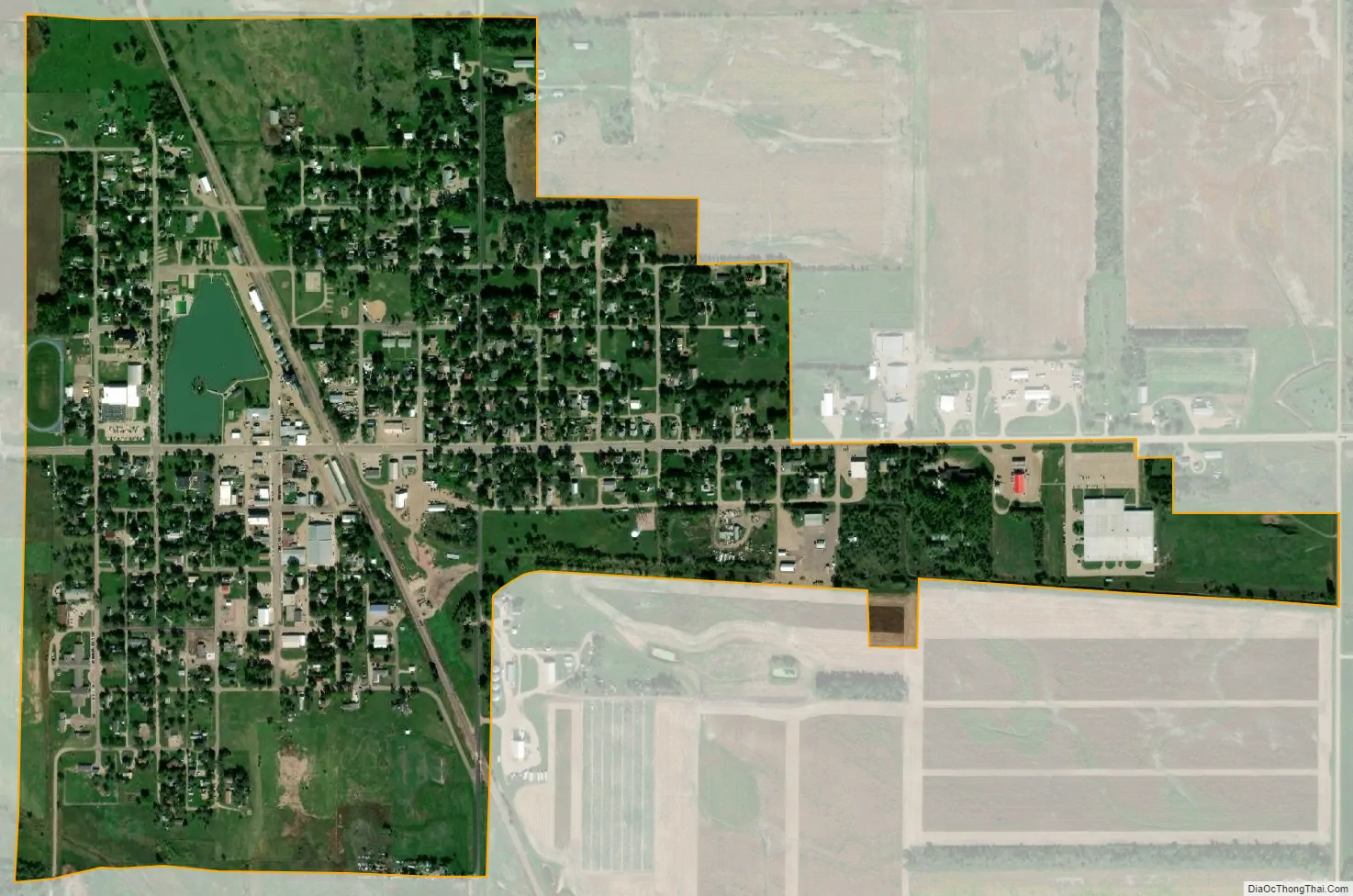
Geography
Woonsocket is located at 44°03′10″N 98°16′25″W / 44.052797°N 98.273699°W / 44.052797; -98.273699.
According to the United States Census Bureau, the city has a total area of 0.79 square miles (2.05 km), of which 0.78 square miles (2.02 km) is land and 0.01 square miles (0.03 km) is water.
See also
Map of South Dakota State and its subdivision:- Aurora
- Beadle
- Bennett
- Bon Homme
- Brookings
- Brown
- Brule
- Buffalo
- Butte
- Campbell
- Charles Mix
- Clark
- Clay
- Codington
- Corson
- Custer
- Davison
- Day
- Deuel
- Dewey
- Douglas
- Edmunds
- Fall River
- Faulk
- Grant
- Gregory
- Haakon
- Hamlin
- Hand
- Hanson
- Harding
- Hughes
- Hutchinson
- Hyde
- Jackson
- Jerauld
- Jones
- Kingsbury
- Lake
- Lawrence
- Lincoln
- Lyman
- Marshall
- McCook
- McPherson
- Meade
- Mellette
- Miner
- Minnehaha
- Moody
- Pennington
- Perkins
- Potter
- Roberts
- Sanborn
- Shannon
- Spink
- Stanley
- Sully
- Todd
- Tripp
- Turner
- Union
- Walworth
- Yankton
- Ziebach
- Alabama
- Alaska
- Arizona
- Arkansas
- California
- Colorado
- Connecticut
- Delaware
- District of Columbia
- Florida
- Georgia
- Hawaii
- Idaho
- Illinois
- Indiana
- Iowa
- Kansas
- Kentucky
- Louisiana
- Maine
- Maryland
- Massachusetts
- Michigan
- Minnesota
- Mississippi
- Missouri
- Montana
- Nebraska
- Nevada
- New Hampshire
- New Jersey
- New Mexico
- New York
- North Carolina
- North Dakota
- Ohio
- Oklahoma
- Oregon
- Pennsylvania
- Rhode Island
- South Carolina
- South Dakota
- Tennessee
- Texas
- Utah
- Vermont
- Virginia
- Washington
- West Virginia
- Wisconsin
- Wyoming