Livingston is a town in Overton County, Tennessee, United States, and serves as the county seat. The population was 3,905 at the 2020 census and 4,058 at the 2010 census. The current mayor, Curtis Hayes, began serving his mayoral position in September 2006.
Livingston is part of the Cookeville, Tennessee Micropolitan Statistical Area.
| Name: | Livingston town |
|---|---|
| LSAD Code: | 43 |
| LSAD Description: | town (suffix) |
| State: | Tennessee |
| County: | Overton County |
| Founded: | 1833 |
| Incorporated: | 1907 |
| Elevation: | 1,037 ft (316 m) |
| Total Area: | 6.53 sq mi (16.91 km²) |
| Land Area: | 6.51 sq mi (16.86 km²) |
| Water Area: | 0.02 sq mi (0.06 km²) |
| Total Population: | 3,905 |
| Population Density: | 600.03/sq mi (231.66/km²) |
| ZIP code: | 38570 |
| Area code: | 931 |
| FIPS code: | 4743140 |
| GNISfeature ID: | 1291738 |
| Website: | www.cityoflivingston.net |
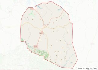
Online Interactive Map
Click on ![]() to view map in "full screen" mode.
to view map in "full screen" mode.
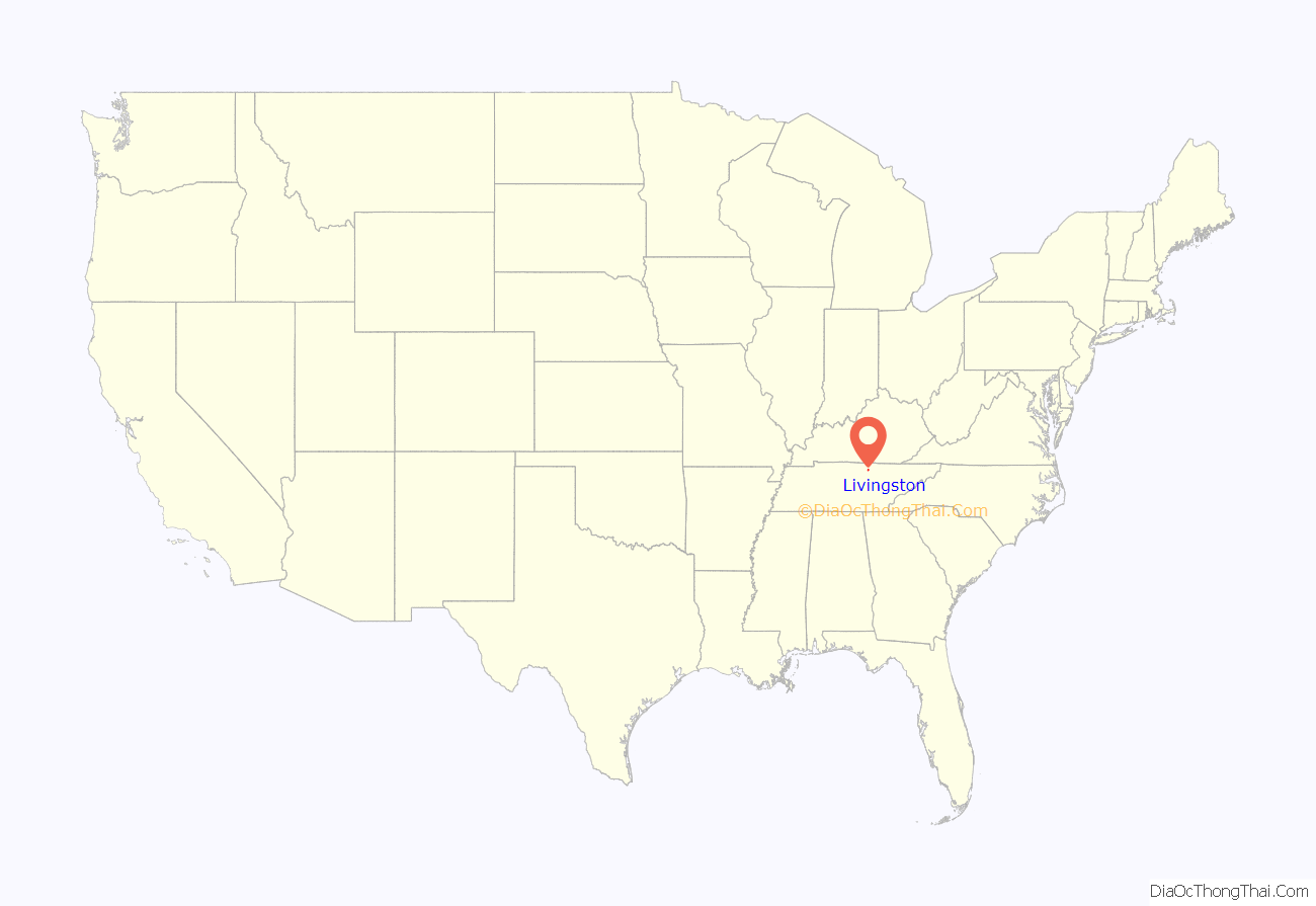
Livingston location map. Where is Livingston town?

History
Livingston was named after Edward Livingston (1764–1836), who served as Secretary of State under President Andrew Jackson. In 1833, in a close and controversial election, the residents of Overton County voted to move the county seat from the town of Monroe to Livingston.
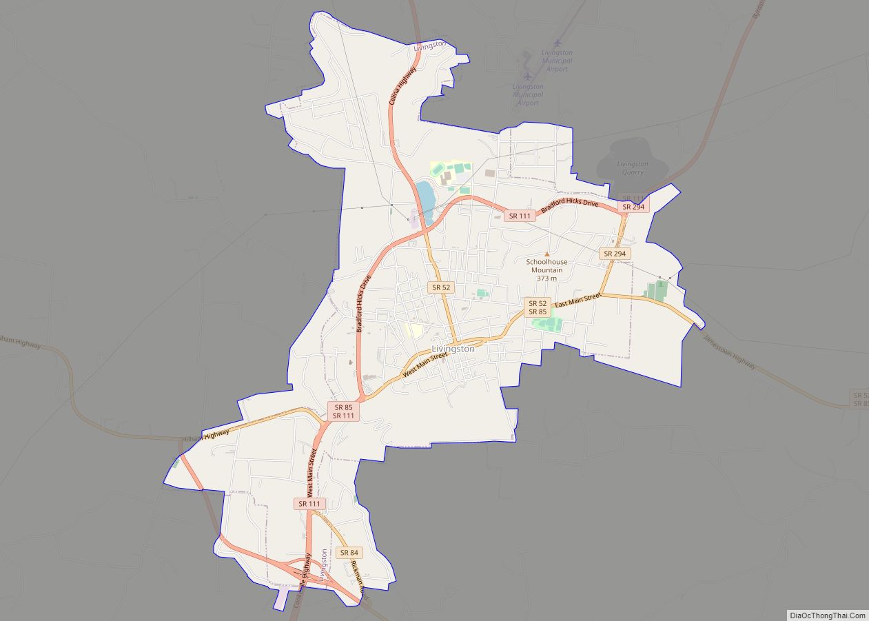
Livingston Road Map
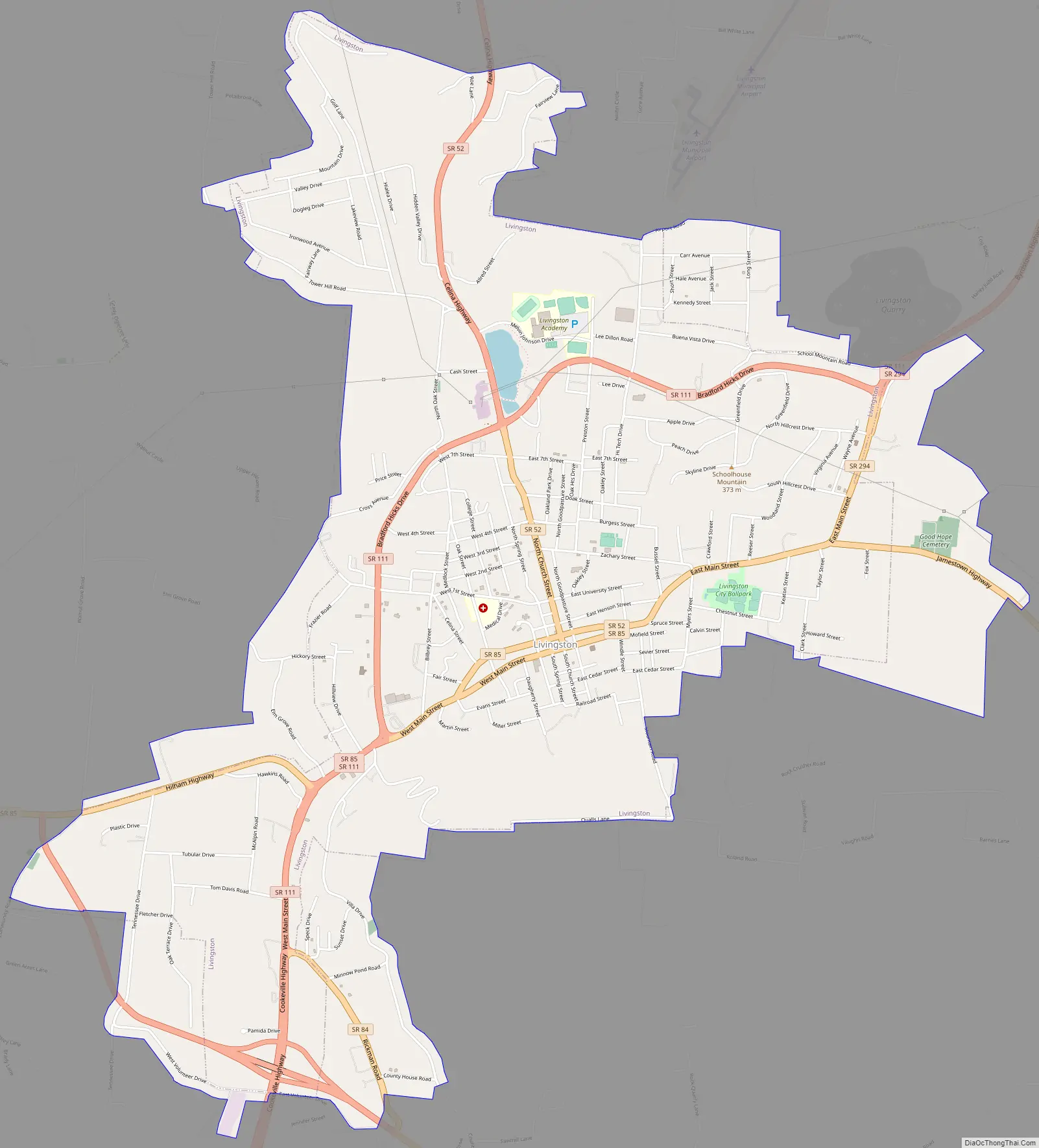
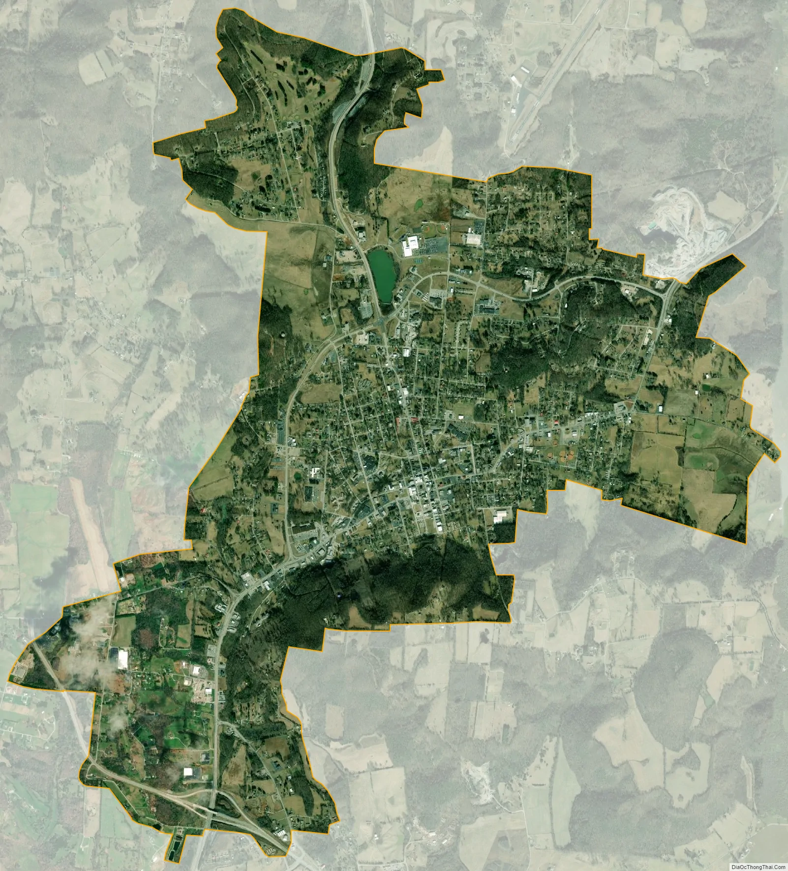
Livingston city Satellite Map
Geography
Livingston is located at 36°23′13″N 85°19′32″W / 36.38694°N 85.32556°W / 36.38694; -85.32556 (36.386942, -85.325568), approximately 15 miles north by northeast of Cookeville.
According to the United States Census Bureau, the town has a total area of 5.2 square miles (13 km), of which 5.1 square miles (13 km) is land and 0.04 square miles (0.10 km) (0.77%) is water. Elevation in the town ranges from 1,027 ft (313 m) to 1700 ft (518.16 m)
Climate
See also
Map of Tennessee State and its subdivision:- Anderson
- Bedford
- Benton
- Bledsoe
- Blount
- Bradley
- Campbell
- Cannon
- Carroll
- Carter
- Cheatham
- Chester
- Claiborne
- Clay
- Cocke
- Coffee
- Crockett
- Cumberland
- Davidson
- Decatur
- DeKalb
- Dickson
- Dyer
- Fayette
- Fentress
- Franklin
- Gibson
- Giles
- Grainger
- Greene
- Grundy
- Hamblen
- Hamilton
- Hancock
- Hardeman
- Hardin
- Hawkins
- Haywood
- Henderson
- Henry
- Hickman
- Houston
- Humphreys
- Jackson
- Jefferson
- Johnson
- Knox
- Lake
- Lauderdale
- Lawrence
- Lewis
- Lincoln
- Loudon
- Macon
- Madison
- Marion
- Marshall
- Maury
- McMinn
- McNairy
- Meigs
- Monroe
- Montgomery
- Moore
- Morgan
- Obion
- Overton
- Perry
- Pickett
- Polk
- Putnam
- Rhea
- Roane
- Robertson
- Rutherford
- Scott
- Sequatchie
- Sevier
- Shelby
- Smith
- Stewart
- Sullivan
- Sumner
- Tipton
- Trousdale
- Unicoi
- Union
- Van Buren
- Warren
- Washington
- Wayne
- Weakley
- White
- Williamson
- Wilson
- Alabama
- Alaska
- Arizona
- Arkansas
- California
- Colorado
- Connecticut
- Delaware
- District of Columbia
- Florida
- Georgia
- Hawaii
- Idaho
- Illinois
- Indiana
- Iowa
- Kansas
- Kentucky
- Louisiana
- Maine
- Maryland
- Massachusetts
- Michigan
- Minnesota
- Mississippi
- Missouri
- Montana
- Nebraska
- Nevada
- New Hampshire
- New Jersey
- New Mexico
- New York
- North Carolina
- North Dakota
- Ohio
- Oklahoma
- Oregon
- Pennsylvania
- Rhode Island
- South Carolina
- South Dakota
- Tennessee
- Texas
- Utah
- Vermont
- Virginia
- Washington
- West Virginia
- Wisconsin
- Wyoming